


This anonymous manuscript atlas, made in 1547, is one of the most outstanding works of sixteenth-century cartography. Named after its first owner, Nicholas Vallard, it was created in the context of the so-called Dieppe School of cartography, famous for its superb and lavish maps, with remarkable decoration in their marginalia. The Vallard Atlas shows a strong Portuguese influence, and, interestingly, it is not oriented to the north, but rather to the south. Thus, the south is located at the top of the maps.
The atlas shows the eastern coast of a mysterious landmass in the southern Indian Ocean, something that has been used as evidence by several scholars to argue that Australia had already been discovered before the arrival of Willem Janszoon in 1606.
Where Cartography Meets Art
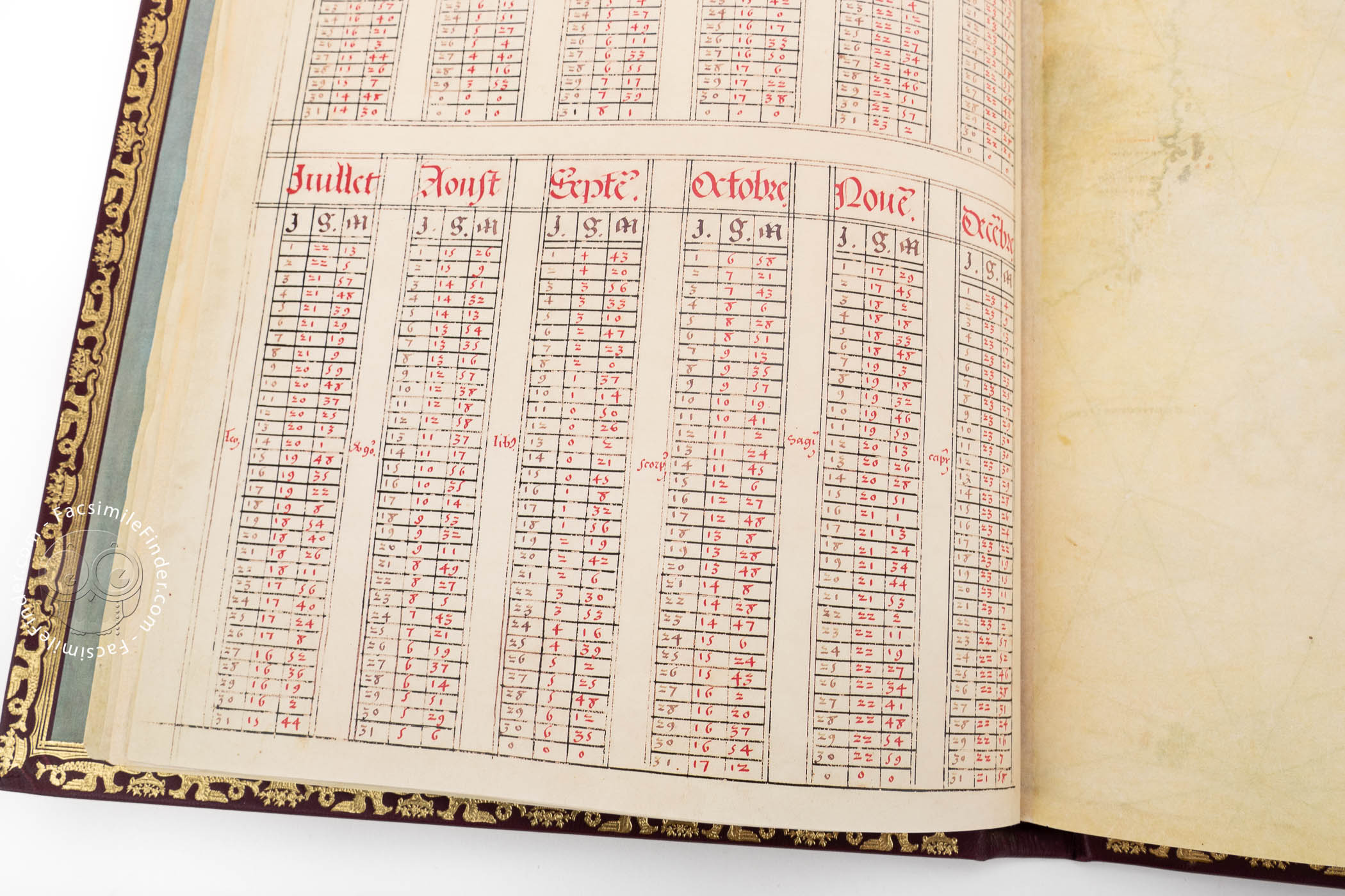
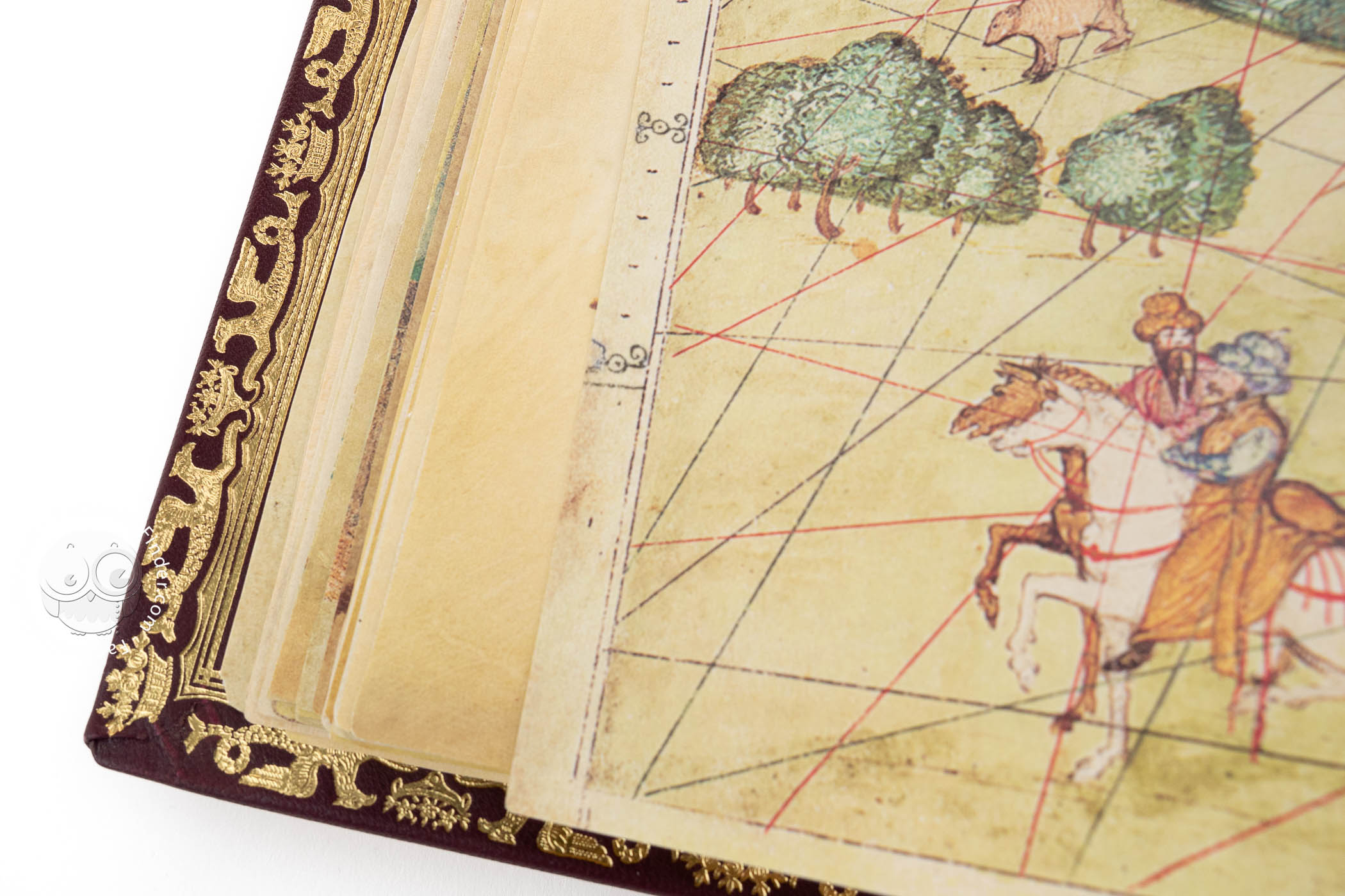
The Vallard Atlas consists of thirty-four folios written on parchment and measuring 39 x 28.5 cm. The first four folios contain a text about nautical science, and the rest of the work comprises fifteen charts representing the world known to Europeans except for northern Europe, Asia, and the western coast of America.
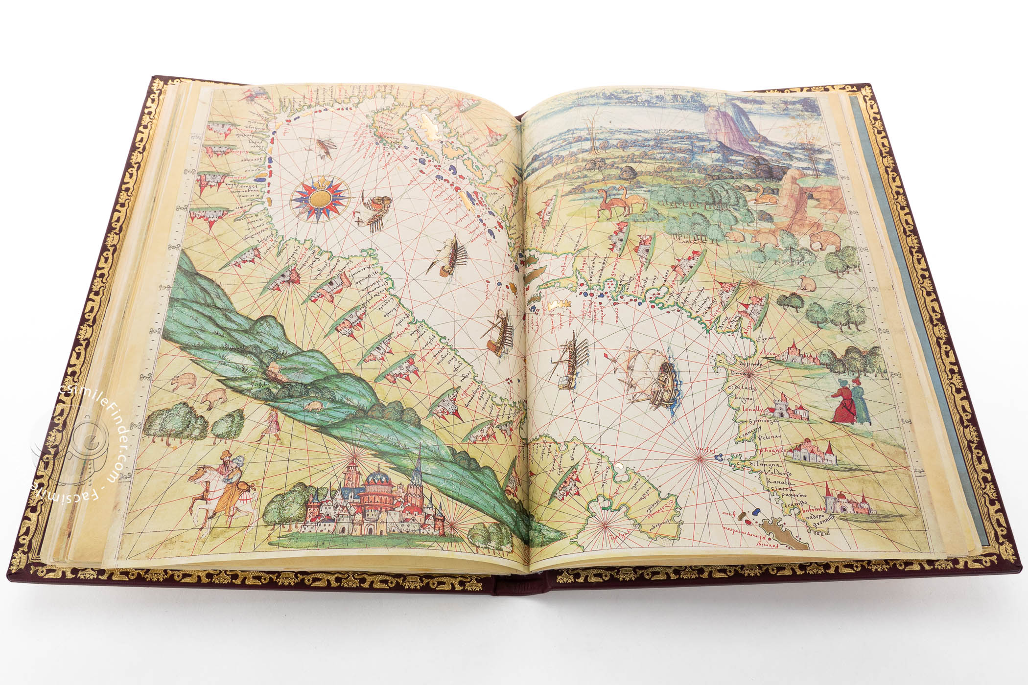
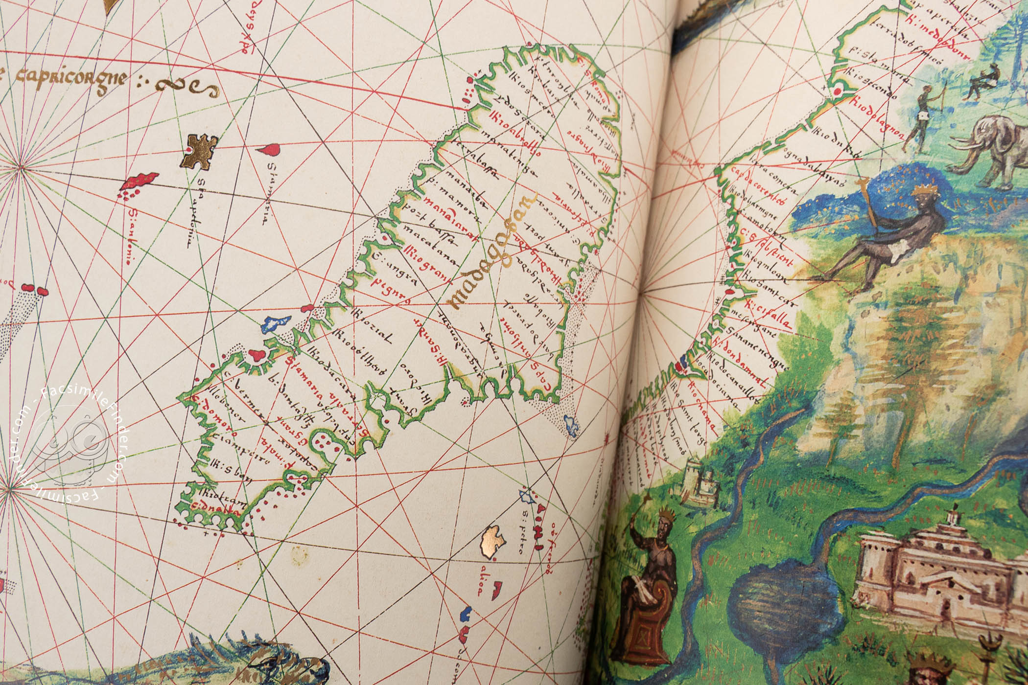
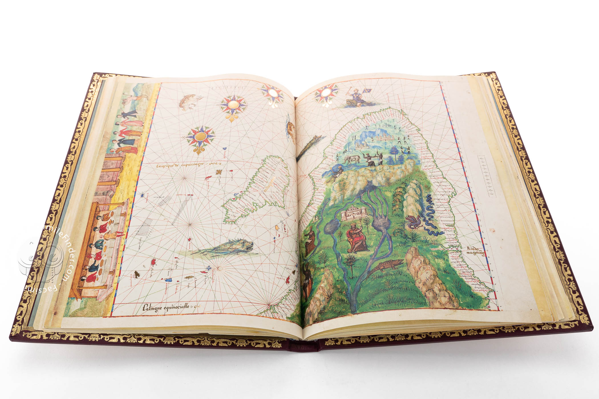
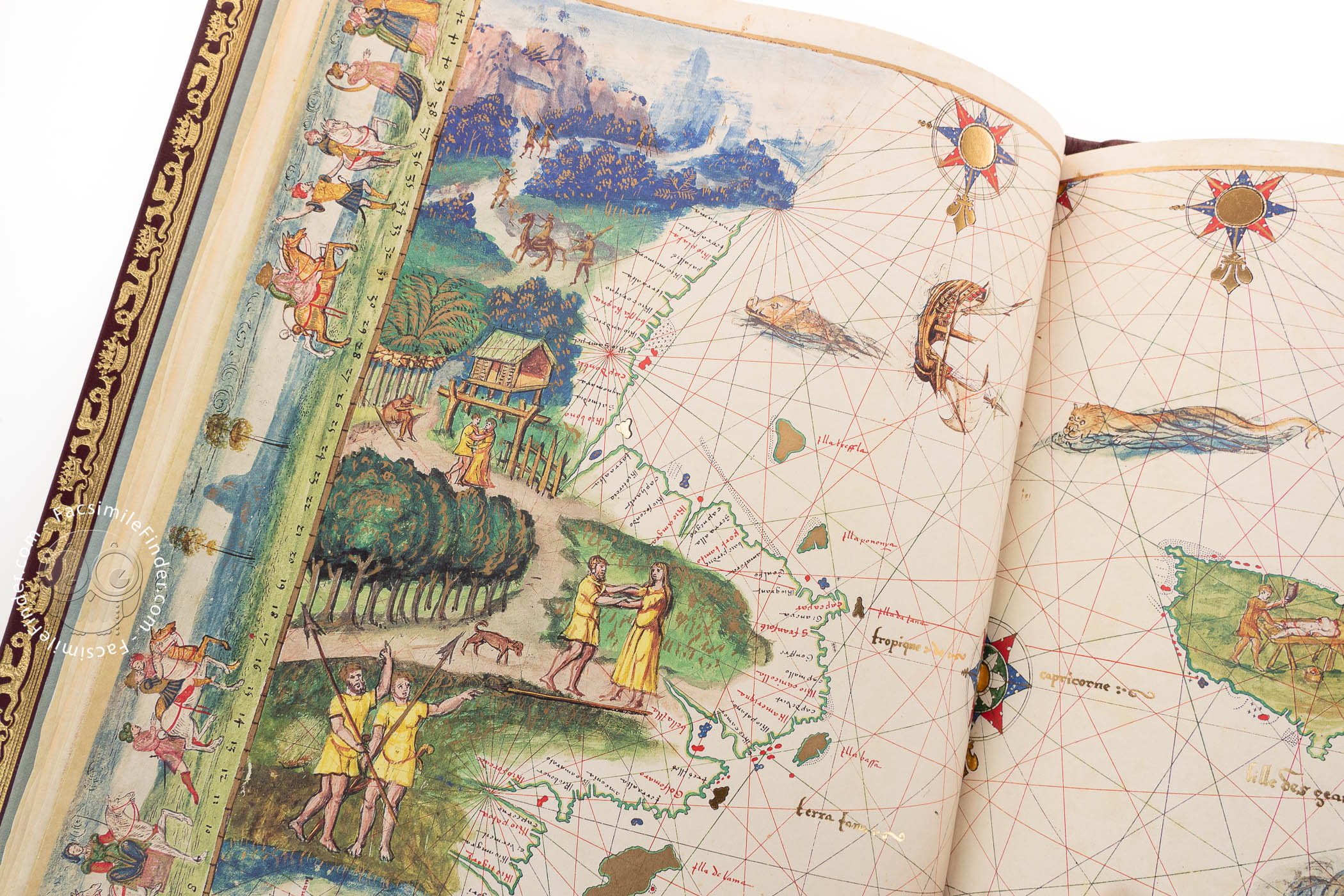
One of the remarkable features of the charts is their orientation. The maps show south instead of north at the top. This orientation is certainly not unprecedented in the cartography of the time, but it is unusual to have all of the maps in an atlas so oriented.
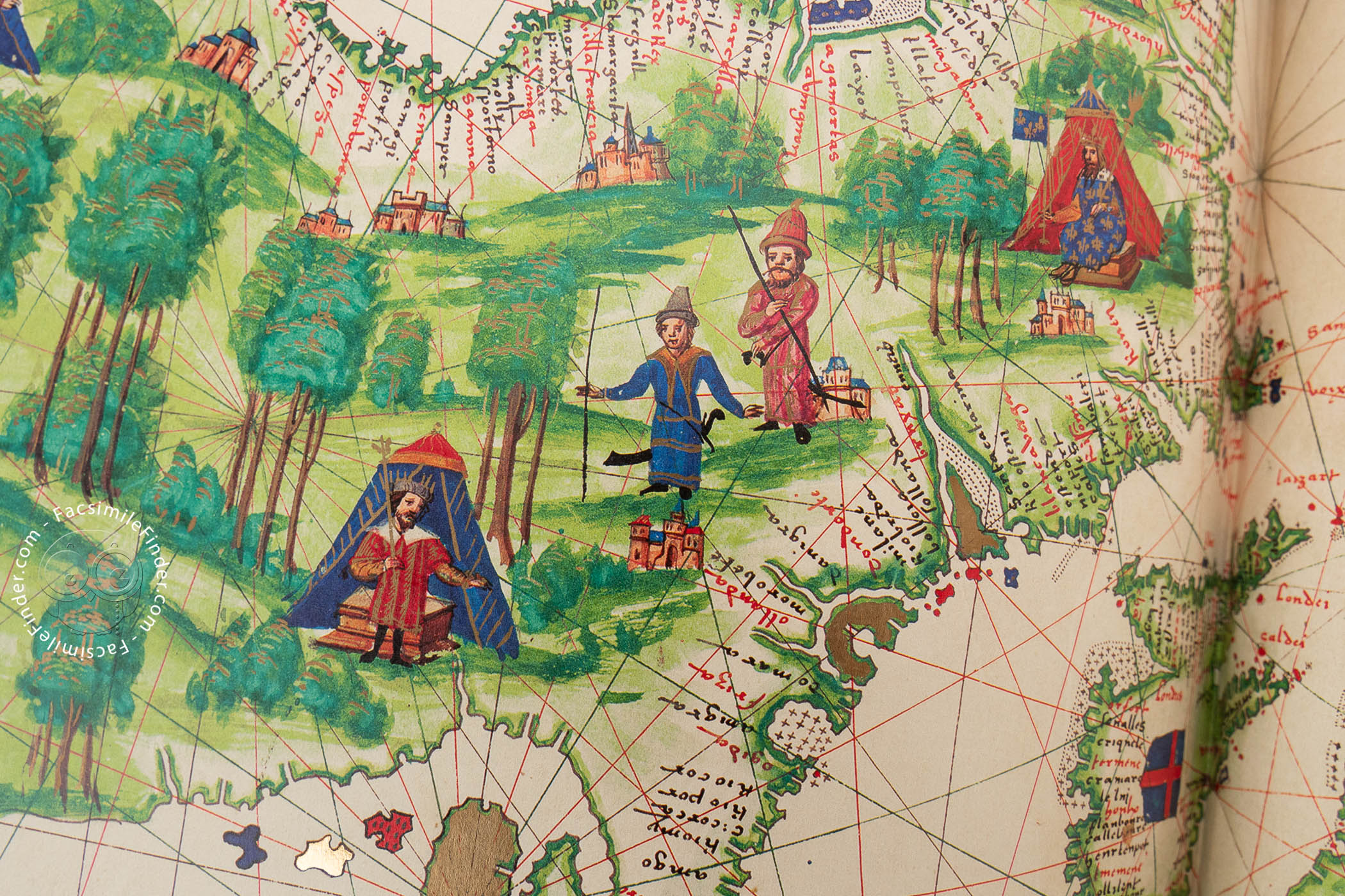
The coastlines are accurately depicted, showing abundant place names and reminding us of the tradition of late medieval and early modern nautical charts.
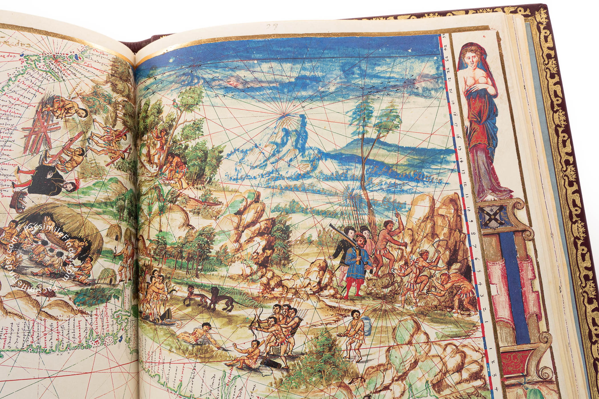
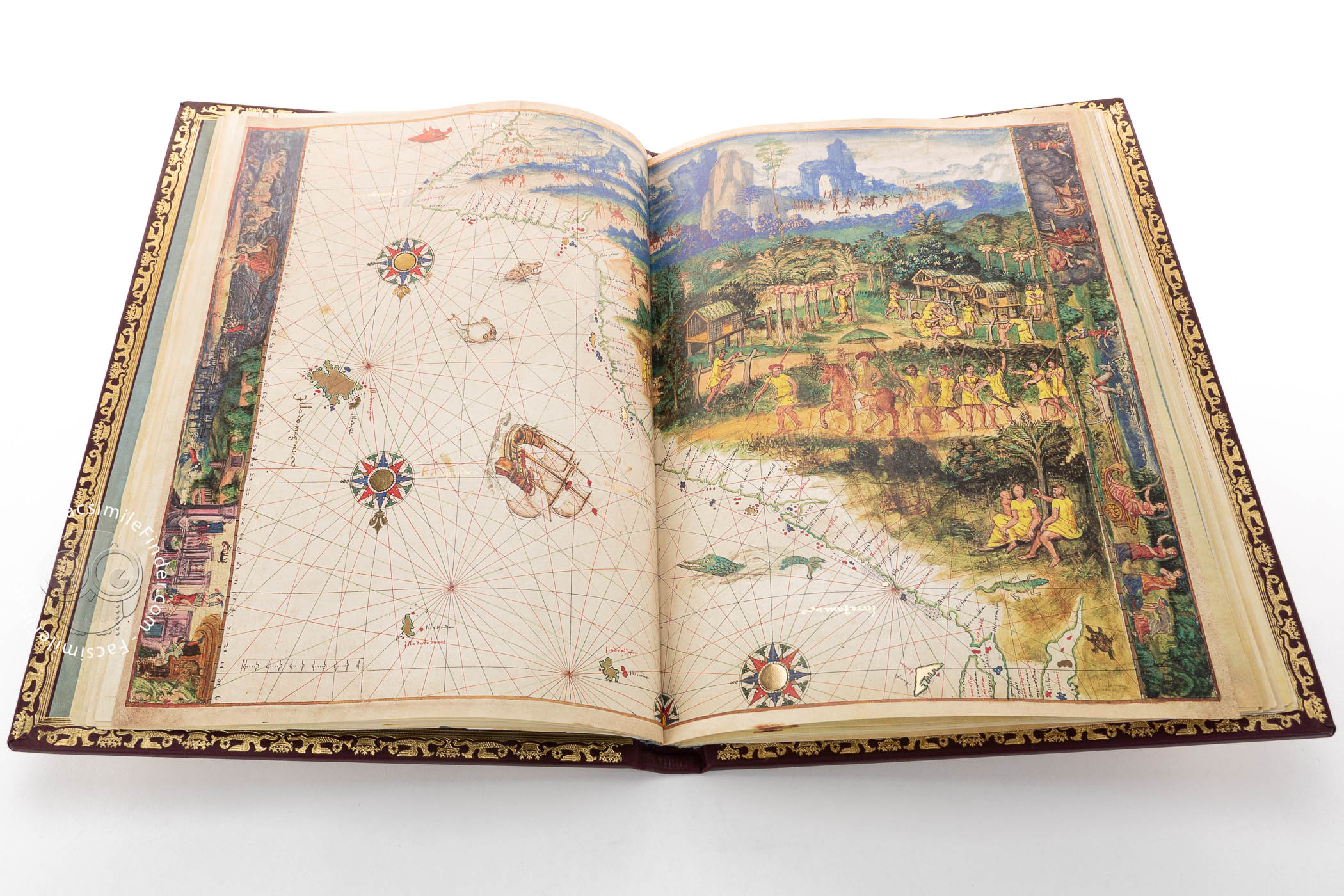
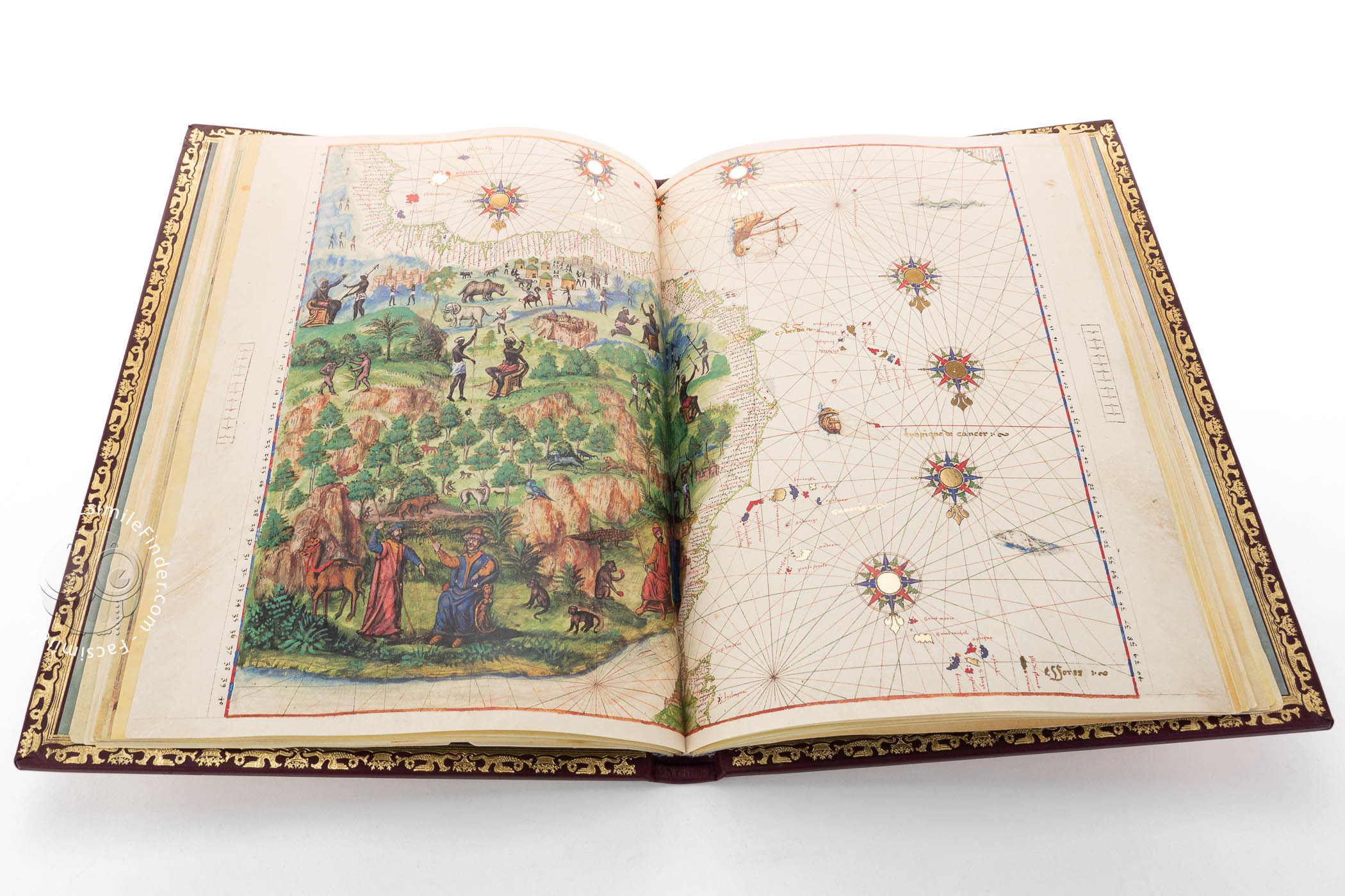
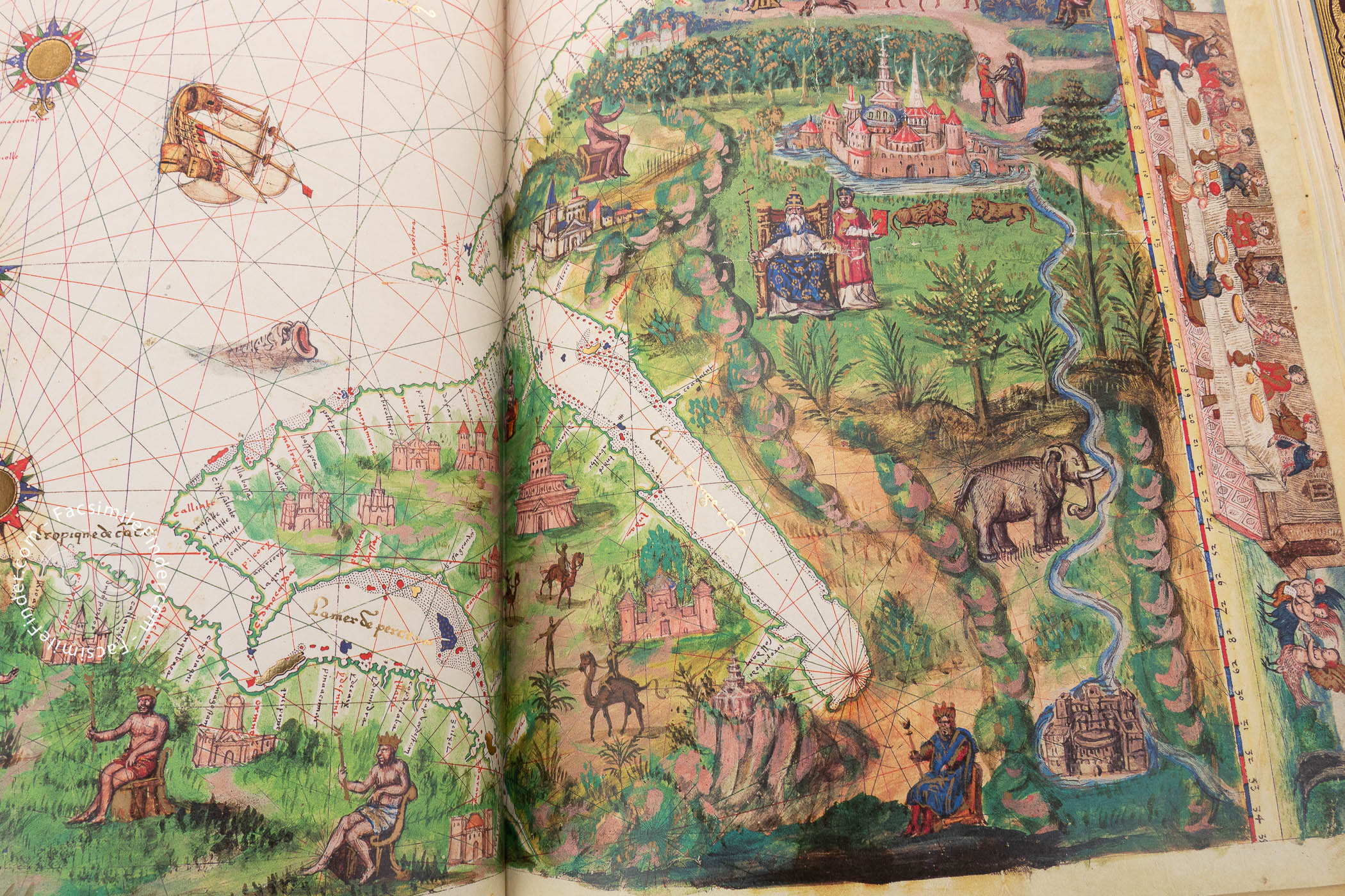
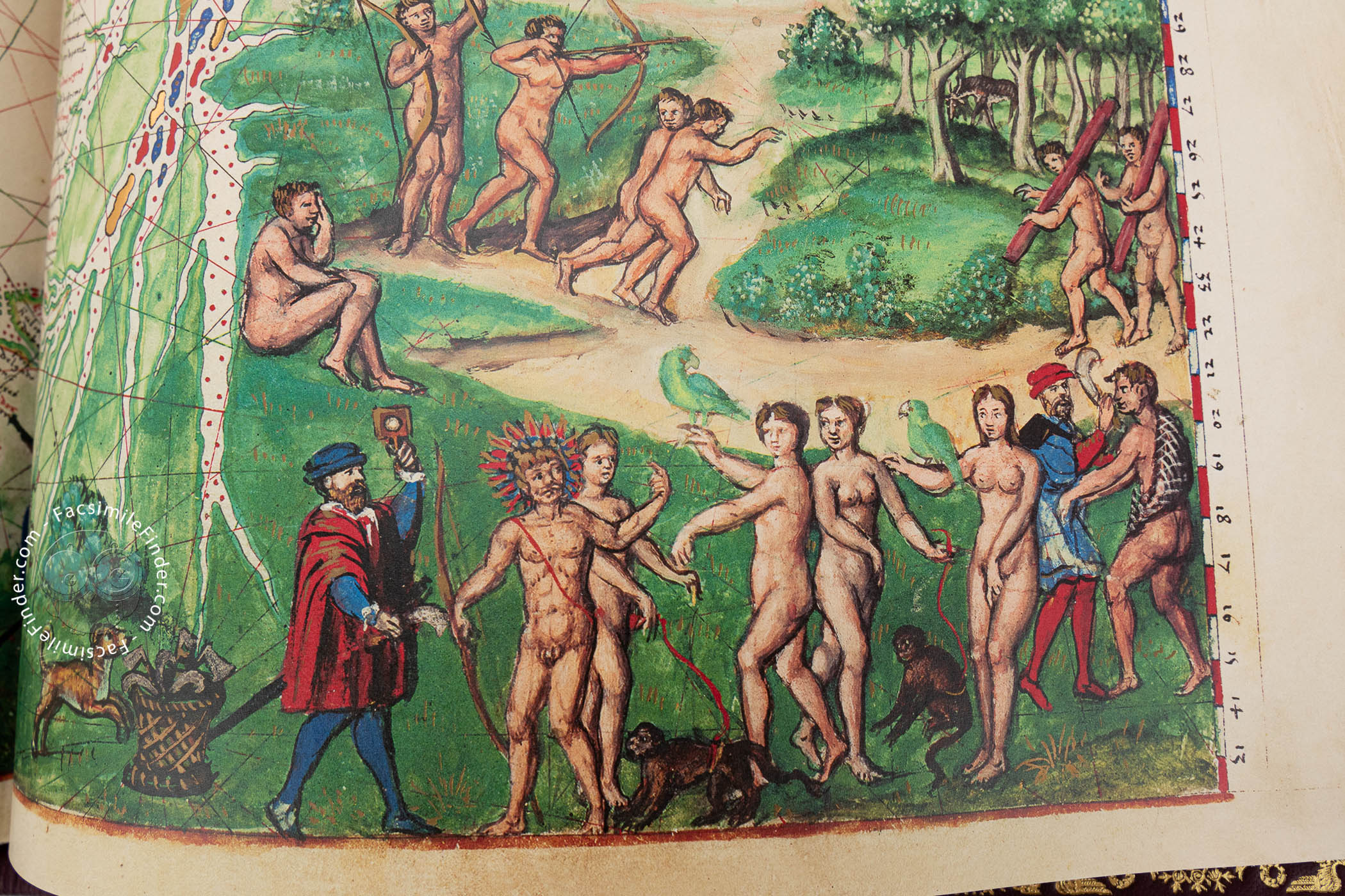
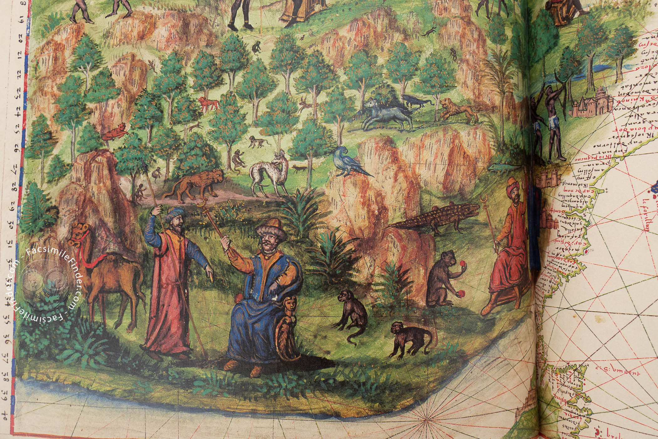
The most extraordinary feature of the atlas is, perhaps, its decorative elements. Both the oceans and the hinterlands of the continents are filled with abundant decoration, showing great attention to detail. The miniatures represent the way of living of the indigenous peoples, as well as scenes of colonization, a very interesting reflection of the work’s sixteenth-century historical and geographical context.
On the chart of northwestern Africa, for example, the interior of Africa is decorated with animals such as elephants and rhinoceroses, as well as with indigenous peoples. Thus, the inhabitants of Sub-Saharan Africa, with black skin and bare chests, contrast with those of the Maghreb area, white-skinned and dressed in Islamic-style clothing.
The same contrast is visible in the Americas, which contain abundant graphical information about their inhabitants and the European conquerors. We can also see mountains prominently depicted all over the continent. In the oceans, decorative elements like compass roses, ships, and sea monsters are abundant, and several rulers and important cities are included in areas like Europe and the Adriatic.
Given its almost unique decorative features, which reminds us of the superb Miller Atlas (1519) and its lavish presentation, the Vallard Atlas is one of the most remarkable cartographic works of the early modern period, as well as a fundamental example of the artistic importance of maps. It is held in the Huntington Library of San Marino, California, under the shelfmark HM 29.
The Many Owners of a Cherished Atlas
According to the records and the information available in its folios, the Vallard Atlas has had various owners, Nicolas Vallard being the first one. On 8 May 1816, Charles Maurice de Talleyrand-Périgord, one of the most important personalities of the late eighteenth and early nineteenth centuries, sold it to Robert Triphook, who sold it to Henry Bohn on 29 March 1833.
On 7 May 1849, the atlas was purchased by Sir Thomas Phillips, and in 1924 it was sold to Henry E. Huntington in whose library is currently housed.
We have 1 facsimile edition of the manuscript "Vallard Atlas": Atlas Vallard facsimile edition, published by M. Moleiro Editor, 2010
Request Info / Price