Vienna, Österreichische Nationalbibliothek, Cod. 324

Peutinger Map Facsimile Edition

Our price

More Buying Choices

Request Info

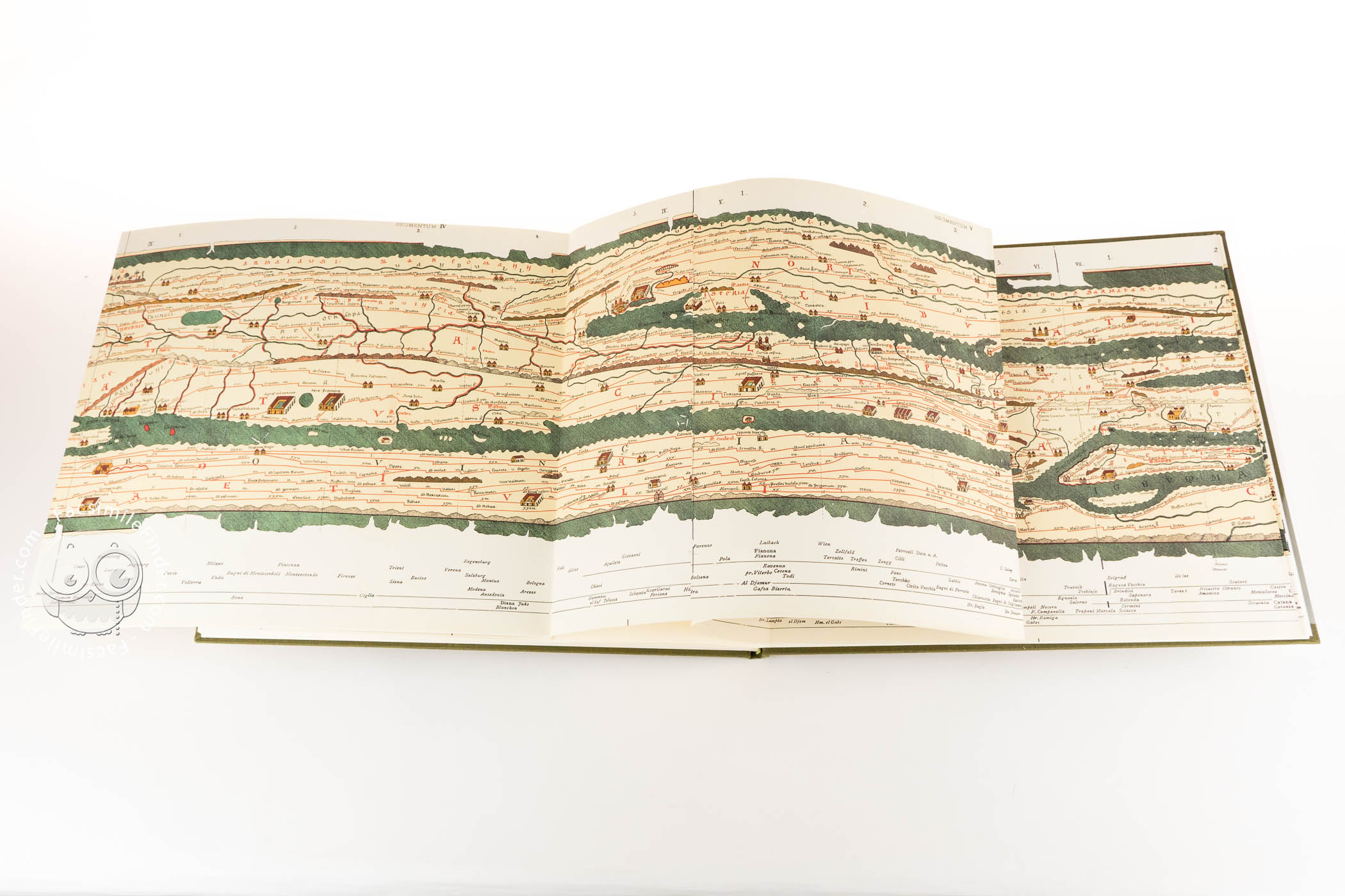
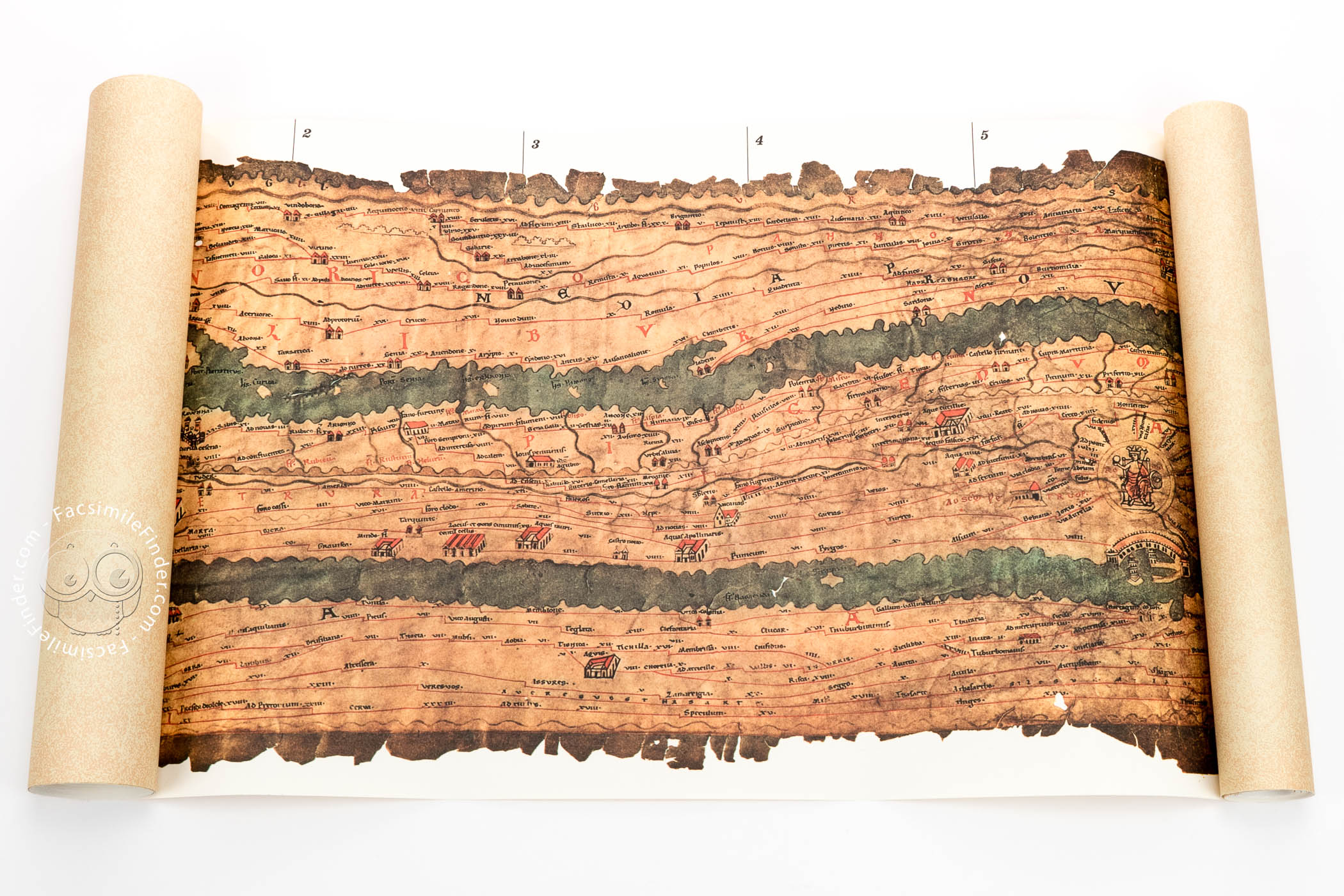
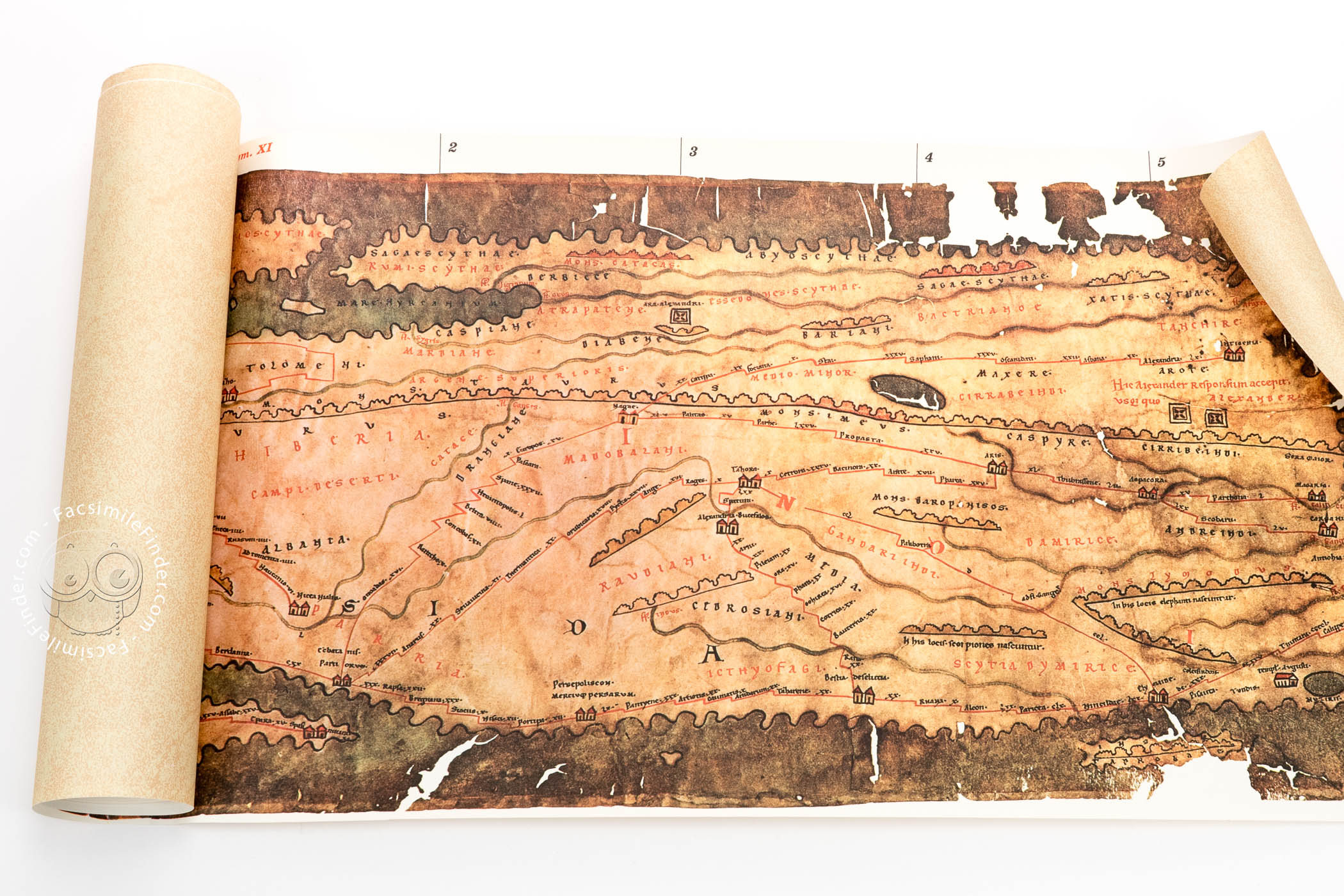
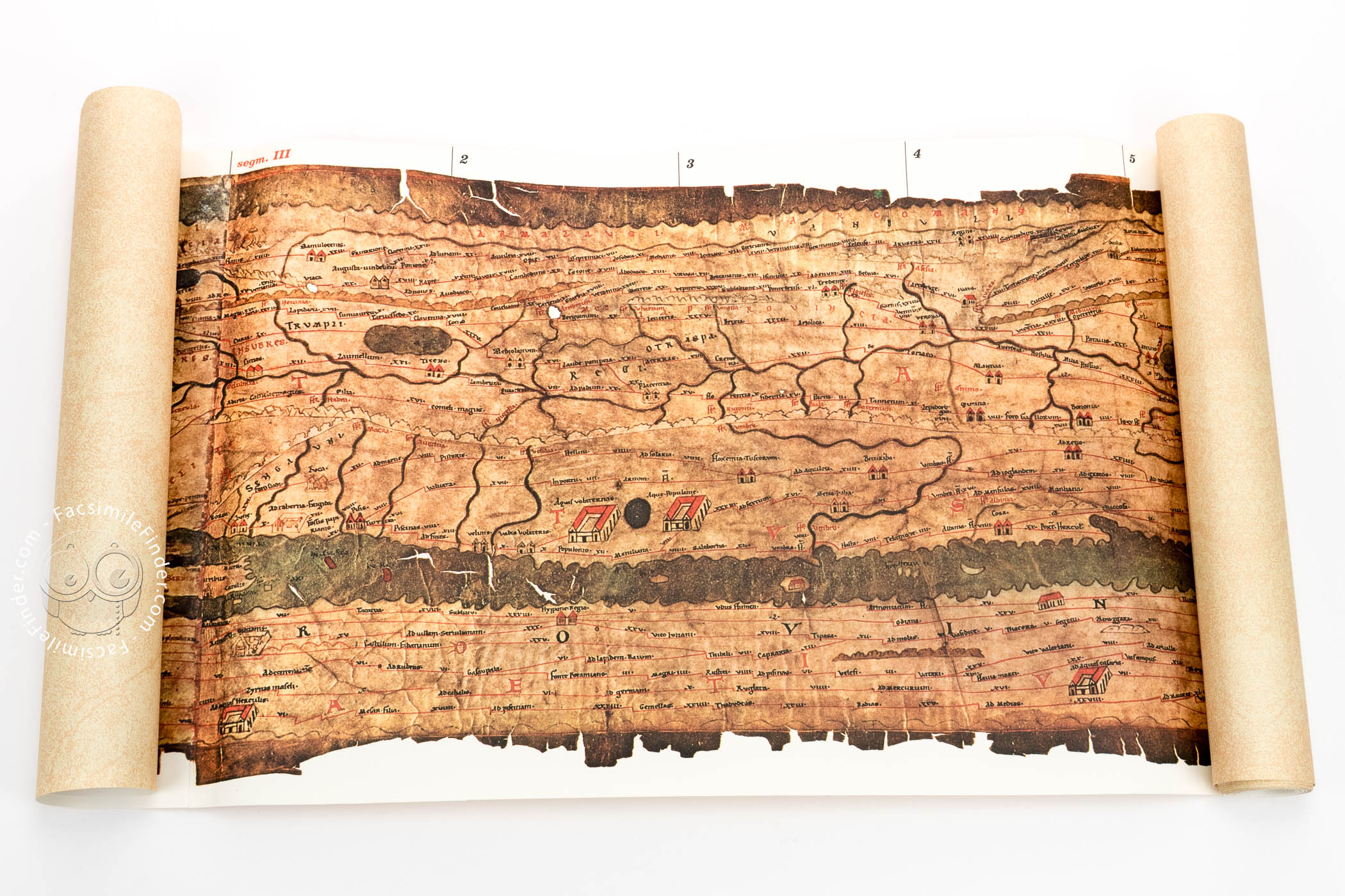
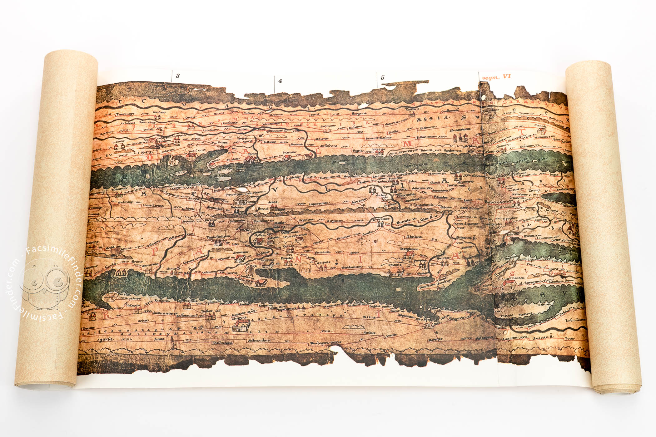
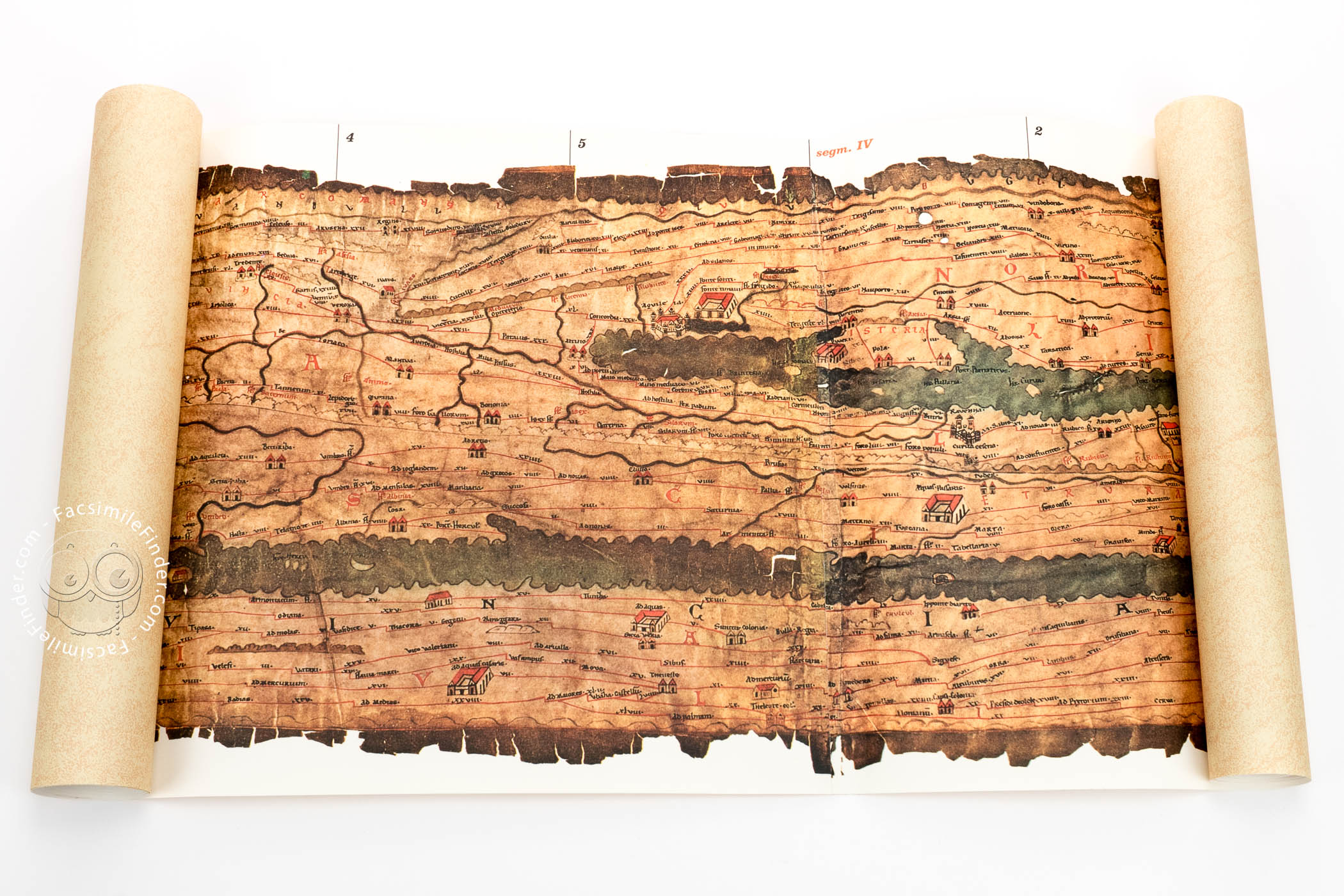
The Peutinger Map, which shows the road network of the Roman Empire, is one of the most important documents in the history of cartography. Created ca. 1200 probably in greater Swabia (southern Germany) and based on an ancient Roman model, it is a fundamental tool for understanding and studying the known world during the Roman imperial period. It portrays, among other features, main roads, rivers, forests, and villages, covering originally an area from Sri Lanka in the Far East to the Atlantic. A part of the model—i.e., much of Britain, Spain, and the northwestern part of Africa—was missing at the time the copy was made, and the Peutinger Map reflects that lacuna.

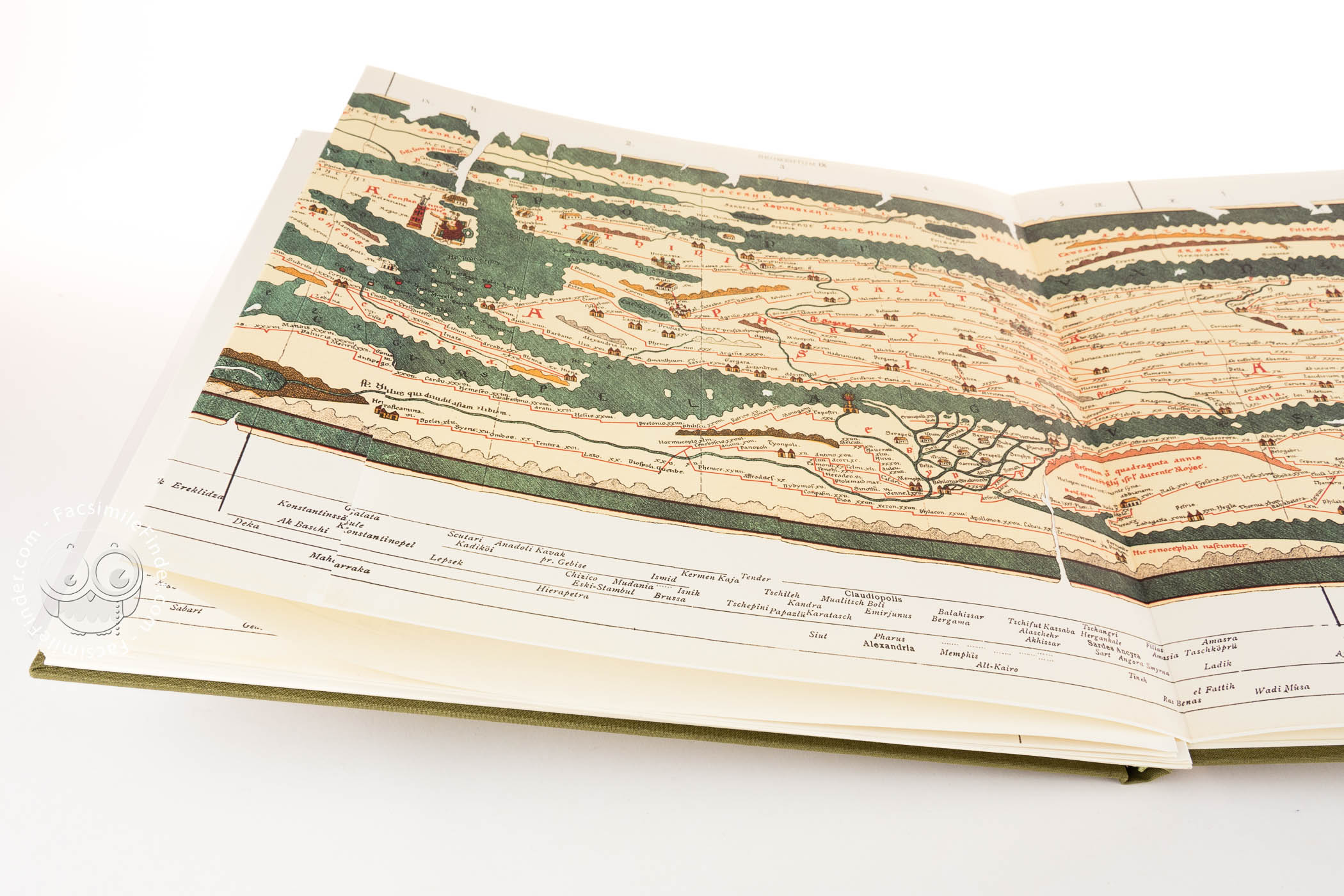
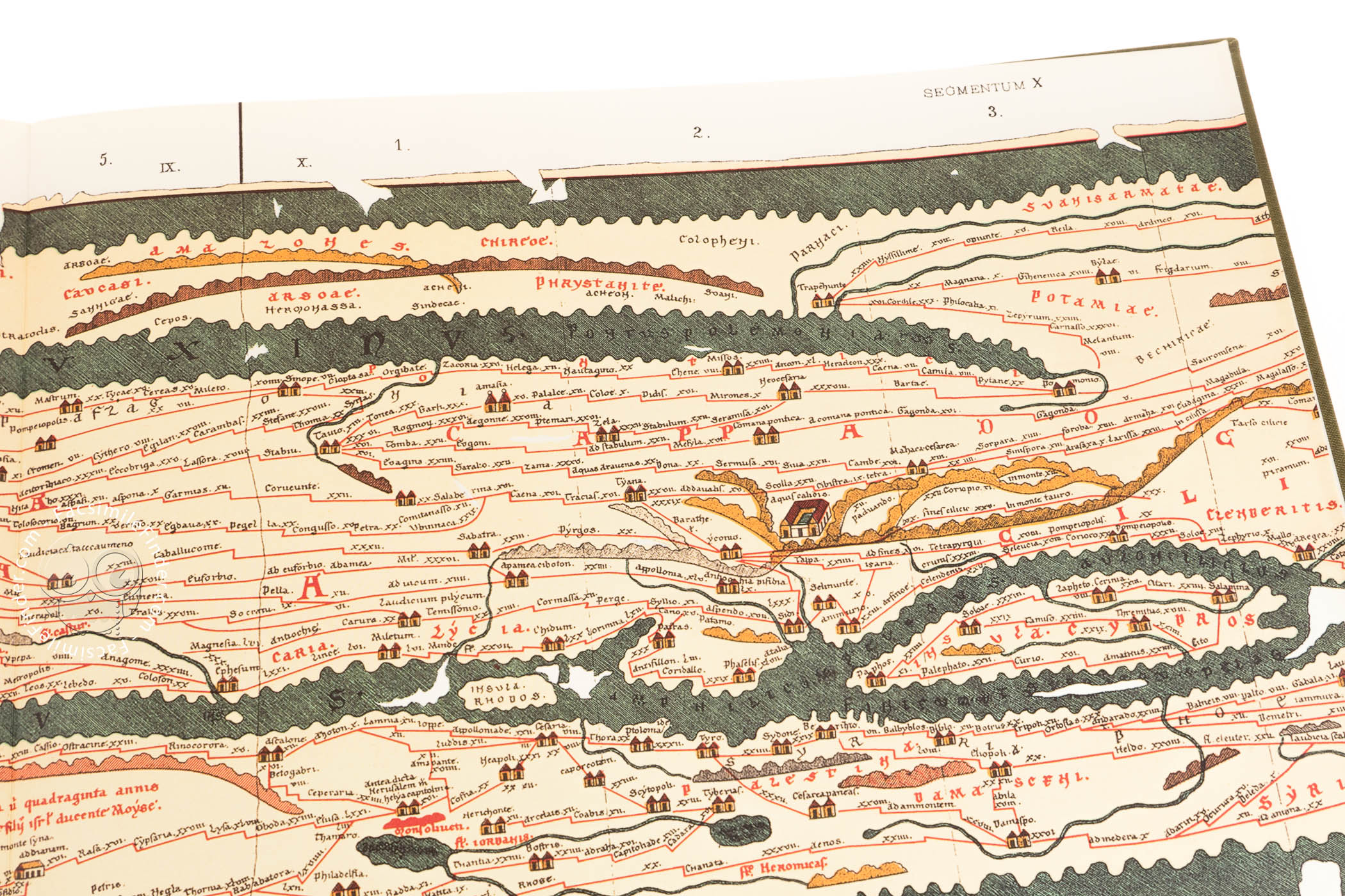
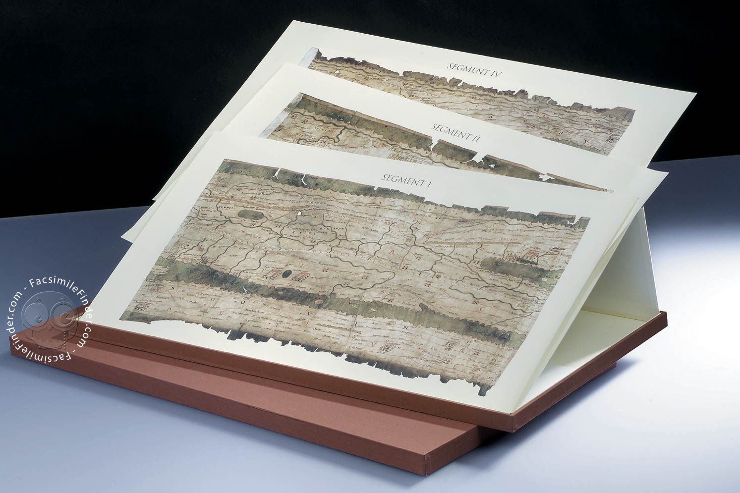
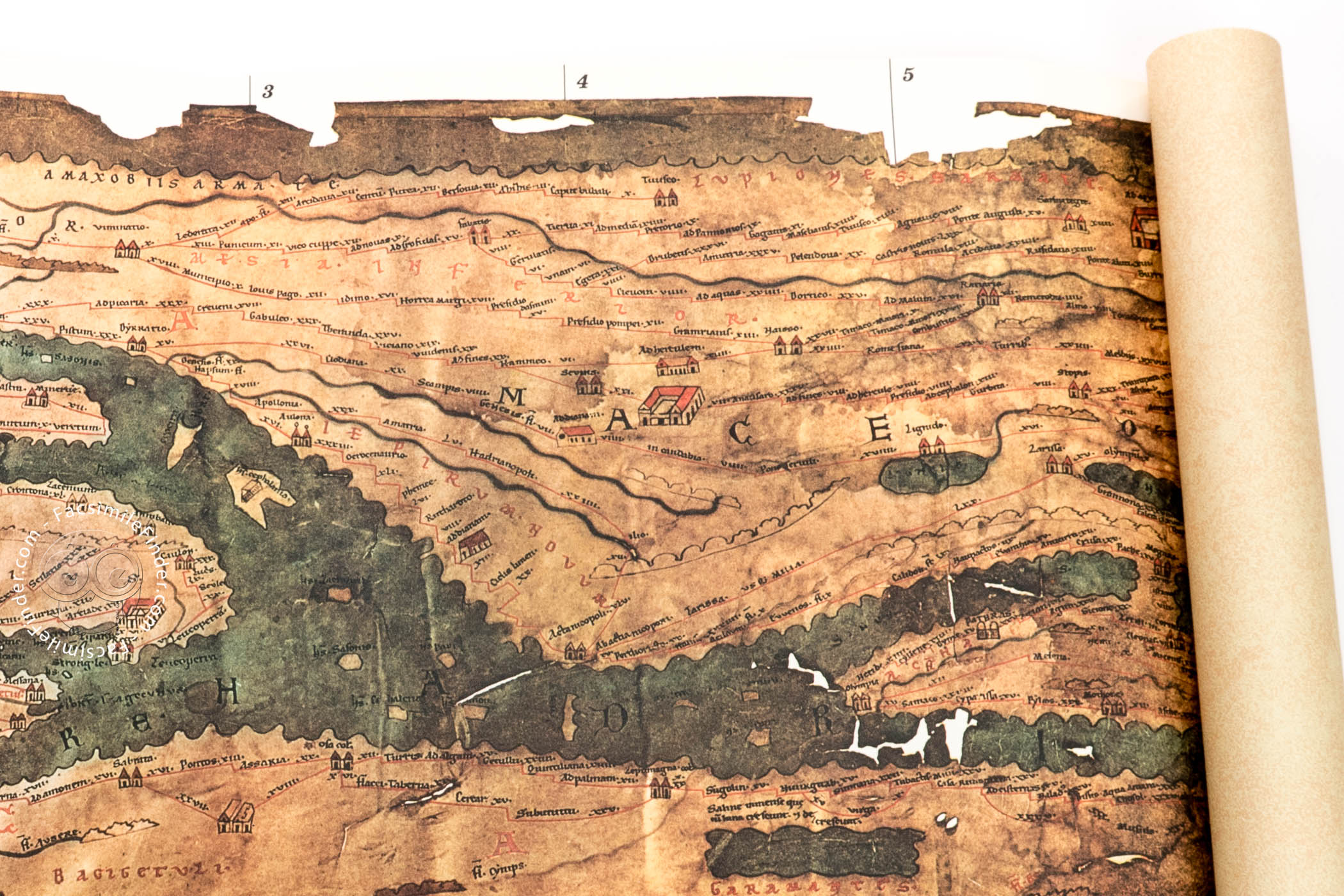
One of the most remarkable features of the Peutinger Map is its format as a roll and its large size. It was composed of eleven segments of parchment, now separated. The chart contains abundant information on the inhabited world known to the ancient Greeks and Romans, including mountains, cities, harbors, baths, and temples.

A Pictorial Image of the Roman Empire

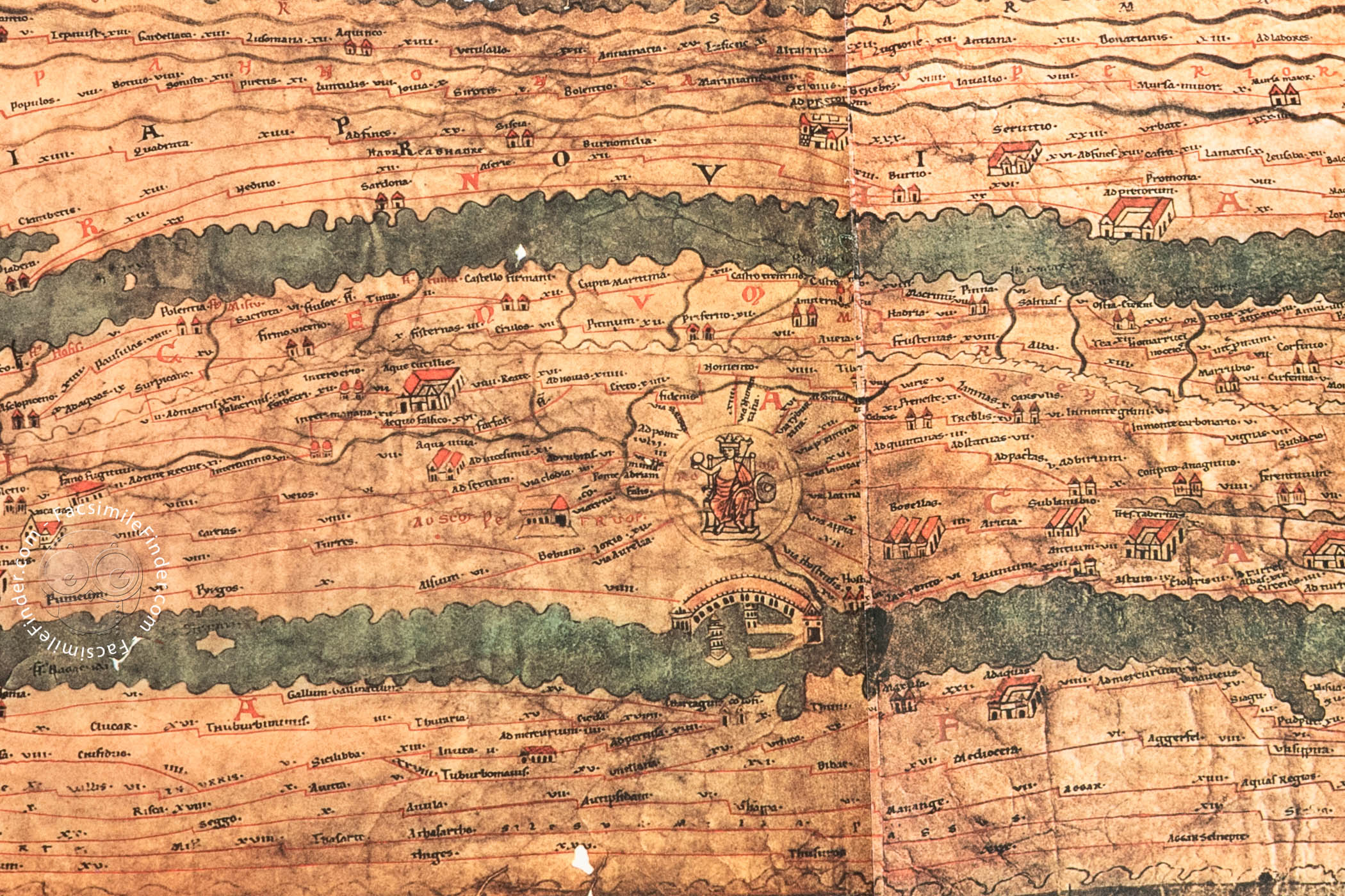
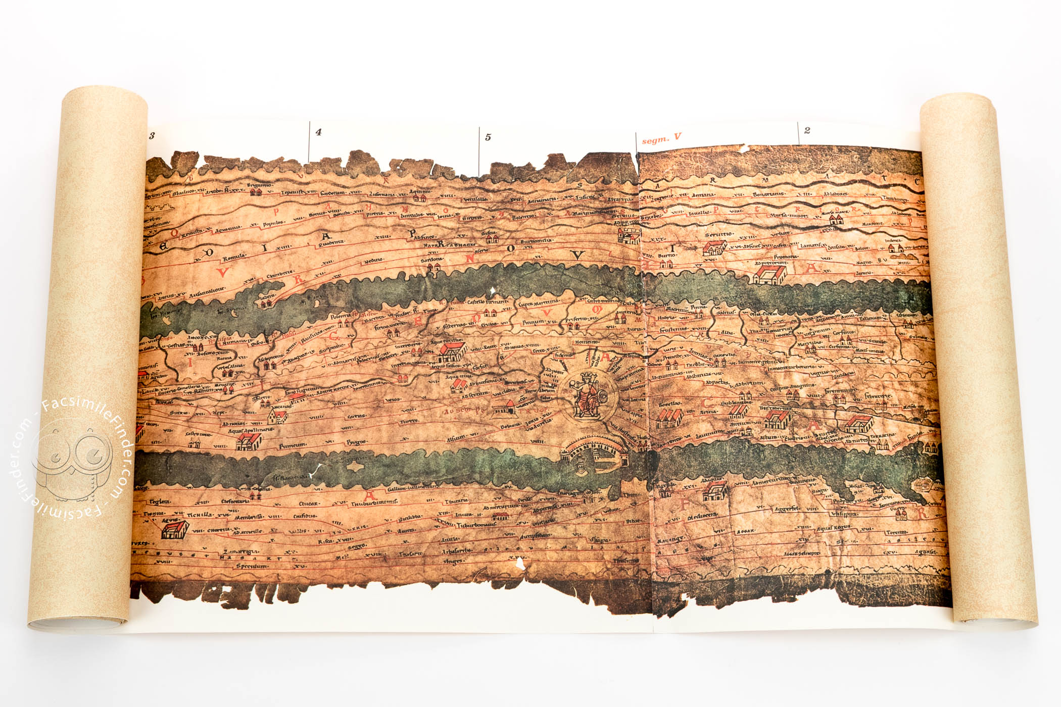
The distances on the map are recorded in Roman miles (1481 meters). The medieval mapmaker introduced Christian references, such as the Church of Saint Peter's in Rome and the site of the Mount of Olives.

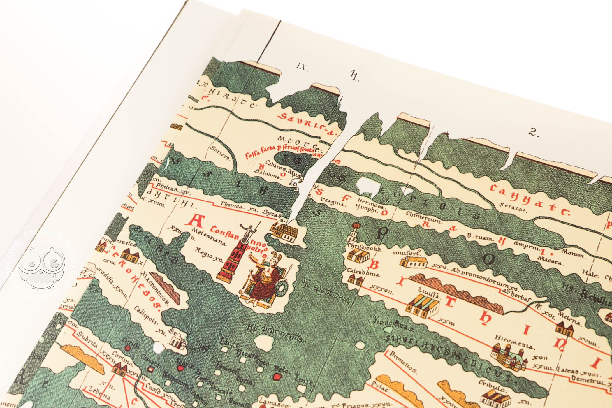
Personifications of Major Cities

The most noteworthy feature of the map is perhaps the prominence given to the cities of Antioch, Constantinople, and Rome. Antioch is represented by an enthroned female personification and a bridge.

Constantinople appears as another enthroned woman, wearing a helmet and holding a shield. Near that figure is depicted a high tower surmounted by a statue, believed to represent Emperor Constantine the Great (d. 337).

The Importance of Rome

The city given the most prominence on the map is Rome. It is symbolized by a female figure holding a globe, a lance, and a shield, stressing the idea of Rome as caput mundi ("head of the world"). The figure is framed by a circle, from which a series of important Roman streets and roads emerge. The Tiber River, as well as the port of Ostia, are clearly depicted.

The whole map is crossed by a complex road network, which is thought to have been based in part on information gleaned from ancient textual sources listing distances. Thus, the Peutinger Map, although not topographically accurate, offers one of the most complete images of the road and transportation system of the Roman period.

A Map of Interest to Humanists

The Peutinger Map was discovered around 1500 by the German humanist Konrad Celtes (1459-1508), who gave it in 1507 to the antiquarian Konrad Peutinger (1465-1547), after whom it was named. Ignaz Desiderius Peutinger (1641-1718) sold the manuscript around 1714, and it was acquired by Eugene, Prince of Savoy (1663-1737), whose library was subsequently acquired by Charles VI (1685-1740), Holy Roman Emperor, for the Austrian Imperial Library, renamed the Österreichische Nationalbibliothek after World War II. The map was added to UNESCO's Memory of the World Register in 2007.

We have 3 facsimiles of the manuscript "Peutinger Map":

Request Info / Price
Roll description compiled by Kevin R. Wittmann.
Please Read
International social justice movements and the debates that ensued prompted us to start considering the contents of our website from a critical point of view. This has led us to acknowledge that most of the texts in our database are Western-centered. We have asked the authors of our content to be aware of the underlying racial and cultural bias in many scholarly sources, and to try to keep in mind multiple points of view while describing the manuscripts. We also recognize that this is yet a small, first step towards fighting inequality.

If you notice any trace of racist or unjust narratives in our communications, please help us be part of the change by letting us know.

#1 La Tabula Peutingeriana

Bologna: Edizioni Edison, 1978

+ 1

Tabula Peutingeriana, Vienna, Österreichische Nationalbibliothek, Codex Vindobonensis 324, La Tabula Peutingeriana facsimile edition by Edizioni Edison.
La Tabula Peutingeriana facsimile edition by Edizioni Edison.

+ 1

Tabula Peutingeriana, Vienna, Österreichische Nationalbibliothek, Codex Vindobonensis 324, The Edison Edizioni facsimile is in scroll format
The Edison Edizioni facsimile is in scroll format
  • Commentary (Italian) by Levi, Mario; Levi, Annalina
  • This is a partial facsimile of the original document, Peutinger Map: the facsimile might represent only a part, or doesn't attempt to replicate the format, or doesn't imitate the look-and-feel of the original document.

The facsimile (fully colored) is the complete reproduction of the whole original document in its original size (35 x 640 cm). The scroll is set on a larger white background.

Our Price

More Buying Choices

Request Info

#2 Tabula Peutingeriana. Le antiche vie del mondo

Florence: Leo S. Olschki, 2009

+ 5

Tabula Peutingeriana. Le antiche vie del mondo, Codex Vindobonensis 324 - Österreichische Nationalbibliothek (Vienna, Austria), Tabula Peutingeriana. Le antiche vie del mondo facsimile edition by Leo S. Olschki Editore.
Tabula Peutingeriana. Le antiche vie del mondo facsimile edition by Leo S. Olschki Editore.
  • Commentary (Italian) by Prontera, Francesco; Magini, Manlio; Gautier Dalché, Patrick; Calzolari, Mauro
  • This is a partial facsimile of the original document, Peutinger Map: the facsimile might represent only a part, or doesn't attempt to replicate the format, or doesn't imitate the look-and-feel of the original document.

Reprint of the 1888 facsimile edition by K. Miller (portion of the original document). Reproduced in full colors and enlarged in size compared to the previous facsimile, the Tabula Peutingeriana is represented on a larger white background.

Our Price

More Buying Choices

Request Info

#3 Tabula Peutingeriana

Graz: Akademische Druck- u. Verlagsanstalt (ADEVA), 1976

Tabula Peutingeriana, Codex Vindobonensis 324 - Österreichische Nationalbibliothek (Vienna, Austria), Tabula Peutingeriana facsimile edition by Adeva.
Tabula Peutingeriana facsimile edition by Adeva.
  • Commentary (German) by Weber, Ekkehard
  • This is a partial facsimile of the original document, Peutinger Map: the facsimile might represent only a part, or doesn't attempt to replicate the format, or doesn't imitate the look-and-feel of the original document.

The facsimile is the complete reproduction of the 11 sections of the original document in original size (total length: 675 cm; breadth: 34 cm). The scroll is set on a larger white background. Every page is doubly reproduced (full color reproductions and black-and-white reproductions with a locating screen and designation of local names). The commentary describes the contents of the map, its original quality and the story of its discovery and exploration. A comprehensive bibliography and a complete register of the towns and stops indicated are also featured.

Binding

Cloth.

Our Price

More Buying Choices

Request Info