
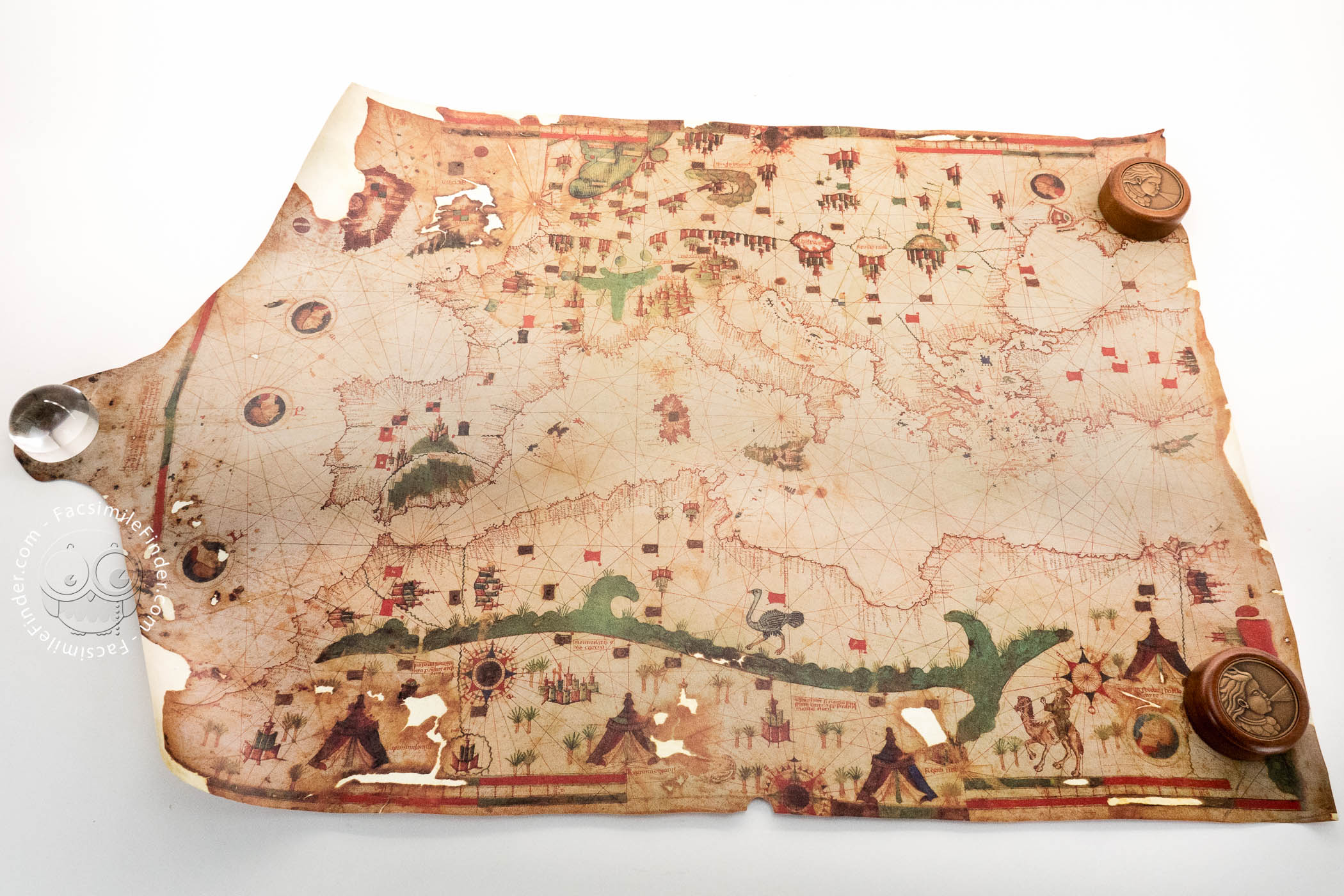

The map is one of the most interesting works of the Jewish chart maker Jehuda ben Zara. Created in Alexandria, it depicts the Mediterranean Sea, Northern Africa, Europe, and part of Asia quite accurately for its time. The author added a legend on the left of the chart dating it 8 February 1497, and referring to the deposition of the Sultan of Cairo a few days before.
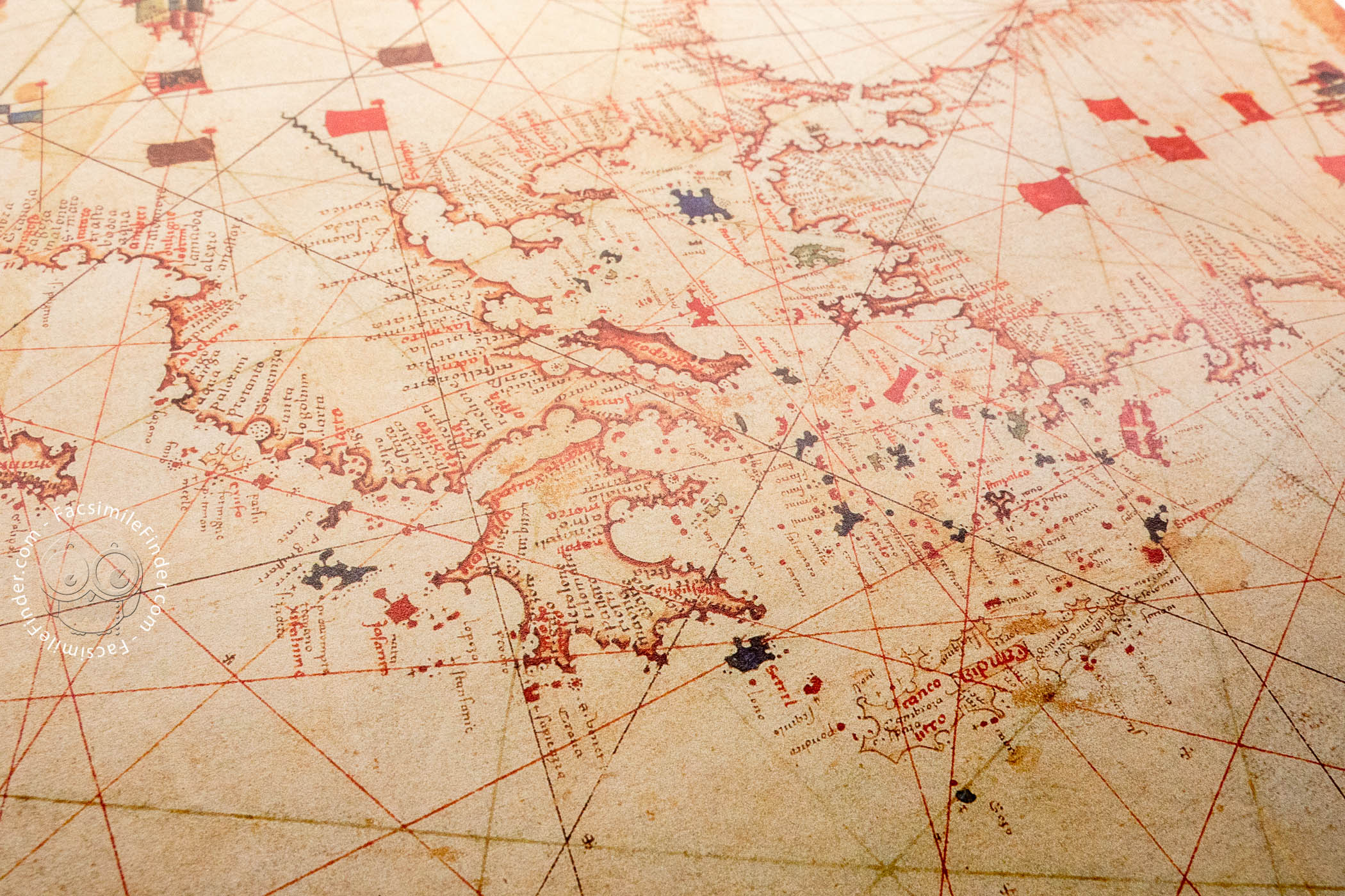
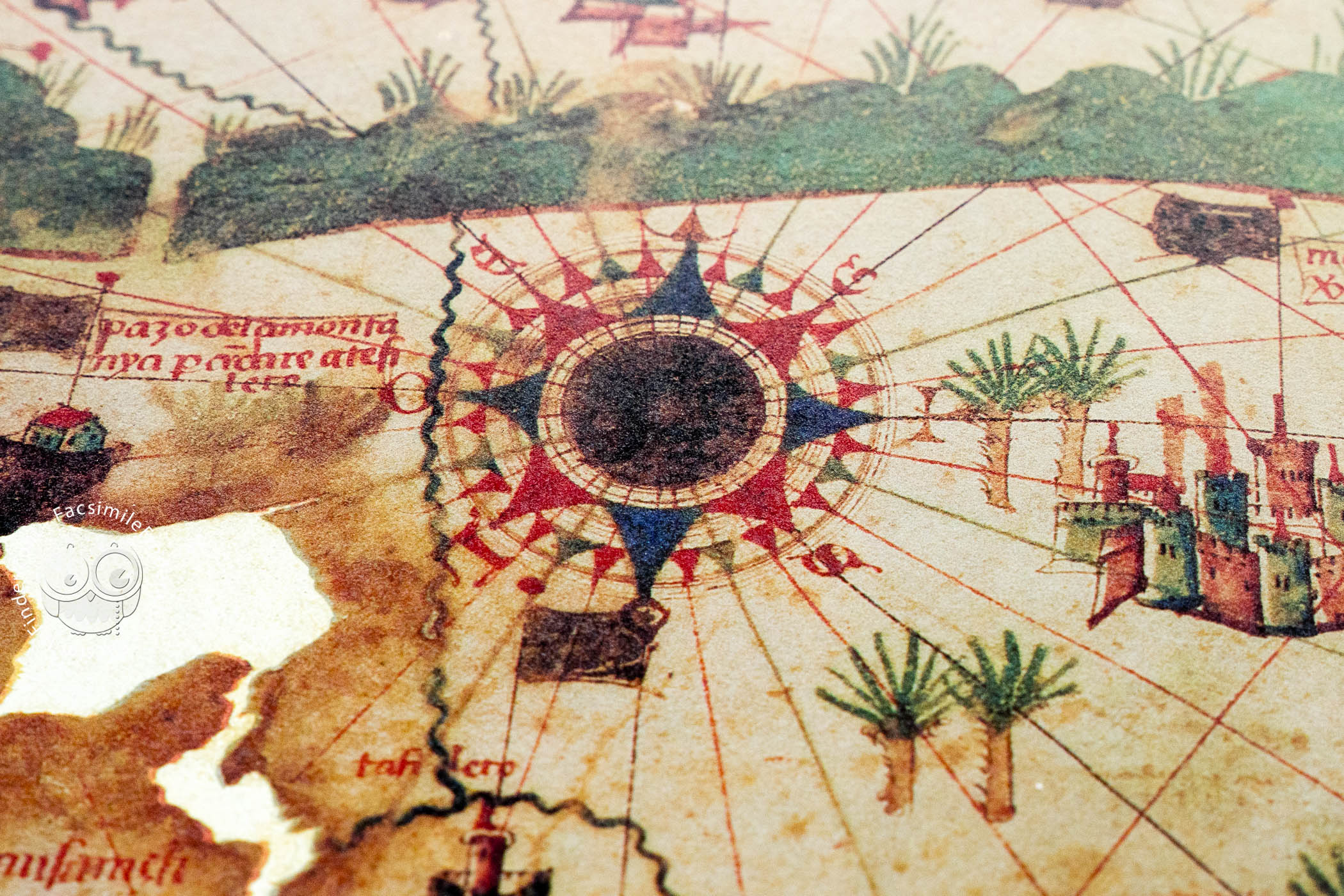
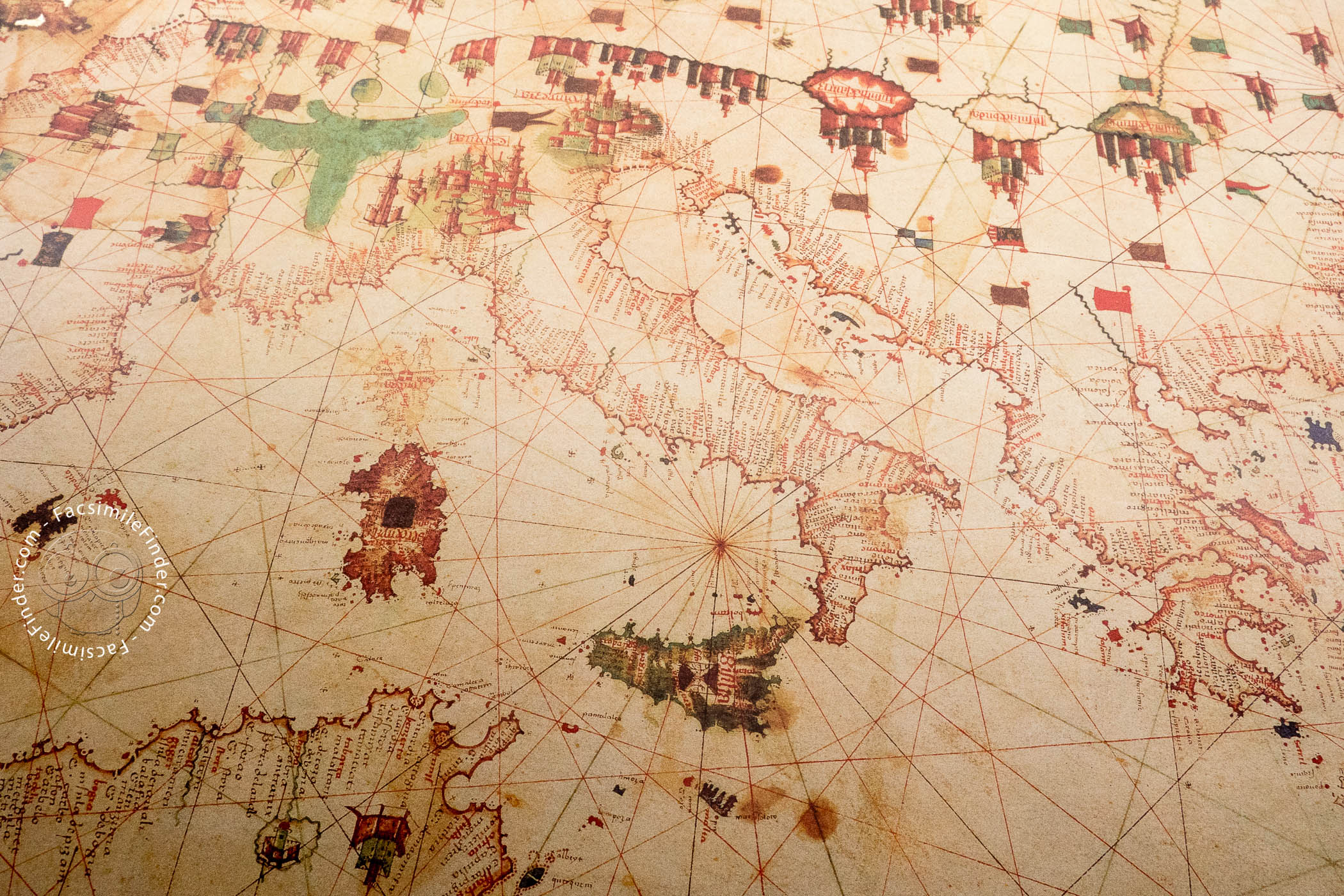
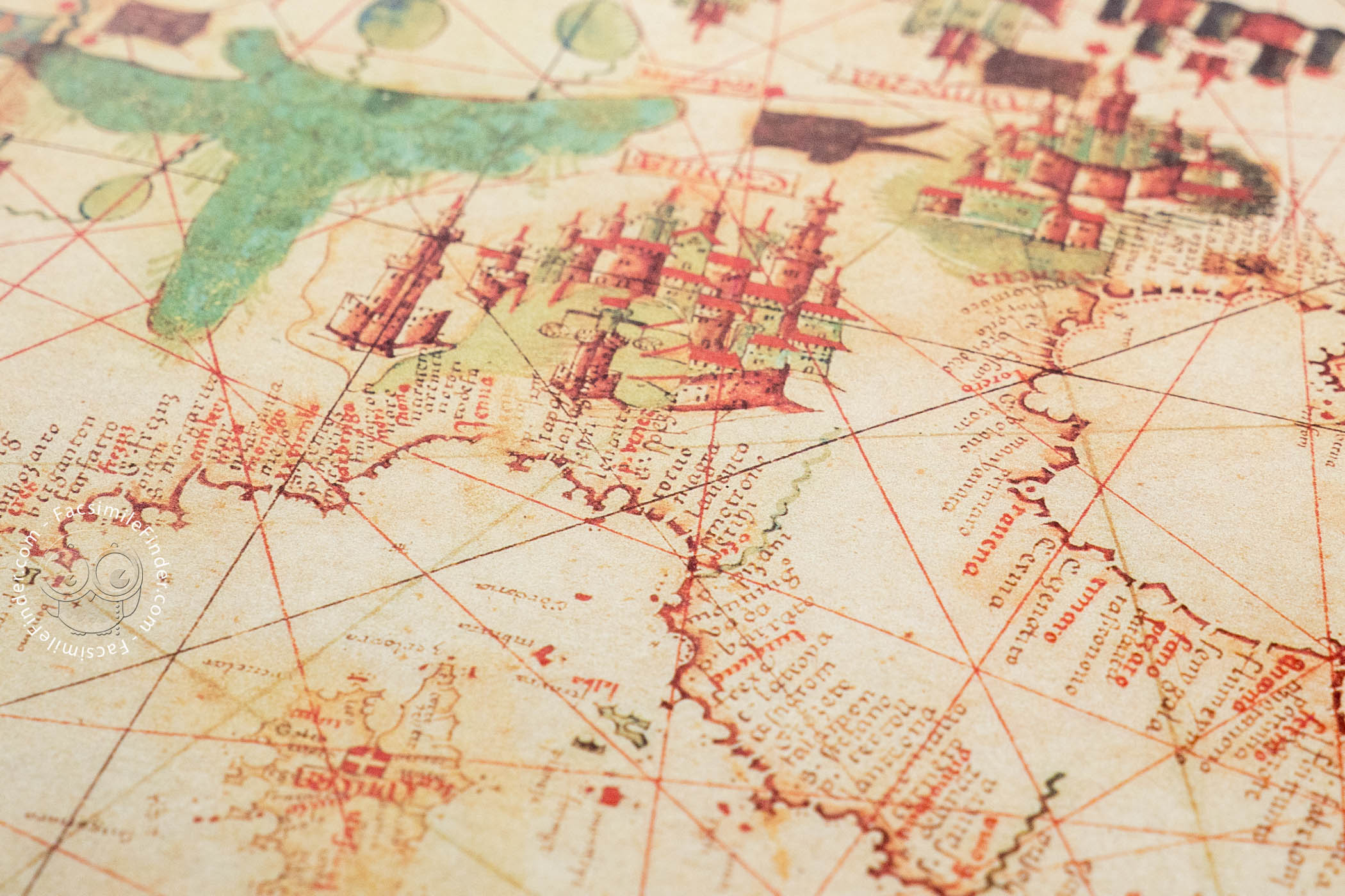
Following the tradition of Mediterranean fifteenth-century nautical charts, the shorelines on this chart are dense with the names of coastal cities and ports, and their names are written perpendicularly. The decorative elements in the hinterlands are also very interesting, showing several cities, topographical features, and animals, as well as beautiful compass roses and representations of the winds surrounding the map.
A Superb Example of Fifteenth-Century Nautical Chart
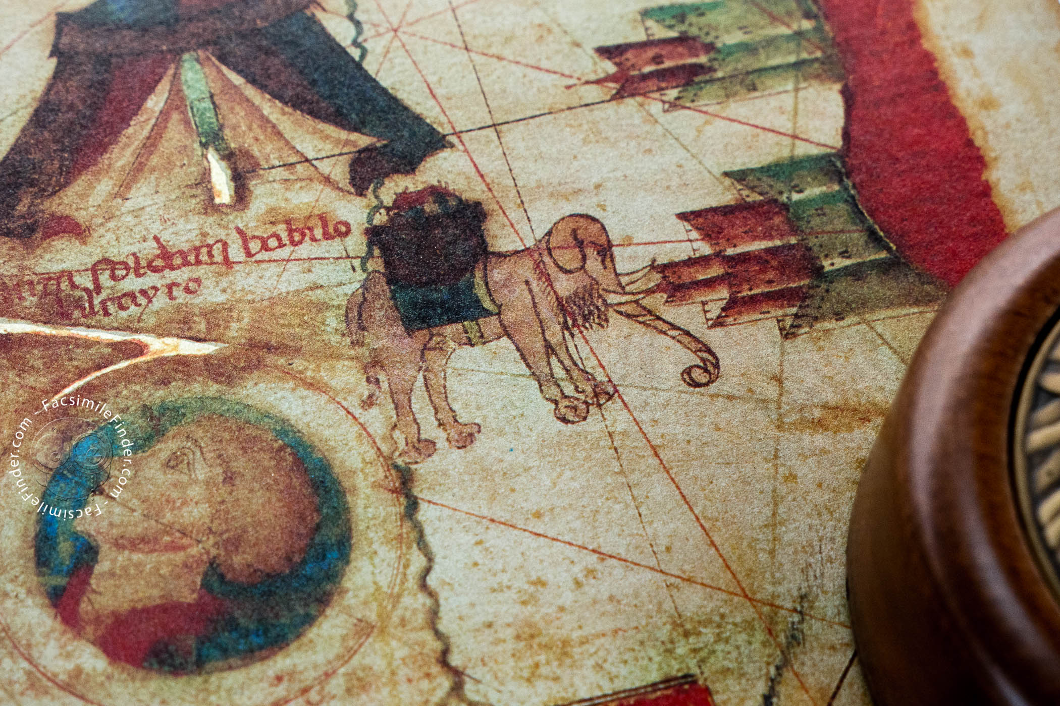
The chart is written on parchment and measures 67 x 92.5 cm. Among the several representations of cities, Genoa is the most prominent. Flags indicating political control also mark different territories all over the map. In Africa, four tents representing the abodes of specific sovereigns are drawn, and a big, green band represents the Atlas Mountains in the northern Sahara.
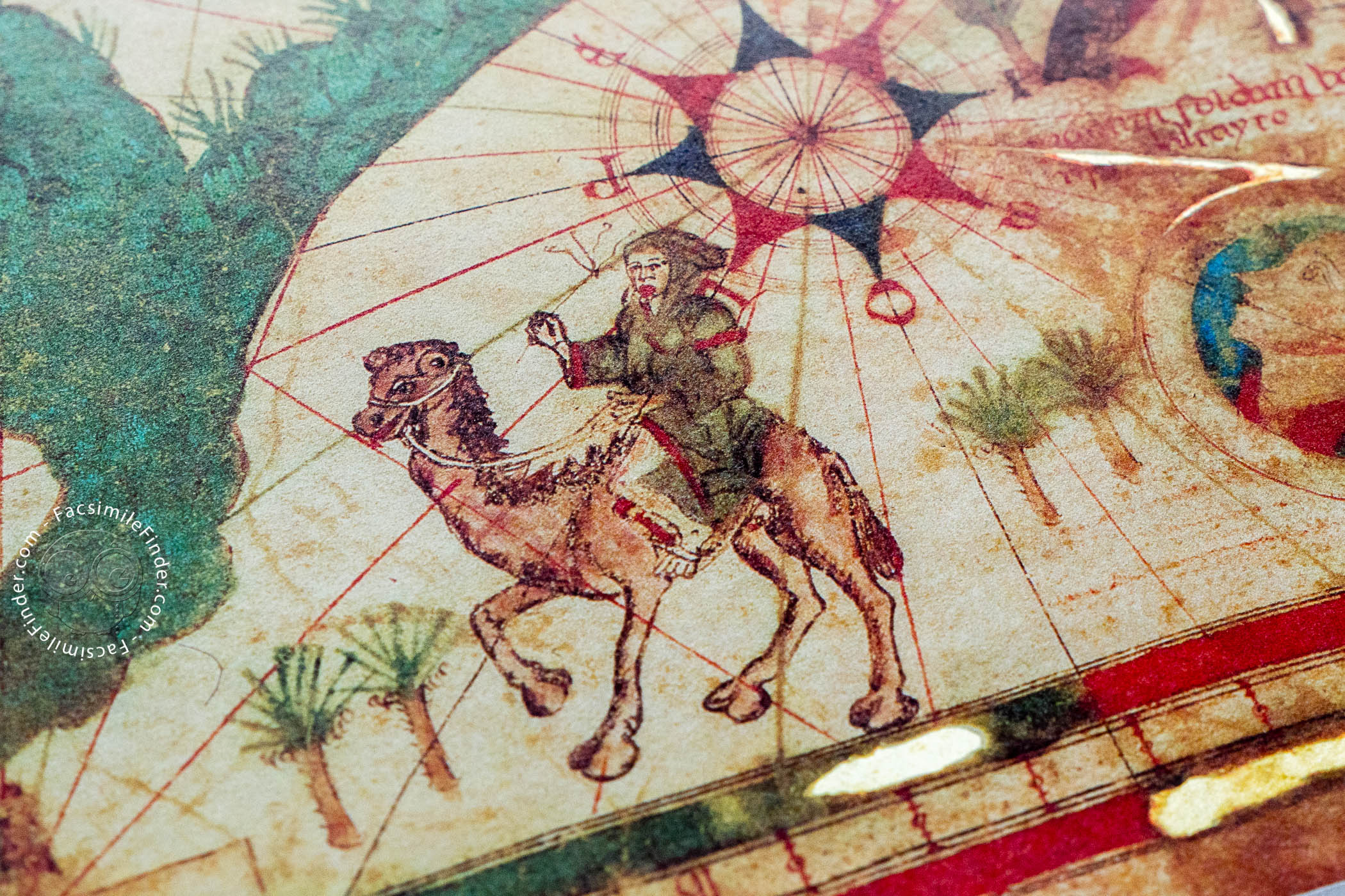
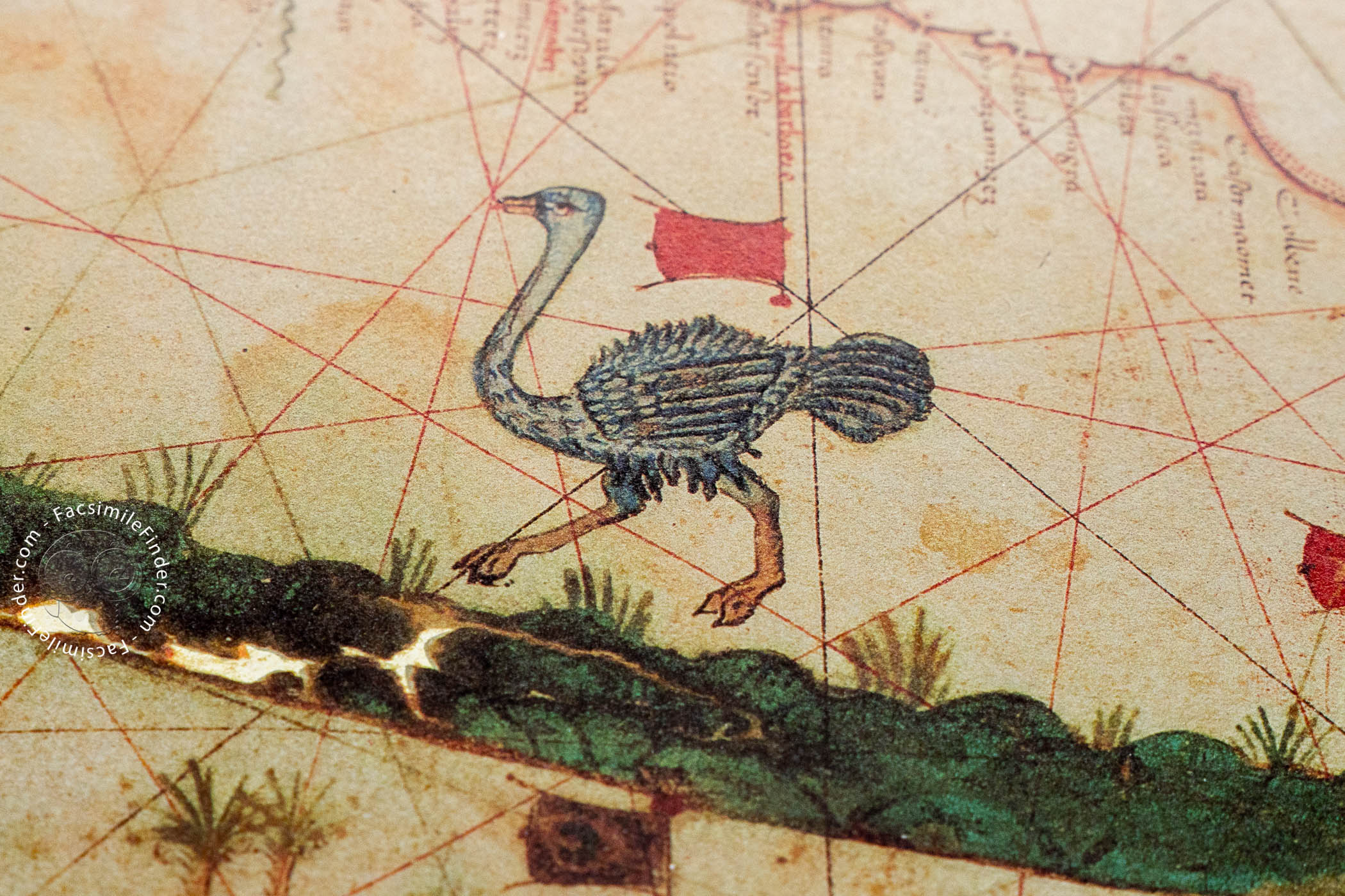
It is worth mentioning the beautiful animals depicted in Africa. An ostrich seems to run westwards over the Sahara, and in northeastern Africa, a local man rides a delightfully drawn camel. An elephant can be seen in the eastern part of Africa, showing the references that Europeans had about African fauna.
Five heads representing the winds and inserted in circles are drawn around the map, a decorative detail also present in other nautical charts of the period, such as the works of Petrus Roselli. These high-quality decorations indicate that the chart was made for display by a noble, rather than for use at sea.
Given its decorative and stylistic features, this map is a superb example of Catalan-Majorcan nautical chart works of the fifteenth century, one of the most important cartographic schools of southern Europe. It is currently held in the Vatican Apostolic Library, under the shelfmark Borg. VII.
Jehuda ben Zara and Fifteenth-Century Mediterranean Cartography
The Jew Jehuda ben Zara, also known as Judah Abenzara, is an author of Mediterranean nautical charts of the late fifteenth century. Little is known about his life, but, given the stylistic features of his works, it is believed that he was in close contact with the Catalan-Majorcan school of mapmakers.
Through its strategic situation and commercial activity, the island of Majorca was one of the earliest and most important cartographic centers in the Mediterranean. Different cultures, including Islamic, Latin, and Jewish, coexisted in the island, and the reflection of that coexistence is clearly reflected in Majorcan art and culture.
The nautical charts created in that context are a good example of this mixture of cultures. Jewish cartographers drew some of the most important and lavish charts of the time, like the so-called Catalan Atlas made by Abraham and Jehuda Cresques, and the works of Juan de Vallseca. The nautical chart of Jehuda ben Zara is another example of that mixture of cultures.
We have 1 facsimile edition of the manuscript "Sea Map of Iehuda Ben Zara": Seekarte des Iehuda Ben Zara. Borgiano VII facsimile edition, published by Belser Verlag, 1983
Request Info / Price