
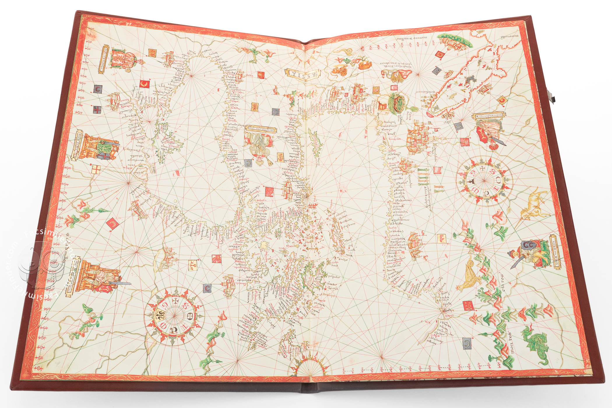

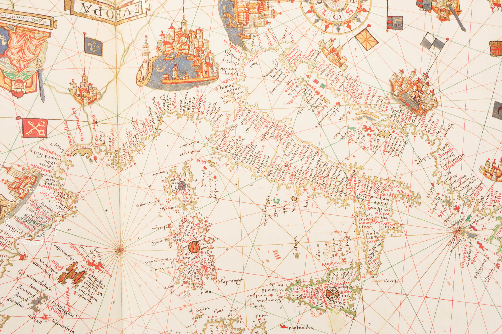

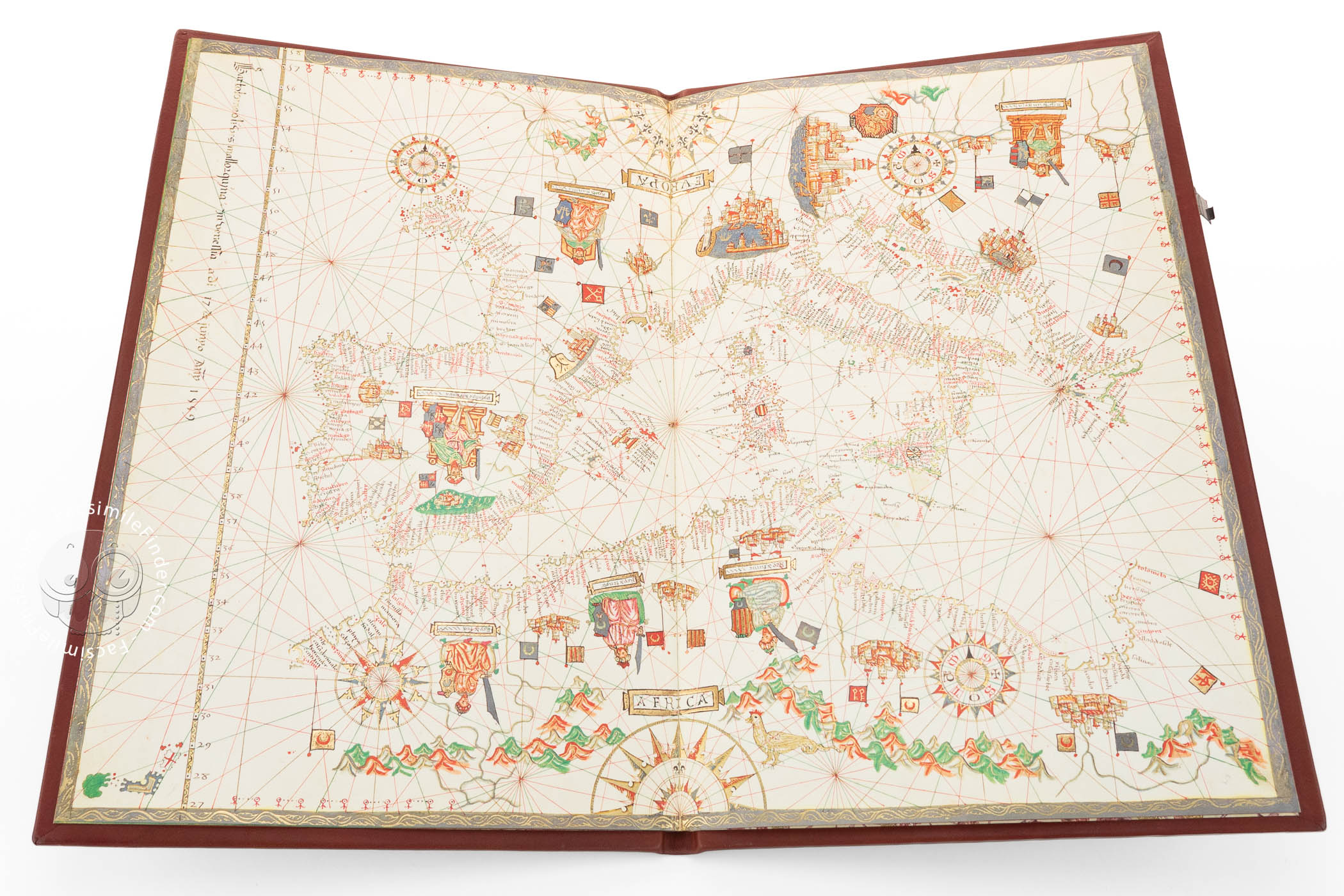
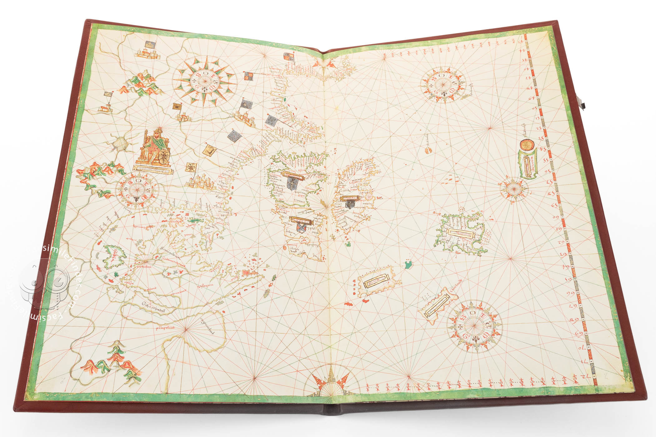

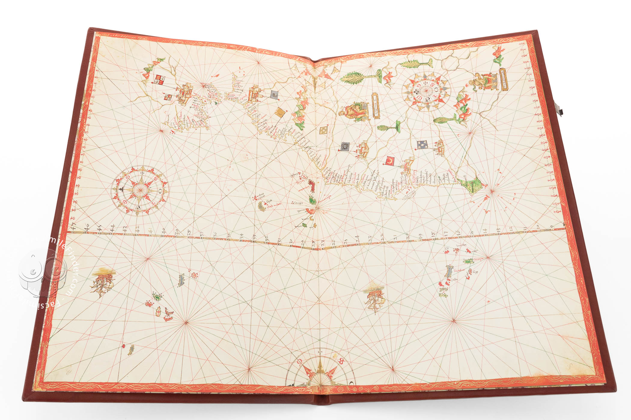


The Portolan Charts of Bartolomeo Oliva is a bound volume of five nautical maps of the Mediterranean Basin, the area around the Black Sea, and the Atlantic coasts of Europe and Africa. One chart is signed and dated June 17, 1559, by the cartographer Bartolomeo Oliva, who describes himself as from Majorca. Although the charts were produced in Venice, they feature the abundant and colorful illustrations characteristic of the Majorcan tradition of mapmaking. They stand out for their high artistic quality, with generous use of gold.
Each large map, in landscape format, was folded in half and bound into the book along the fold to create a series of maps charting waters extending from the Holy Land in the east across the Mediterranean and Atlantic to Brazil's coast.
The Majorcan "School"
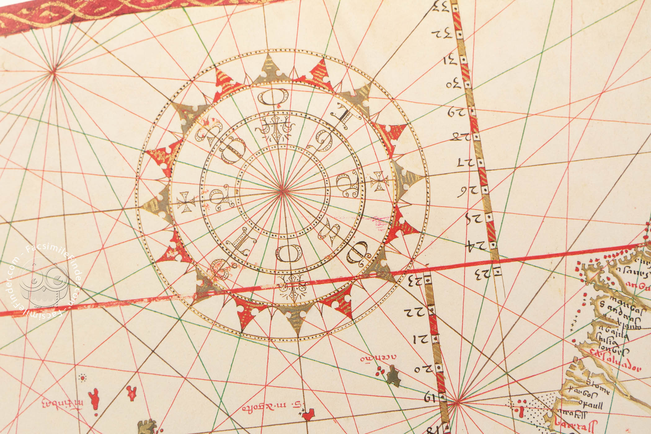
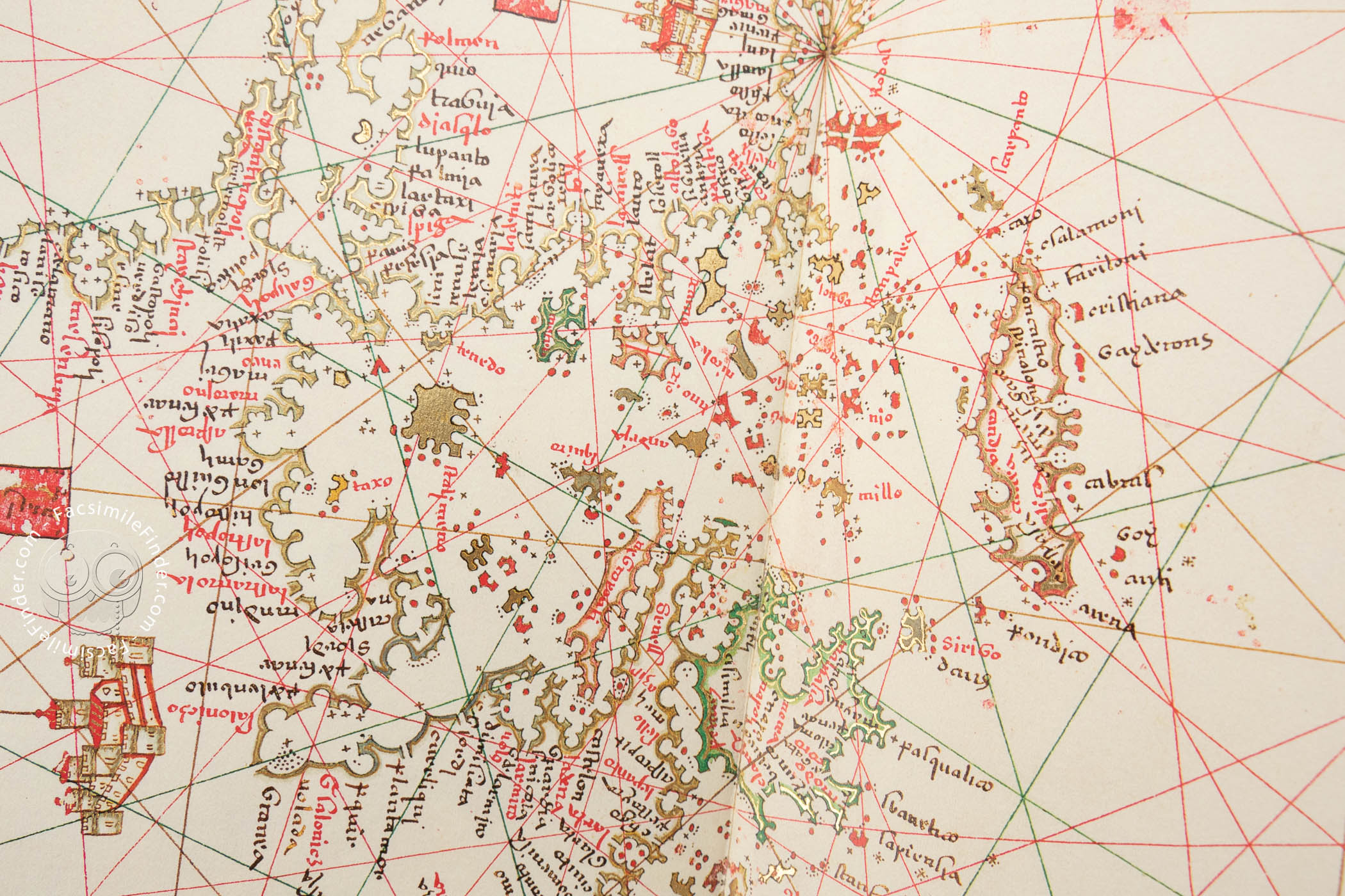
Portolan charts outline seacoasts, with place names written on the land mass perpendicular to the coastline. In principle, they are navigational aids, but the practice developed—in Catalonia and Majorca—of embellishing the land masses of such charts with graphic information about topography and peoples.
Bartolomeo Oliva—also known as Bartomeu/Bartolomeu/Bartlomé Olives—was trained as a mapmaker in his native Majorca. He enjoyed a long career (1538-1588) producing portolan charts in Messina and Venice.
Coastlines, Islands, Mountains, and Harbors
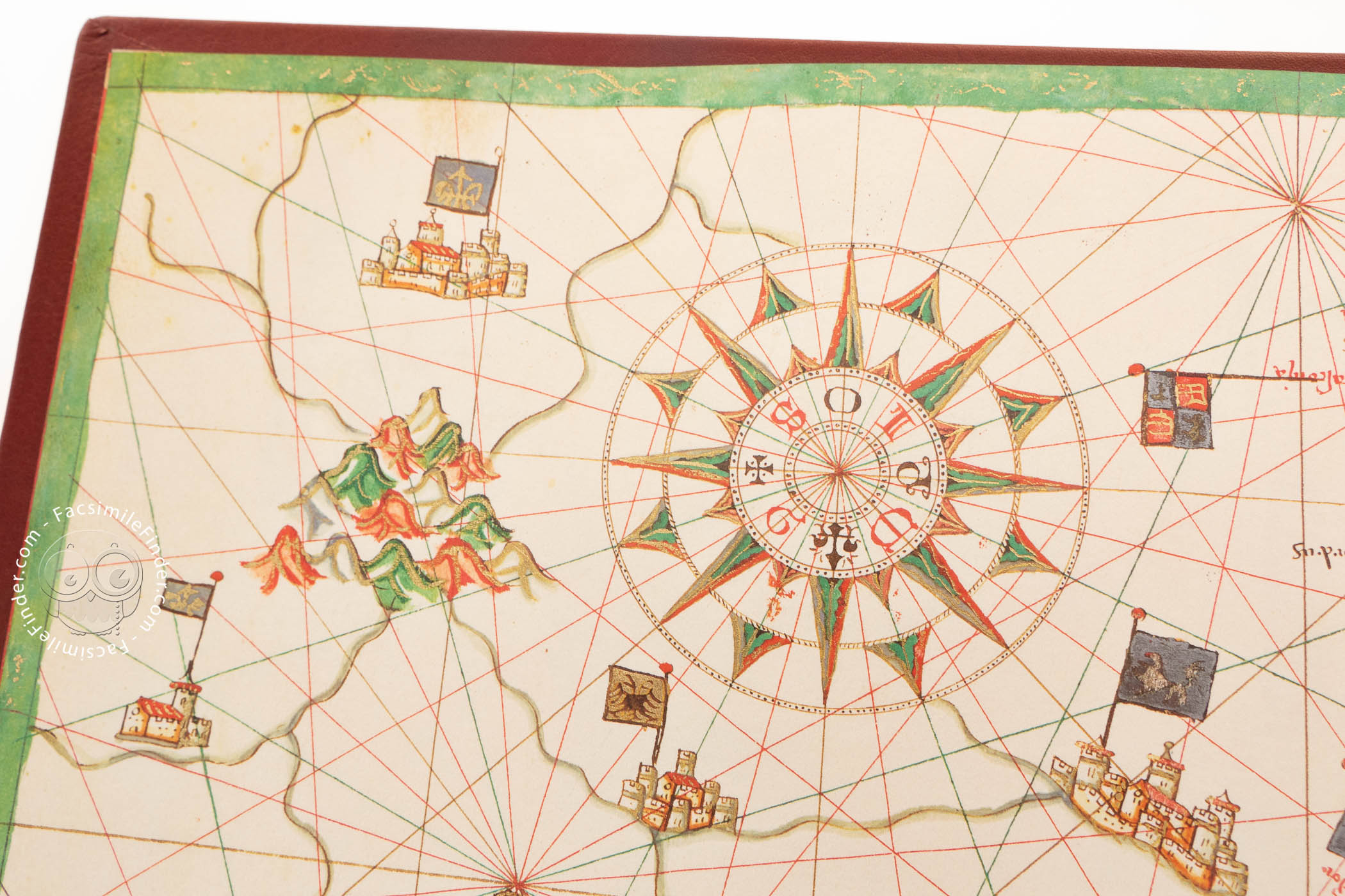
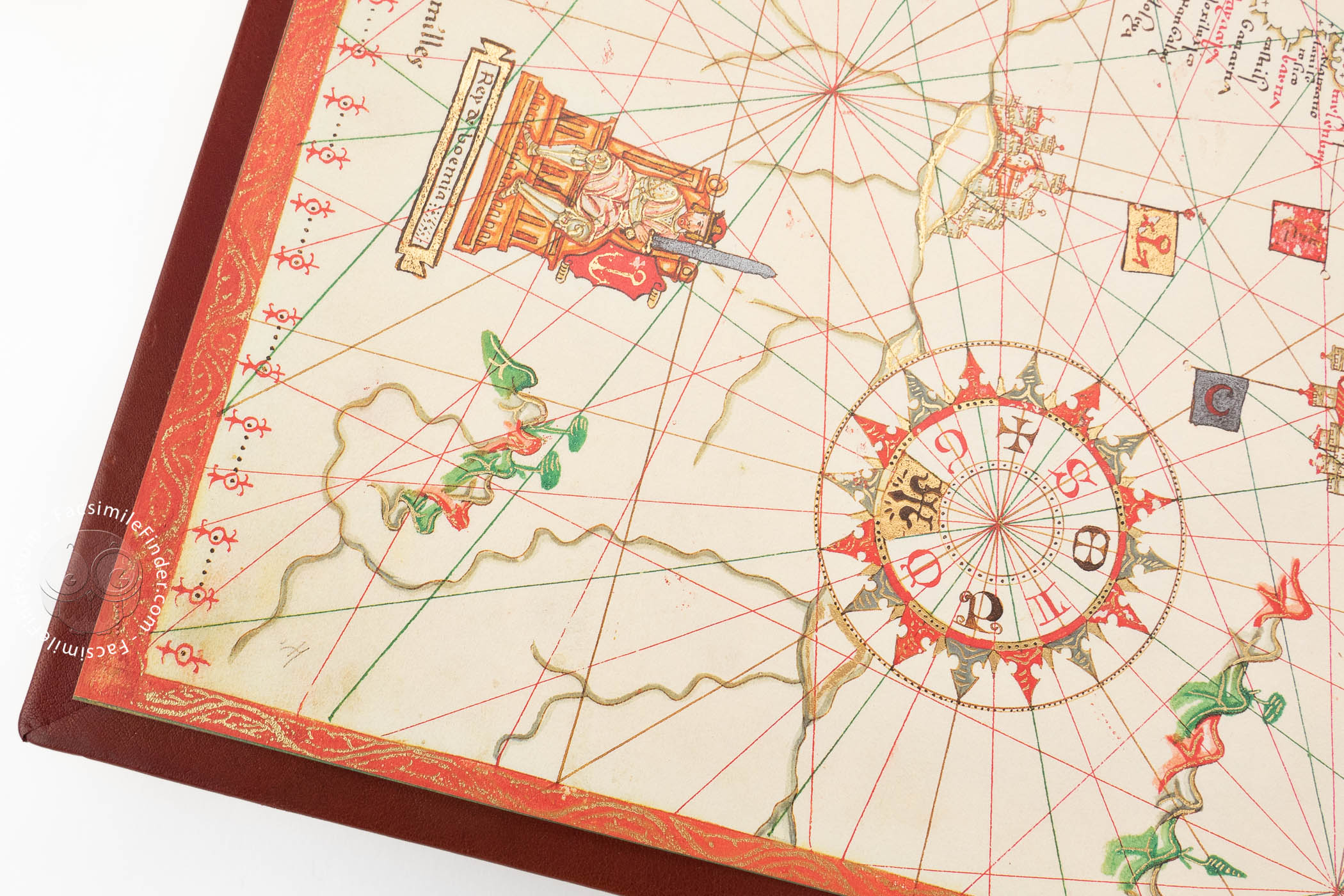
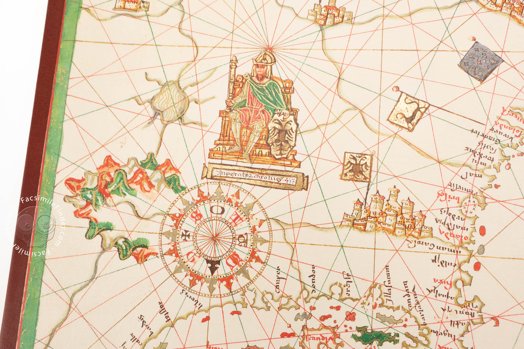
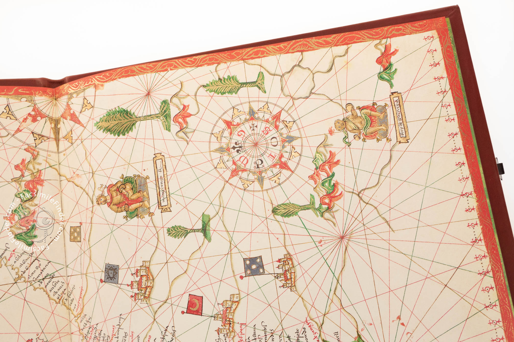
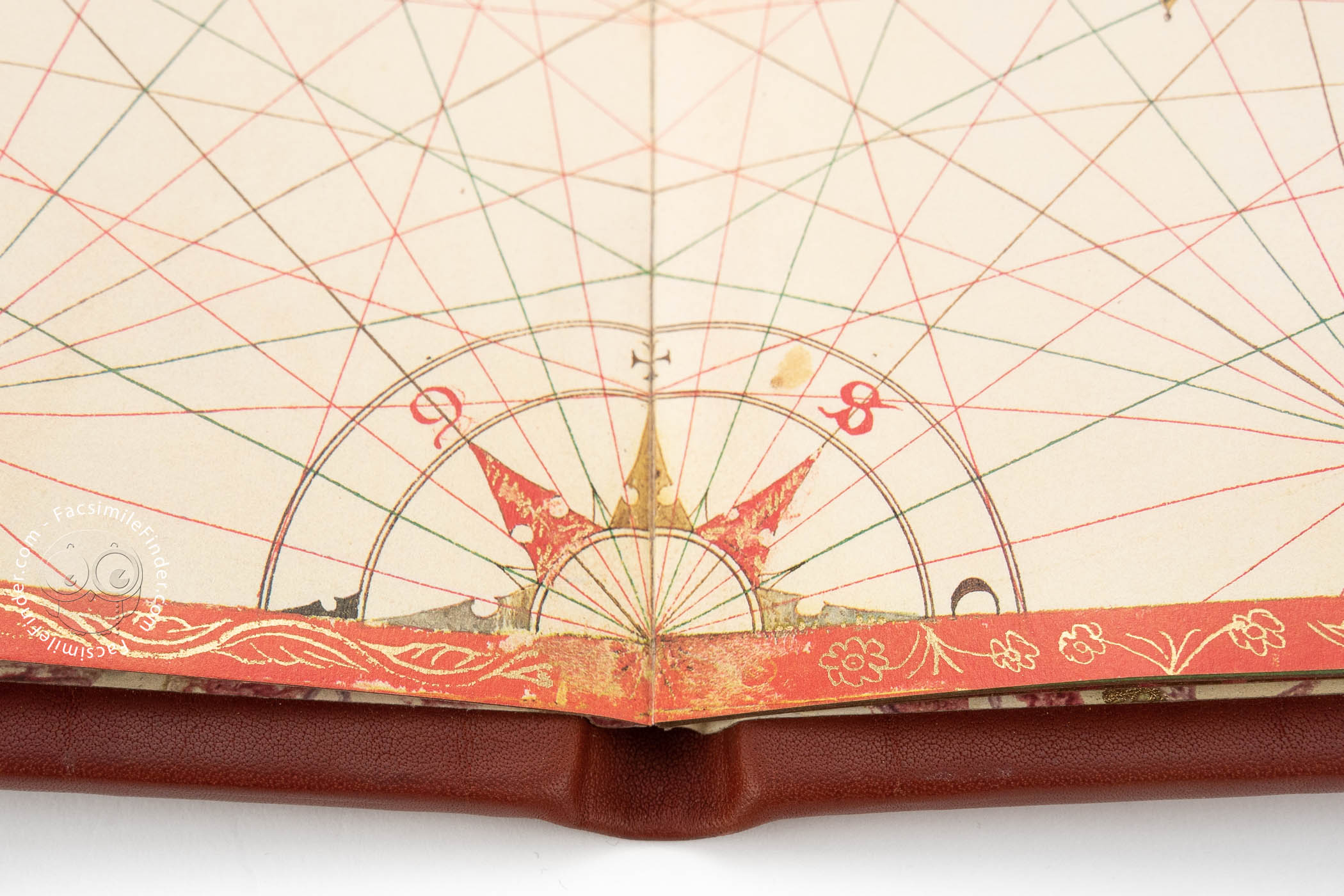
The key feature of each chart is the contour of coastlines; for large land masses, these are customarily colored gold. The shore of the Red Sea is red (chart 4), and a few coastlines are shaded green. Small islands are of solid color—gold, red, or green—with the names of landmarks written in the sea.
Mountain ranges are exceptionally bright and colorful in red, green, and gold. Blue is used sparingly and mostly in flags and to color the harbors in the detailed depictions of Genoa, Venice, and Kotor. Colorful flags indicate ruling powers. The whole island of Majorca is rendered in Catalonia's red and gold stripes (chart 3).
Enthroned Rulers and Creatures, Real and Fantastic
Each chart includes a portrait of at least one ruler. For example, Charles V (1500-1588), Holy Roman Emperor, is pictured in northern Europe (chart 2). His nemesis, Süleyman I "the magnificent" (d. 1566), Sultan of the Turks, is shown seated on a cushion; labeled "gran turcho," he has a distinctive red mustache and beard and wears a turban (chart 4).
The legendary Prester John is shown in sub-Saharan Africa (chart 5). Among the creatures depicted on the charts are a unicorn, a dragon, a basilisk, a bear, a lion, and a snake (chart 4), as well as a camel (chart 5).
A Mixture of Languages
Coastal landmarks, including cities and harbors, are labeled in black or red, red being reserved for more important places. They are written in a script that might be classed as Gothic Hybrida. Continents and human figures are labeled in fictive scrolls in either the hybrida of the placenames or display script, often Square Capitals.
At least one descriptive label is in Italian, the designation of Mount Sinai as "monte sinayi dove sta il corpo di Santa caterina" (chart 4). The intention may have been that the place and ruler names be in Latin, but Spanish words appear.
Acquired by an Avid Collector
Matteo Luigi Canonici (1727–1805), who amassed a large collection of manuscripts, owned the manuscript, which he probably acquired during his residency in Venice. His collection passed through the hands of his brother and nephew before being purchased by the Bodleian Library in 1817.
We have 1 facsimile edition of the manuscript "Portolan Charts of Bartolomeo Oliva": Carta da Navigar di Bartomeu Olives facsimile edition, published by Istituto dell'Enciclopedia Italiana - Treccani, 2019
Request Info / Price