
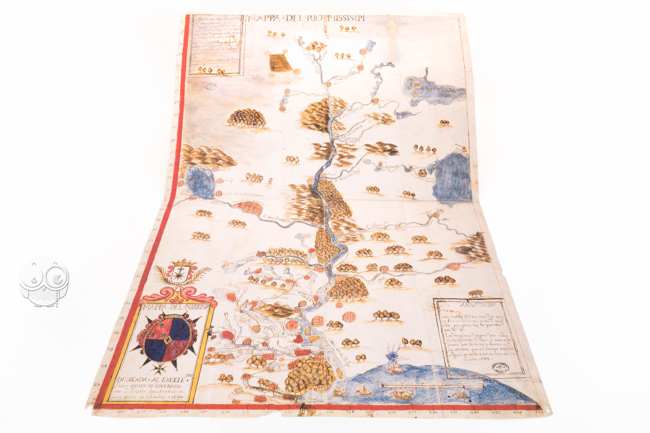


This anonymous manuscript map, made in 1699, represents the Mississippi River and its tributaries, showing an interesting view of the river’s surroundings and settlements. With abundant orographic details and place names and several explanatory texts, this map allows us to observe the situation of the Mississippi and its geographic context in the late seventeenth century. The inscriptions and cartouches present in the map explain various features, making it one of the most interesting and useful maps of that area at the time.
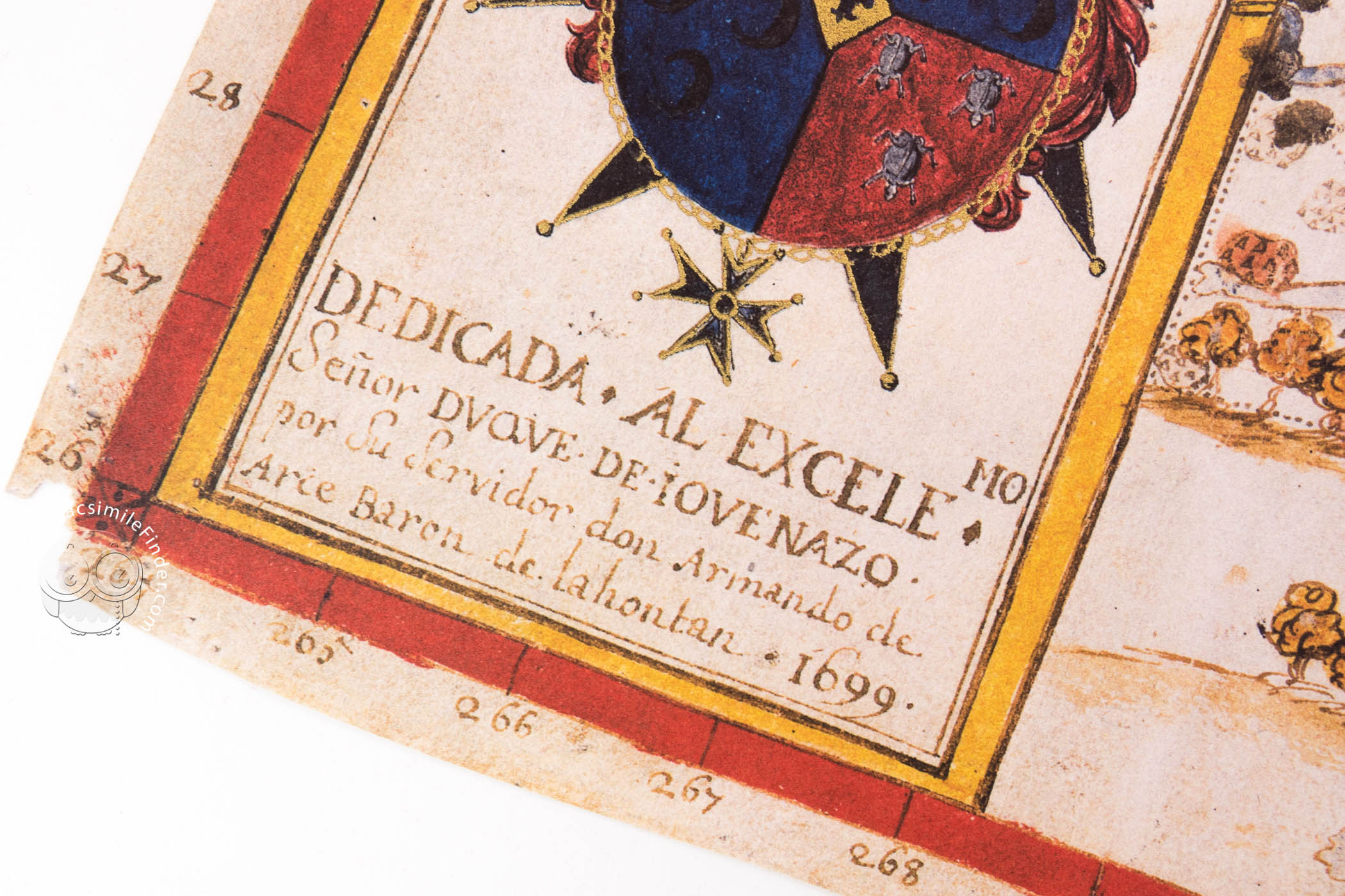
The map was commissioned by Louis-Armand de Lom d’Arce, Baron of Lahontan (1666-1716), and dedicated to the Duke of Jovenazo, Spanish ambassador in Lisbon. Its geographic information stems from various sources, such as the diary of the second voyage of Cavelier de la Salle (1643-1687), who explored much of the Mississippi, founding several settlements along the river.
A Reflection of the Mississippi in the Late Eighteenth Century
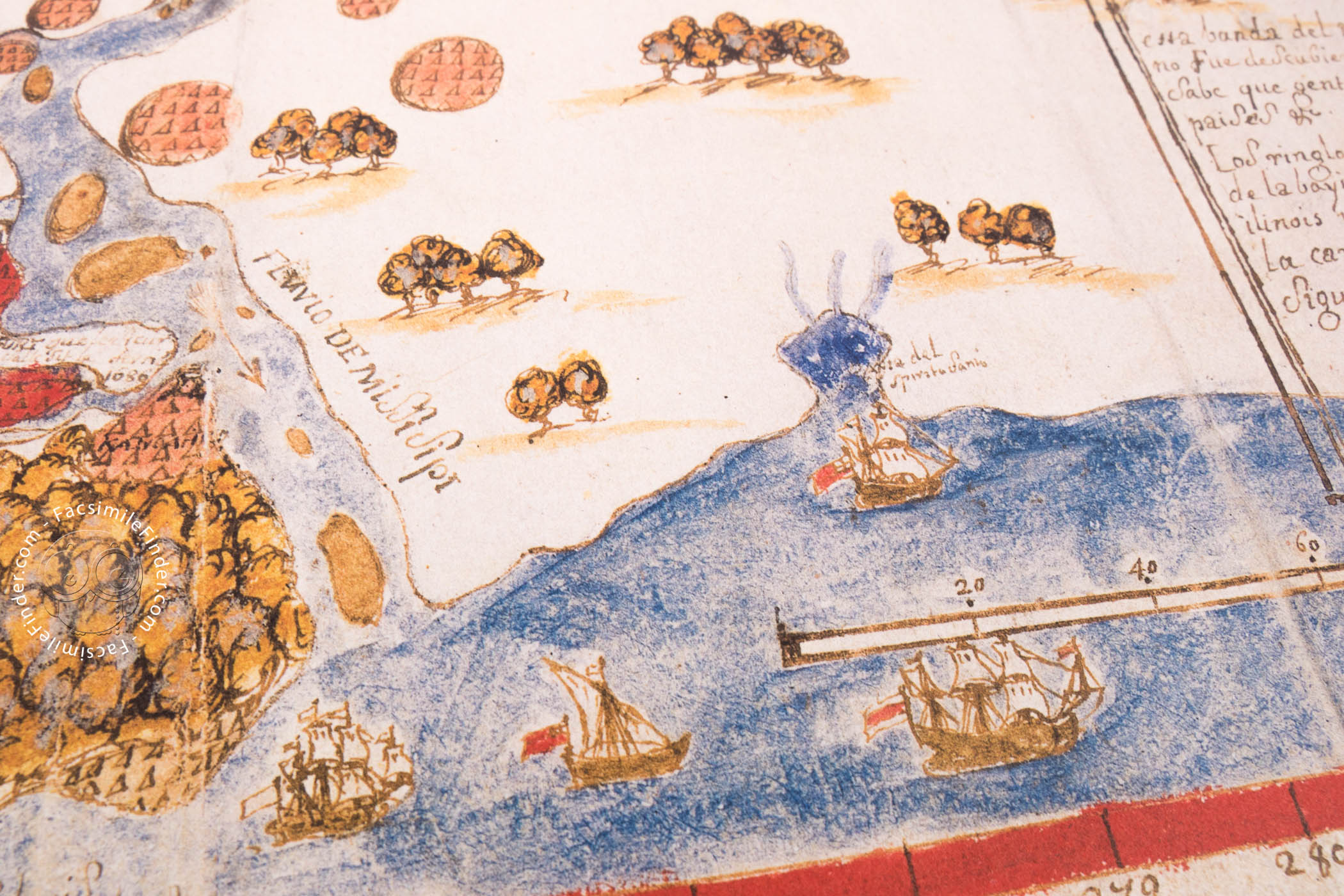
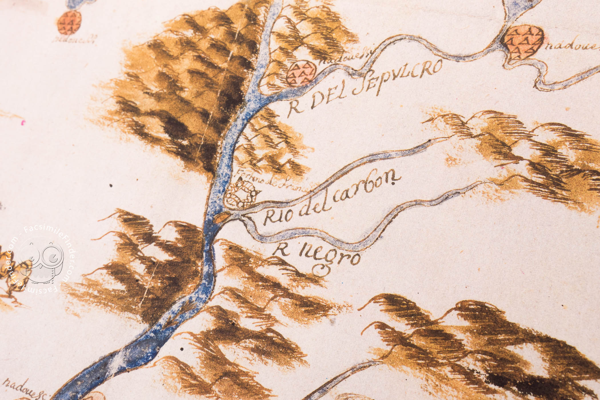
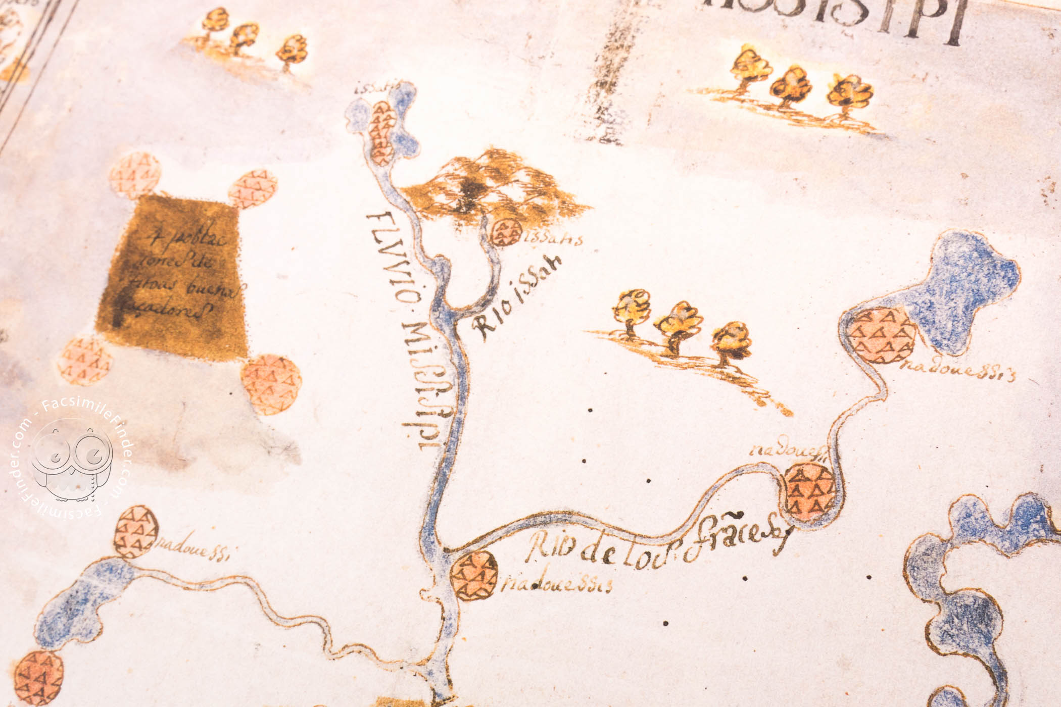
The map is oriented with north at the top and represents the Mississippi with remarkable accuracy. At the bottom of the map, we can see the mouth of the river with several ships, as well as the scale of leagues in the water.
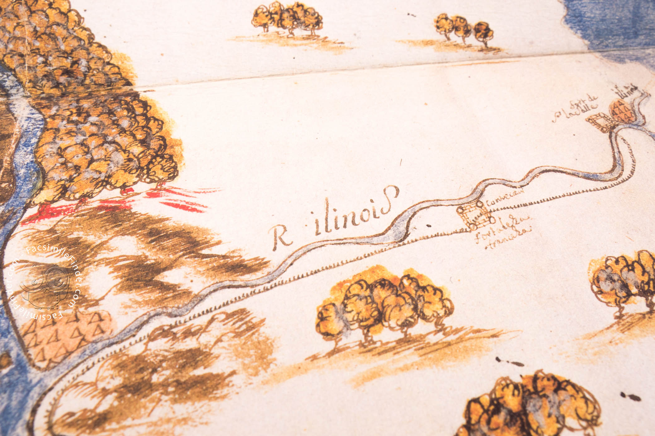
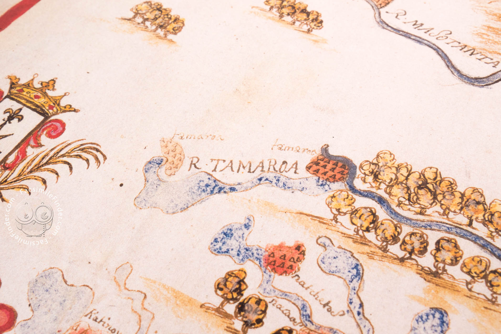
With a northwards progression, the depiction of the river is accompanied by abundant depictions of woods, tributaries, settlements, and fortifications. Those settlements are indicated by little groups of triangles painted in red. Most of the villages are gathered near the mouth, i.e. at the bottom of the map, while the northern part of the area shows less information.
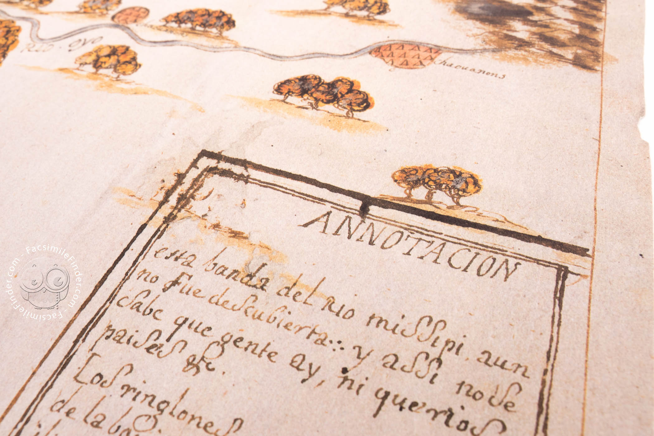
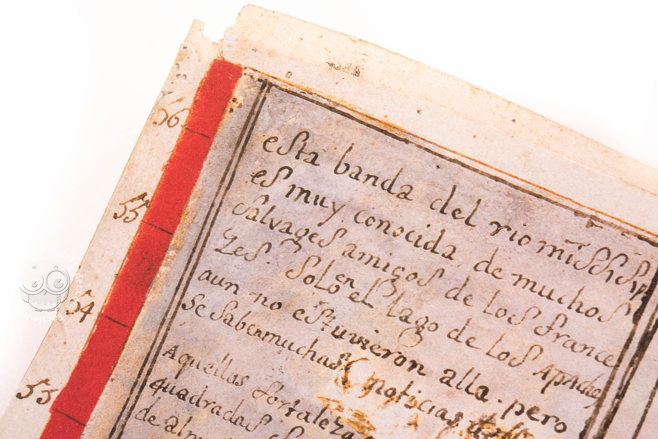
At the lower-left corner of the map, a cartouche with a coat of arms and the title of the map is shown. It is believed that the coat of arms is that of the Duke of Jovenazo, for whom the map was made. Beneath that coat of arms, we can see the dedication of the map, as well as its date of creation. At the upper left corner, we can read a brief text, written in Spanish, which explains several features of the river and its surroundings.
At the lower right corner of the map, an inscription explains the meaning of a dotted black line that runs across the map from St. Louis, at the southwest, to Illinois, at the northeast: it indicates the route taken by René-Robert Cavelier de la Salle in 1688, during his second voyage through North America. In fact, his diary of that voyage is one of the sources of information on this map.
This map of the Mississippi, held in the General Archive of the Indies in Seville under the shelfmark MP-Florida-Louisiana 29, is an interesting document for studying the Mississippi river and its surroundings in the late seventeenth century, as well as the importance of the French explorations in North America at the time.
The Baron of Lahontan and the Knowledge of North America
As we can read in the cartouche in the lower-left corner, the map was commissioned by Louis-Armand de Lom d’Arce, Baron of Lahontan, and dedicated to the Duke of Jovenazo, Spanish ambassador in Lisbon.
The Baron of Lahontan had been sent by the viceroy of New France (Canada) to follow the course of the Mississippi River. In fact, his accounts of the several voyages he undertook through New France and his experiences with the indigenous peoples were widely read in Europe and became one of the most successful travel accounts of the eighteenth century.
We have 1 facsimile edition of the manuscript "Map of the Mississippi": Mapa del Río Misisipi facsimile edition, published by Testimonio Compañía Editorial, 2001
Request Info / Price