
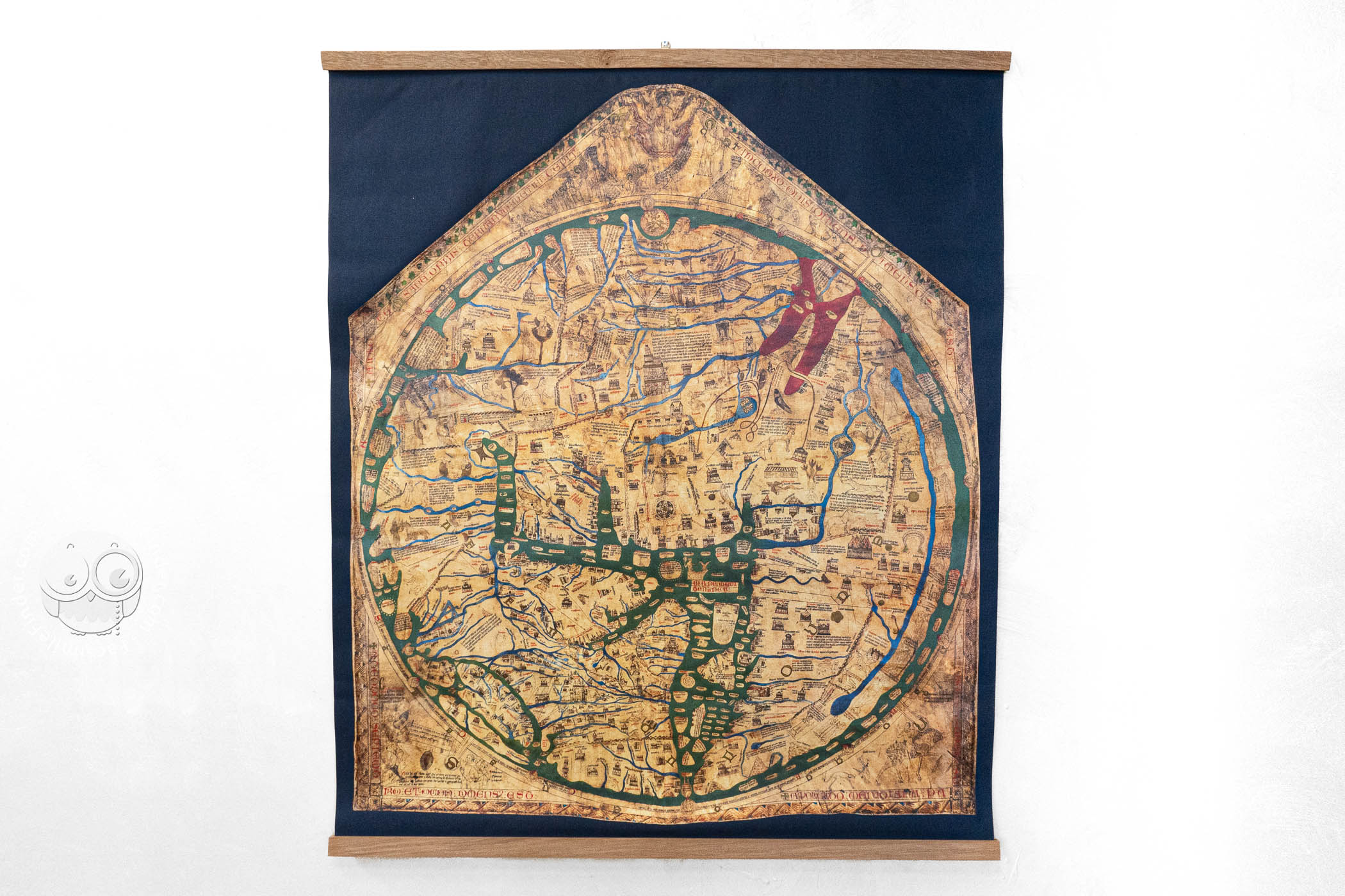
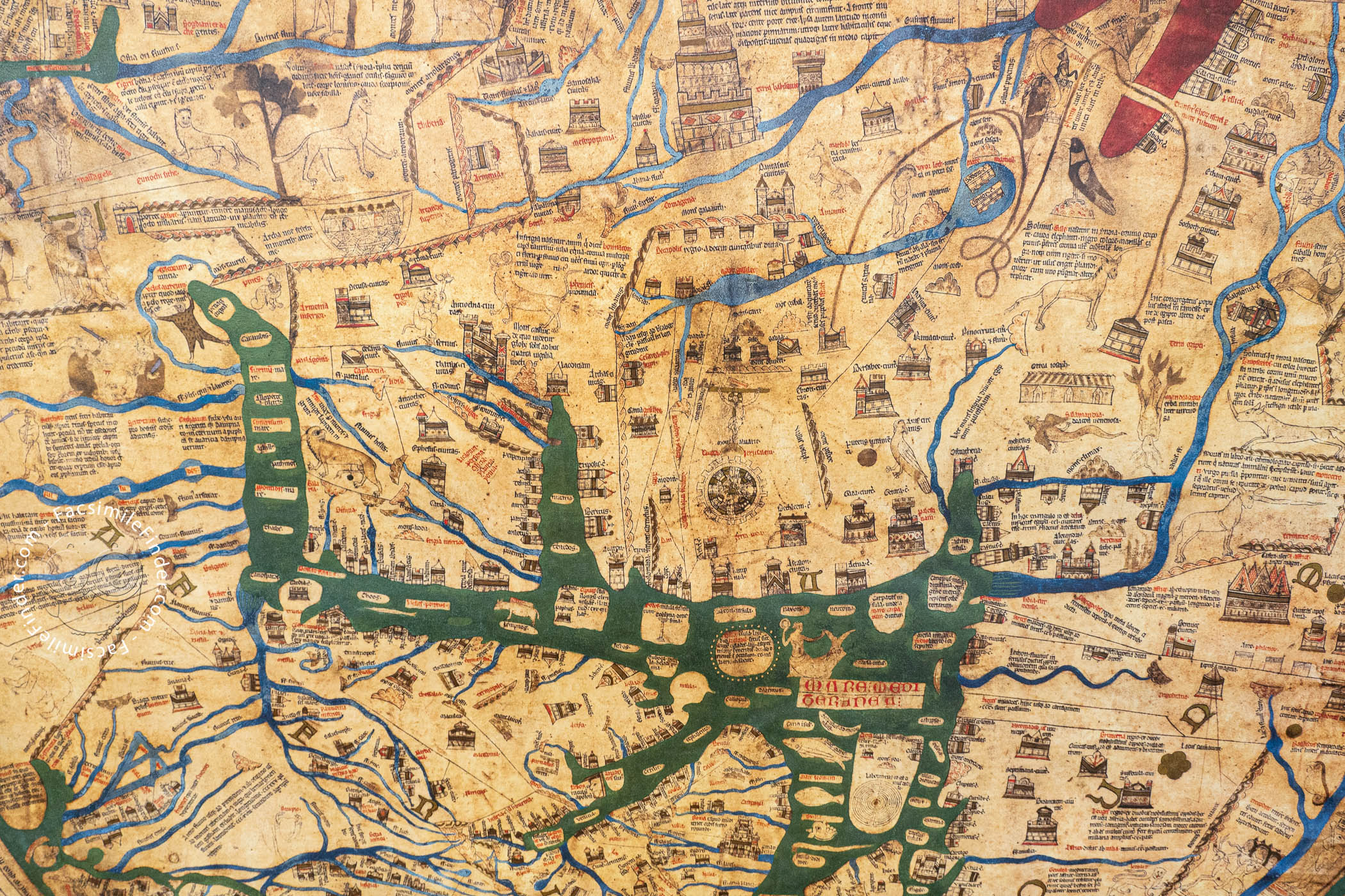
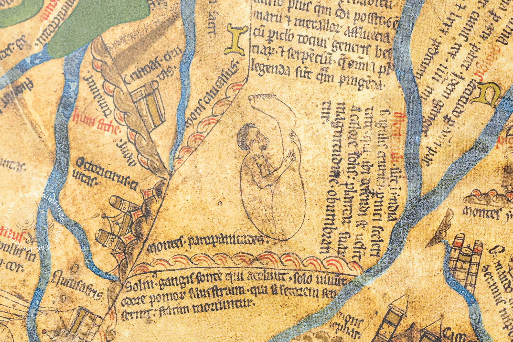
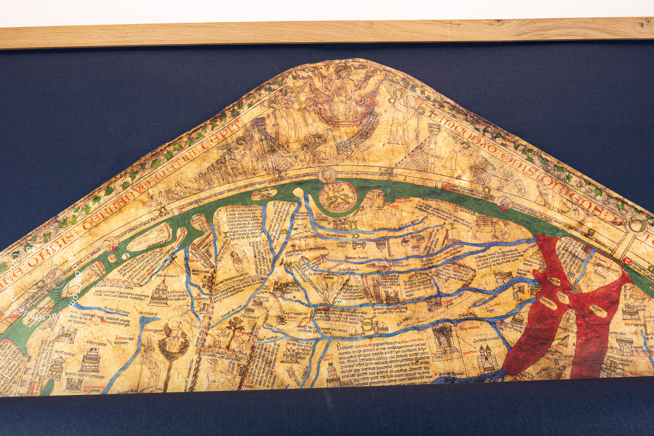
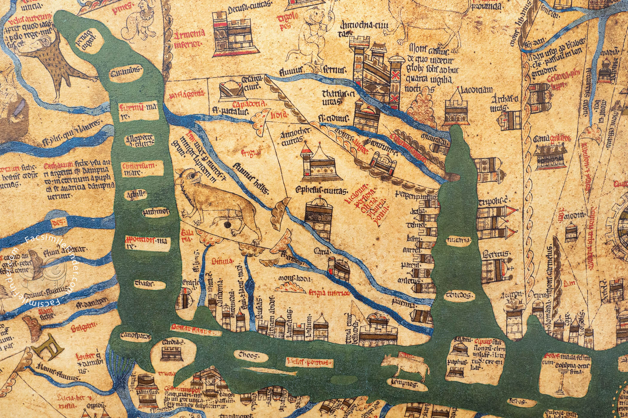
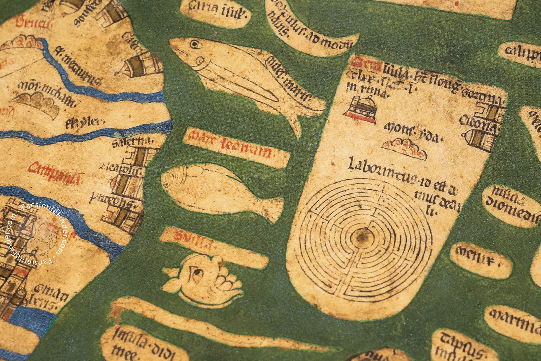
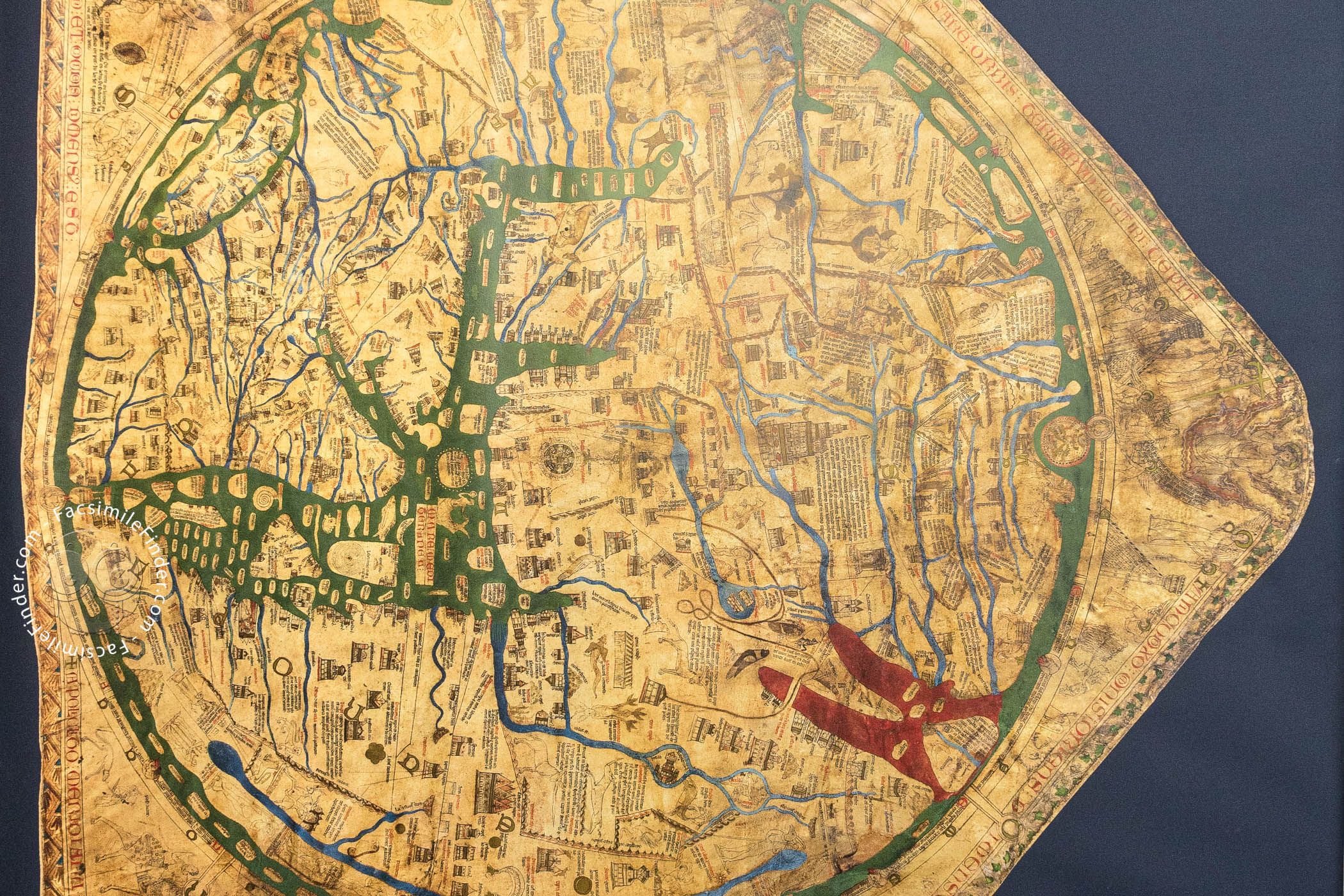


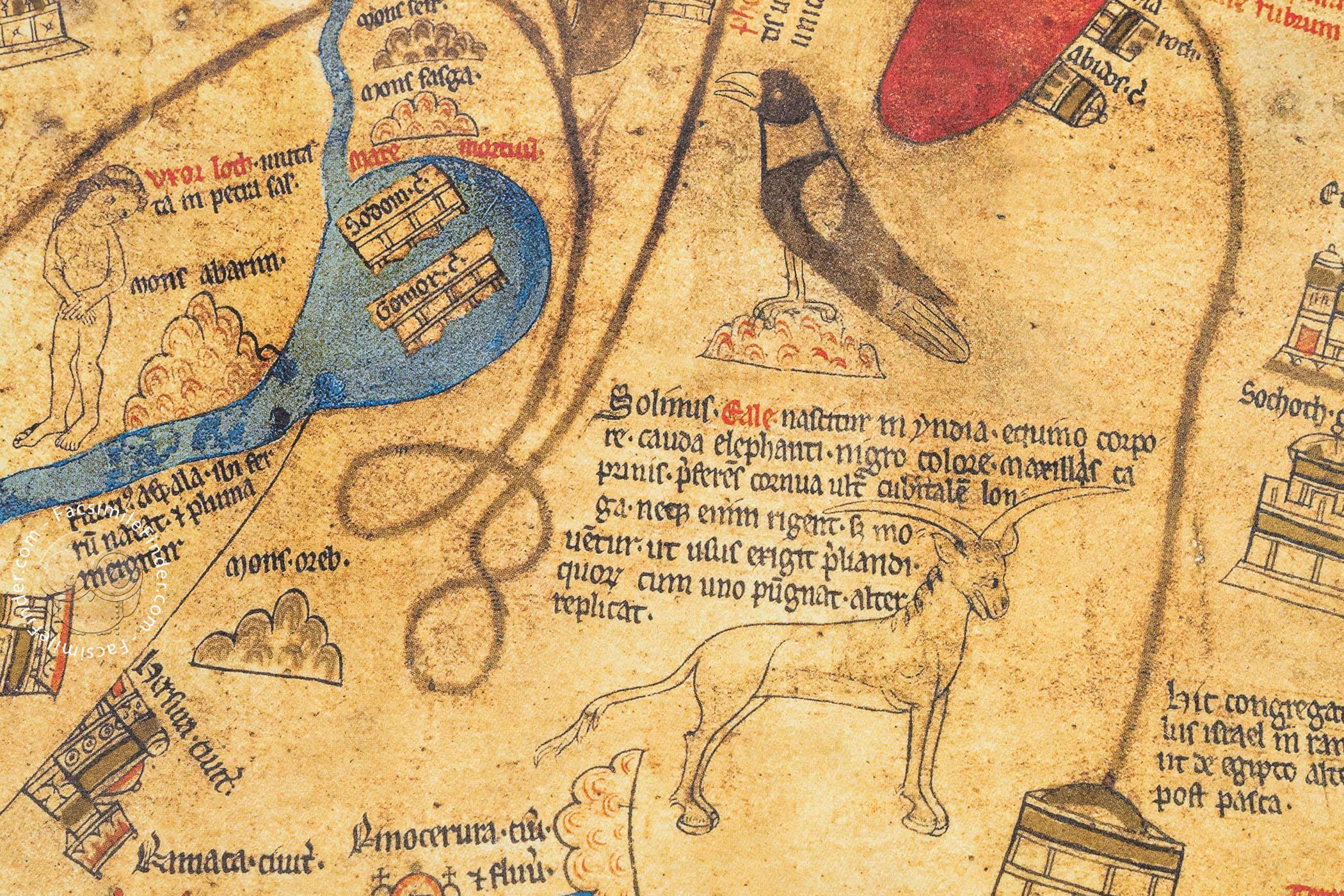
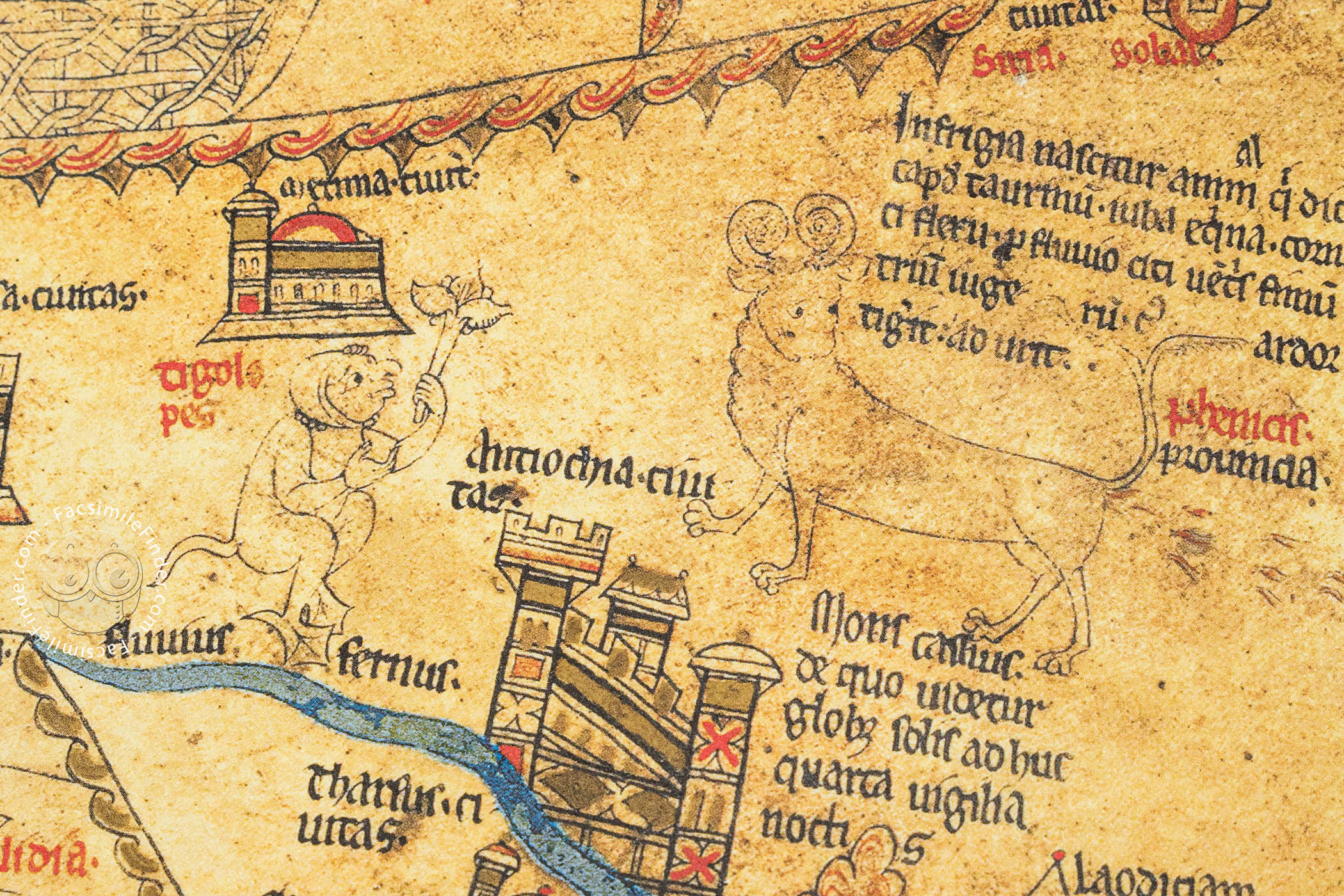
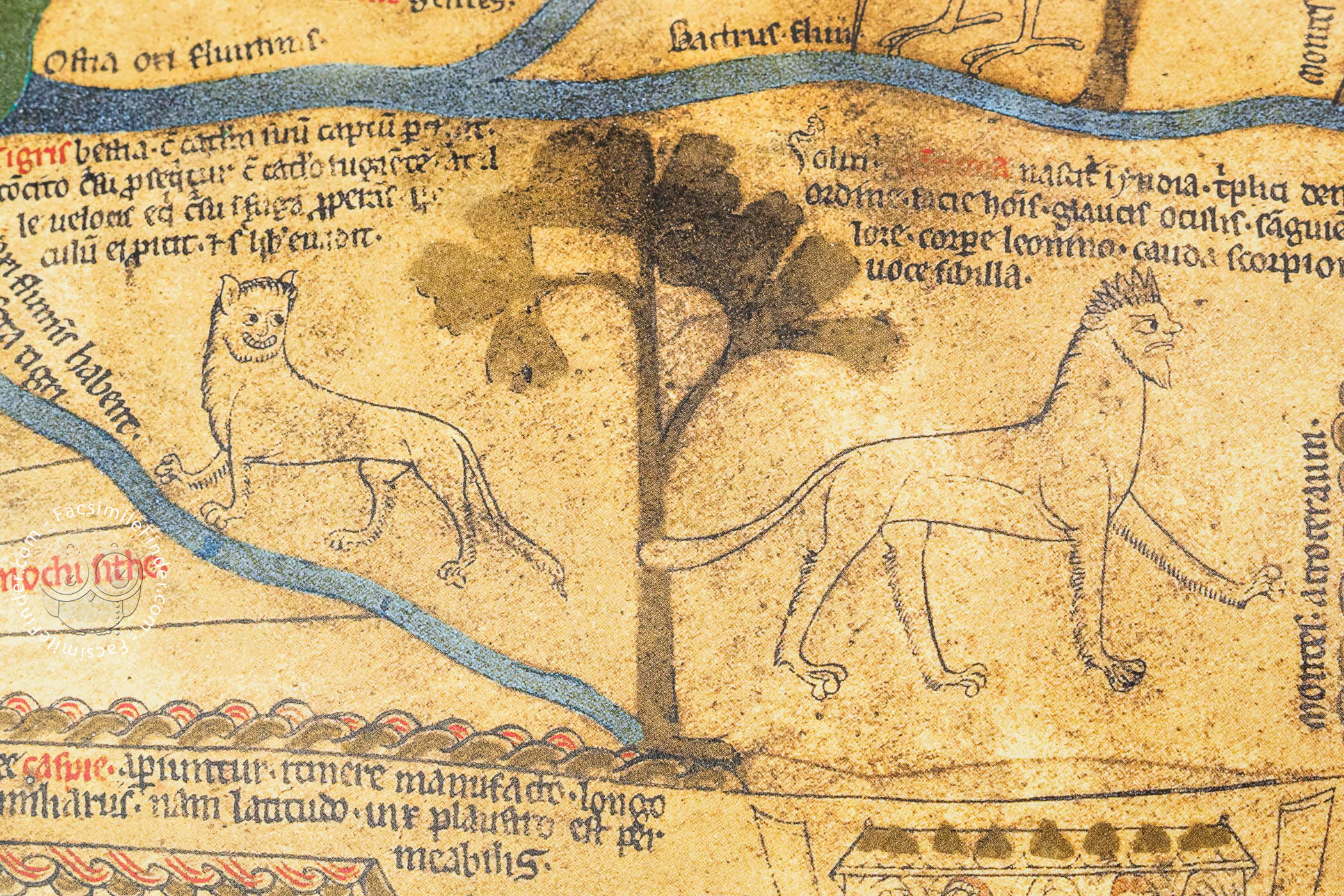
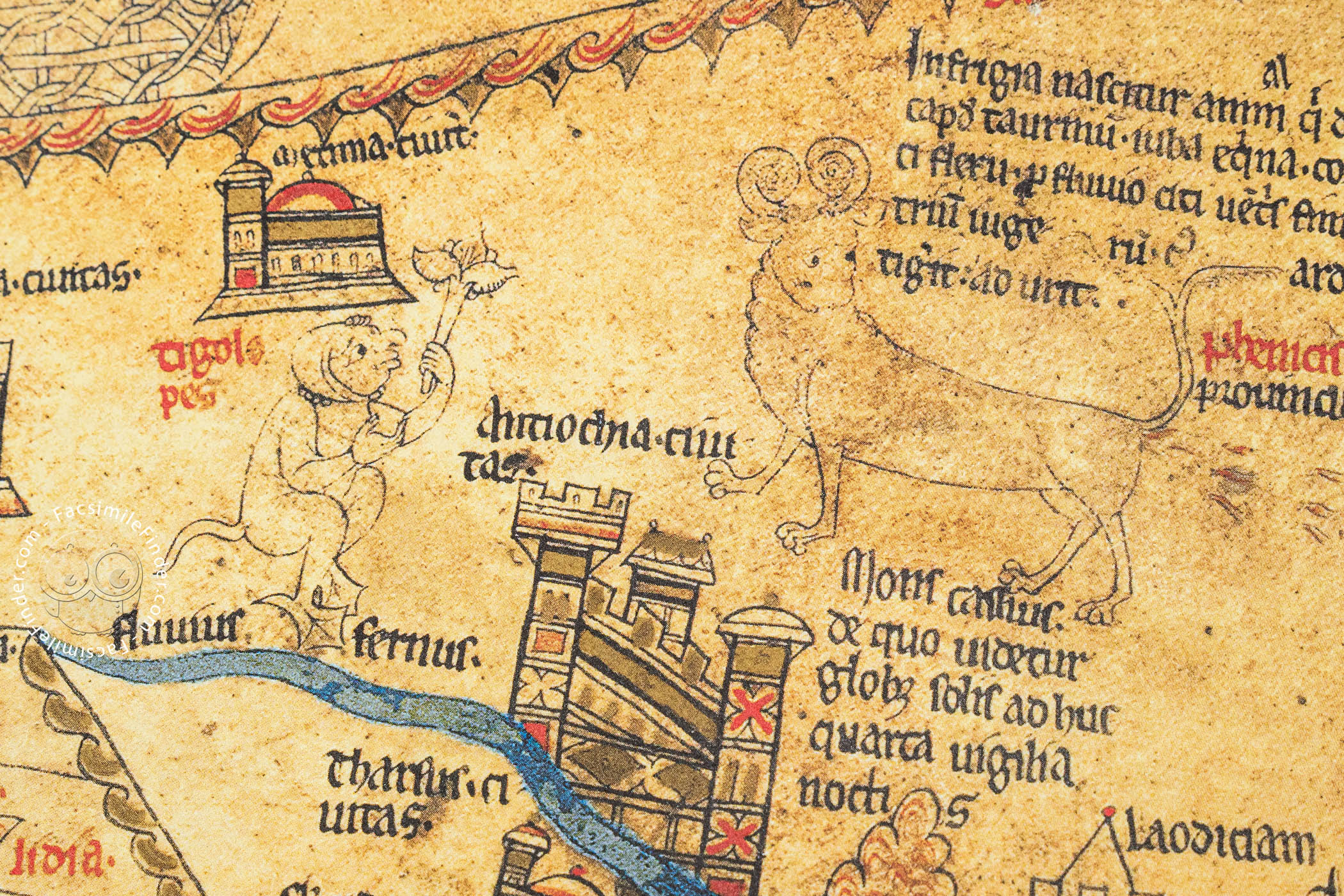

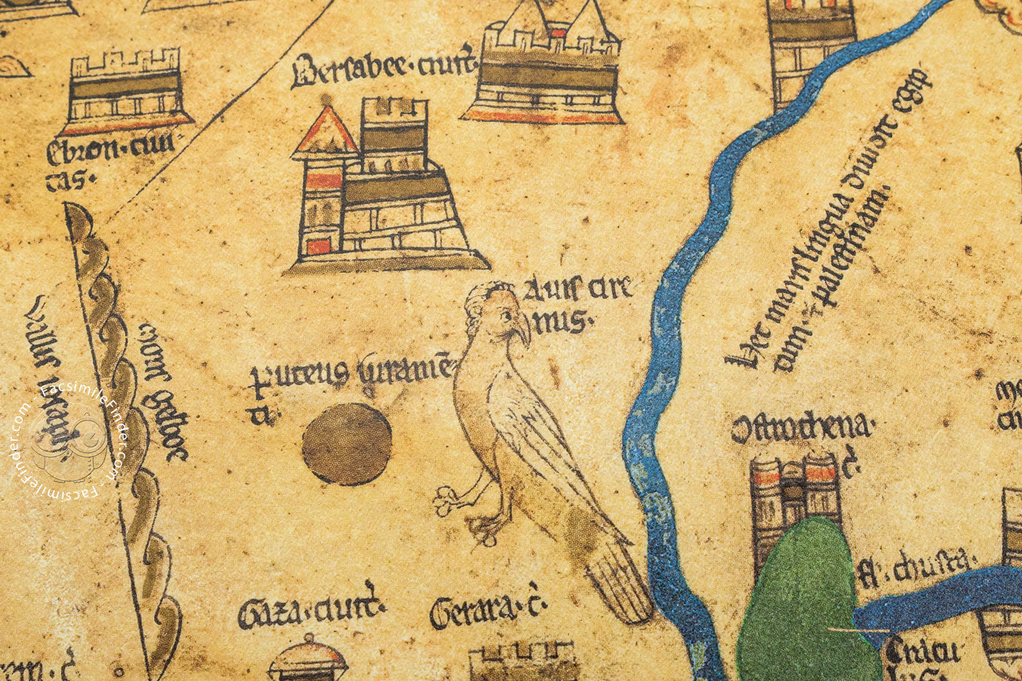
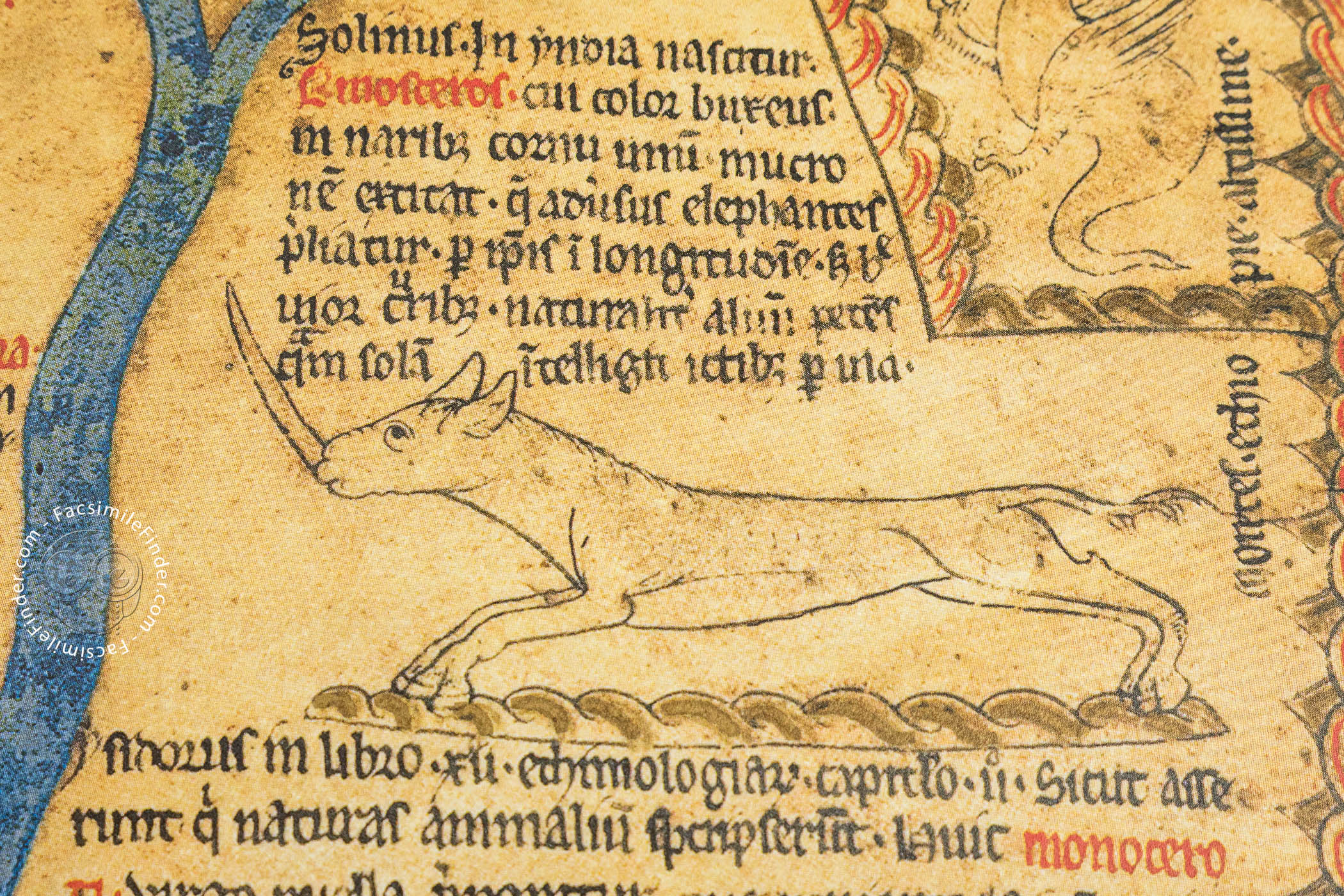
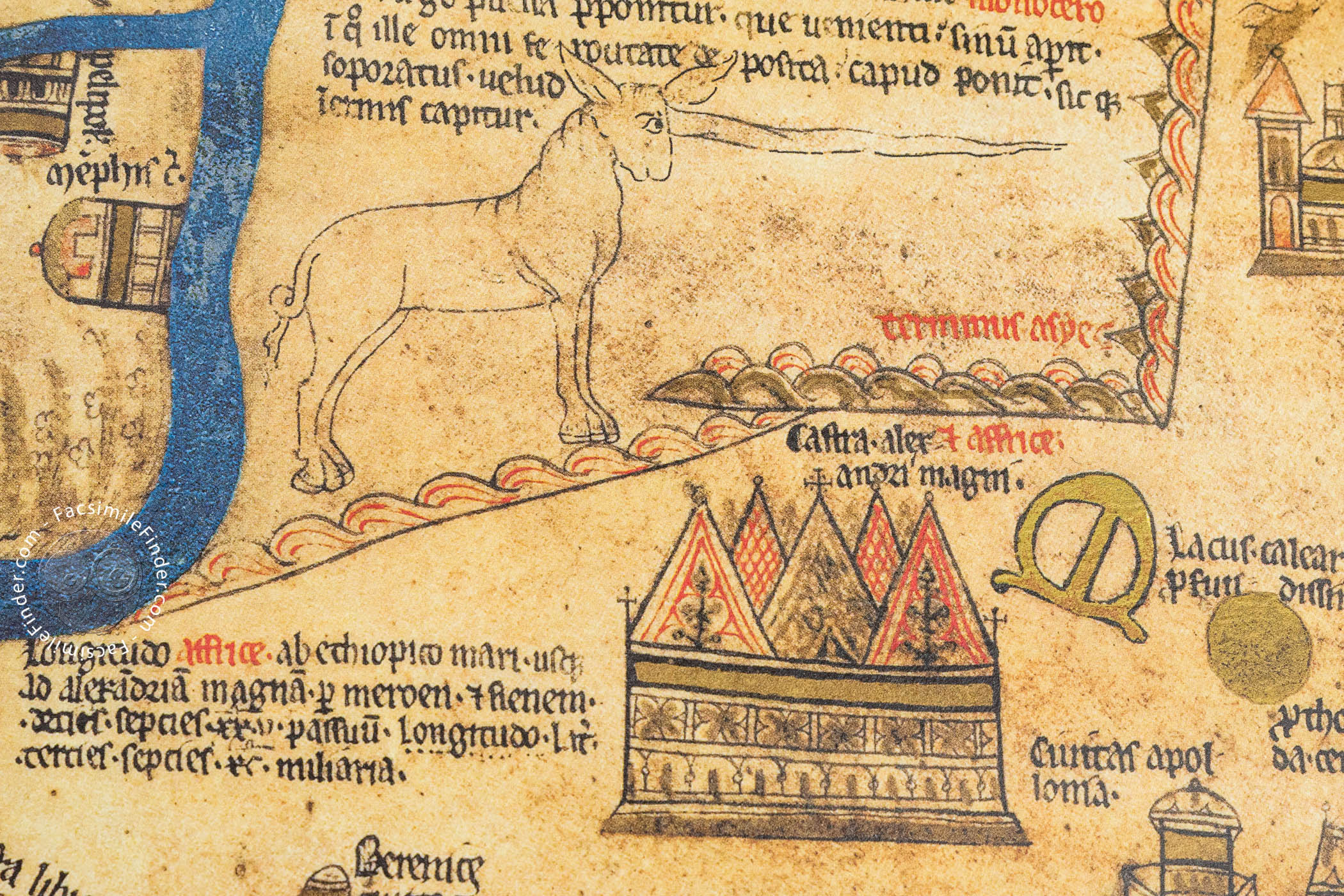
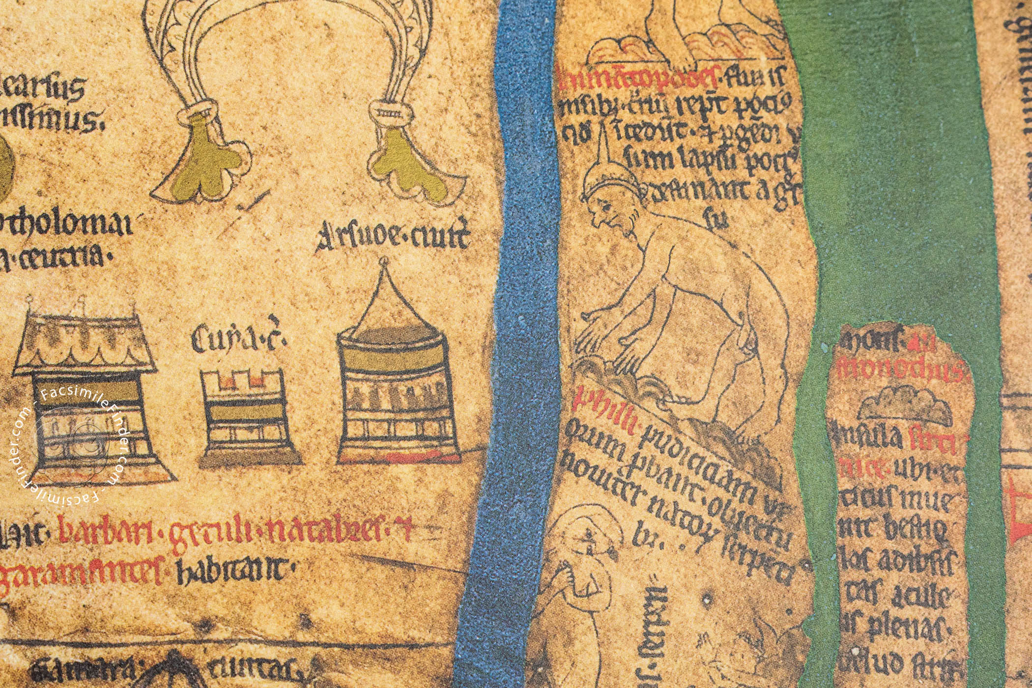
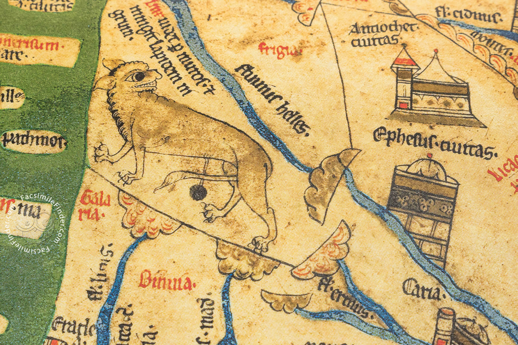
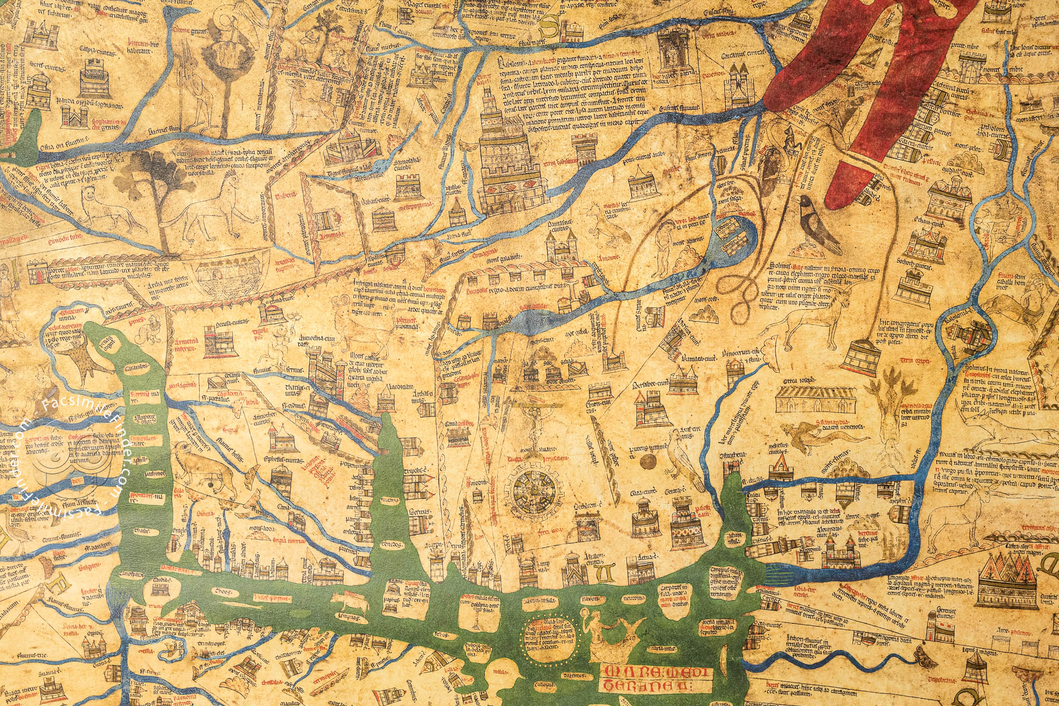


The Hereford Mappa Mundi, made in the last quarter of the thirteenth century, is one of the most impressive masterpieces of medieval cartography. It is named after the cathedral city where it has been since its creation. It is thought that the map was made in Lincoln, or at least begun there before being taken to Hereford. This superb work of art, the largest surviving medieval world map, reflects how the world was understood by Christian Europeans in the Middle Ages. It boasts around 500 vignettes, including representations of cities and towns, biblical events, plants, animals, birds, strange creatures, peoples, and scenes from classical mythology.
The Hereford Mappa Mundi is a Christianized historical geography that conveys a complex message concerning the coexistence of space and time in a cartographical frame. Its rich decoration and program of descriptive texts have engendered lively debate for centuries.
A Reflection of Space and Time
The map is oriented with east at the top. Asia fills the top portion, while Europe and Africa share the lower part of the map, with the Mediterranean separating those two continents; but, interestingly, the names of Europe and Africa are interchanged, so that we can see the name “Africa” on Europe and “Europa” on Africa.
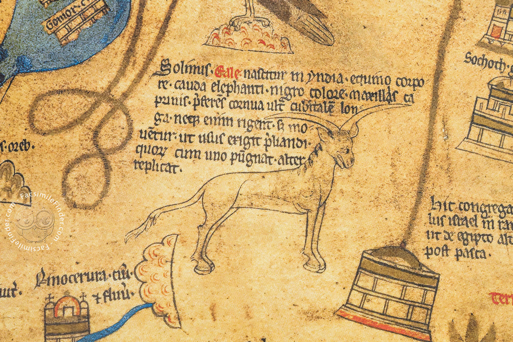
The map's information is derived from many ancient and medieval sources, including the Bible and the writings of C. Julius Solinus (third century CE), Paulus Orosius (fifth century CE), and Isidore of Seville (d. 636).
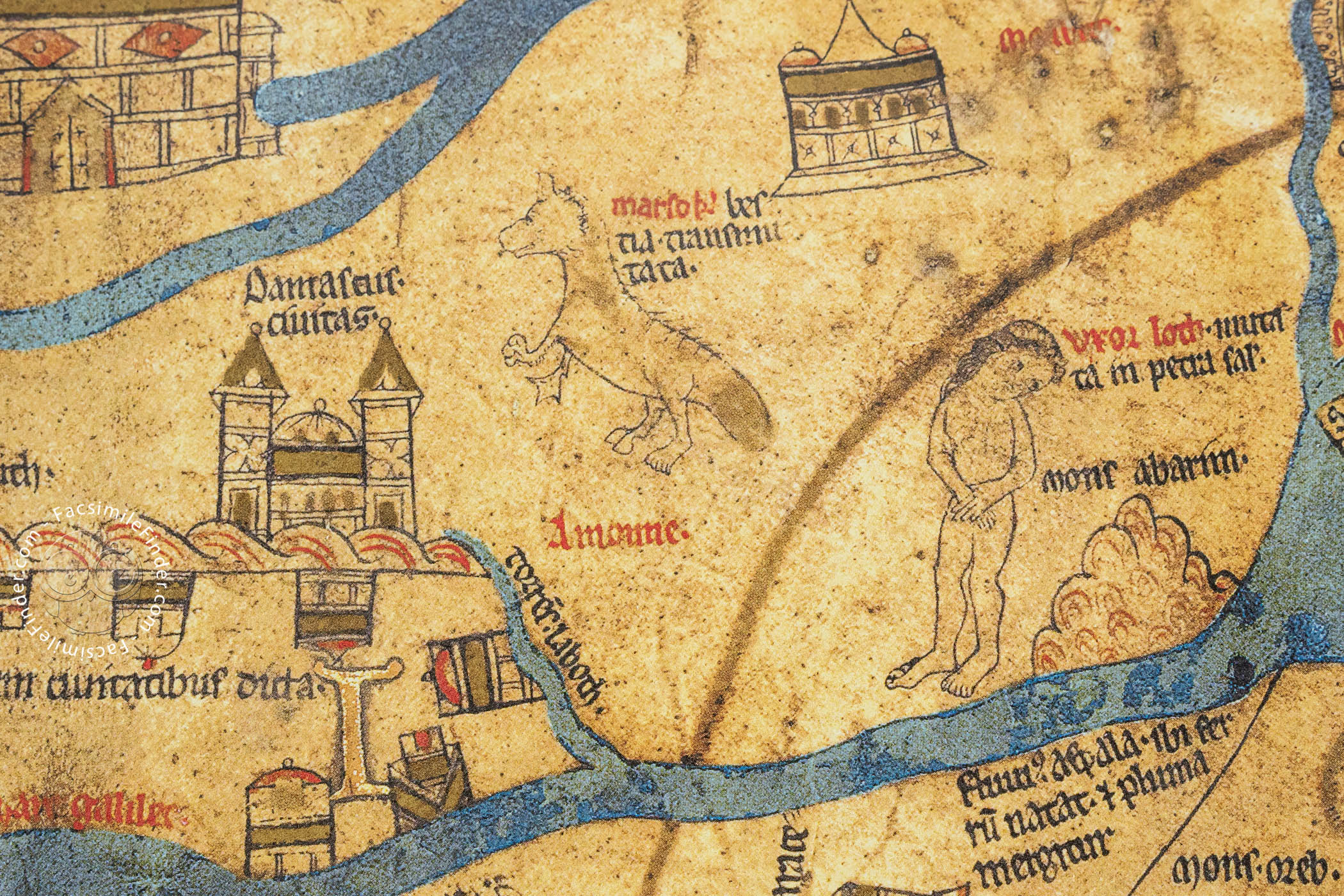
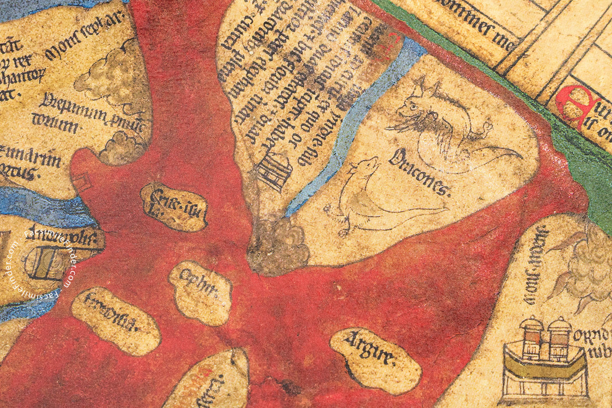
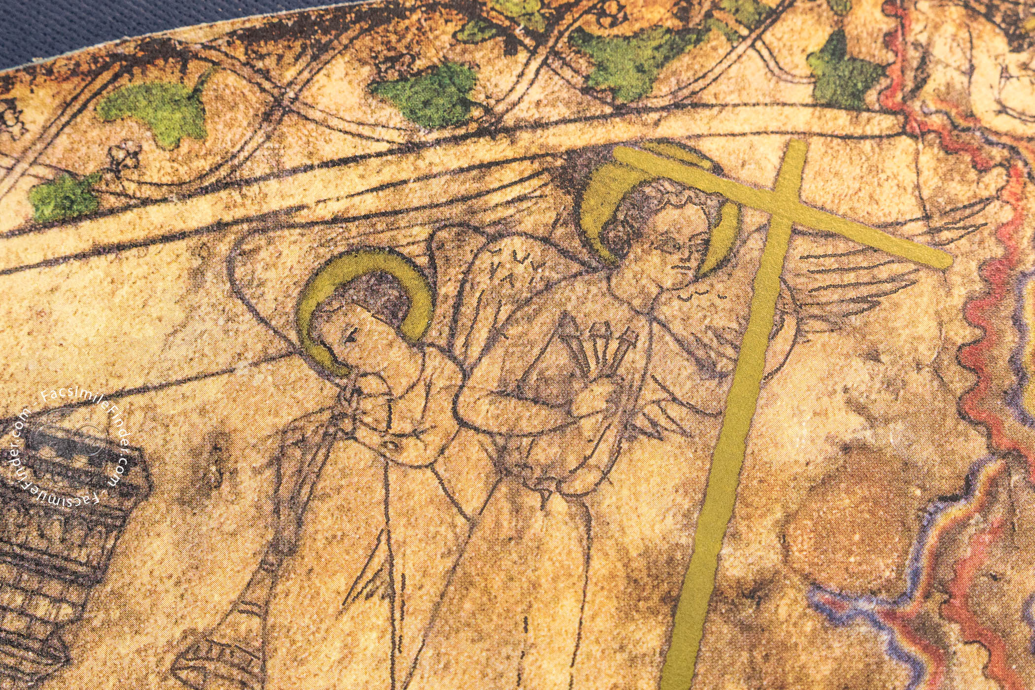
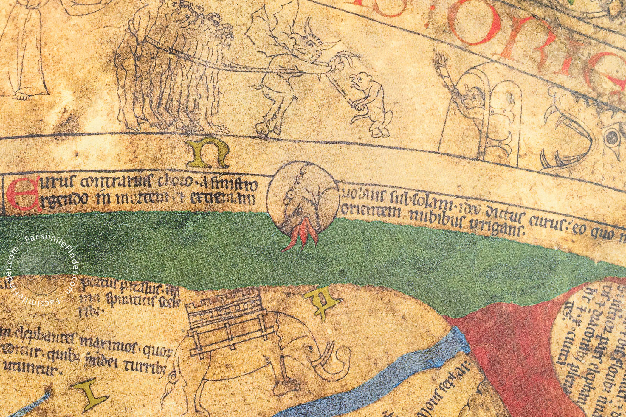
Representations of mythical and strange creatures share space with biblical vignettes, such as the Ark of Noah on Mount Ararat and the Crucifixion, located near the center of the map.
The whole is portrayed as controlled by Christ, who is represented enthroned at the very top of the sheet, outside the physical world, surrounded by angels and dispensing justice in the Last Judgment.
Represented at the top of the map—separated by the sea from Asia—is the Terrestrial Paradise, the spot that was the beginning of human history. Adam and Eve are pictured outside its confines, having already been expelled. The Pillars of Hercules in the strait of Gibraltar are pictured at the very bottom. The charted world is situated in a painted frame that contains the letters M-O-R-S (Latin "death").
An Enigmatic Authorship
An inscription in Anglo-Norman reports that the map was fet e compasse ("made and laid out") by Richard of Haldingham. There is no true scholarly consensus on either the identification or the precise role of this figure. One scribe was responsible for the Latin-language inscriptions on the map.
Although it is nearly certain that the map has been at Hereford cathedral since its completion, it is uncertain what its original placement was. When it first came to the attention of antiquarians in the seventeenth century, it was in the old (chained) library housed in a wooden case with wings on which were depicted the angel Gabriel and the Virgin Mary of the Annunciation. It has been conjectured that it was originally displayed in that case in the north transept of the church. It is currently housed in the New Library.
We have 1 facsimile edition of the manuscript "Hereford Mappa Mundi": Hereford World Map facsimile edition, published by The Folio Society, 2010
Request Info / Price