
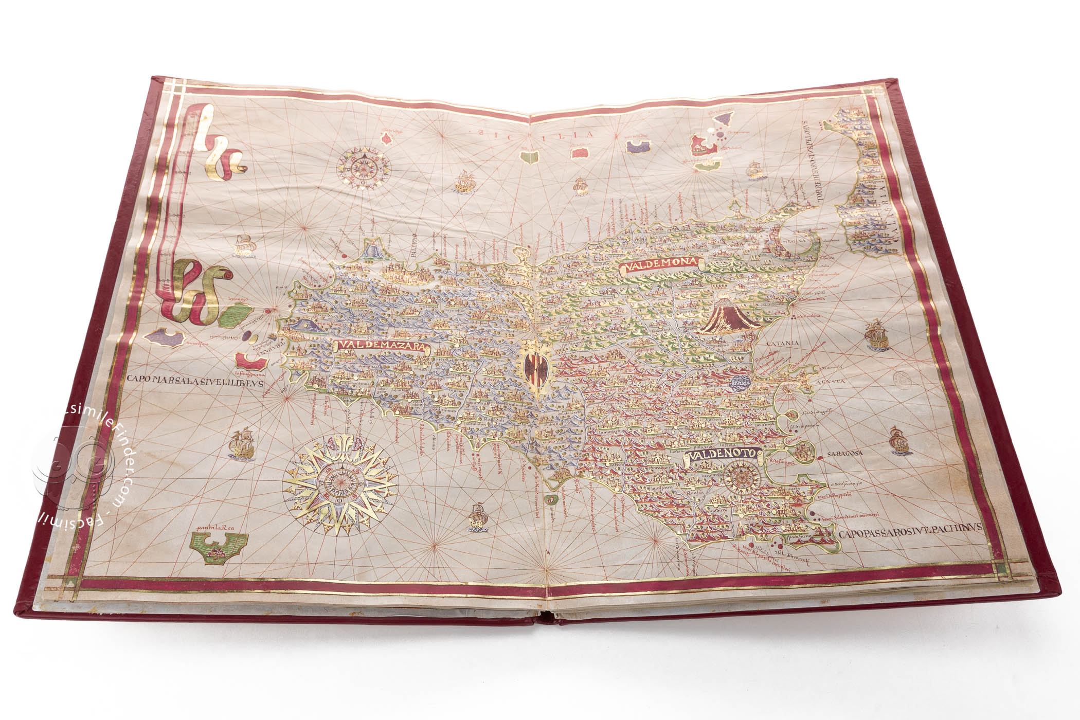

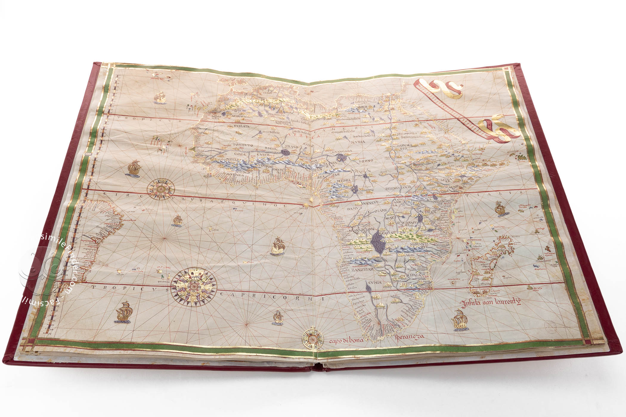
Created in 1587 by Joan Martines, cosmographer to Philip II of Spain, this manuscript atlas is an outstanding example of the union between cartography and art. This richly decorated work contains nineteen illuminated maps on double pages, and shows the geographical knowledge of the time with influences of both the Majorcan portolan chart tradition and the cartographic school of the Low Countries.
The decorative elements are perhaps the most attractive features of the atlas, with very elaborate compass roses, topographic details, and banners. In one of the world maps contained in this atlas the cartographer includes his signature:Joan Martines En Messina, Añy 1587 (Joan Martines in Messina, year 1587).
An Atlas between Art and Geography
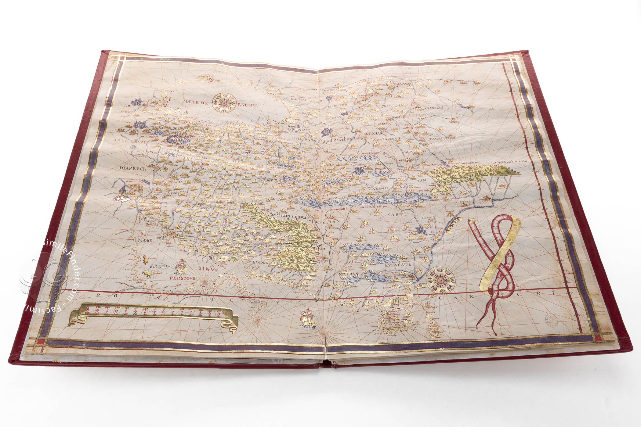
This work is made of twenty-two leaves of parchment, measuring 58 x 80 cm, of which nineteen are decorated with elaborate maps following the tradition of the Majorcan school of cartography, predominant during the 14th and 15th centuries.
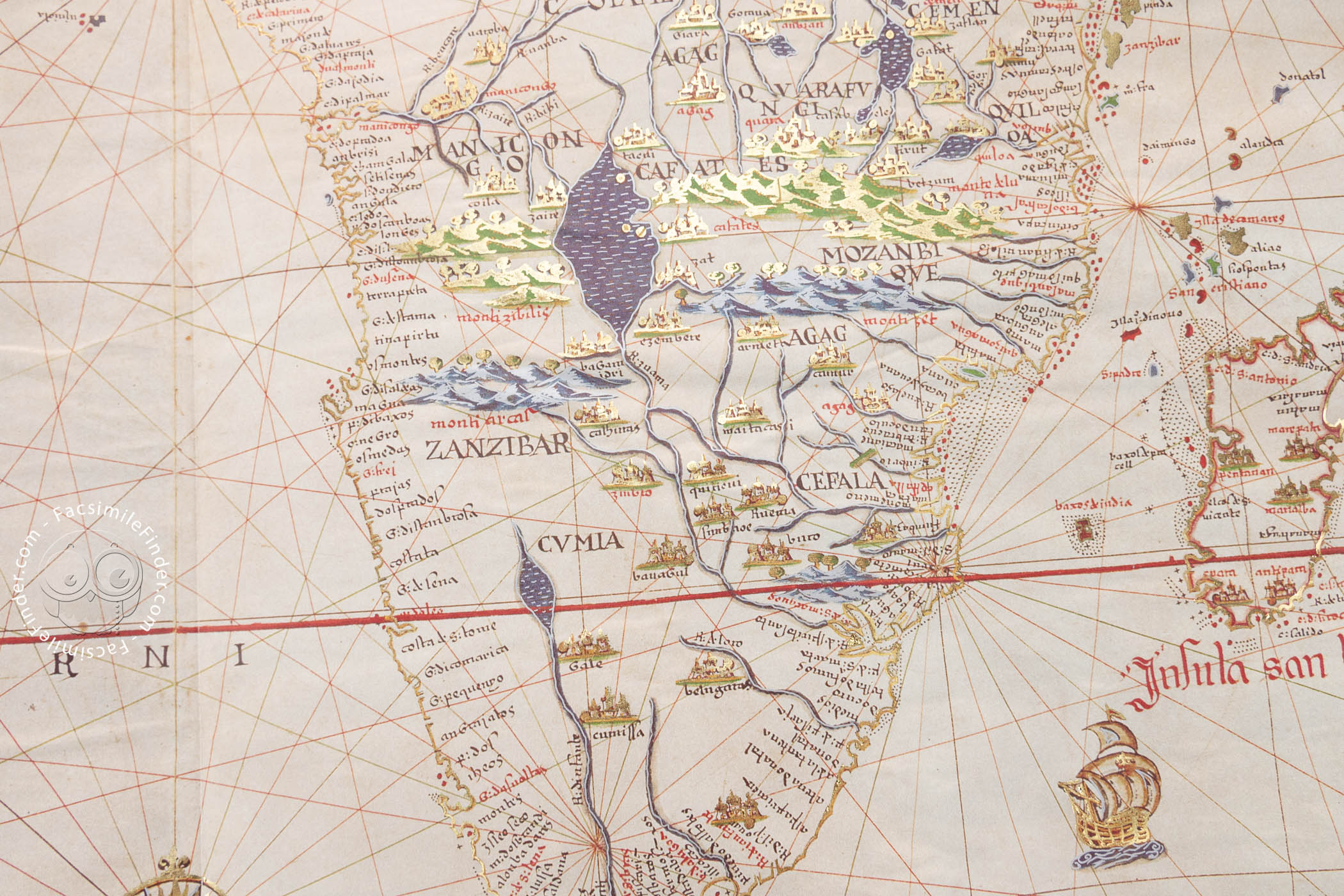
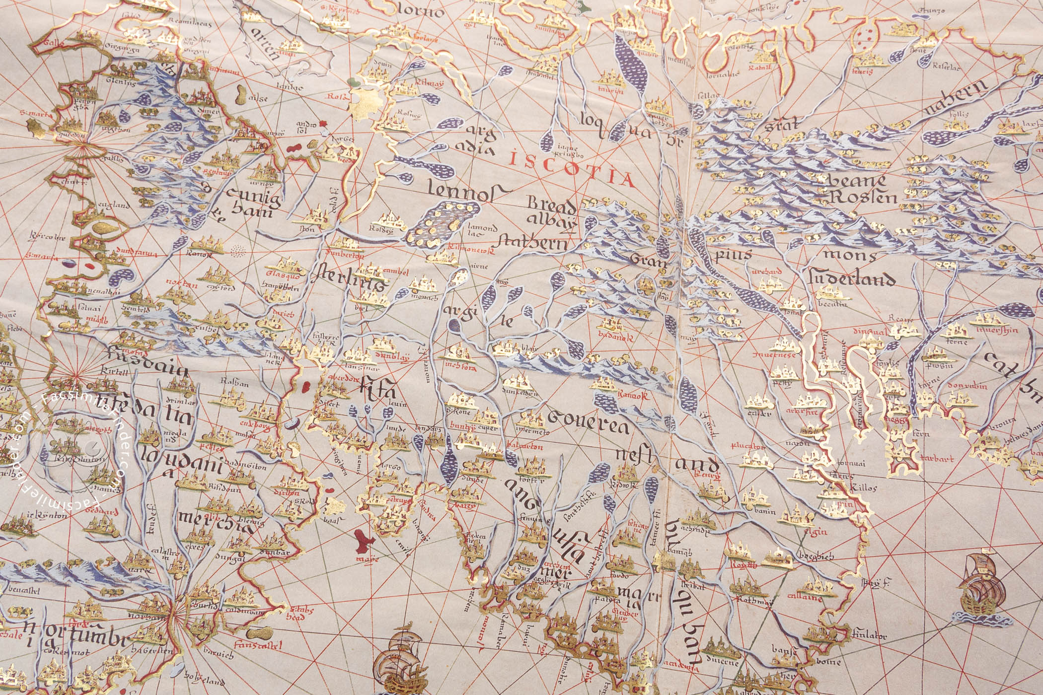
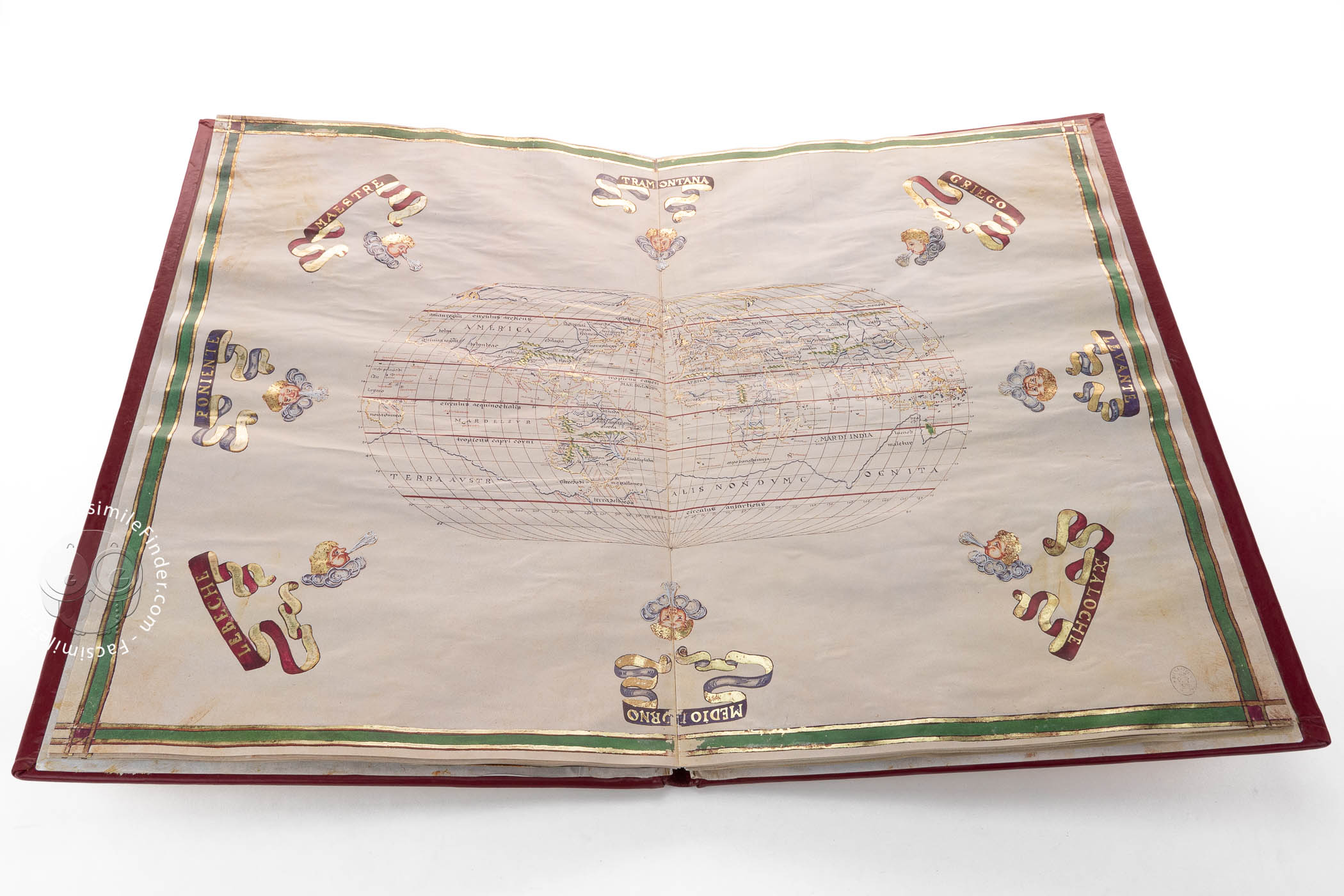
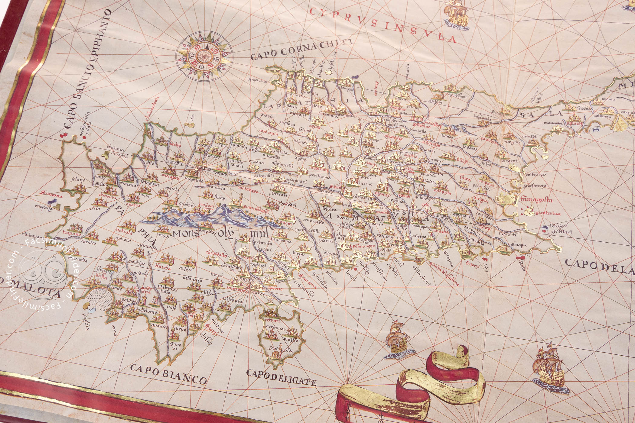
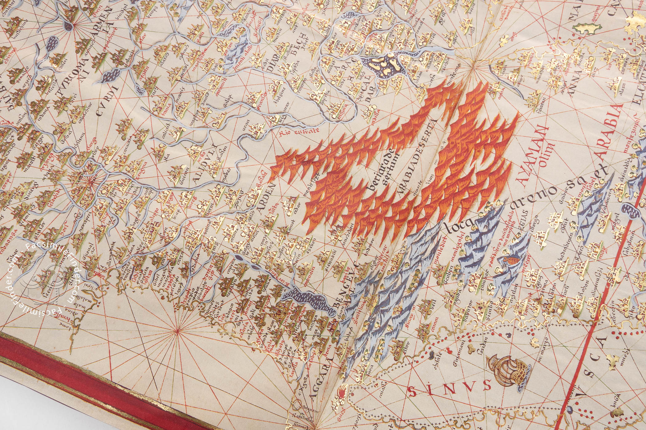
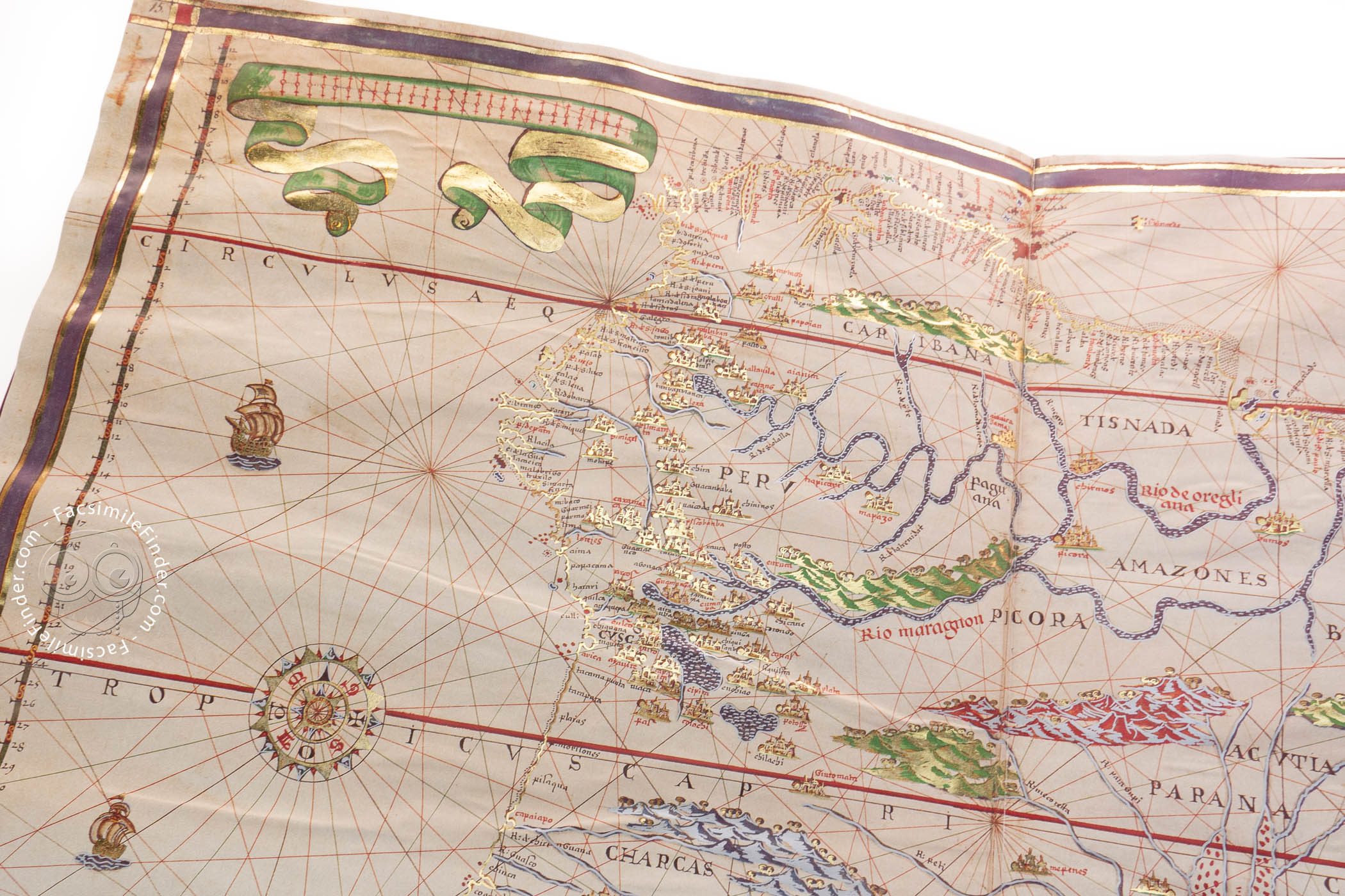
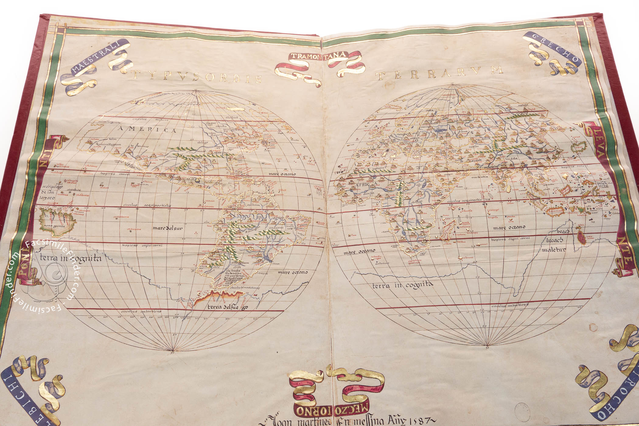
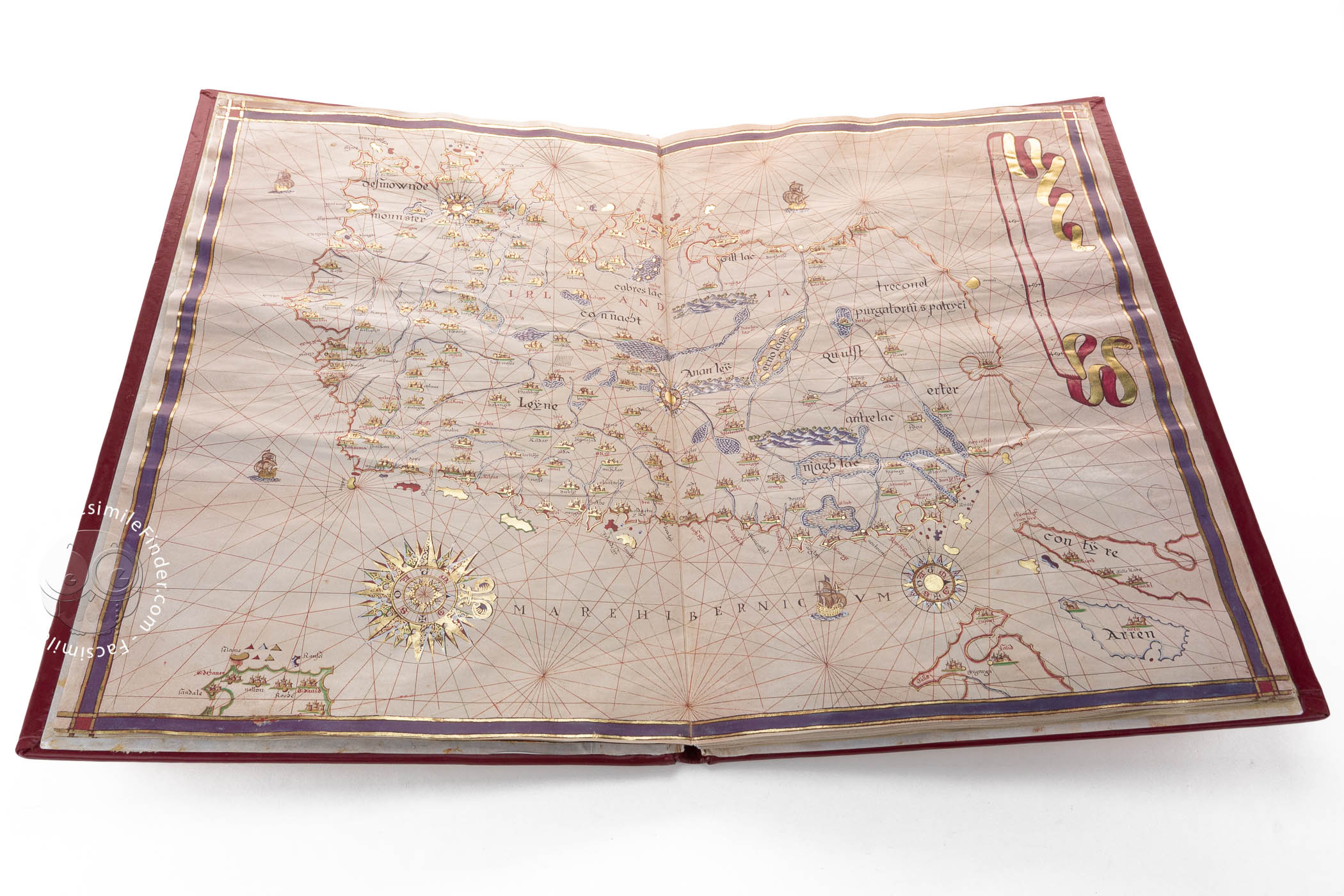
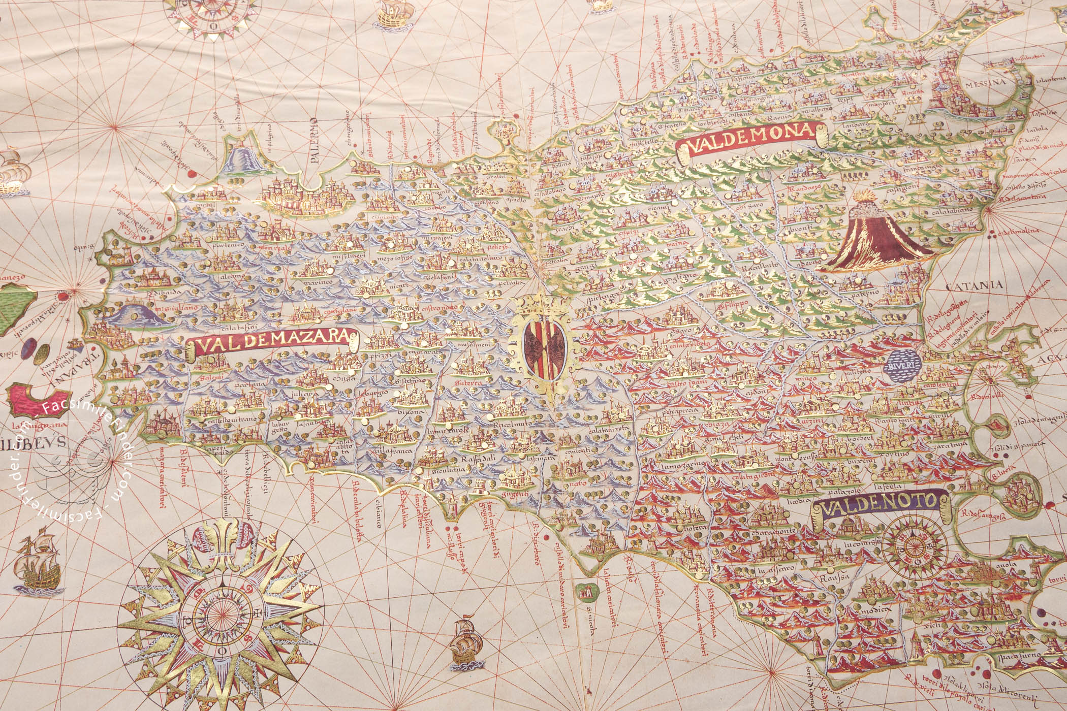
Joan Martines’ atlas is characterized by a lavish decoration, colored with gold, black, red and green. It contains two world maps, six nautical charts, and eleven regional maps. The maps contained in the atlas are: 1) World Map.- 2) Chart of the Mediterranean.- Northeastern Atlantic and Black Sea.- 3) Ireland.- 4) Scotland.- 5) England.- 6) Sicily.- 7 ) Islands of the Aegean Sea.- 8) Cyprus.- 9) World Map.- 10) Southeast Asia.- 11) Persia.- 12) Arabia.- 13) Africa.- 14) Eastern Pacific.- 15) South America.- 16) North America.- 17) Western Atlantic.- 18) Western Mediterranean.- 19) Eastern Mediterranean.
Most of the maps have multiple compass roses and banners, and the continents and countries show abundant cities, mountains, and rivers.
In the first of the two world maps contained in the atlas, the continents are full of details, and the northern edge of America is still blank. At the bottom of the world map, a large terra incognita (unknown land) is shown, and in the southern limit of South America, an inscription cites the discovery of the Strait of Magellan by the Portuguese sailor in 1520.
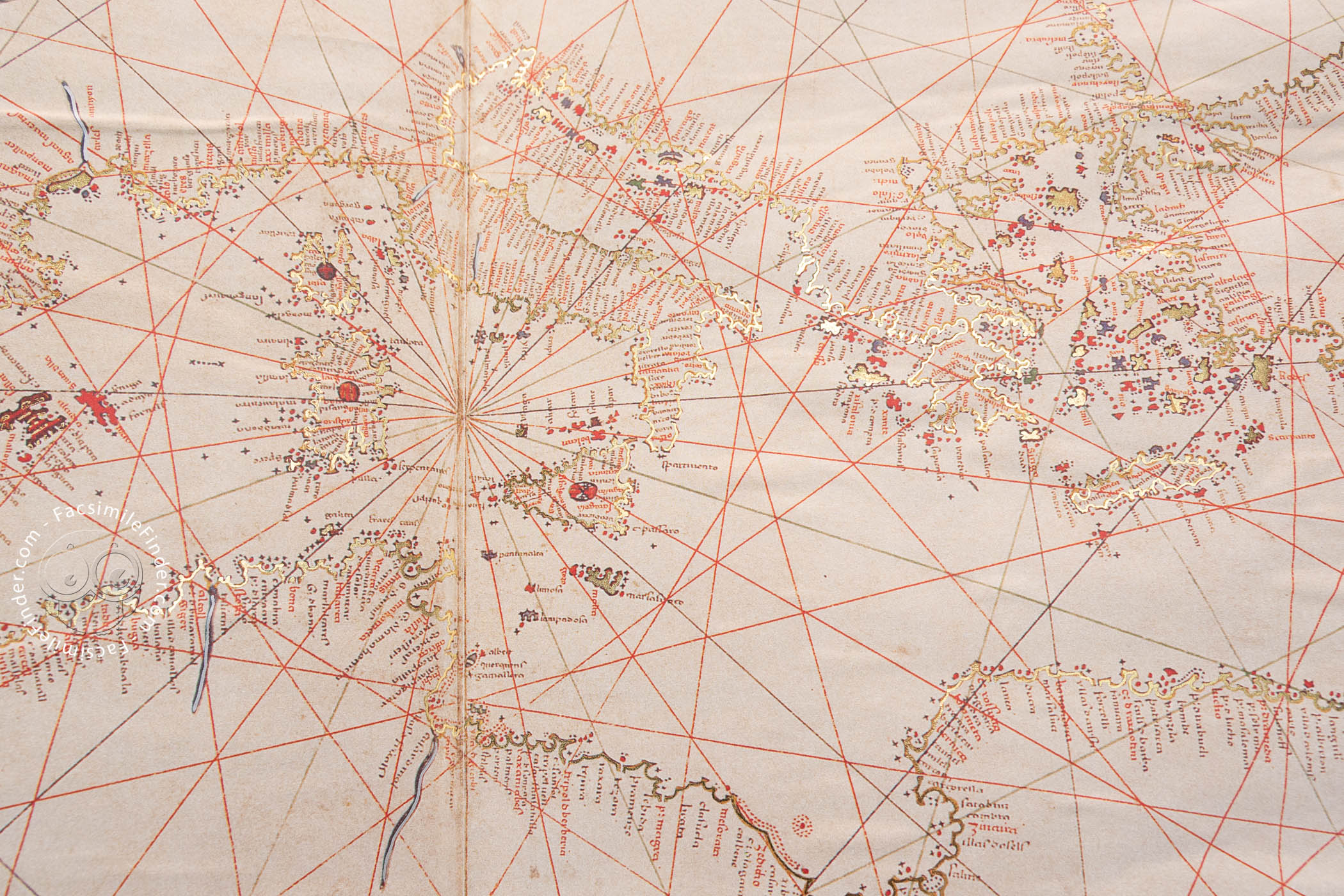
The charts of the atlas are crossed by abundant rhumb lines, and several ships are drawn sailing the seas. The beautiful compass roses located in the maps, of different sizes and showing an outstanding decoration, are one of the most remarkable decorative features of the atlas. Written in Spanish and Latin, the place-names are in red and black Gothic letters.
Joan Martines and His Luxurious Maps
Not much is known about the life of Joan Martines. Given the way he signs his works, it is believed that he was born, or lived, in the Sicilian city of Messina, although he could have a Majorcan, Valentian or Catalan origin. Thanks to his abundant and luxurious works (his cartographic activity covers more than thirty years), he became a cosmographer to Philip II of Spain.
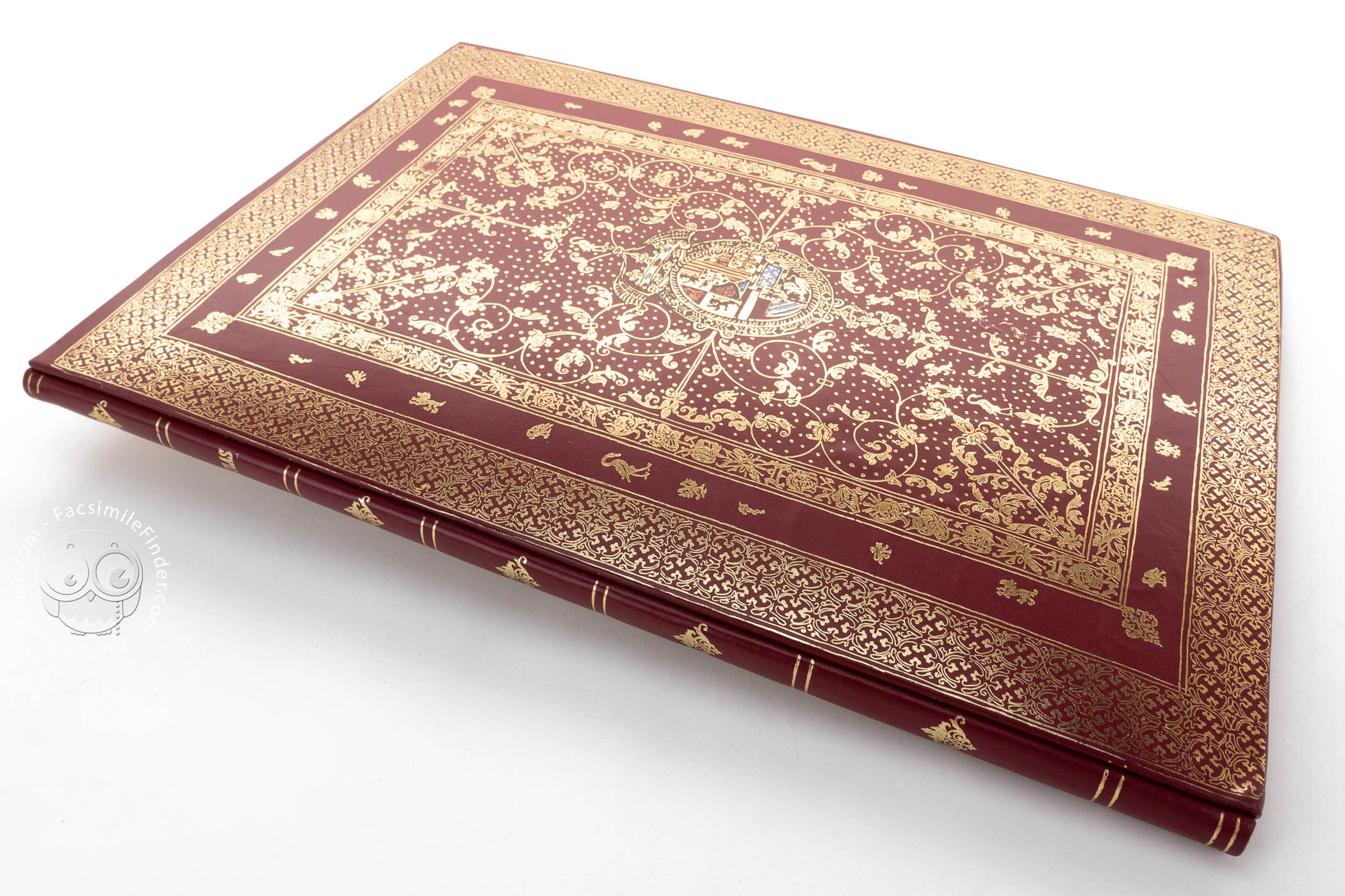
This atlas was held in the Royal Library of Madrid, from where it was transferred to the National Library of Spain, where it is currently held under the shelfmark Vit. 4-20.
We have 1 facsimile edition of the manuscript "Atlas of Joan Martines": Atlas de Joan Martines facsimile edition, published by Ediciones Grial, 2000
Request Info / Price