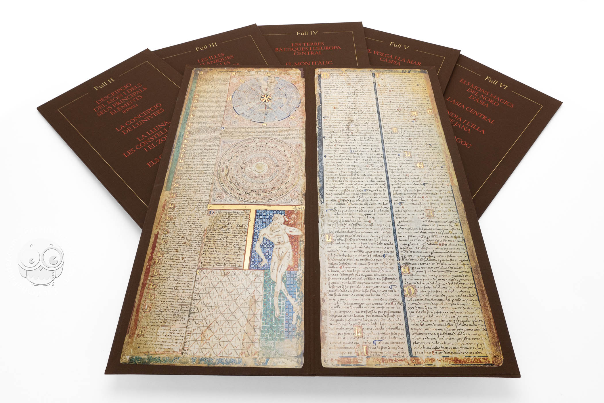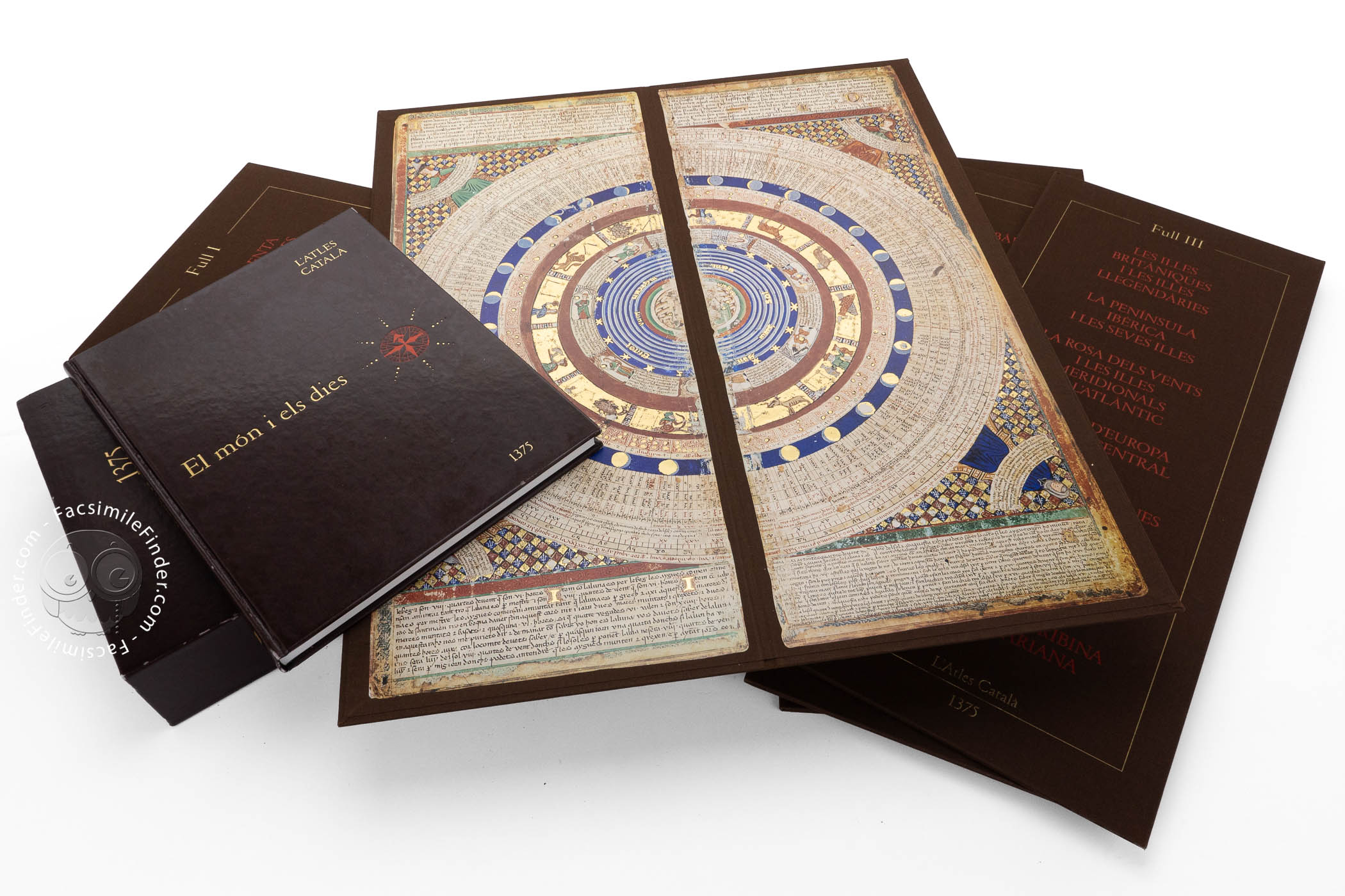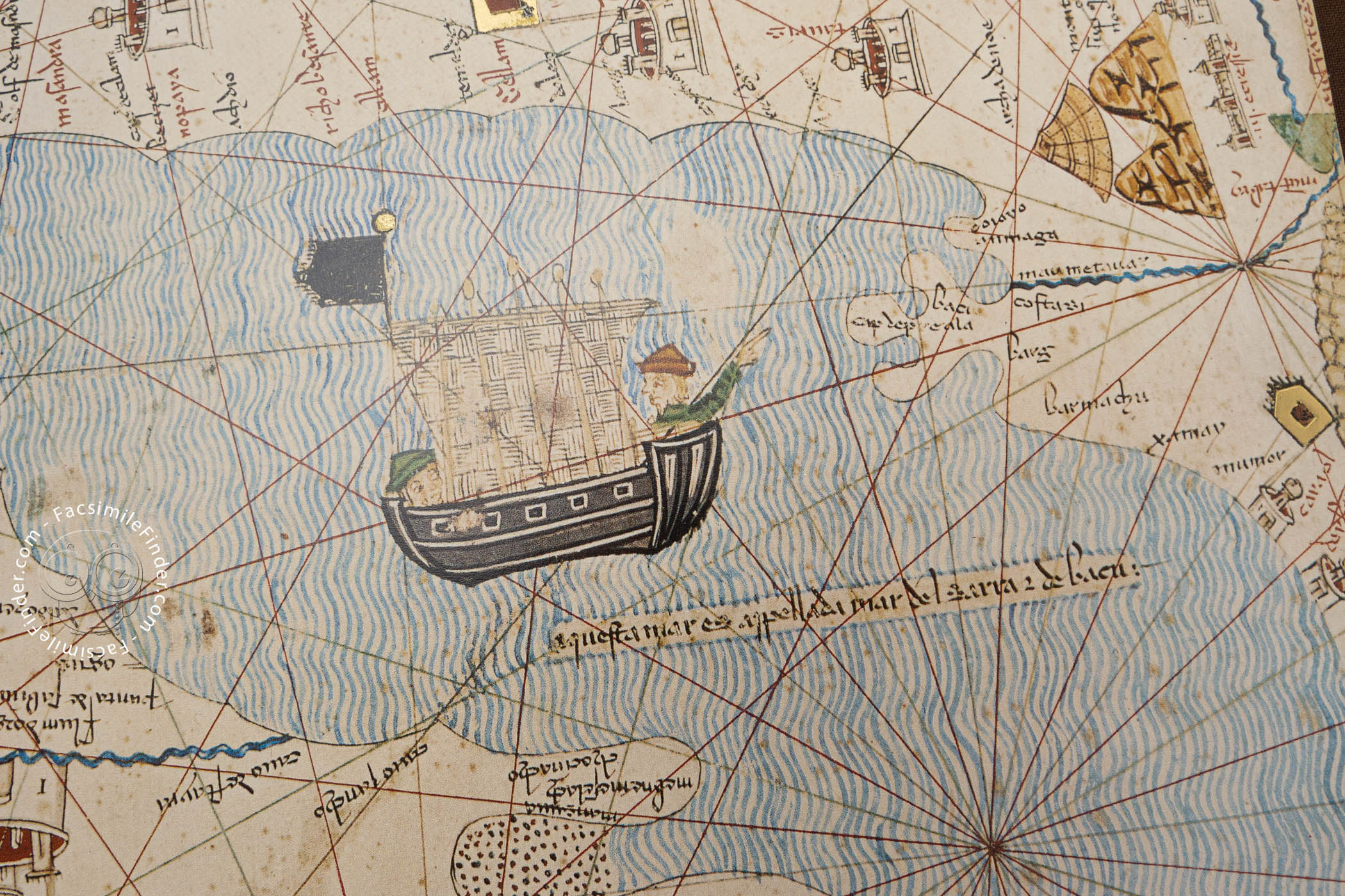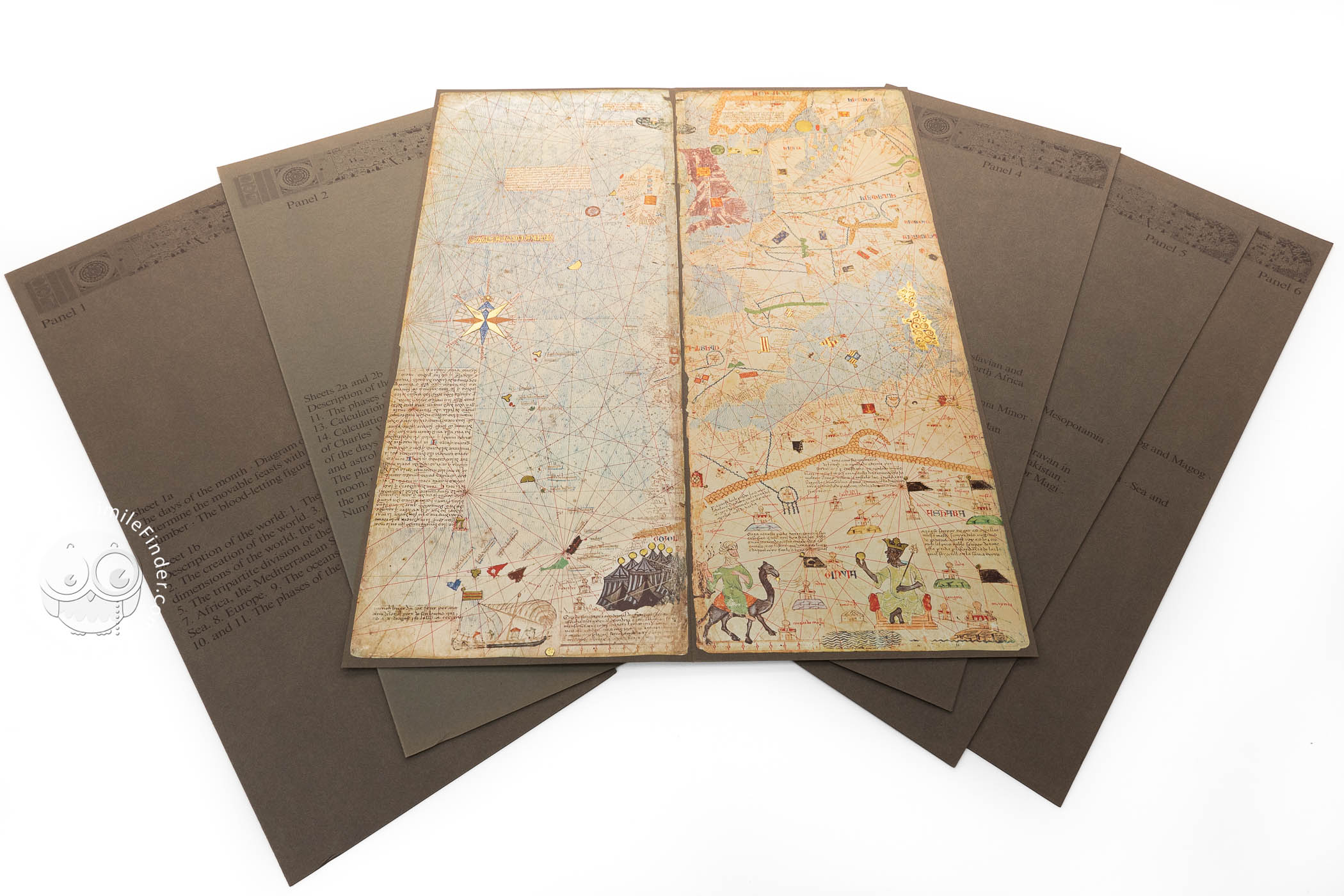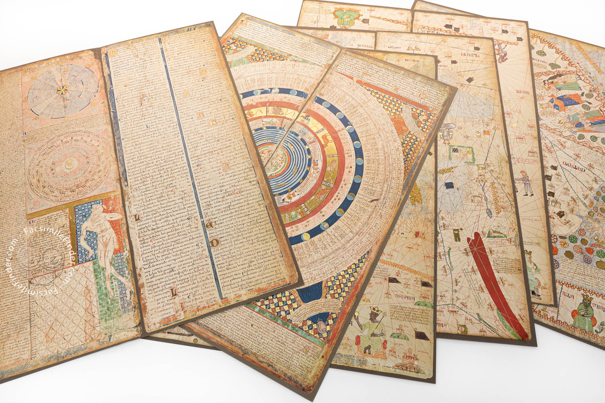


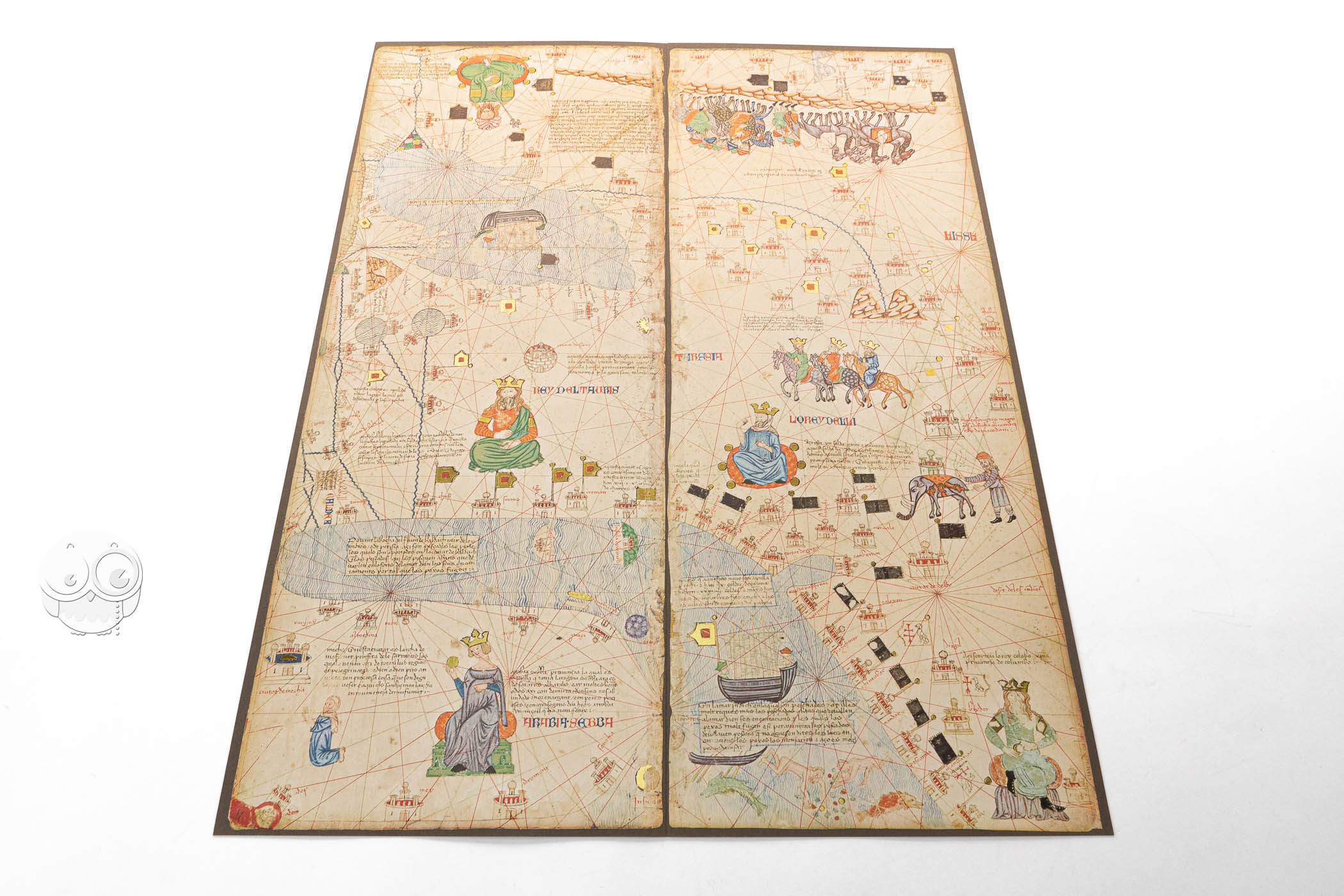


Considered the most beautiful world map to survive from the medieval period, the Catalan Atlas is a series of parchment sheets mounted on wood embracing diagrams, a portolan chart of the Mediterranean and Black Seas, and a map of Asia. With extensive captions in Catalan, it was made around 1375 in Majorca and was in the collection of Charles V, King of France, by the time of his death in 1380. Its six panels are illustrated with brilliantly colored narrative vignettes, portraits, animals, cityscapes, sailing vessels, and banners.
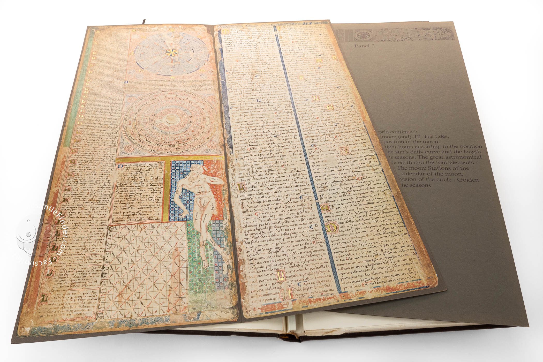
Remarkable for its artistry and content, the Catalan Atlas is also renowned for its unique form. Six sheets of diagrams and maps painted on parchment were initially mounted on wooden boards. In the early sixteenth century, the sheets were remounted on pairs of boards to form a codex.
A Fusion of Portolan Chart and Mappa Mundi
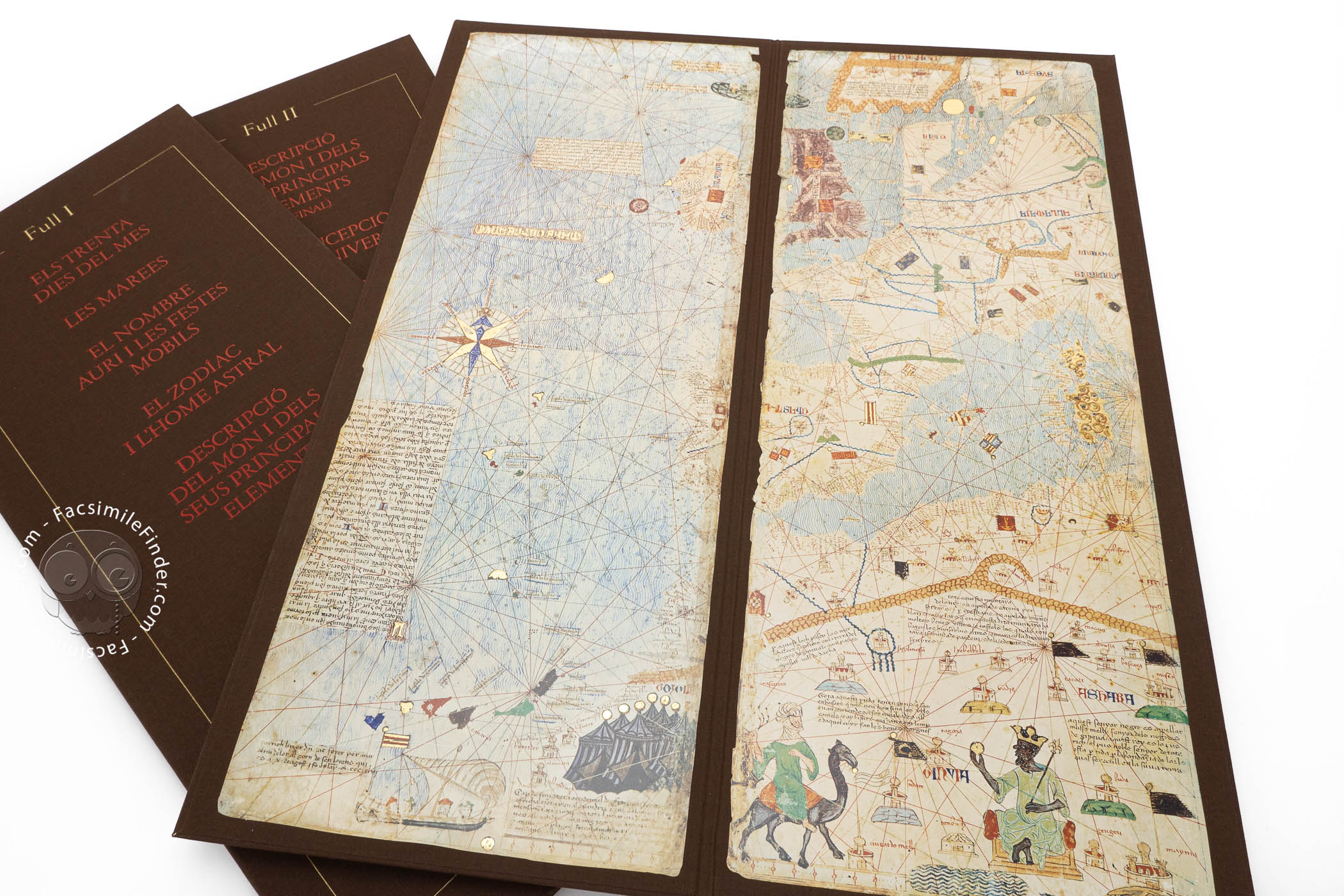
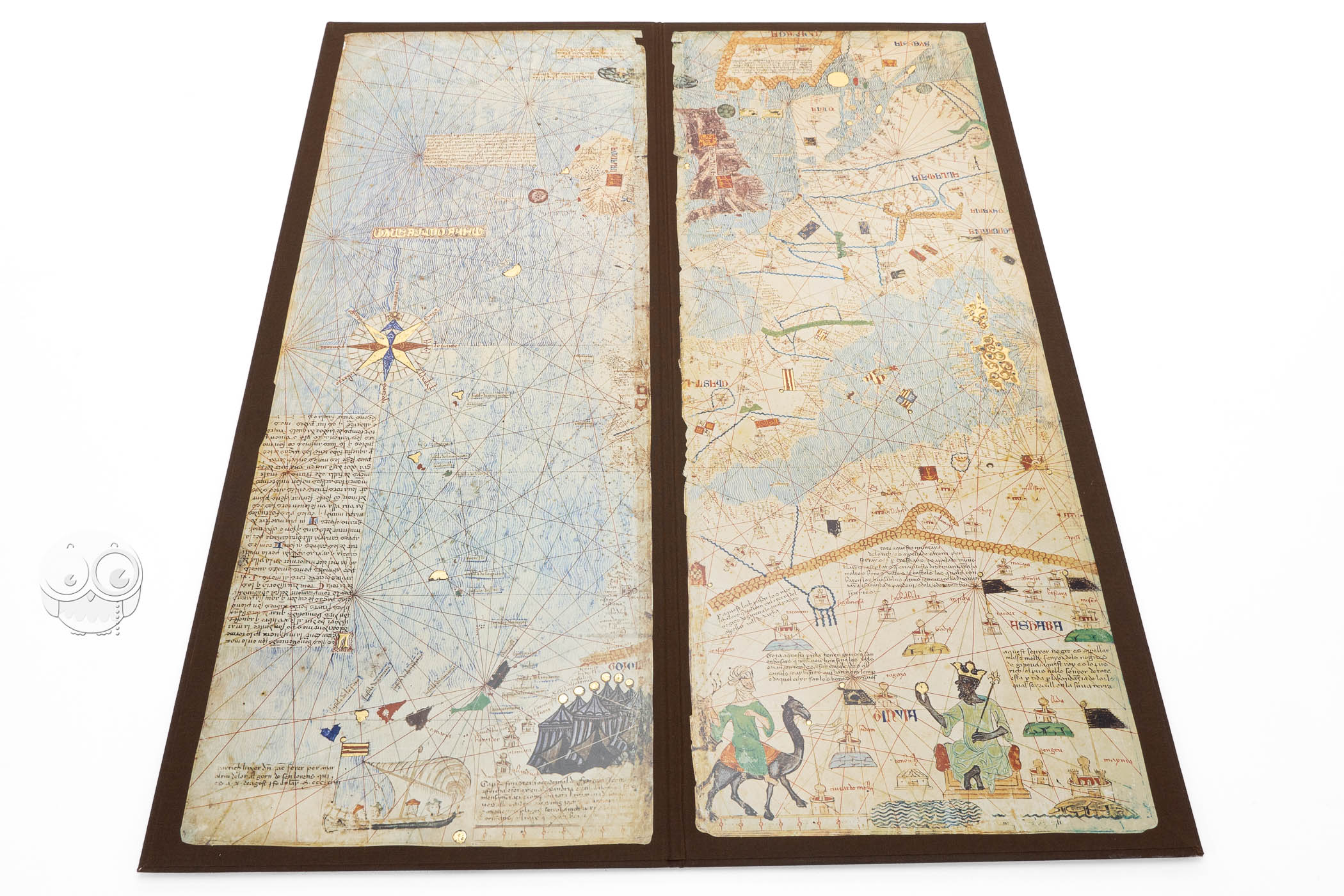
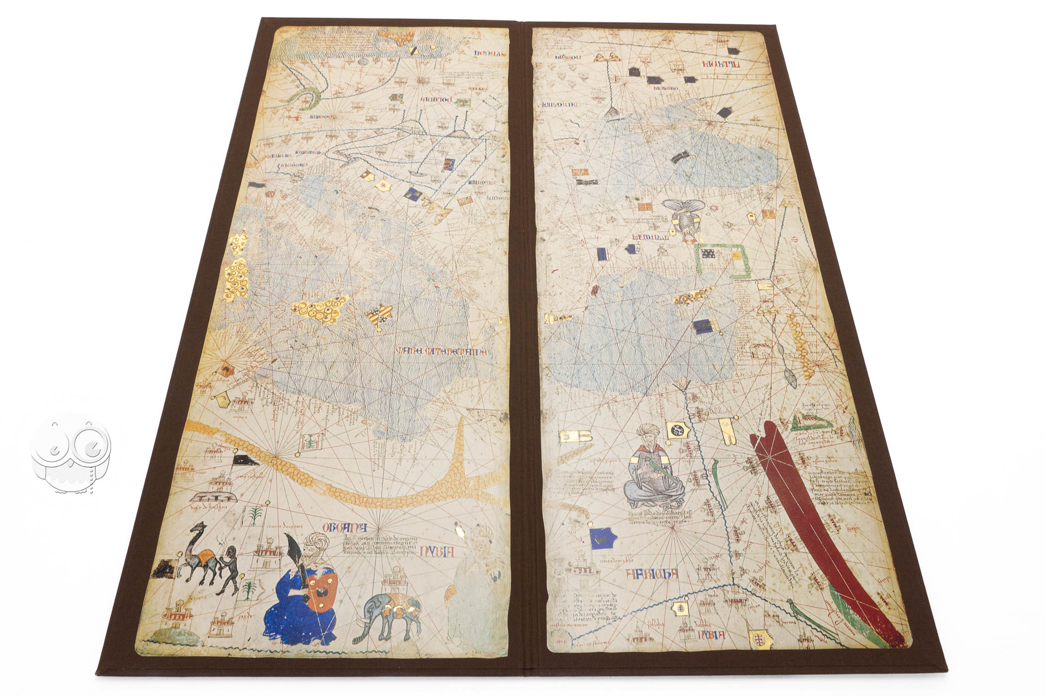
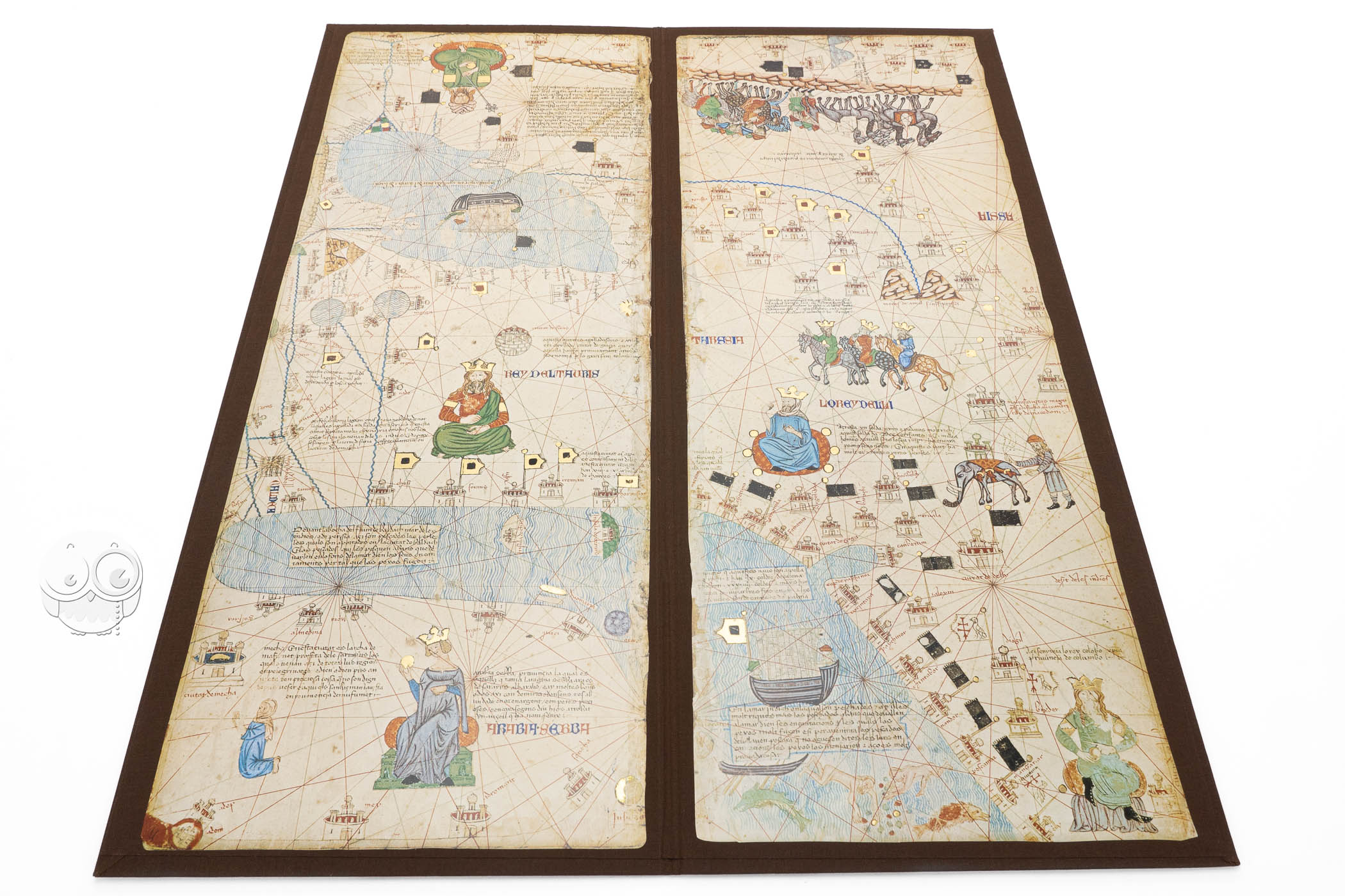
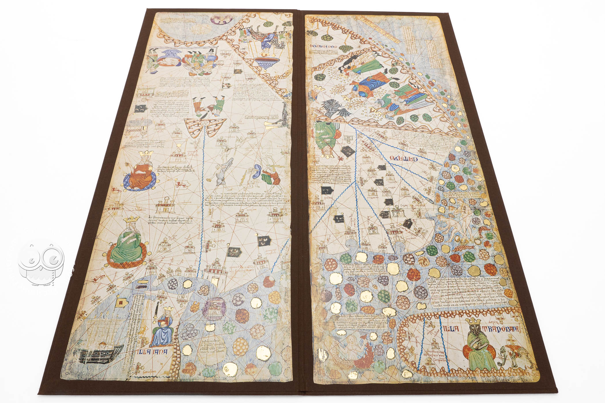
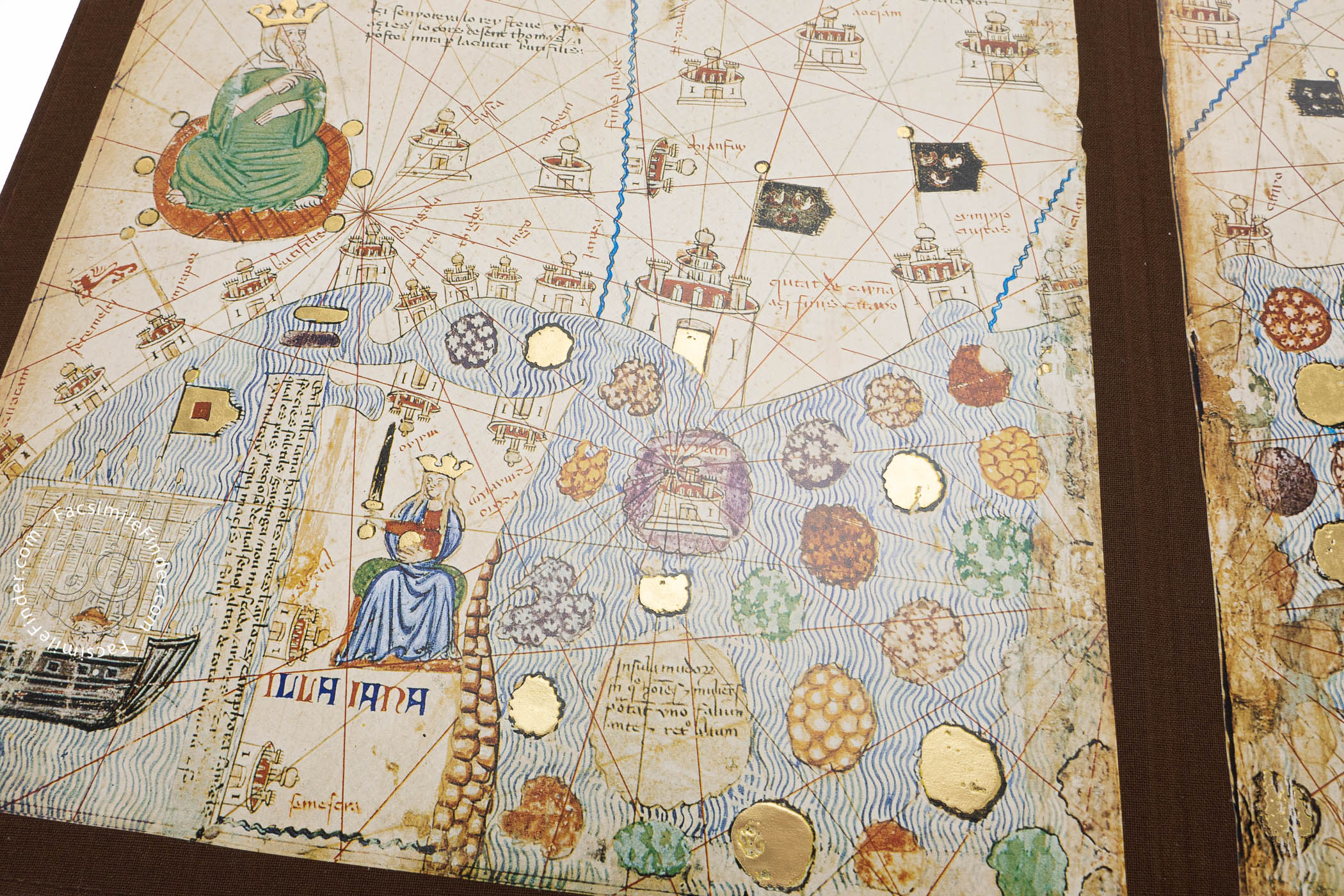
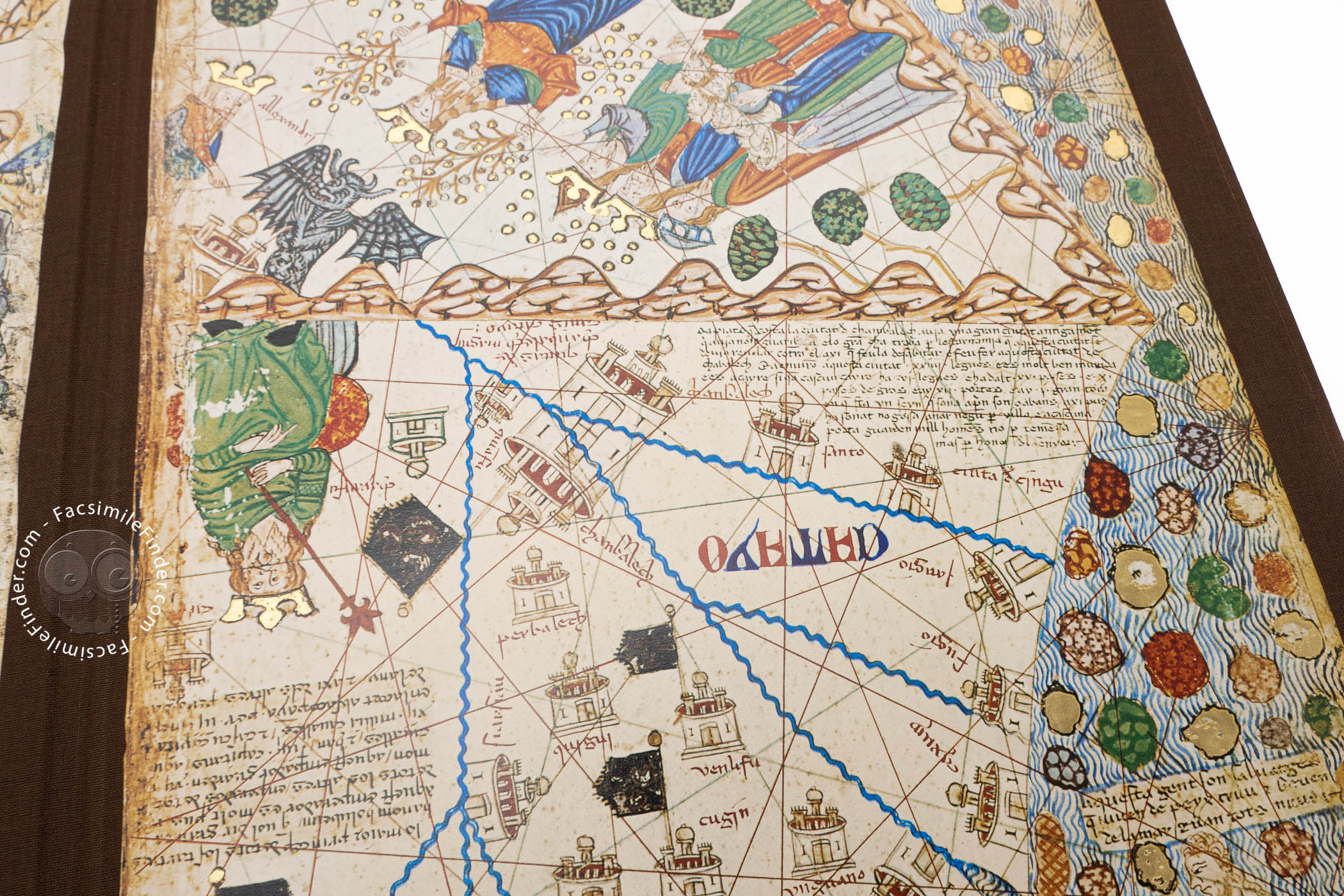
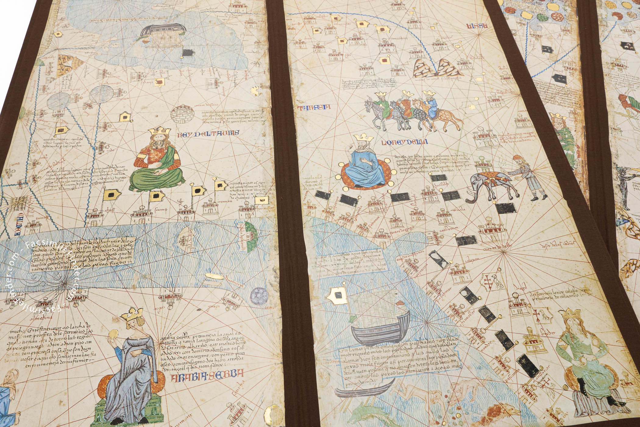
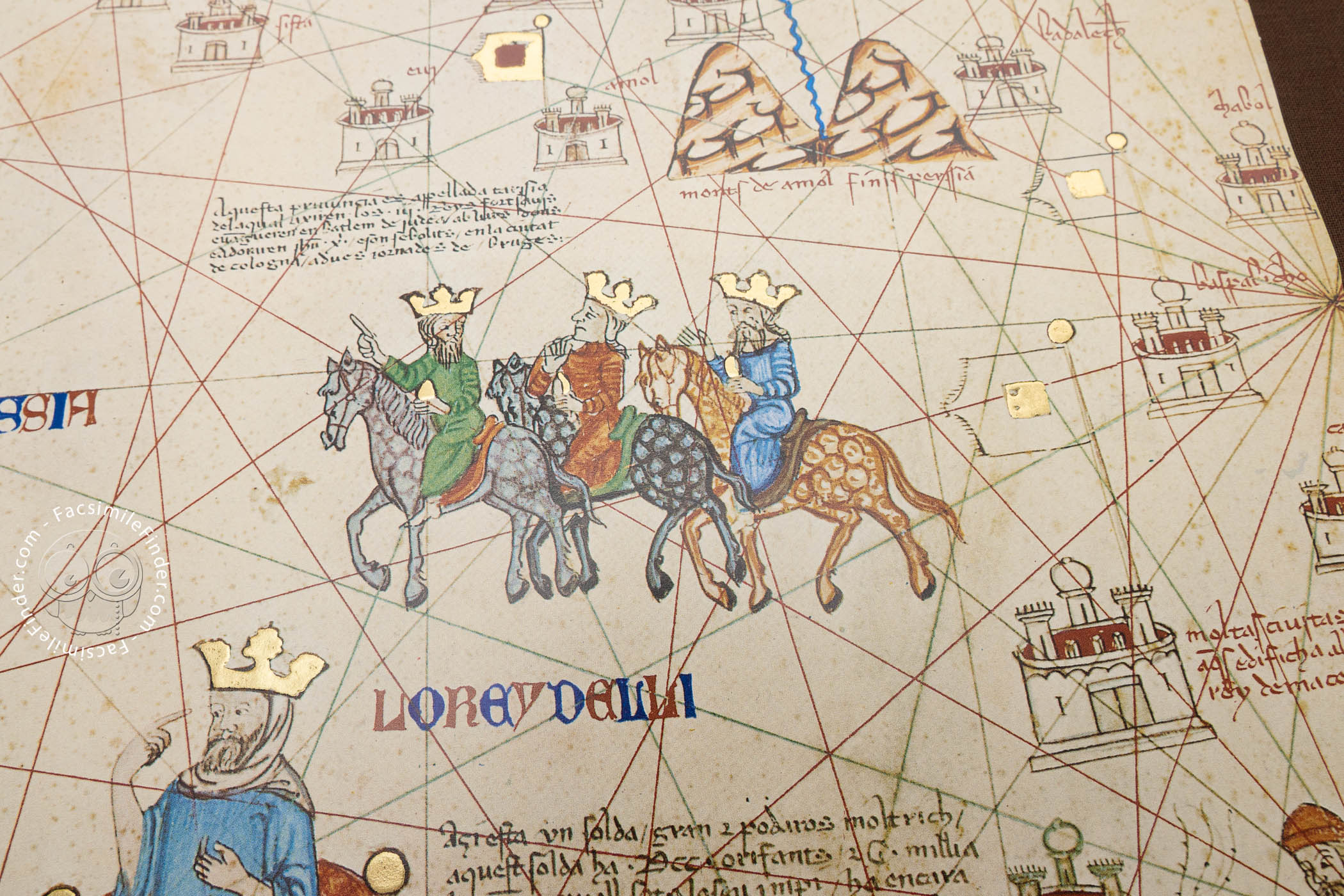
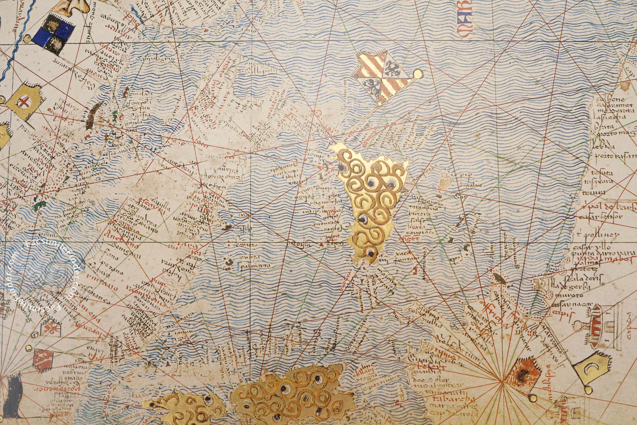
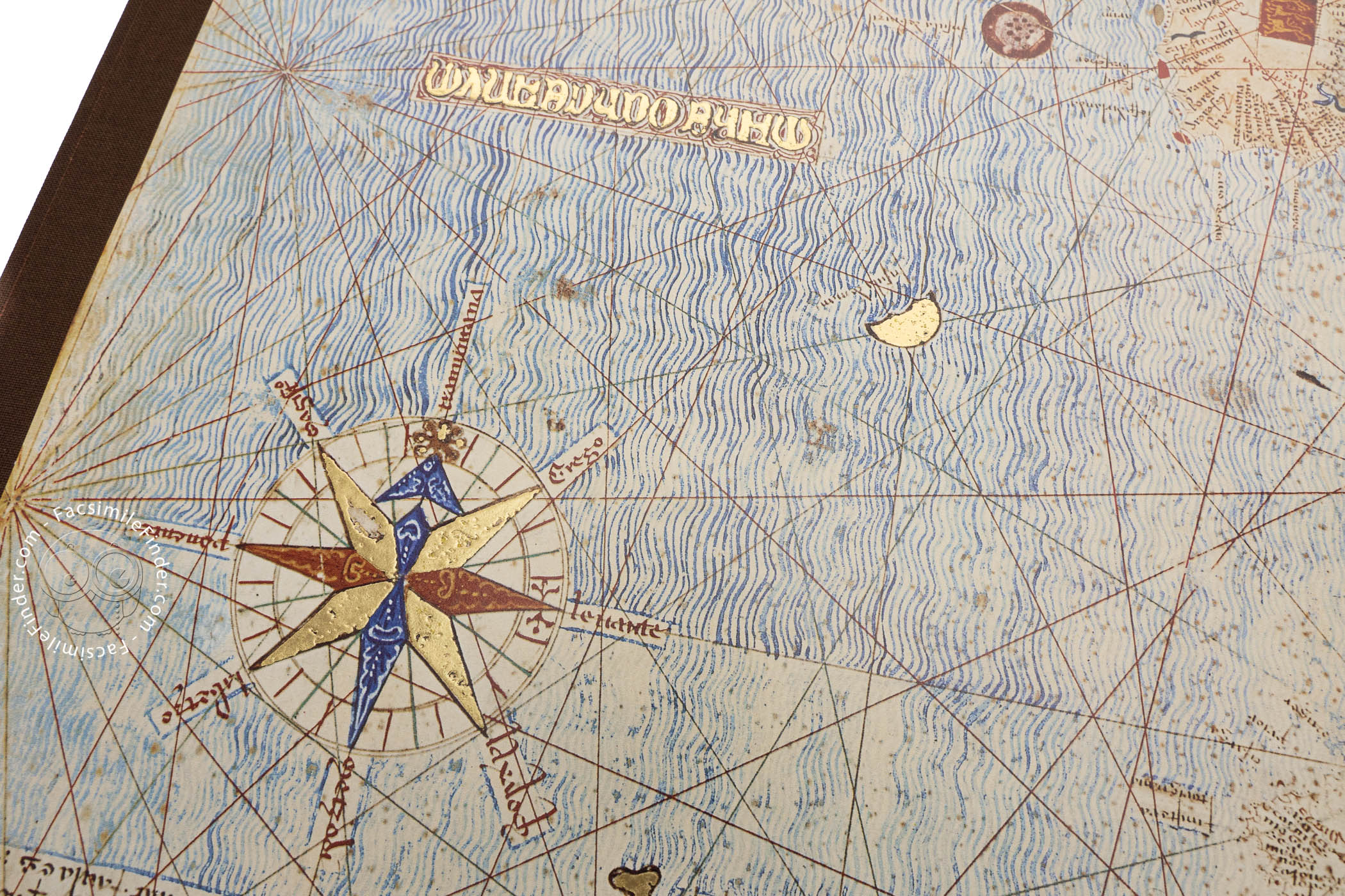
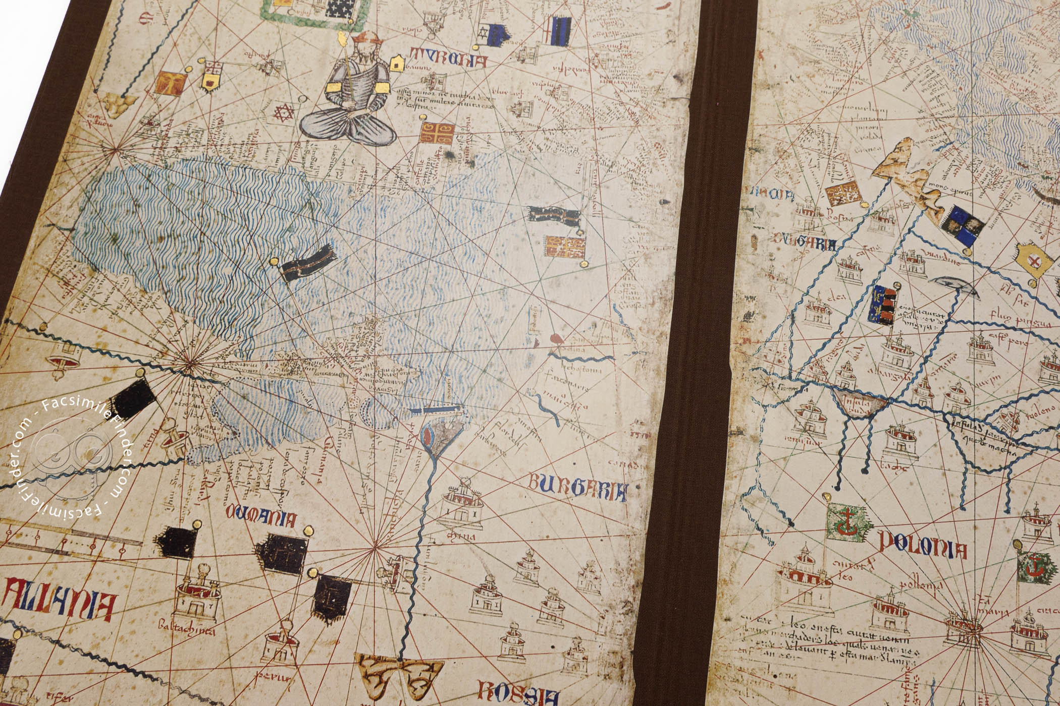
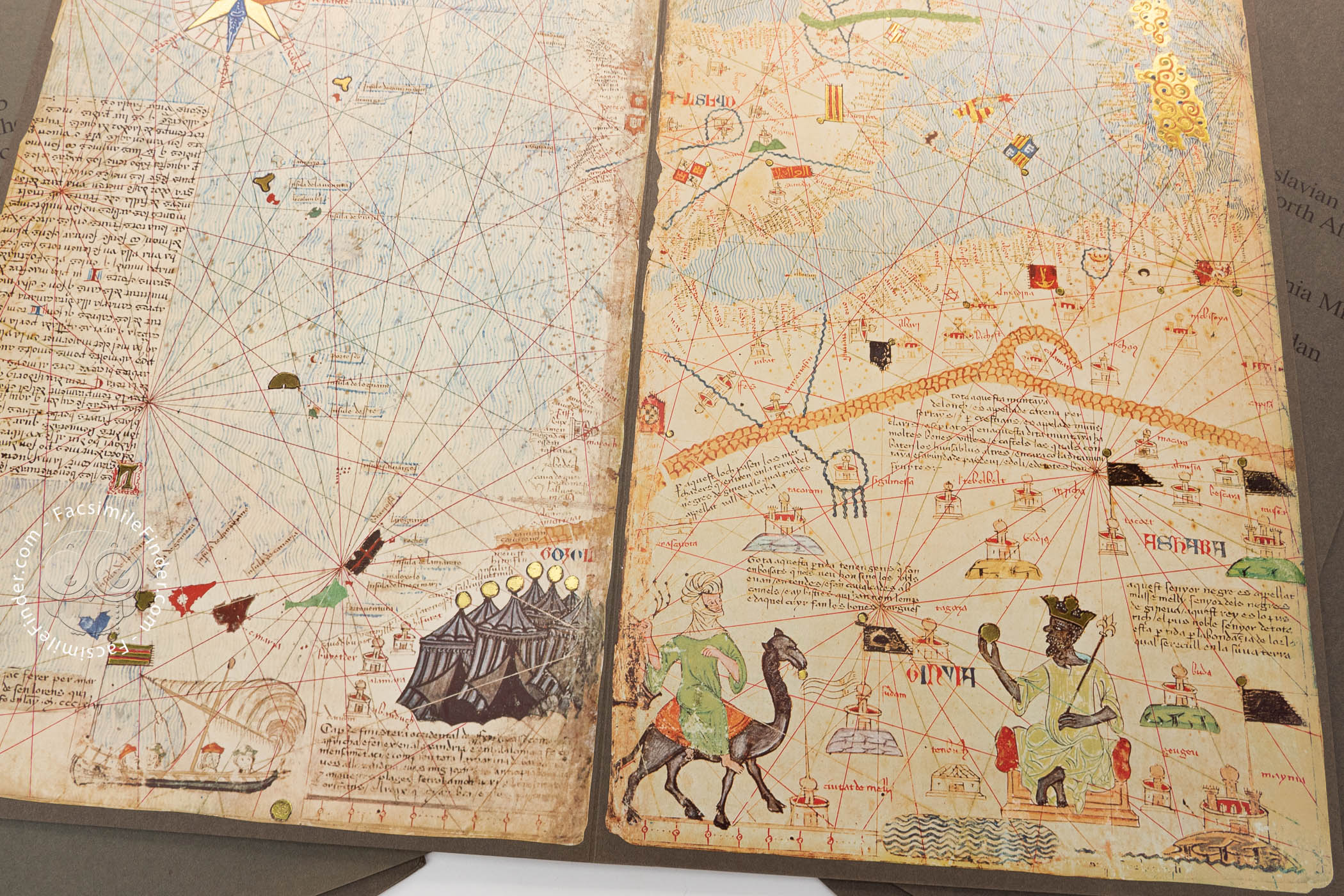
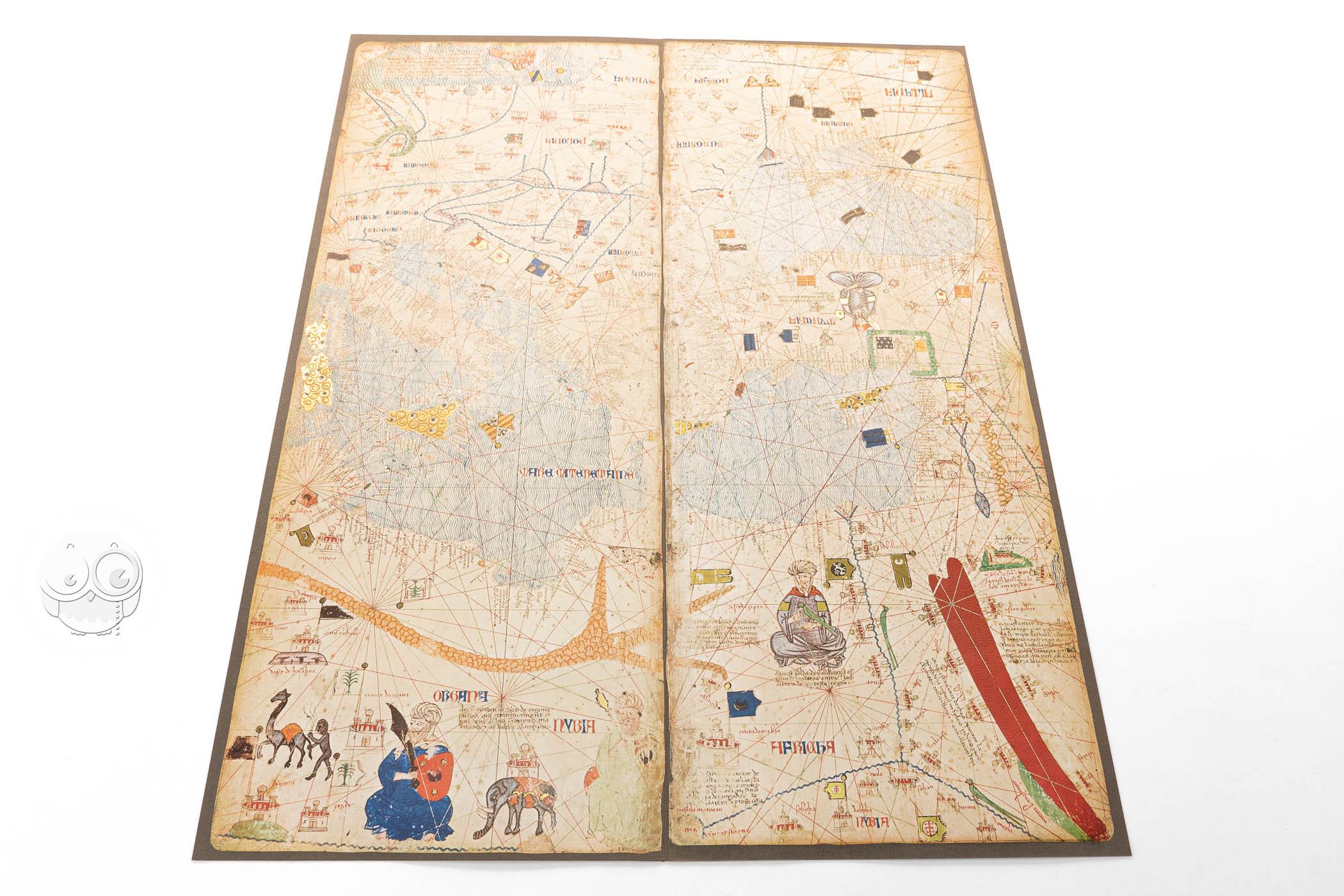
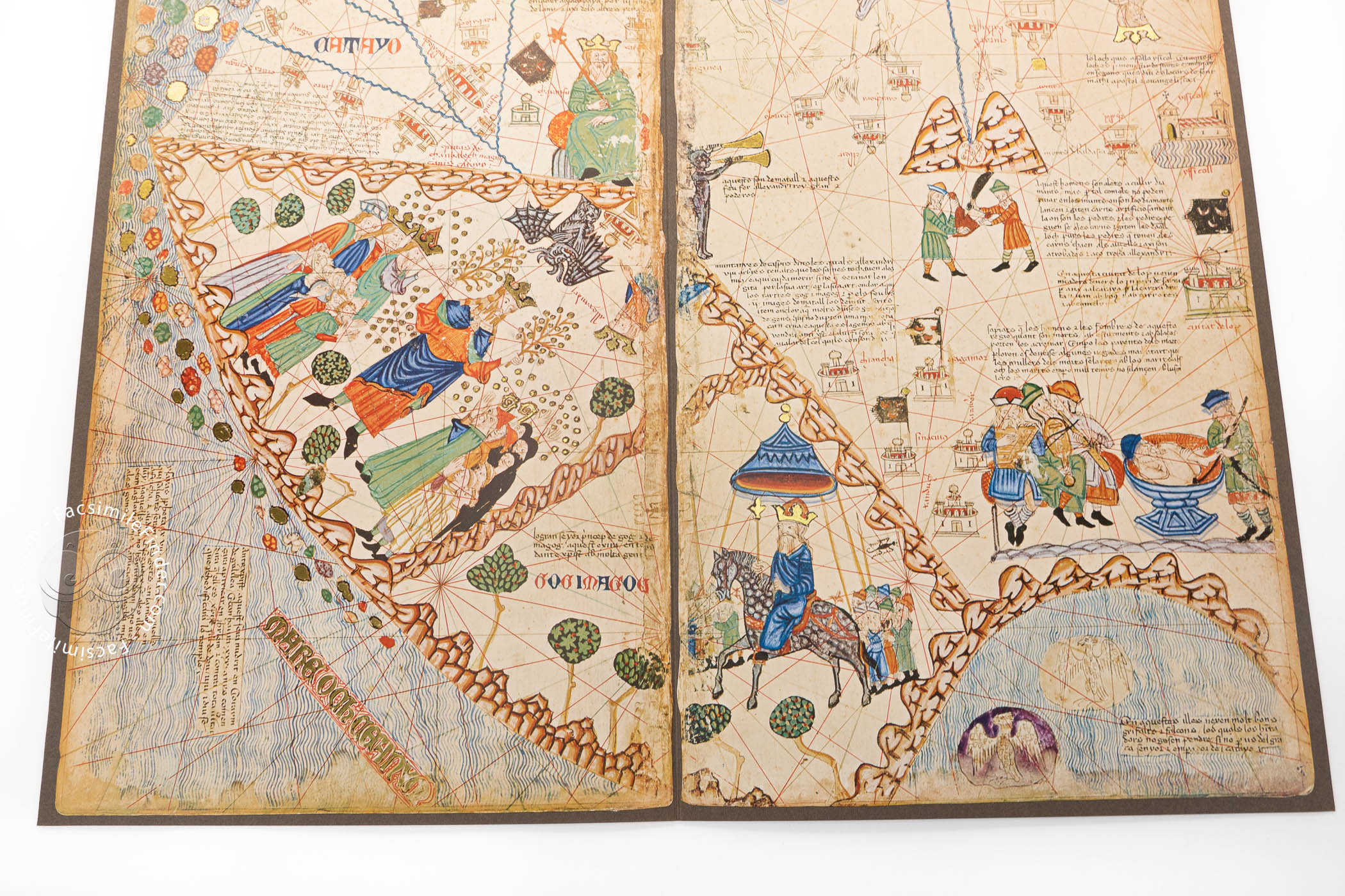
The Catalan Atlas combines a map of the Mediterranean and Black Sea basins, complete with compass and wind roses, rhumb lines, birds-eye-views of important cities and ports, banners, and the names of coastal landmarks in black and red—all features of portolan charts (panels 3 and 4). The networks of rhumb lines continue onto the sheets portraying Asia, which is represented in the tradition of medieval mappae mundi rooted in ancient descriptions (panels 5 and 6).
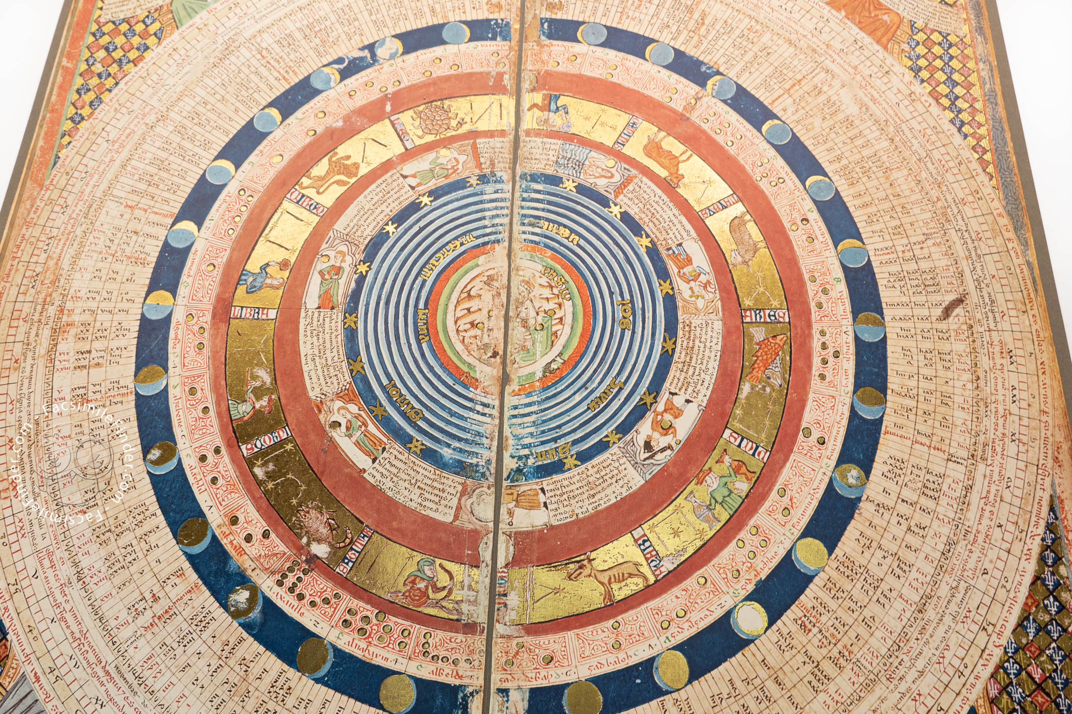
Mapping the Cosmos
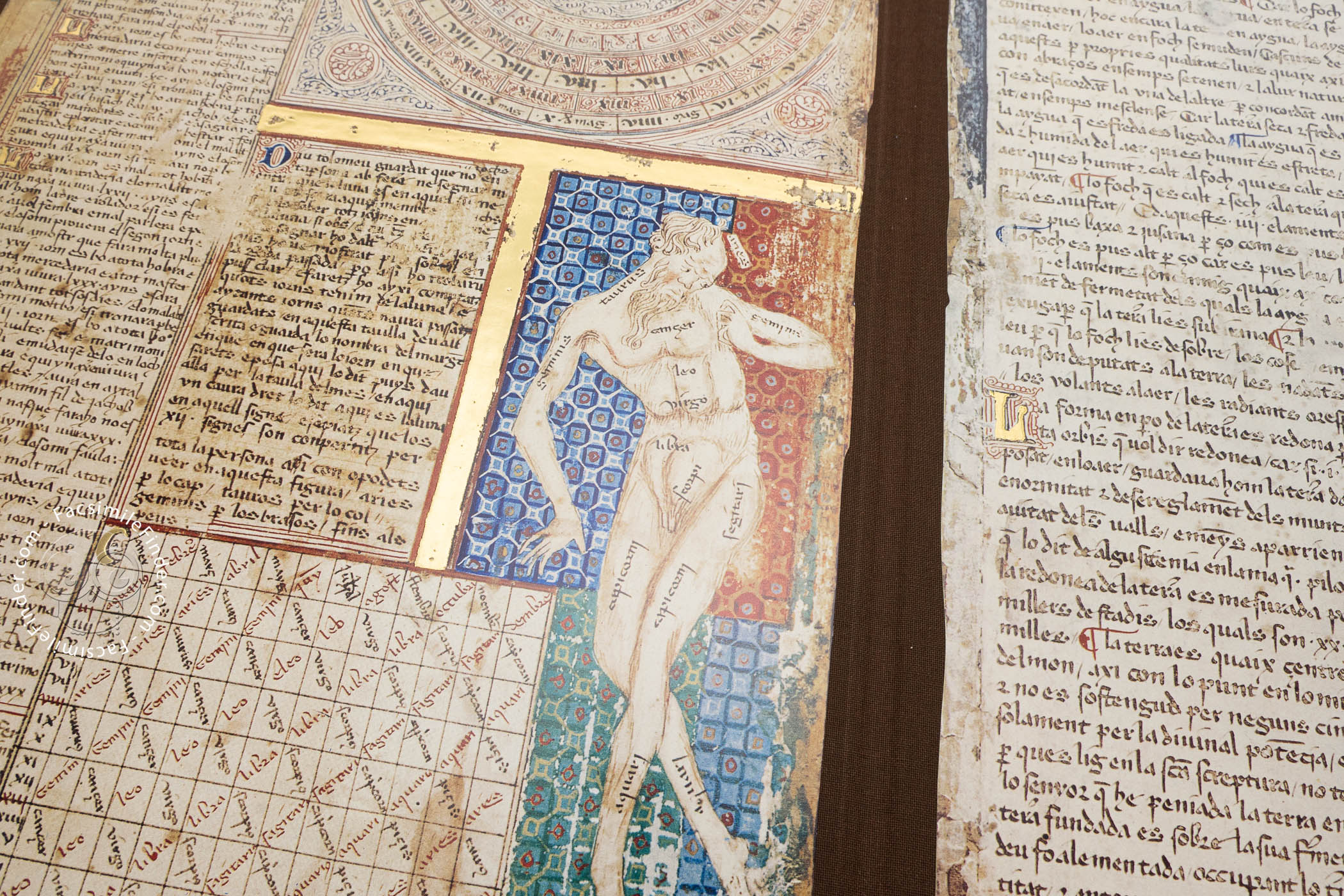
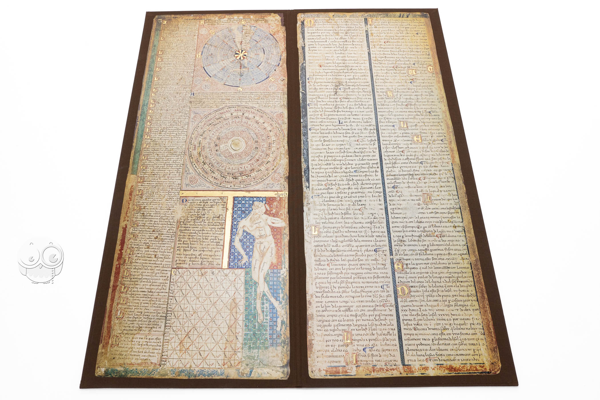
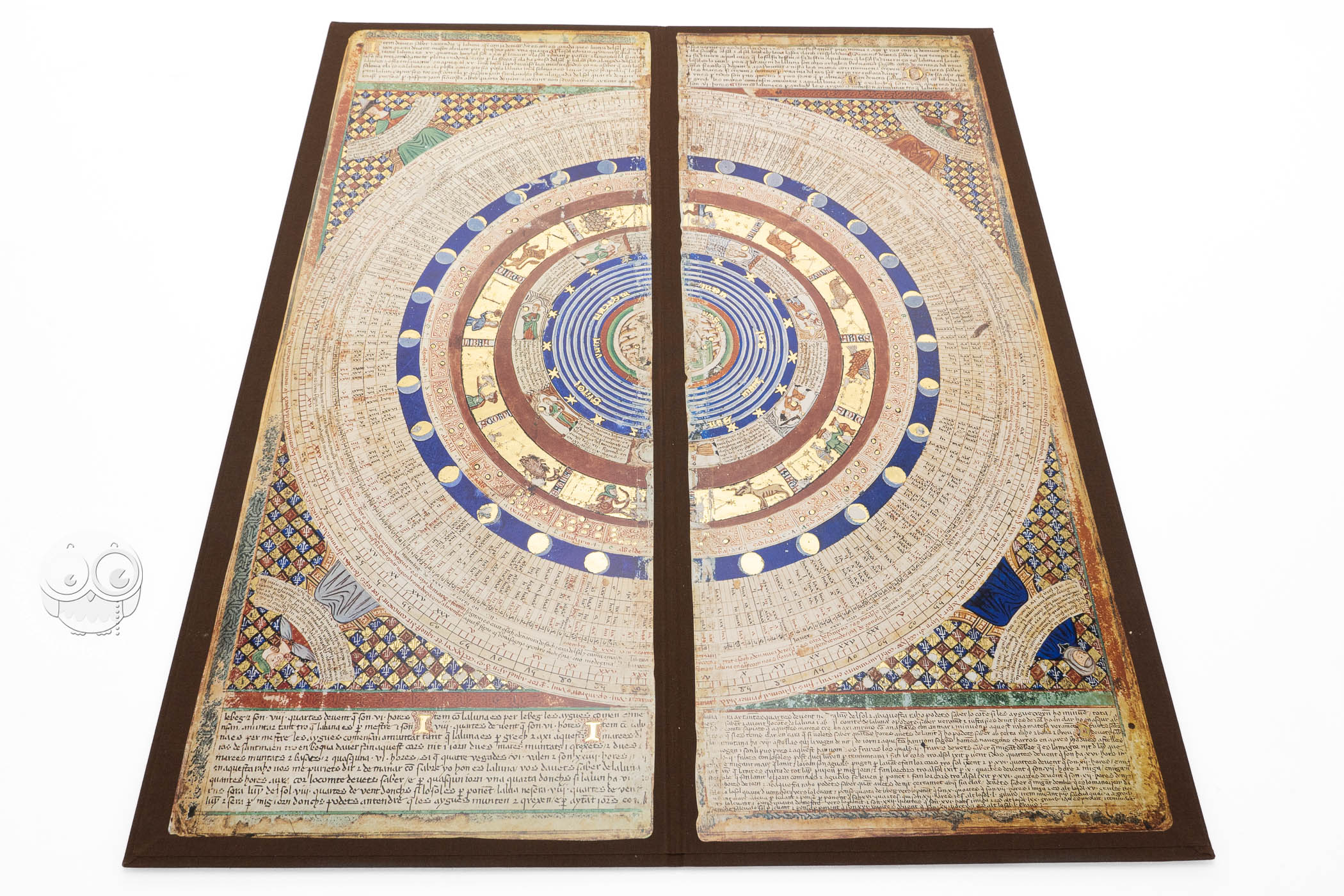
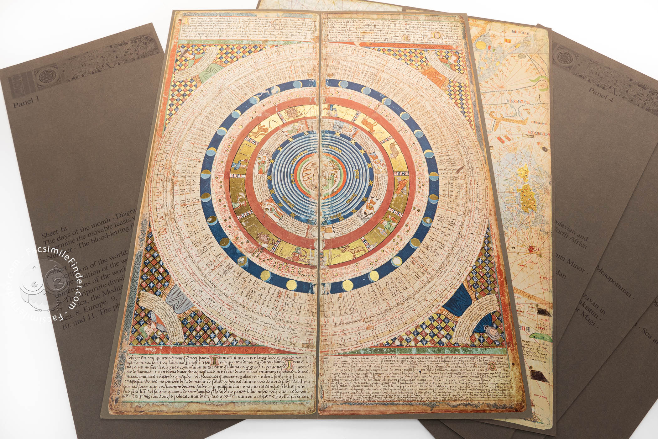
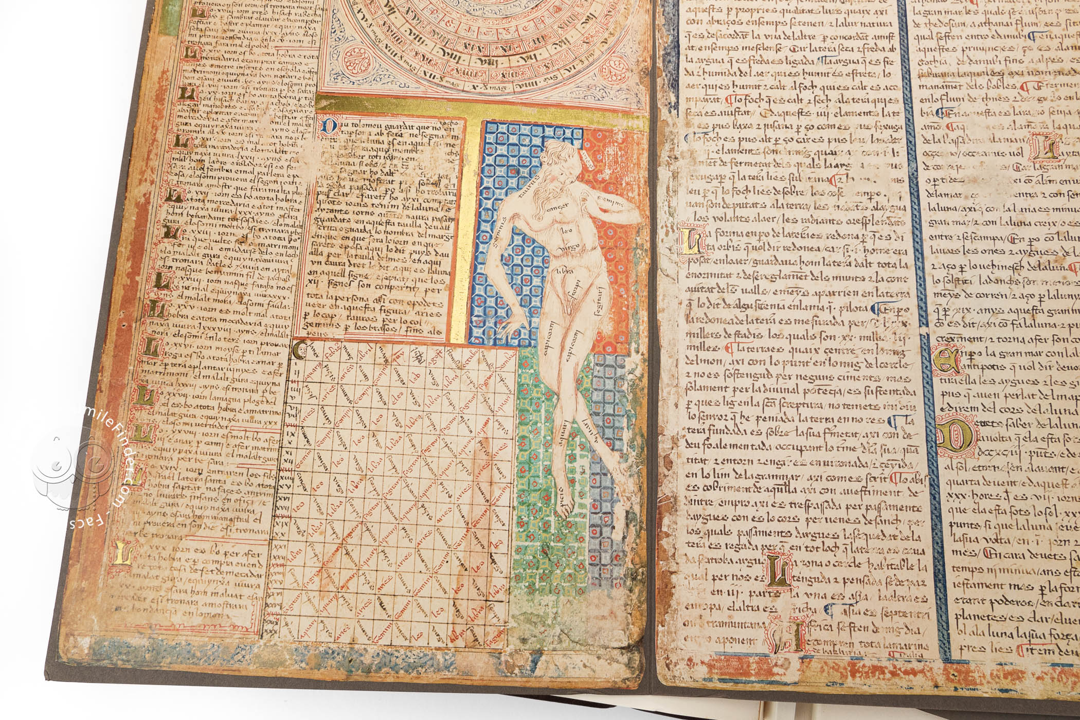
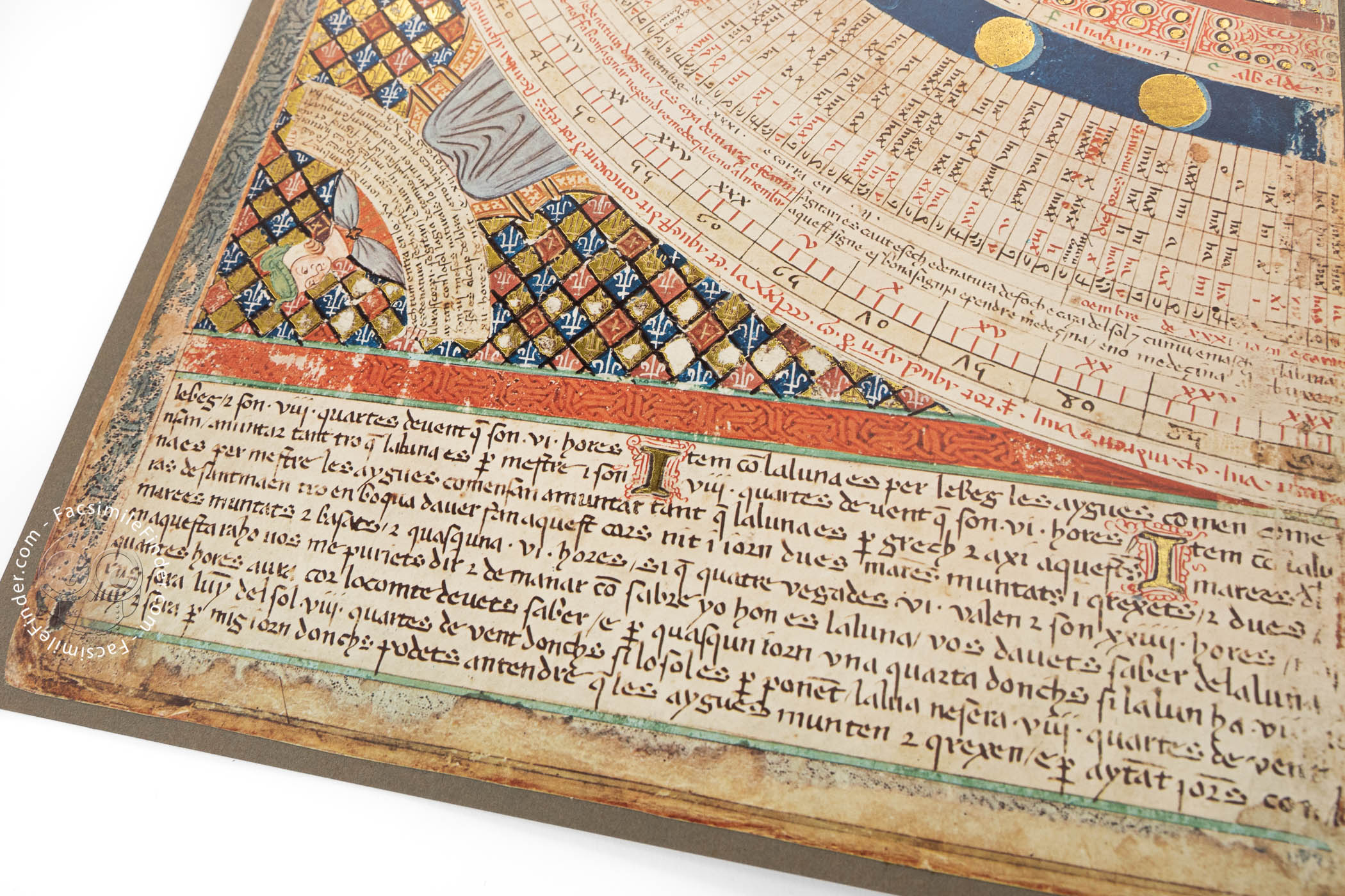
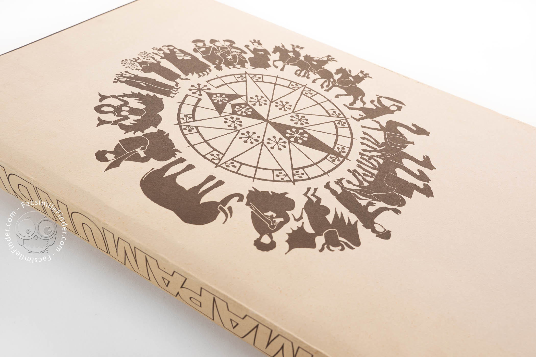
Texts and diagrams concerning the cosmos and calendrical calculations set the stage for the terrestrial maps (panels 1 and 2). Most visually impressive is the calendar wheel, which depicts the earth surrounded by spheres of water, air, and fire; the planets; and the zodiac signs. The outermost rings explain the phases and motions of the moon. In the corners personifications of the seasons are pictured against colorful diapered grounds of gold, red, and blue (panel 2).
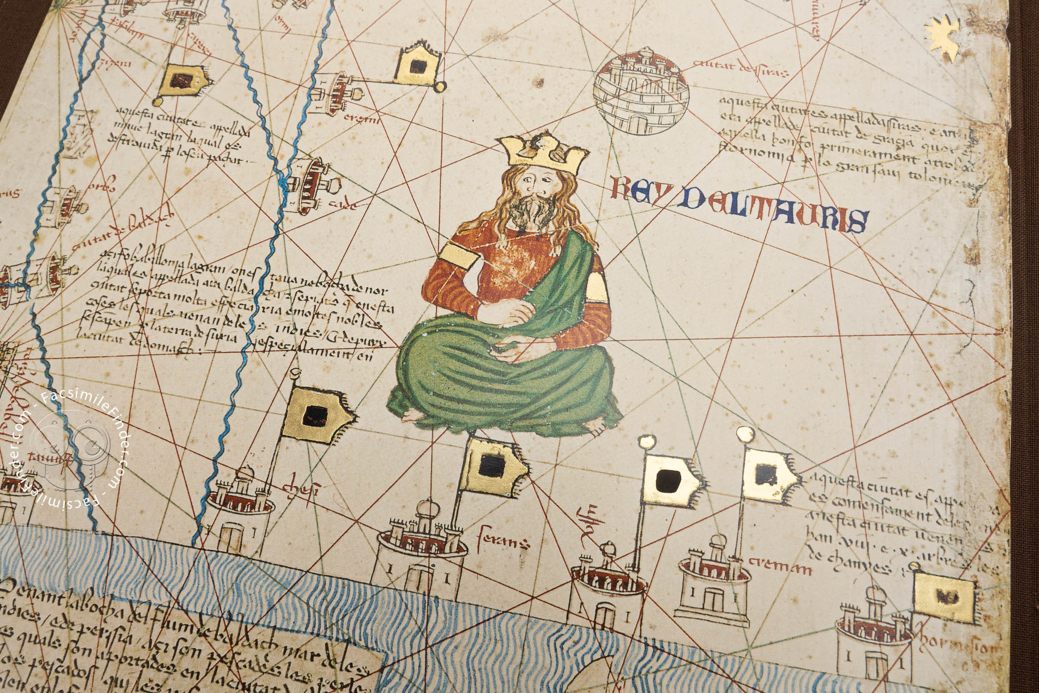
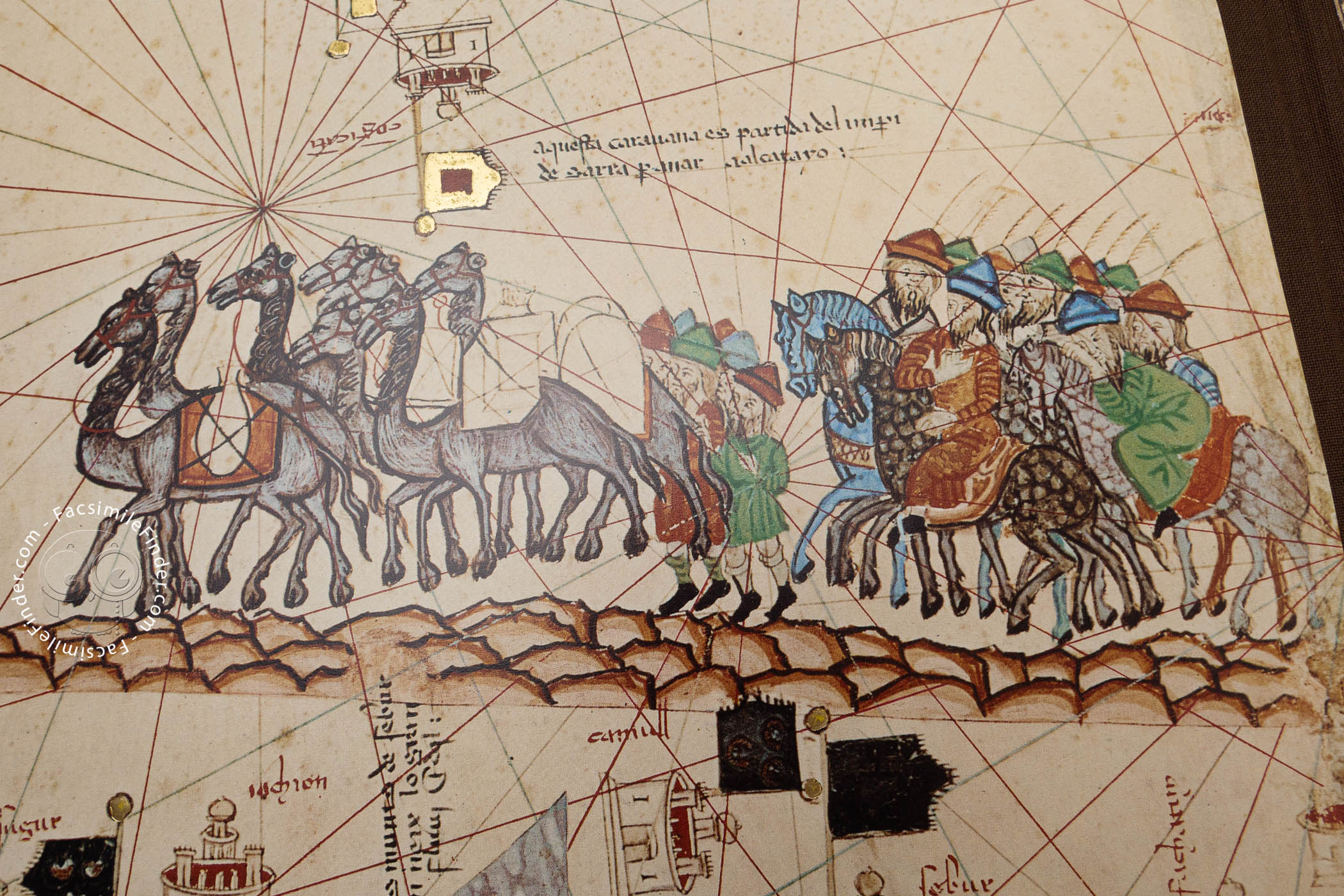
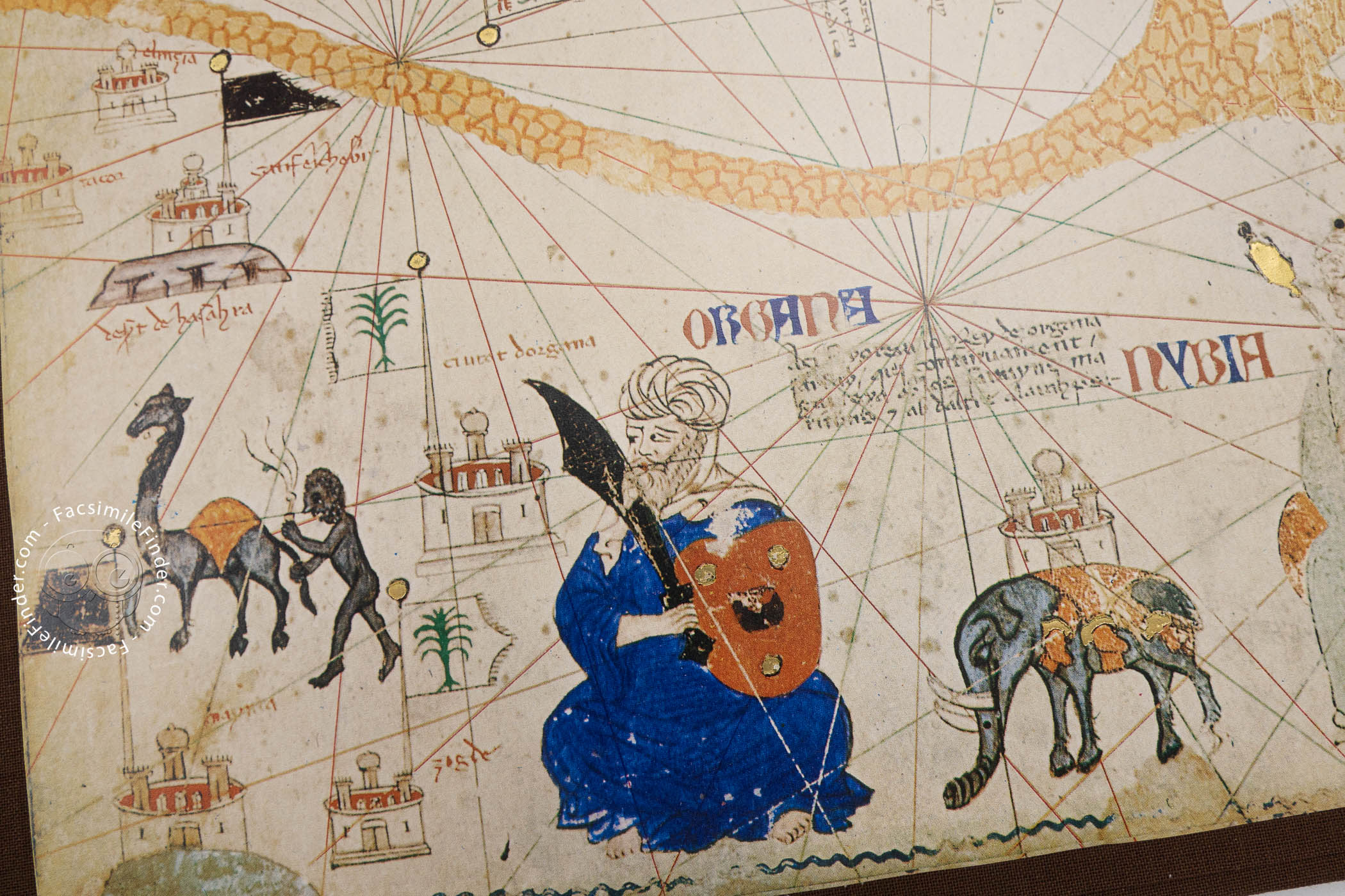
Places, People, and Animals Depicted
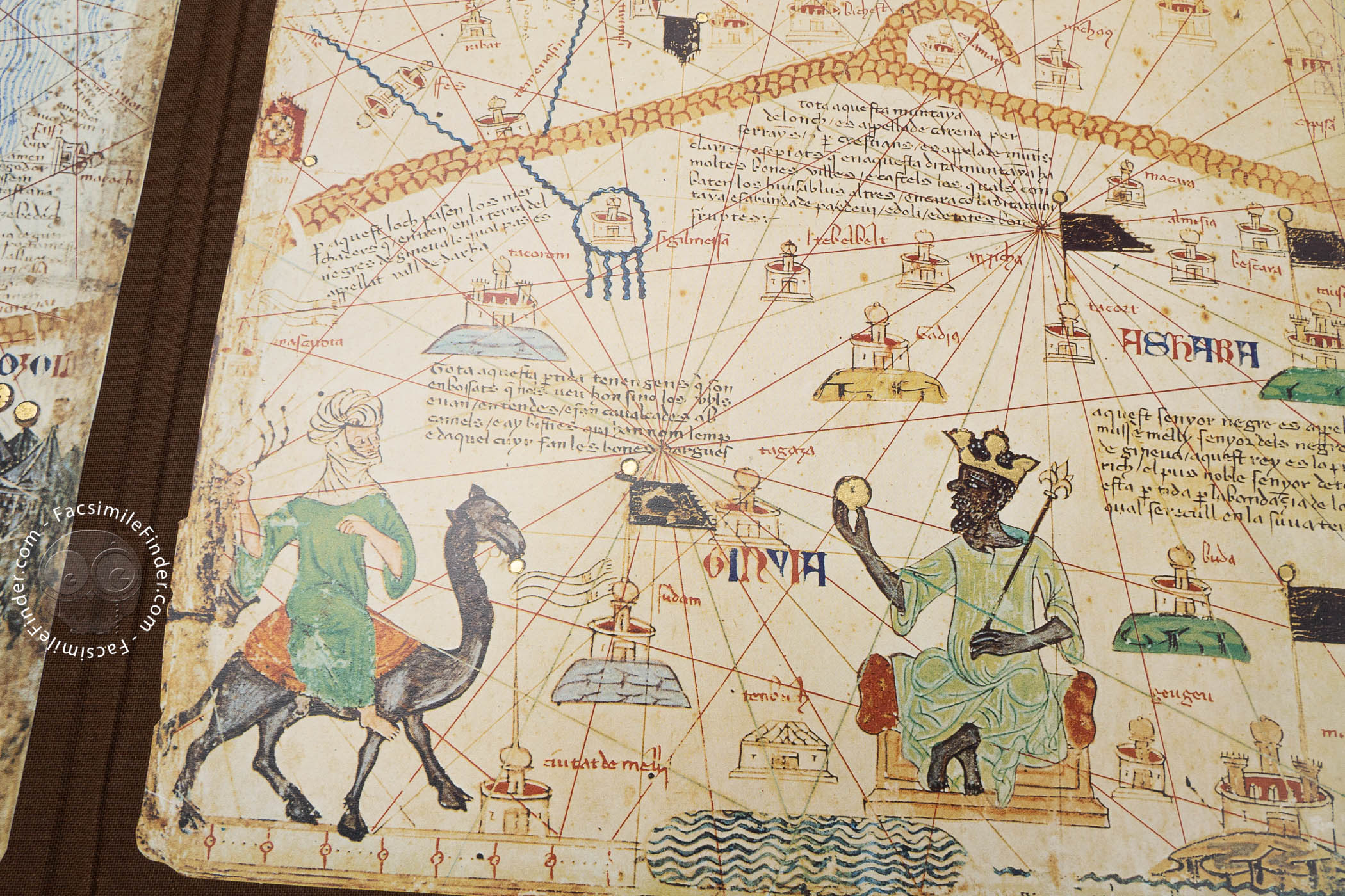
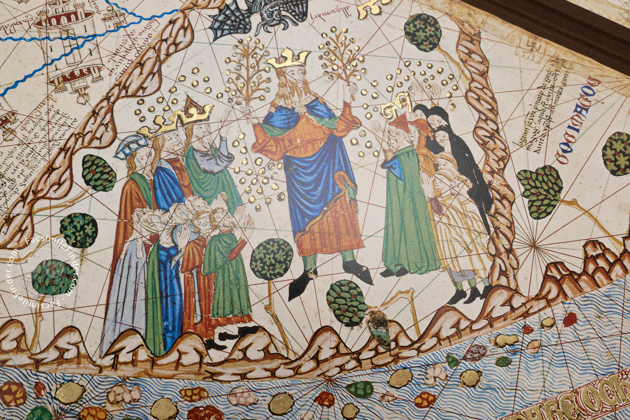
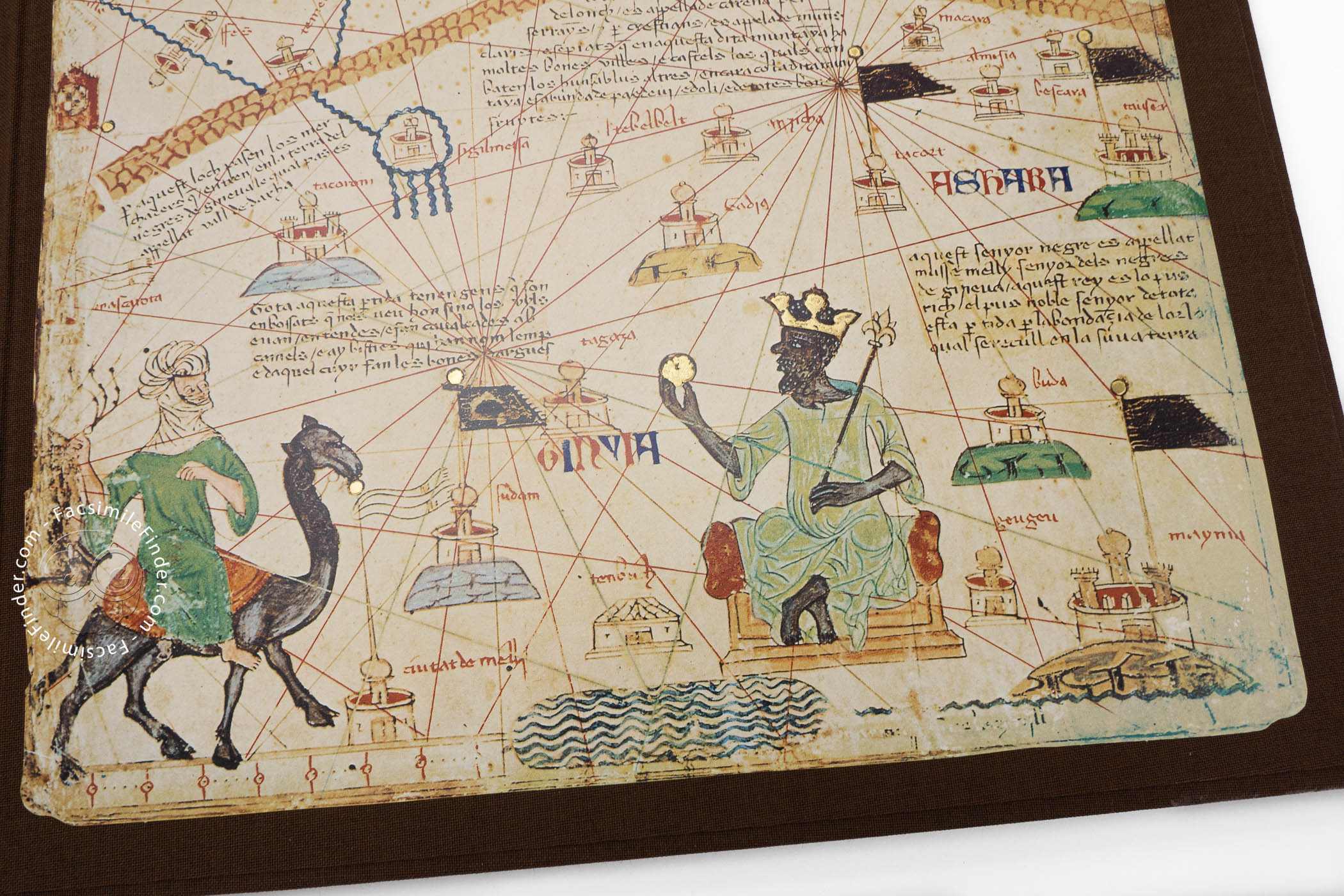
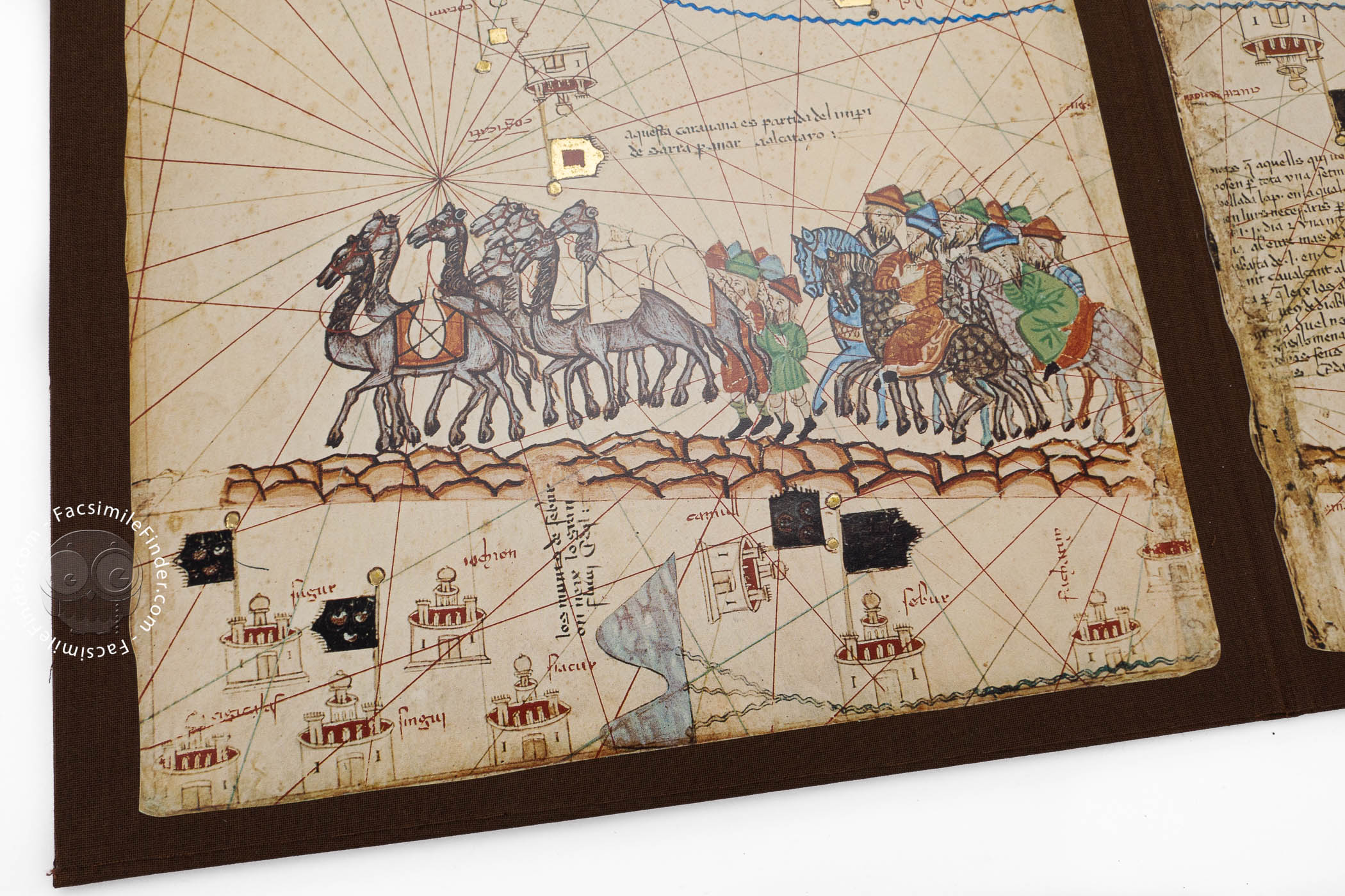
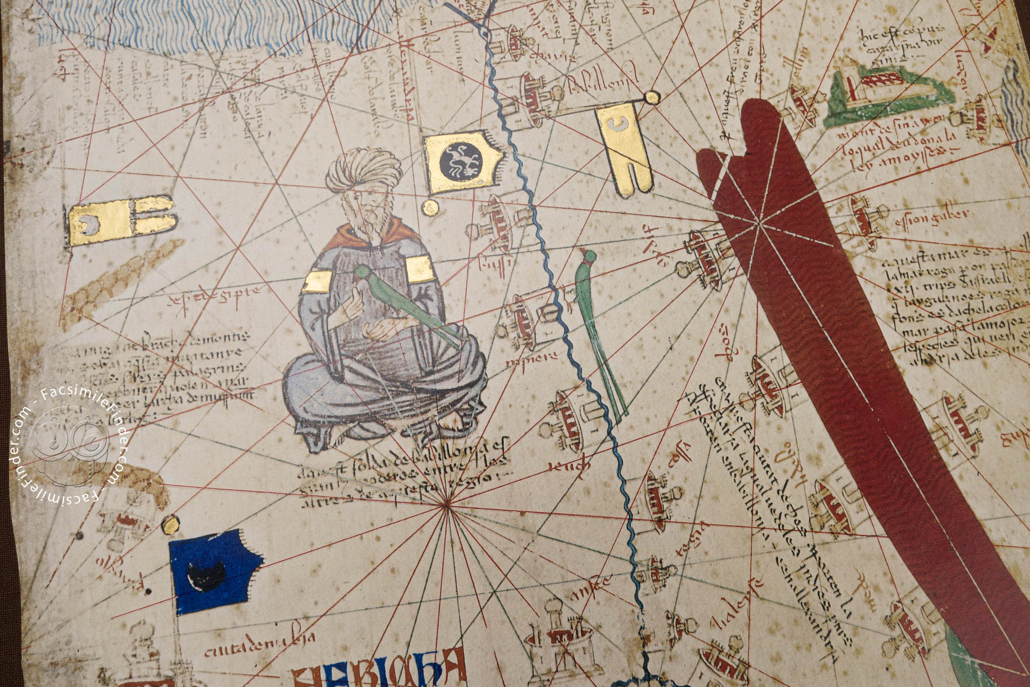
In the Catalan tradition of portolan mapmaking, the areas surrounding the Mediterranean and Black Seas display important places, people, and animals—especially animals unfamiliar to Europeans, such as camels, elephants, and parrots. Among the rulers depicted is Musa (d. 1337), Sultan of Mali, shown seated on a cushion and holding a gold ball. The caption describes him as "the richest and noblest of all these lands due to the abundance of gold that is extracted from his lands" (panel 3).
Marco Polo Mapped
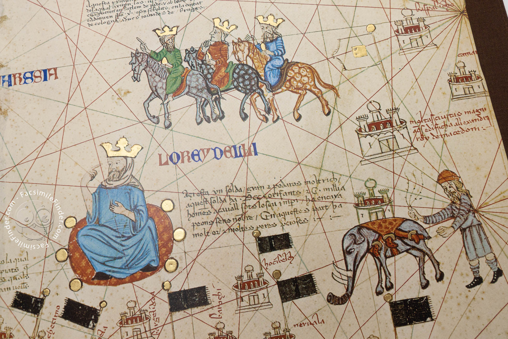
The maker of the Catalan Atlas drew from the mapmaking tradition of his native Majorca and relied directly or indirectly on a great variety of medieval texts, but the atlas is the first surviving world map to quote extensively from the work of Marco Polo (d. 1324?). The map includes Marco's stories concerning the Gobi desert and his description of Khublai Khan (1216-1294).
A Focus on Jewish Concerns
Although the atlas addresses Christian concepts and concerns (such as the calculation of the date of Easter), the maker drew on information gleaned from Jewish traders in developing his picture of northern Africa, and there are many references to places and events described in the Hebrew Bible. It is highly probable that the maker of the Catalan Atlas was a part of the prominent Jewish mapmaking community of Majorca.
The Pride of the French Royal Library
Interest in the Catalan Atlas at the French royal court was immediate and intense. It is described in an inventory of 1380 as "painted and provided with historical illustrations." Already in the early sixteenth century, the sheets were remounted and bound in codex form in the style of Simon Vostre (d. 1521), the most prolific printer and bookseller in France at the time. The original orientation of the maps (whether north or south at the top) and their order is unknown.
We have 2 facsimiles of the manuscript "Catalan Atlas":
- Atles Català 1375. El Món i els Dies facsimile edition published by Enciclopèdia Catalana, 2005
- Mapamundi. The Catalan Atlas of the Year 1375 facsimile edition published by Urs Graf, 1977-1978