

Find out how an American Professor specializing in art history used a facsimile of a medieval map of the Roman Empire to enrich and deepen her students’ learning experience. Teaching in a hybrid environment during the pandemic has been quite a challenge for both teachers and students, but in this case, it turned into a great opportunity.
In Spring 2021, I found myself thinking about all my course material in new ways. My university met in person, or so we called it, during the entire 2020-2021 academic year. What this really meant is that all my courses would be taught in a hybrid environment: most students would attend class in-person once a week and do asynchronous work on the alternate days, a few were permitted to attend all their classes remotely, via Zoom.
It is worth noting that even when students were assigned to attend in one mode or another that did not mean an in-person student would always be in person. On any given day, a student might attend remotely due to contact tracing, quarantine, or a student would feel ill or be experiencing Covid-like symptoms. We all struggled to make connections across these varied and uncertain learning environments, and I never really knew who would show up, how, and in what medium.
Taking Advantage of a Hybrid Teaching Environment
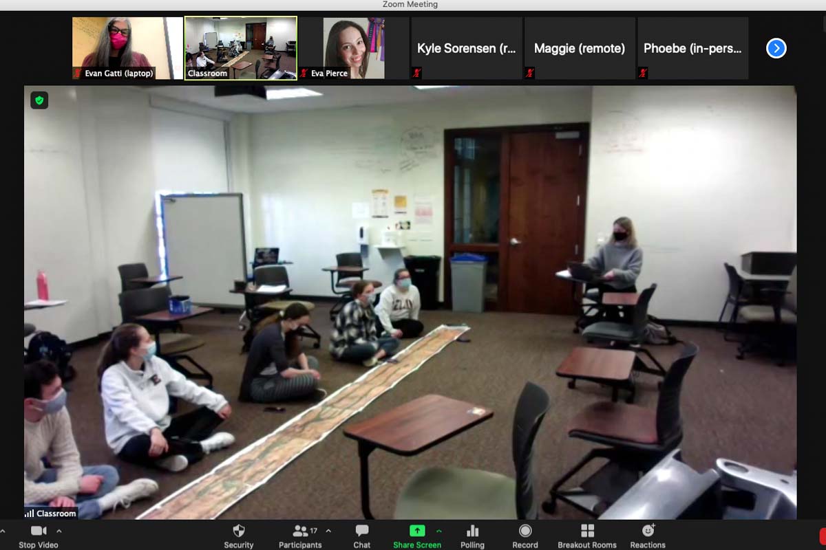
I use that term – medium – intentionally. I began my Fall and Spring hybrid courses by reminding students that in art history courses we almost always learn in a “virtual” format. Even when students and faculty are in person, we study works of art and architecture that are not. We already use presentation software, like PowerPoint and Google Slides, or videos and virtual tours to create a facsimile of the experience of seeing something “in person”. This conversation took on new meaning when I projected my Zoom screen and its black rectangles of names and faces alongside our shared screen of slides and images for students who were here, there, and everywhere.
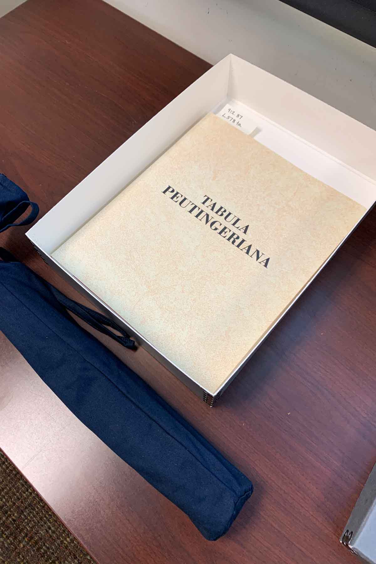
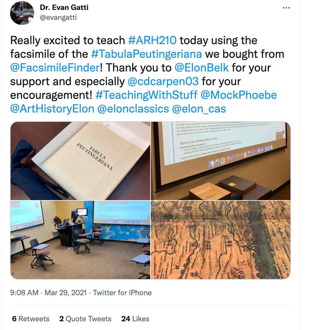
Little of what we did in my courses last year felt satisfactory, but there was one highlight – one set of classes that worked because of the varied spaces in which we were all learning. Over a week in March 2021, I taught a series of classes using the facsimile of the Tabula Peutingeriana that Elon had purchased from Facsimile Finder in 2018. [1]
I had been searching for several years for a facsimile in a price range that my university budget could afford and that I knew would be of interest to a variety of faculty. [2] I am the only permanent full-time faculty member at Elon who teaches courses in medieval and premodern art history and museum studies, but we have several faculty who teach in Classical Studies, or who teach the Ancient World, and so a medieval map of Rome that may have been modeled on an ancient prototype seemed more likely to be used by my colleagues.
Using a Facsimile in Art History Courses: The Tabula Peutingeriana
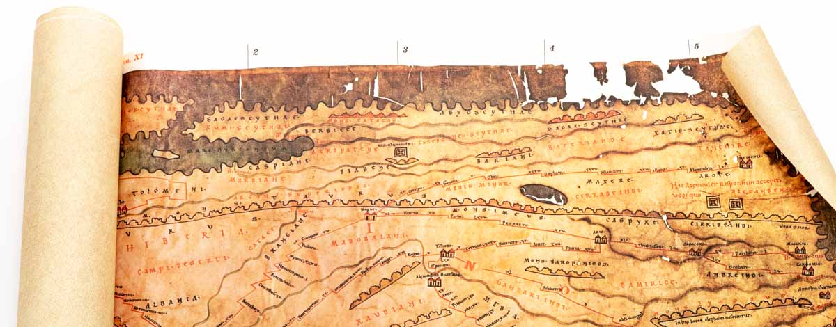
For those of you familiar with the Tabula Peutingeriana, you know that it is a fantastic document to examine in facsimile because the Tabula itself is a copy of something else. Let me back up, the Tabula Peutingeriana, as we now know it, is a 13th-century map of the roads that lead to (and from) Rome that was copied by a monk in the monastery at Colmar (modern-day France). The map, or tabula, records the networks of public roads constructed during the Roman Empire that linked the known world. [3]
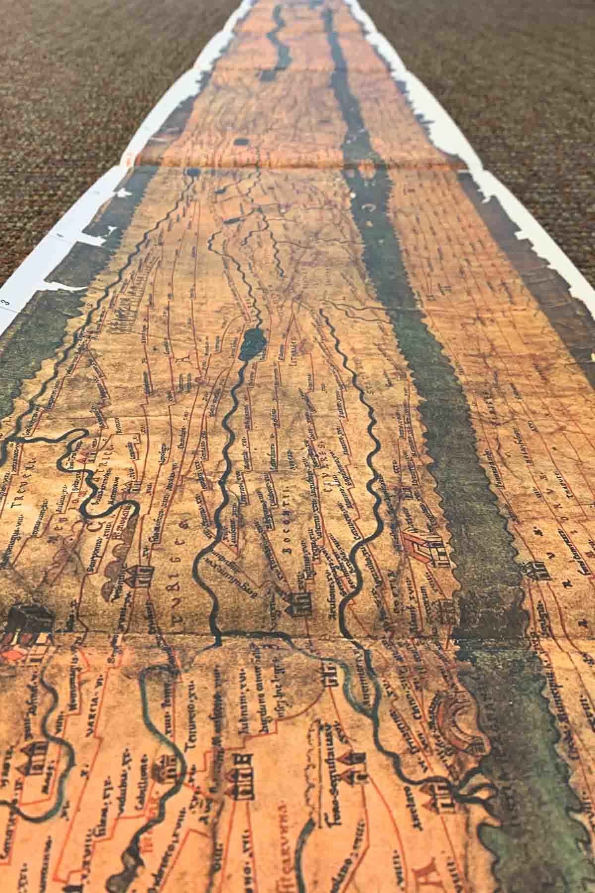
A personification of the city of Rome marks the center of the 22-foot-long map, and the rest of the world is linked to Rome by sections of road marked and annotated with the distance from one place to the other. Major sites are singled out with female personifications, and cities, towns, rivers, and landscapes populate all the spaces in between.
There has been significant debate among scholars, beginning with the map’s namesake, the German antiquarian Konrad Peutinger. Some believe the map emulates a display map made to represent the Roman Empire to Augustus, others argue the map reflects an expansion of early Roman itineraries during the 4th or 5th centuries, and still other scholars argue the “original” map may reflect ancient Roman ideas but was made in the Carolingian period (or the early to mid 9th century) before being copied at Colmar in the 13th century. [4]
A Medieval Map in Facsimile Stimulating a Debate
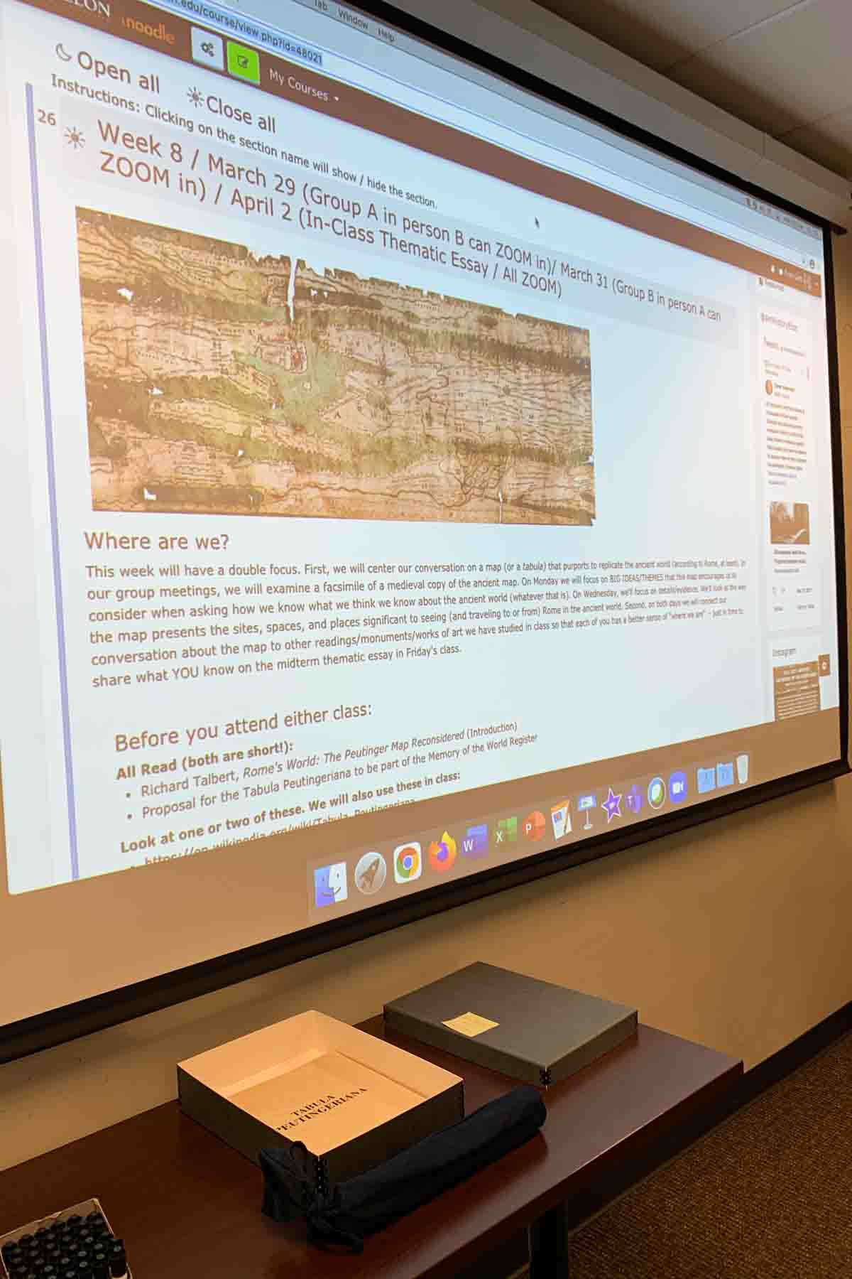
The confusion as to what the map actually represents became a perfect metaphor for the work we were doing in two of my classes: “ARH 210: Art History of the Ancient World” and “ARH 211: Art History of the Medieval and Premodern World” (hereafter ARH 210 and ARH 211). In ARH 210, we used the map to prepare for our course midterm. A short thematic essay, the midterm invited students to argue what they believed to be the most important theme of our class so far. The theme had to be presented as a thesis statement and supported by evidence presented in our course readings (we use scholarly articles rather than a textbook). The students were also required to identify four works of art that they would argue best represent their theme.
We used the Tabula Peutingeriana as fodder to create a list of themes that we had discussed in our class: power and privilege; trade routes, exchange, and influence; issues of likeness and re-presentation; models and copies; strategies for remembering (and forgetting), etc. I then divided the class into small groups and each group was tasked with arguing their theme using visual and textual elements from the map as evidence. We did not focus on what the map might really be but instead on all the things the map could be and the many arguments the map could be marshaled to support.
In ARH 211, we looked at the facsimile as if it were a re-presentation of a medieval map focusing on Emily Albu’s thesis that it was made in the Carolingian period and noting how it represented themes of empire and revival. [5] We paired this with an introduction to medieval Mappa Mundi. In a second class-period dedicated to premodern maps, we compared the Tabula to the Nuremburg Map of Tenochtitlan (included in the letters from Hernán Cortés’ to Charles V) and the Hall of Maps in the Vatican Museums. [6] Our week-long discussion emphasized that medieval and premodern maps re-present a worldview more than a world “guide” and how and what specific things were re-presented in those maps mattered.
The Facsimile Deepened the Learning Experience in the Class
In a “normal” year these two classes would have been exciting – and they were – but the fact that these students were doing this work with a facsimile in a hybrid context deepened our experience.
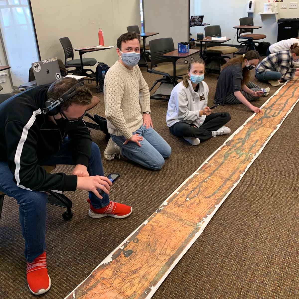
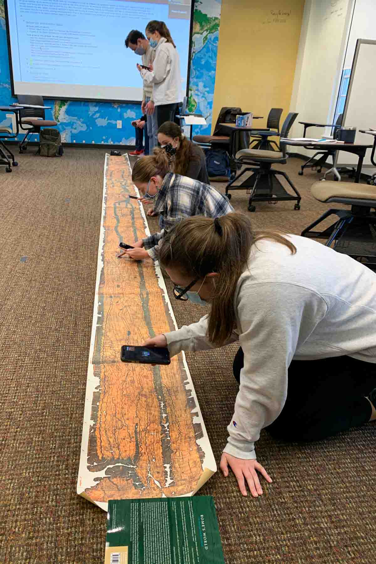
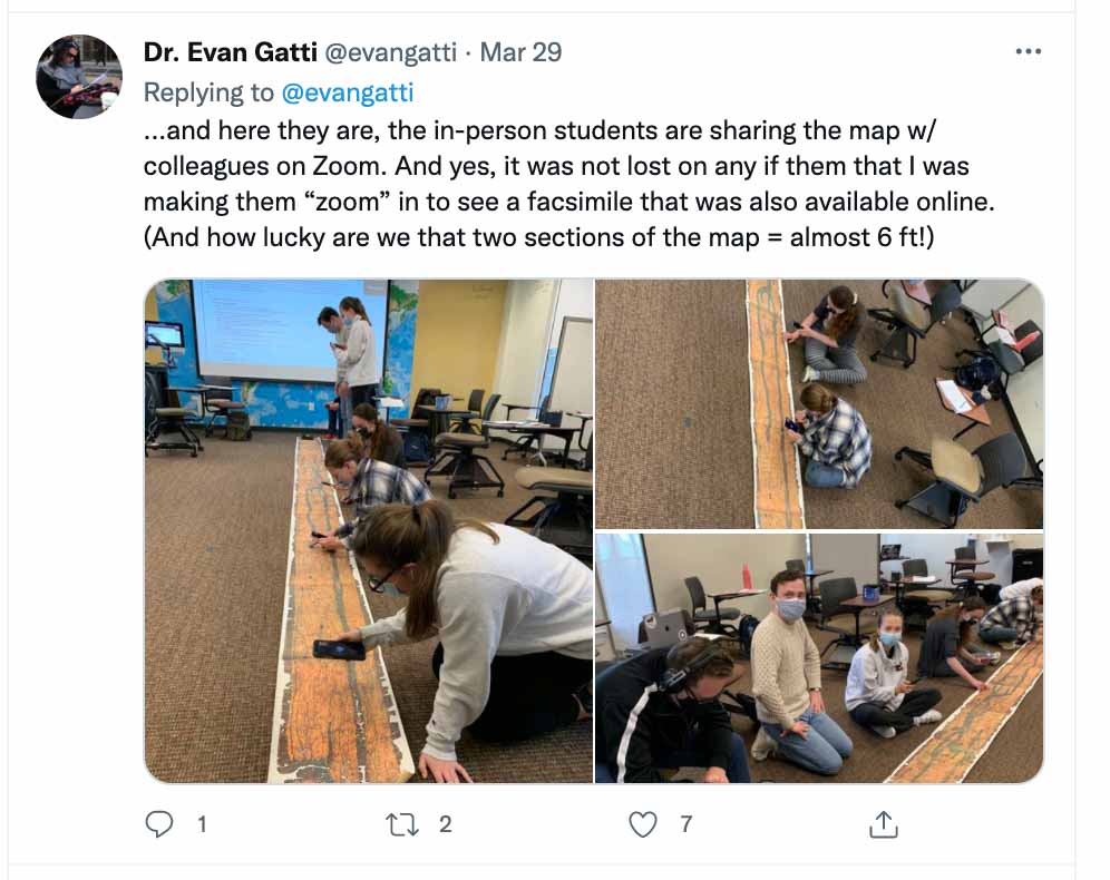
In both classes, students who were attending the class in person were assigned a partner they would work with on Zoom or via FaceTime. The student in class would sit on the floor and show the remote student what they were seeing over their phones. The remote student had access to a digital facsimile of the Tabula Peutingeriana and they would tell the students in class where and on what to focus.
The remote students had access to descriptors and details about the map that the students looking at the physical facsimile did not (the commentary volume for the facsimile is in Italian). As I watched the groups analyze their assigned sections of the map and then move from end to end in ways dictated by their remote partners, I also heard the in-class students describe what they were seeing to their partners on-line.
Their partners were asking questions about how individual parts connected to the whole and seeking a better understanding of how details they were seeing on the digital facsimile fit into the full, physical facsimile. There were lots of conversations about what they could “see” better online or in person and about what made more sense because of context (either the full map or the explanatory text). For the first time in a long time our class felt connected because they were apart; because everyone was looking at something that was not really “there”. We were all looking at a facsimile of a medieval map that was itself a copy of an older map, that was itself a static re-presentation of dynamic spaces that were meant to be experienced in person over time! Nothing and no one were more “there” or less “here”.
While I cannot be sure that each student left the classroom (or Zoom) aware of how the hybrid class mirrored the liminal space of the facsimile – and especially this facsimile – the assignment itself made a difference. Most students used material from this class on their midterm and on their final, and many reflected on how the process of looking, or showing, depending on their role in the class, helped them better understand other work we did in the class.
In the semesters to come I will do this assignment again, except everyone will all be in person. I am interested to see what we may lose because we are all “there” so to speak. I am also hopeful that there is something we may still gain, or at the very least manage better with fewer technology glitches! What I will not do, however, is forget that while we may all be “in person” looking at the same thing in the same ways at the same time, we are also looking through the facsimile. We are seeking to know better what is not there.
[1] Caló, Levi Annalina and Mario Attilio Levi. La Tabula Peutingeriana. Bologna: Edison, 1978.
[2] I would like to offer a special thank you to Chrystal Carpenter, Coordinator of University Archives and Special Collections, and I Dr. Joan Ruelle, Dean of the Carol Grotnes Belk Library for their support of this purchase and for engaging in continued conversations with me about how we might use facsimiles in our classrooms.
[3] The Tabula Peutingeriana received a UNESCO designation in 2007. For basic information, you may refer to the website, which includes a link to the “nomination form”. “Tabula Peutingeriana,” https://en.unesco.org/memoryoftheworld/registry/201 (accessed Wednesday, December 15, 2021). I also referred students to the Wikipedia page for the Tabula Peutingeriana in preparation for our engagement in class. “Tabula Peutingeriana,” https://en.wikipedia.org/wiki/Tabula_Peutingeriana (accessed Wednesday, December 15, 2021).
[4] See especially Richard John Alexander Talbert, Rome’s World: The Peutinger Map Reconsidered (Cambridge: Cambridge University Press, 2014) and Emily Albu, “Imperial Geography and the Medieval Peutinger Map.” Imago Mundi 57, no. 2 (2005): 136–48.
[5] Albu, “Imperial Geography and the Medieval Peutinger Map.” Albu has also published The Medieval Peutinger Map: Imperial Roman revival in a German Empire (Cambridge: Cambridge University Press, 2014).
[6] Students were assigned to read either Barbara E. Mundy, “Mapping the Aztec Capital: The 1524 Nuremberg Map of Tenochtitlan, Its Sources and Meanings.” Imago Mundi 50 (1998): 11–33 or Fiorani, Francesca. “Post-Tridentine ‘Geographia Sacra’. The Galleria Delle Carte Geografiche in the Vatican Palace.” Imago Mundi 48 (1996): 124–48.