
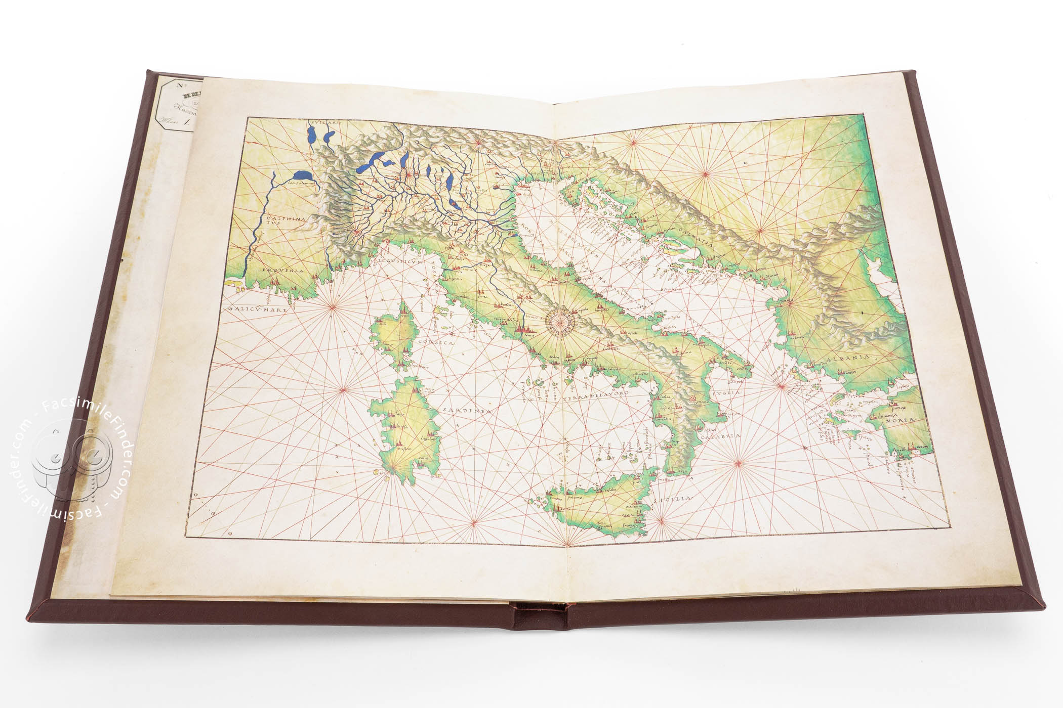
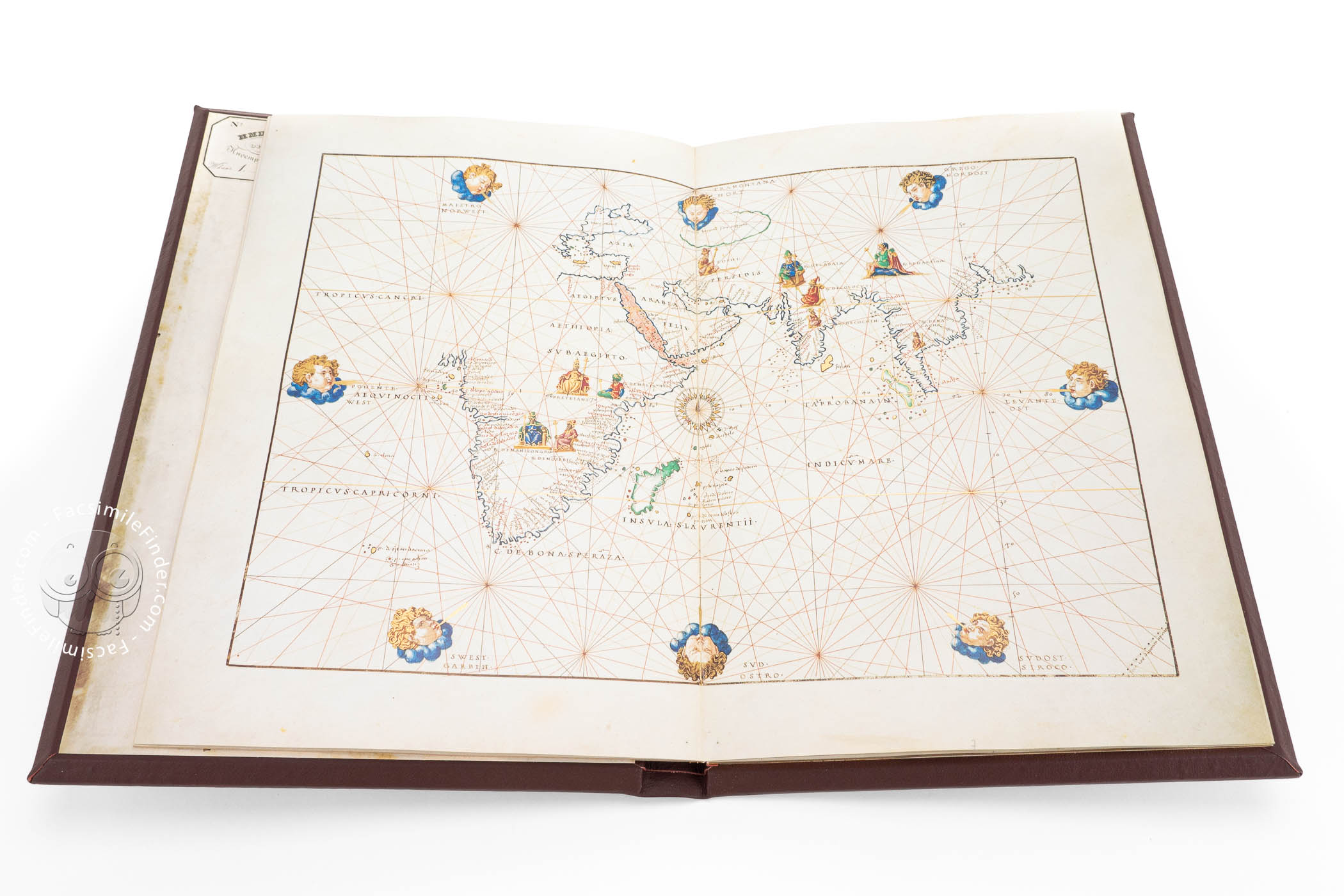
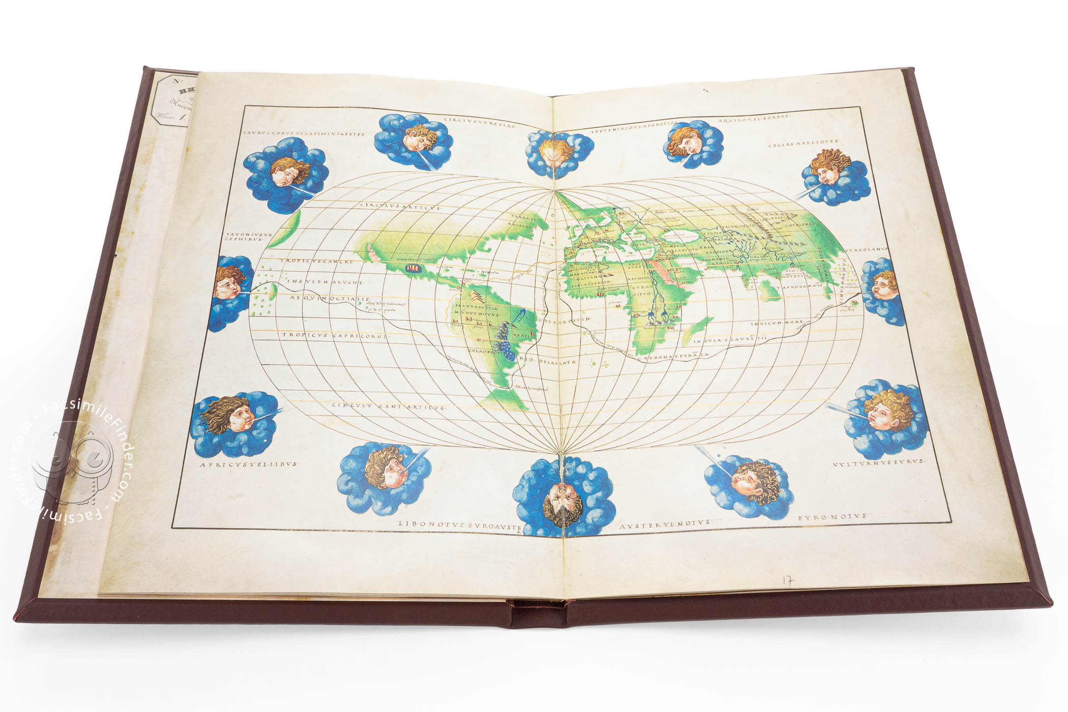
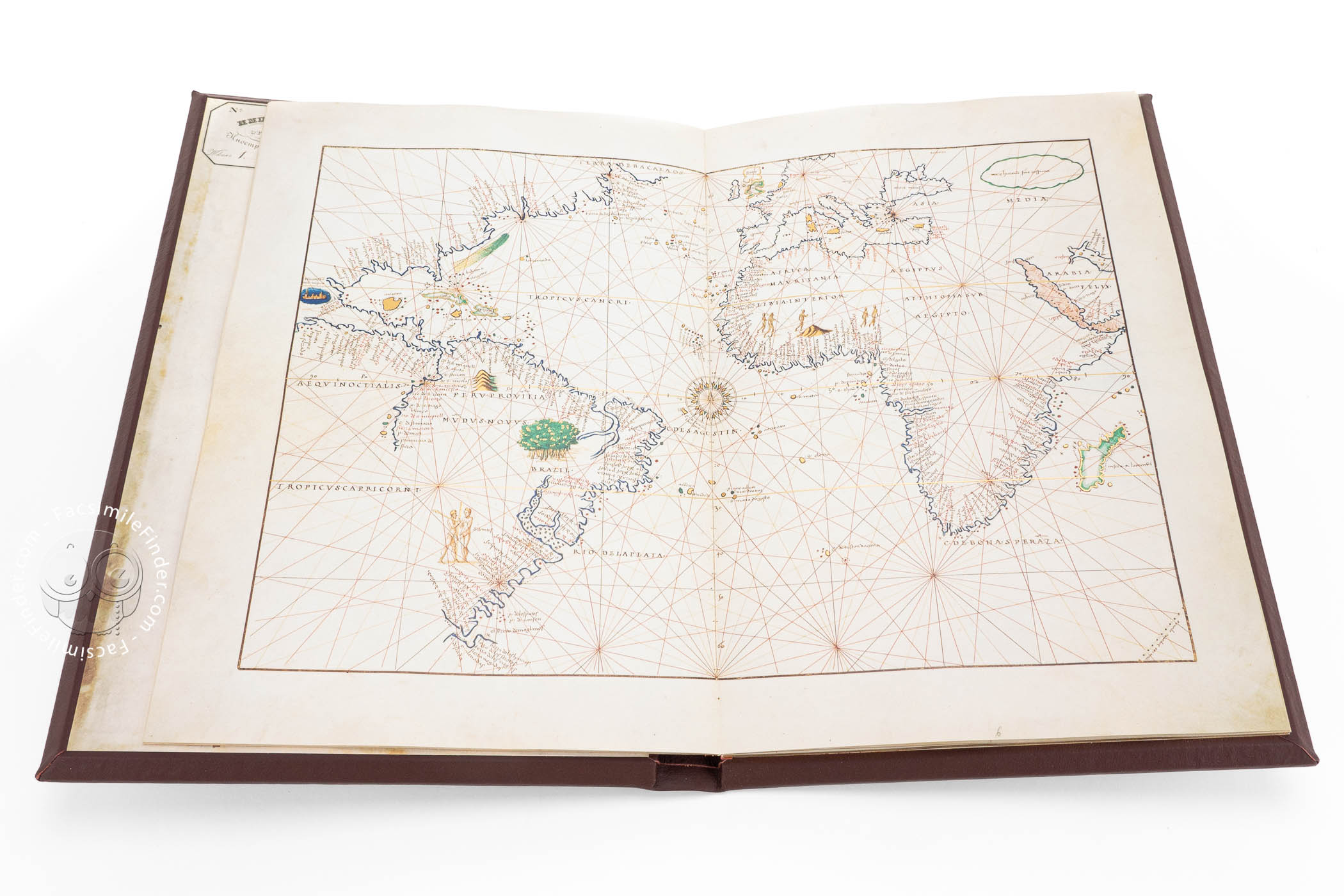

Due to the extremely detailed charts and the high artistic significance of its execution, the Saint Petersburg Atlas by Battista Agnese is among the most exceptional navigational charts dating back to the sixteenth century. It represents the latest state of the time's geographical knowledge. The Atlas includes a map of the world known to Europeans in oval projection pinpointing the route covered by Magellan as he circumnavigated the globe. Just like all artifacts produced in Agnese's workshop, the 1546 Portolan Atlas is a lavish deluxe codex.
Battista Agnese is regarded as one of the most eminent and fruitful map makers of the sixteenth century. Born in Genoa, he came to manage a workshop in Venice. Eighty to 100 navigational charts (portolans) of his are known, among which the 1546 Atlas is the finest example.
A Blend of Science and Mythology
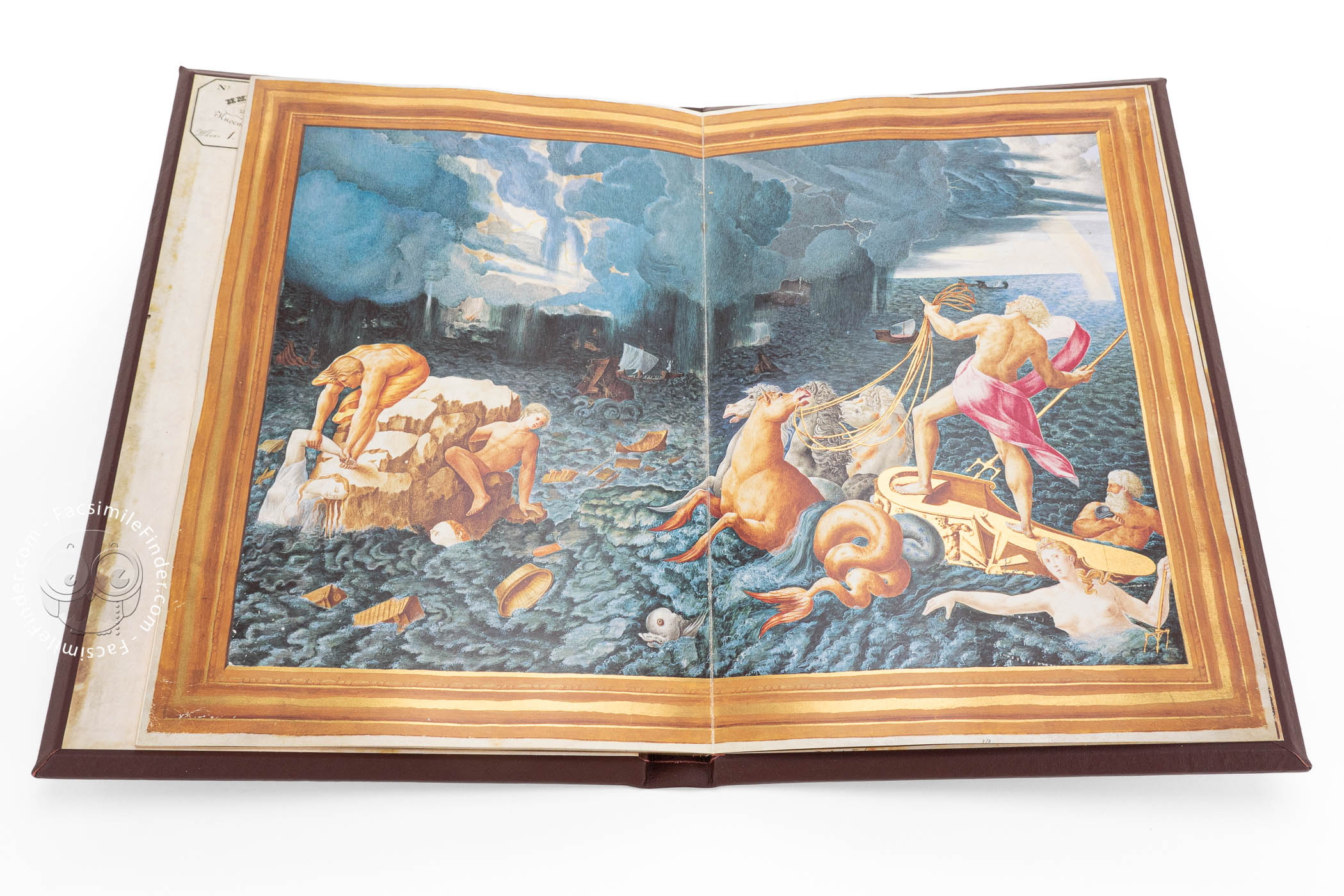
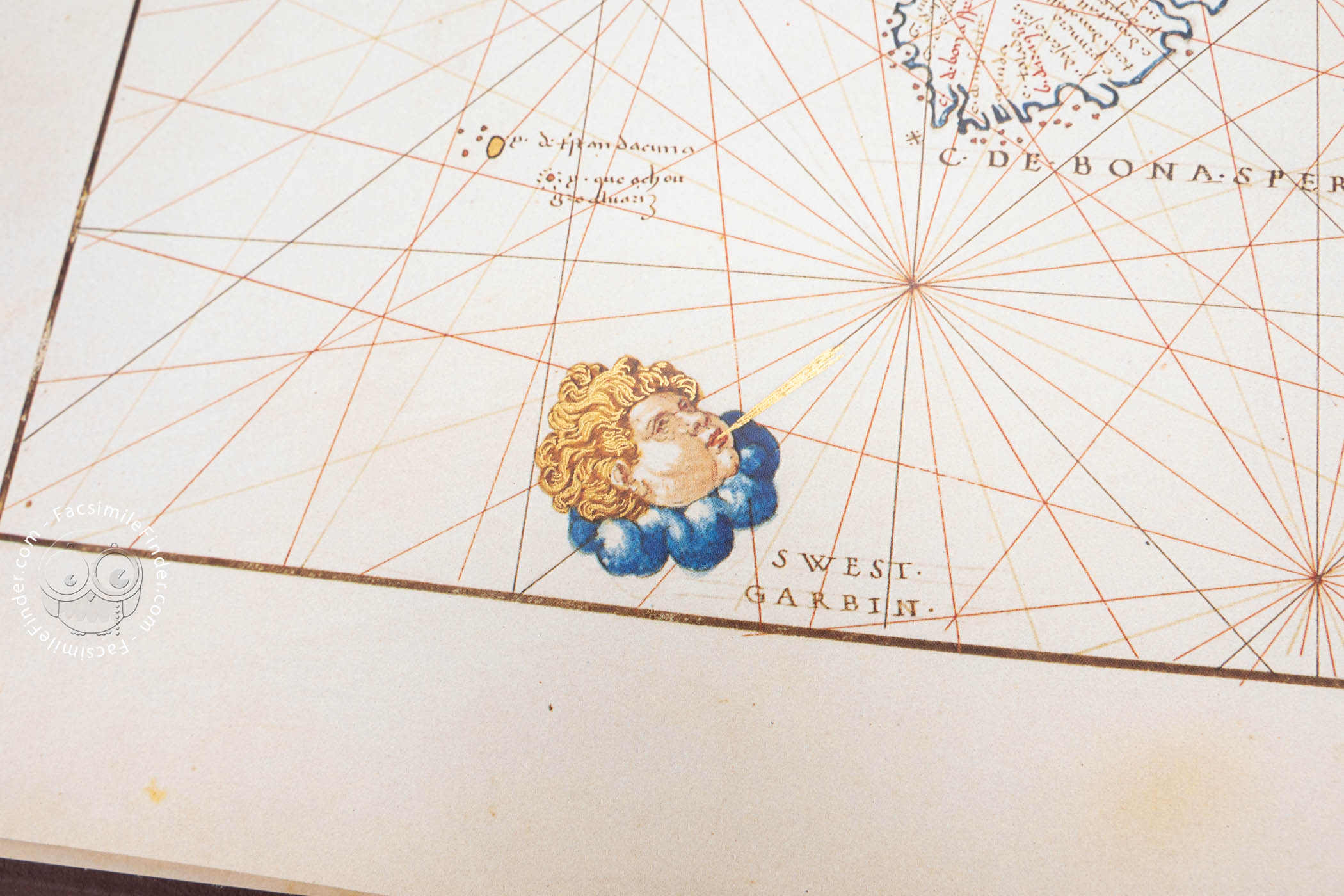
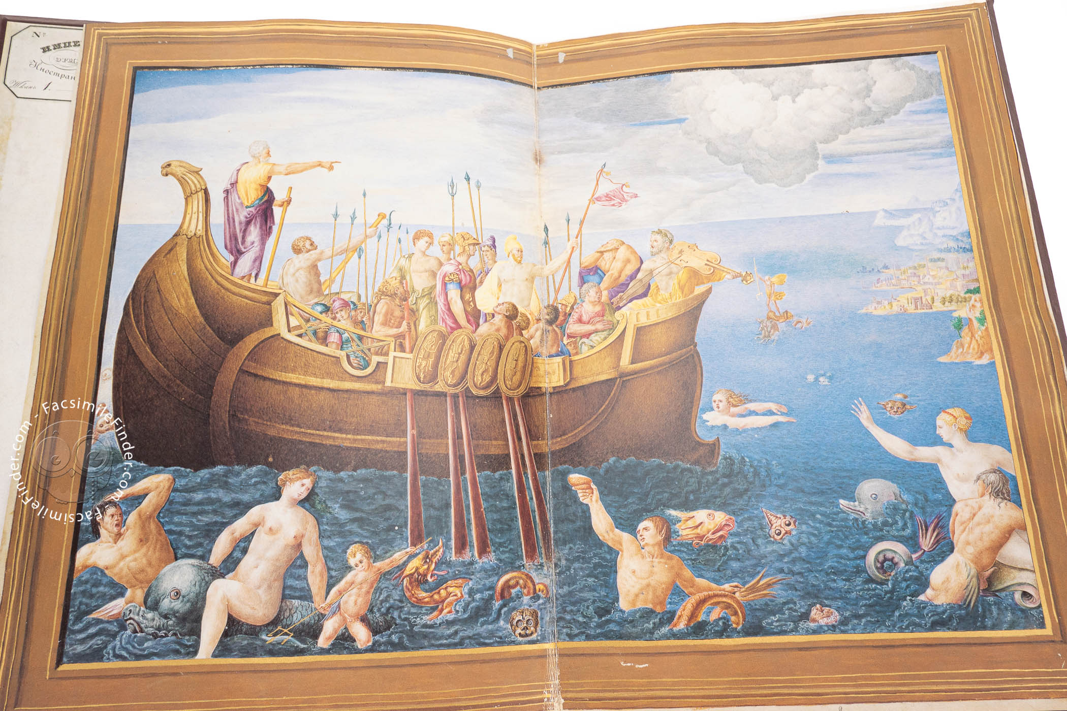
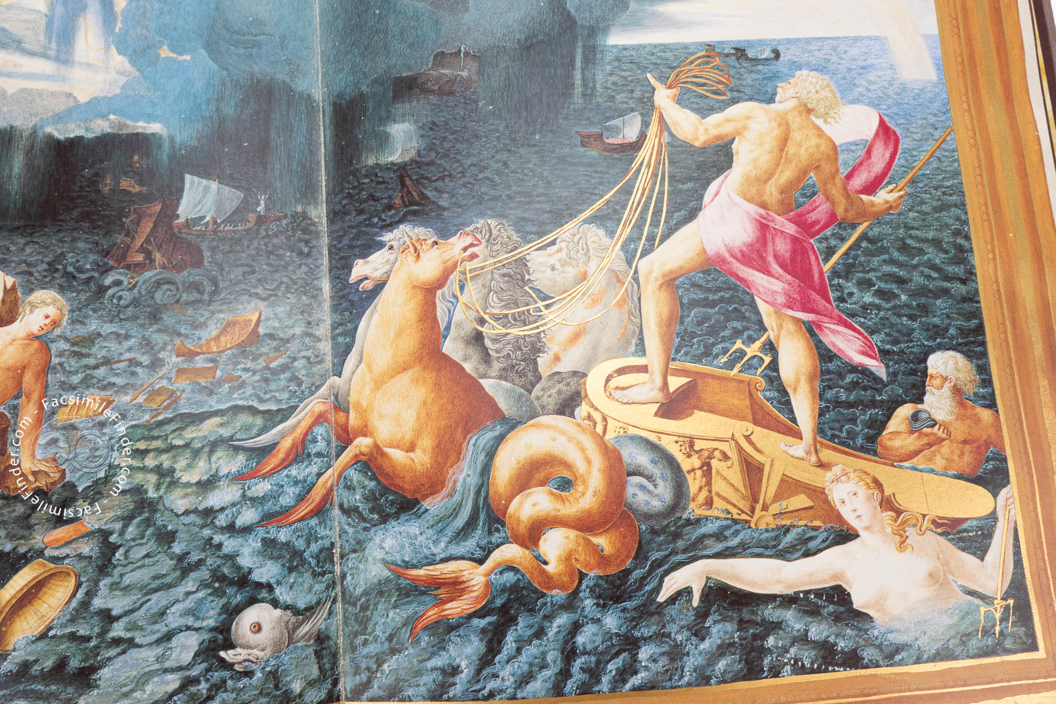
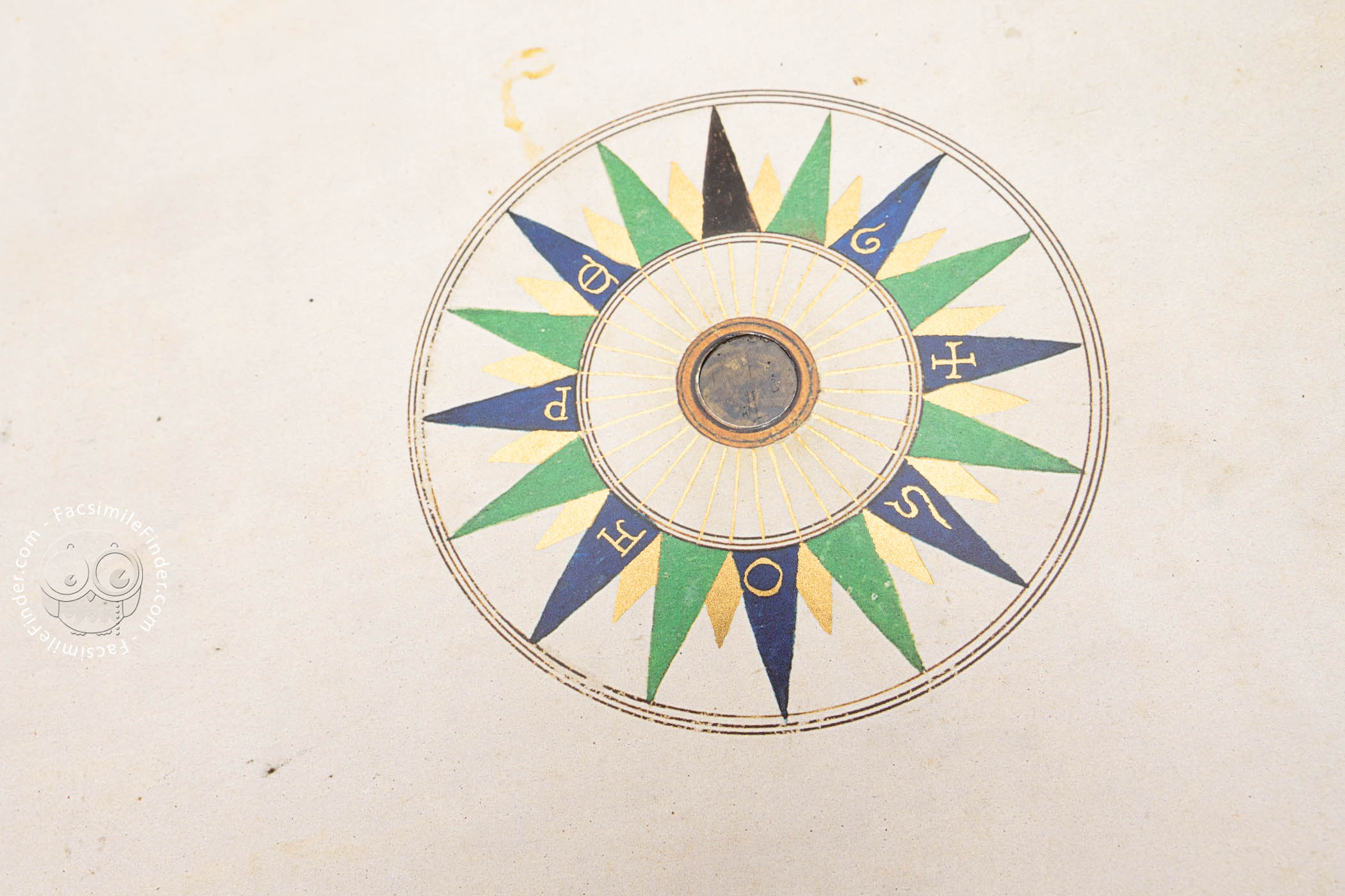
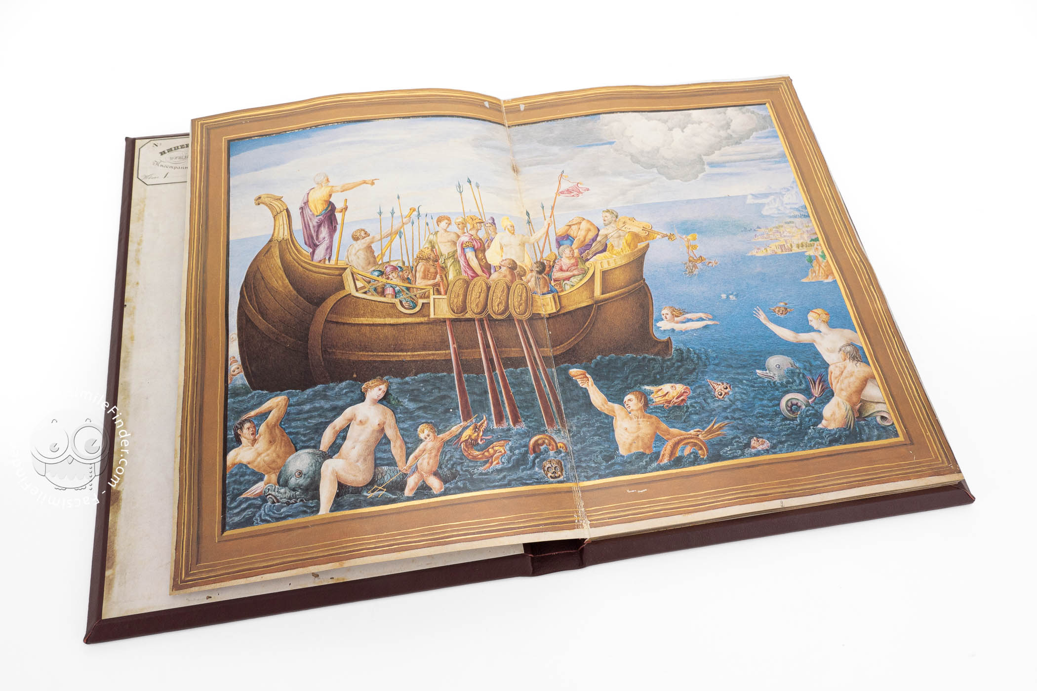
The masterly crafted depictions that flank Agnese's maps were the work of an unknown artist from the Venetian school. The bright colors are intensified by an opulent use of gold. The whole manuscript, including the meticulously drawn maps, is a witness to the absolute craftsmanship of their creators.
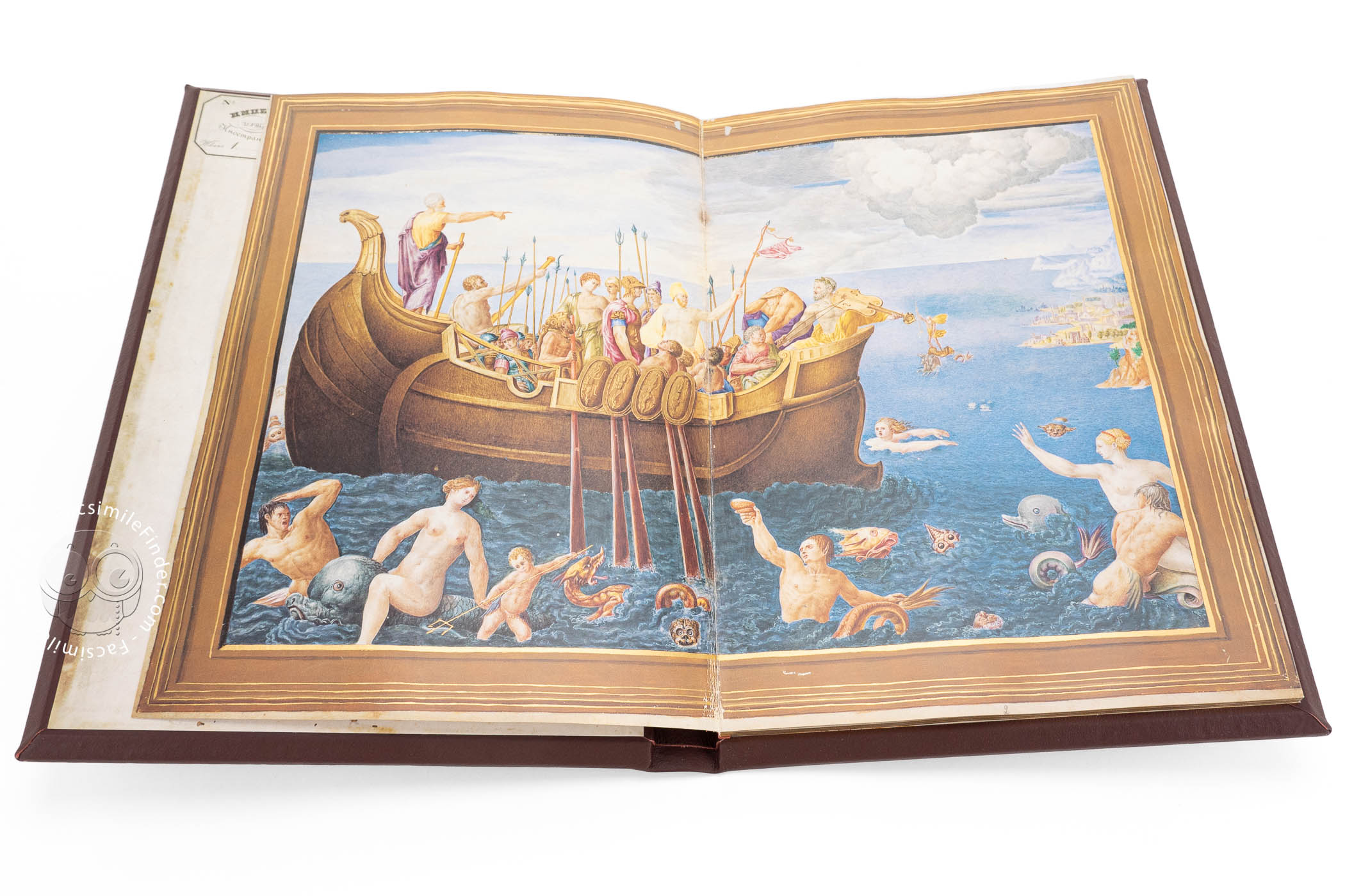
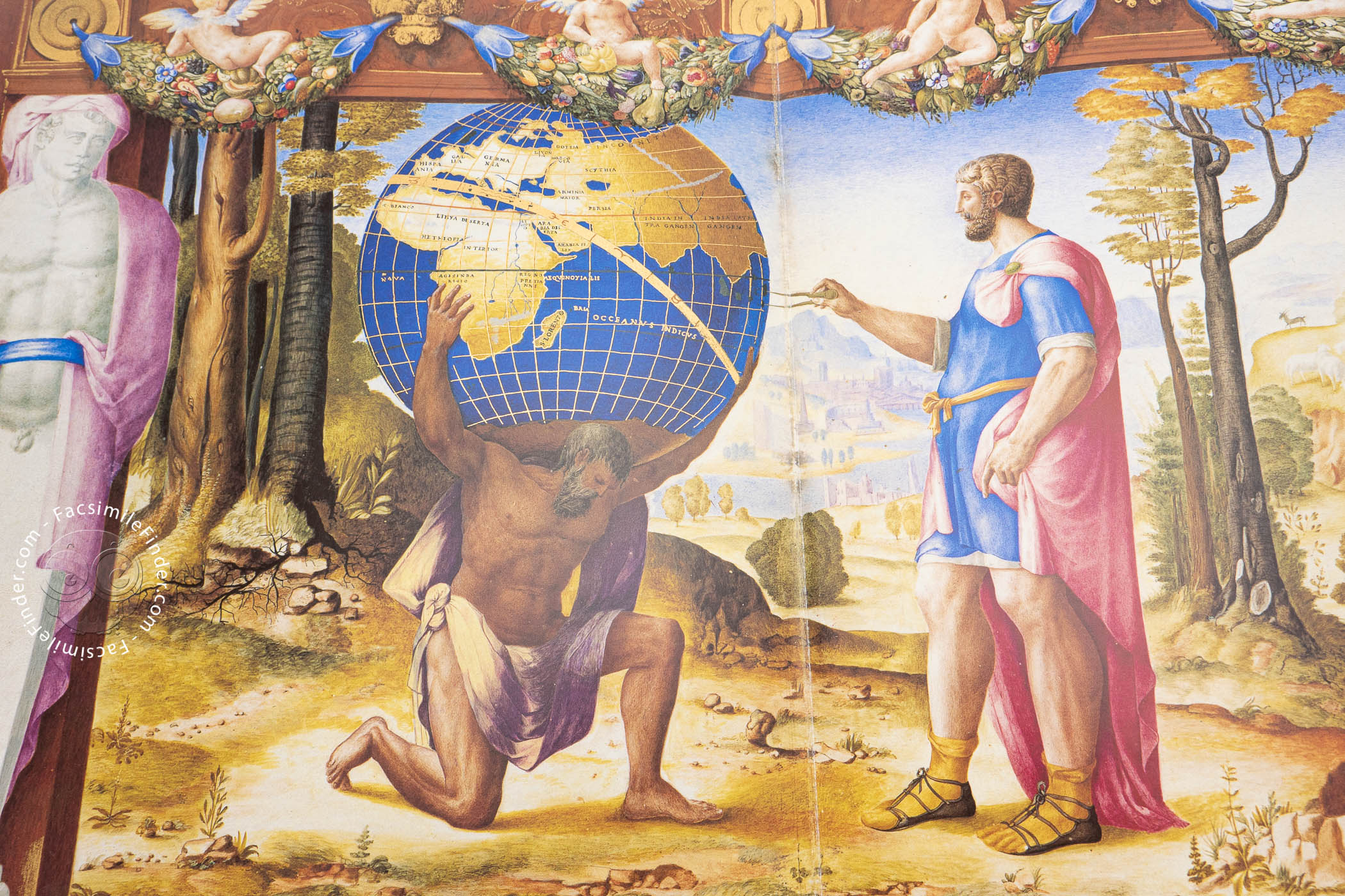
An extremely unusual feature are the three extremely imaginative mythological decorations that embellish the Portolan Atlas of Battista Agnese. They describe well-known episodes from Greco-Roman mythology, though showing them in the context of navigation and cartography: the voyage of Jason and the Argonauts, the storm during which Aeneas' fleet perished, and the Greek god Atlas carrying the globe.
A Treasure Trove of Geographical Knowledge
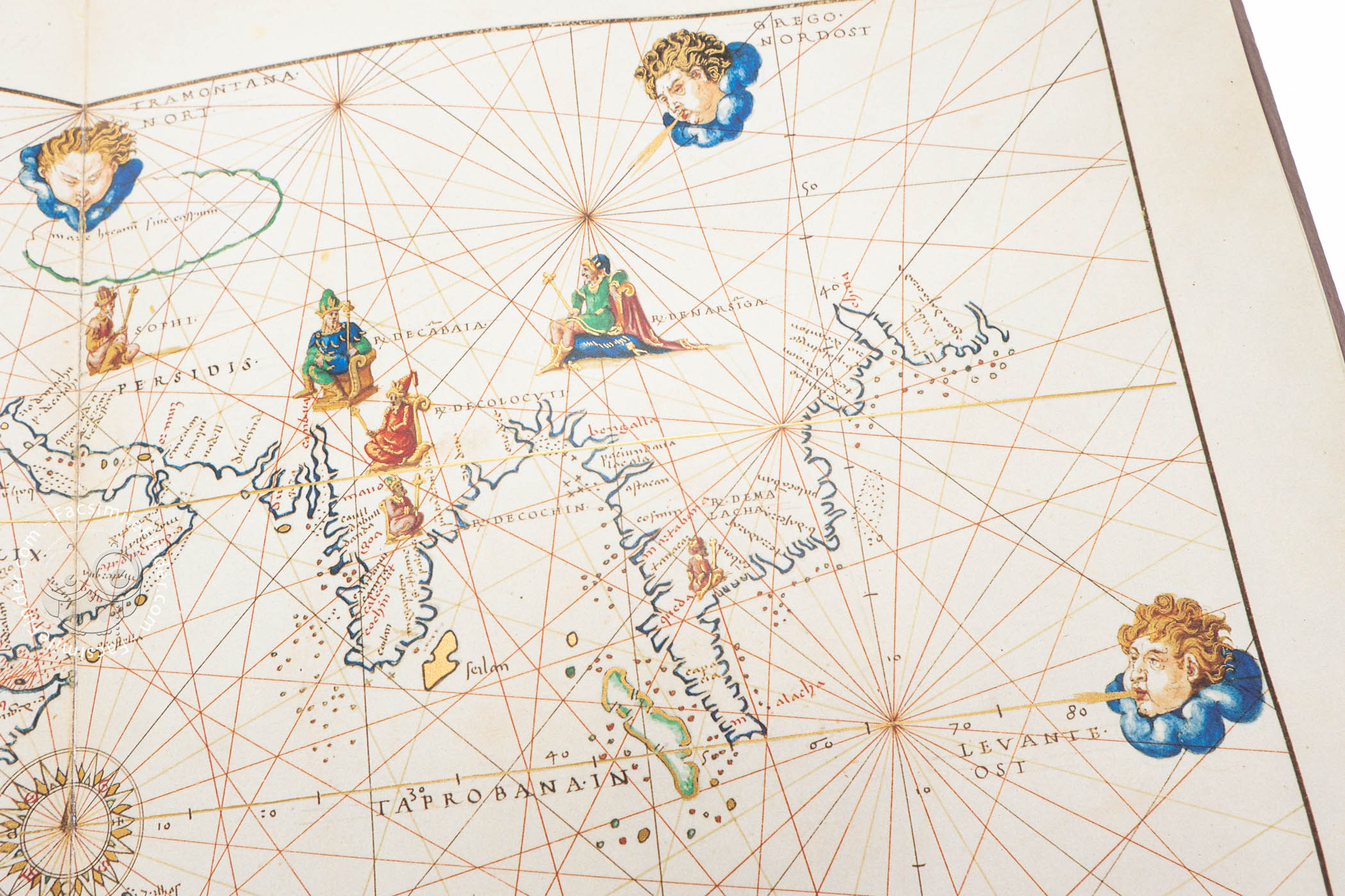
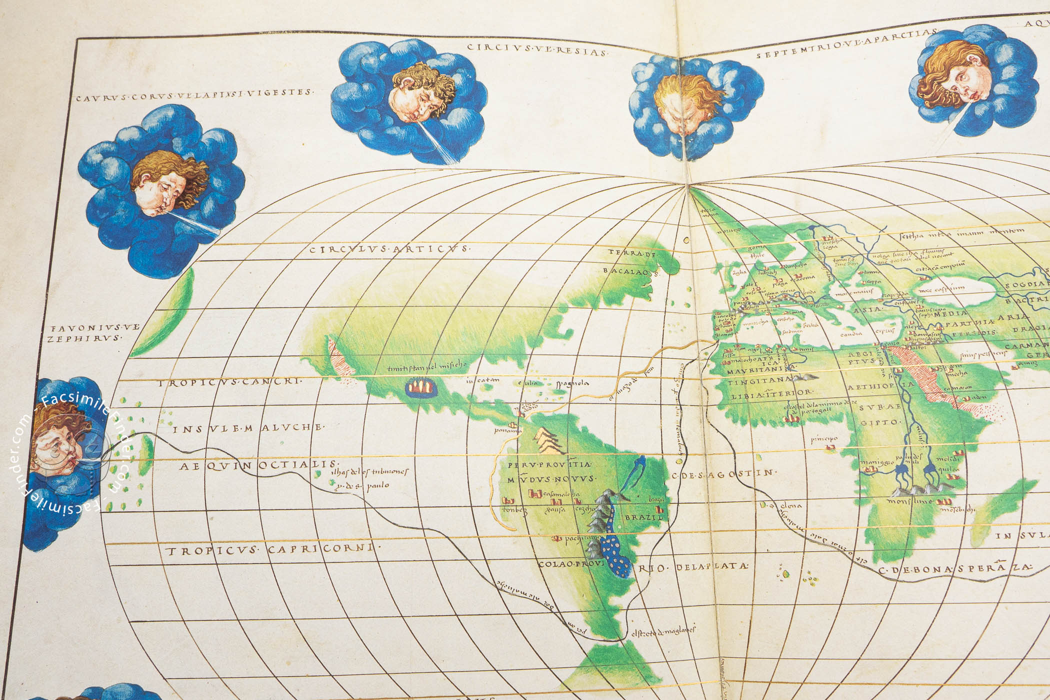
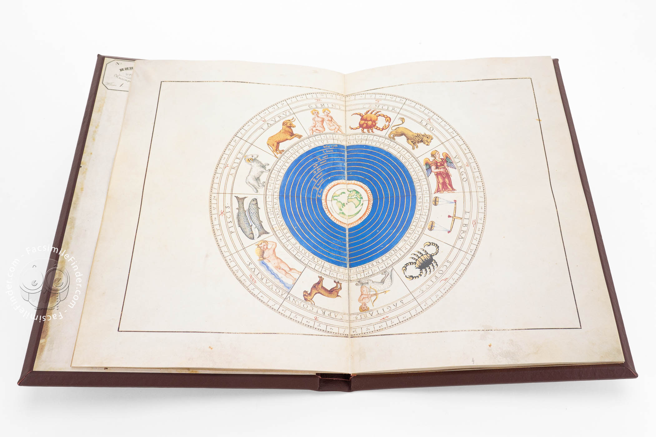
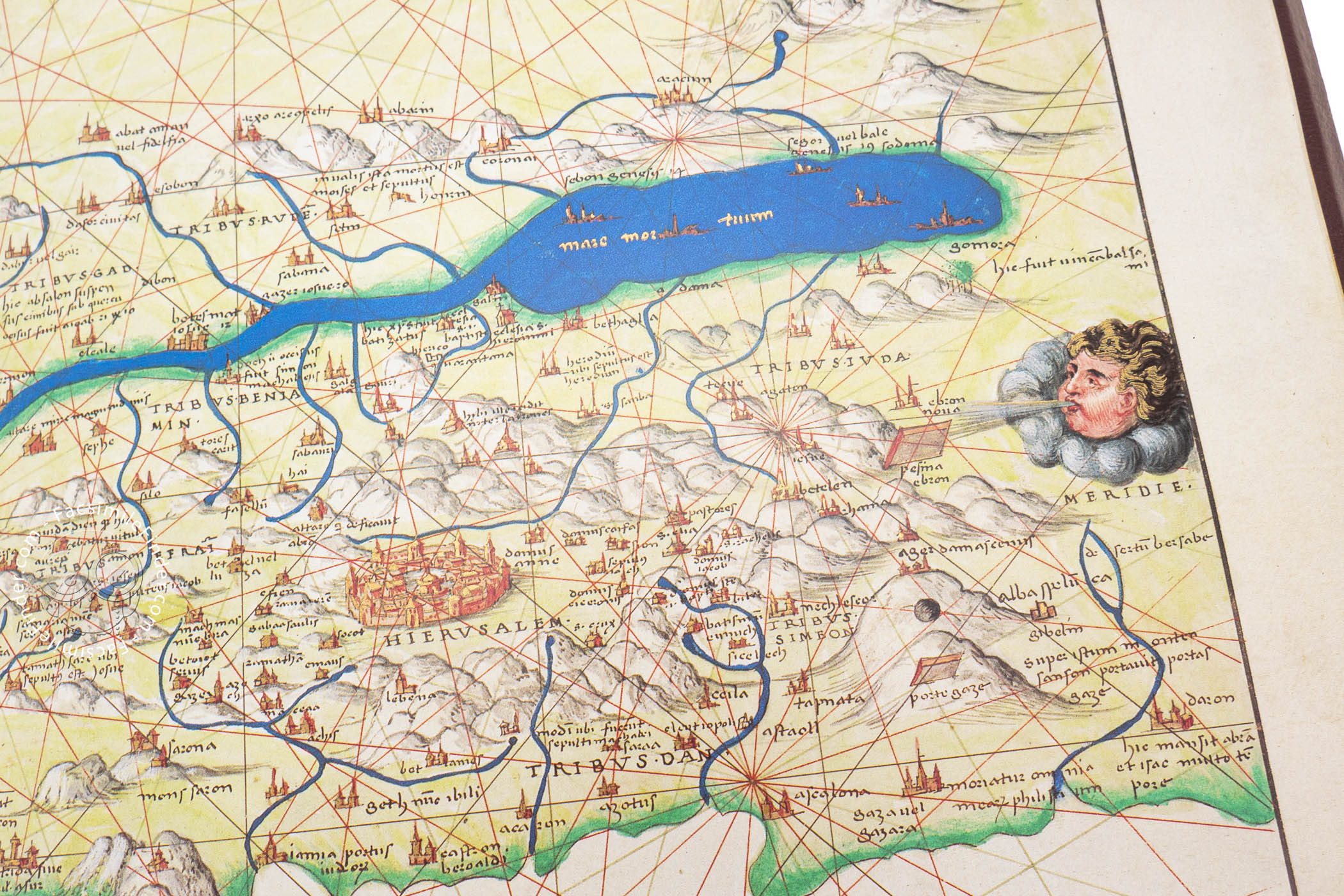
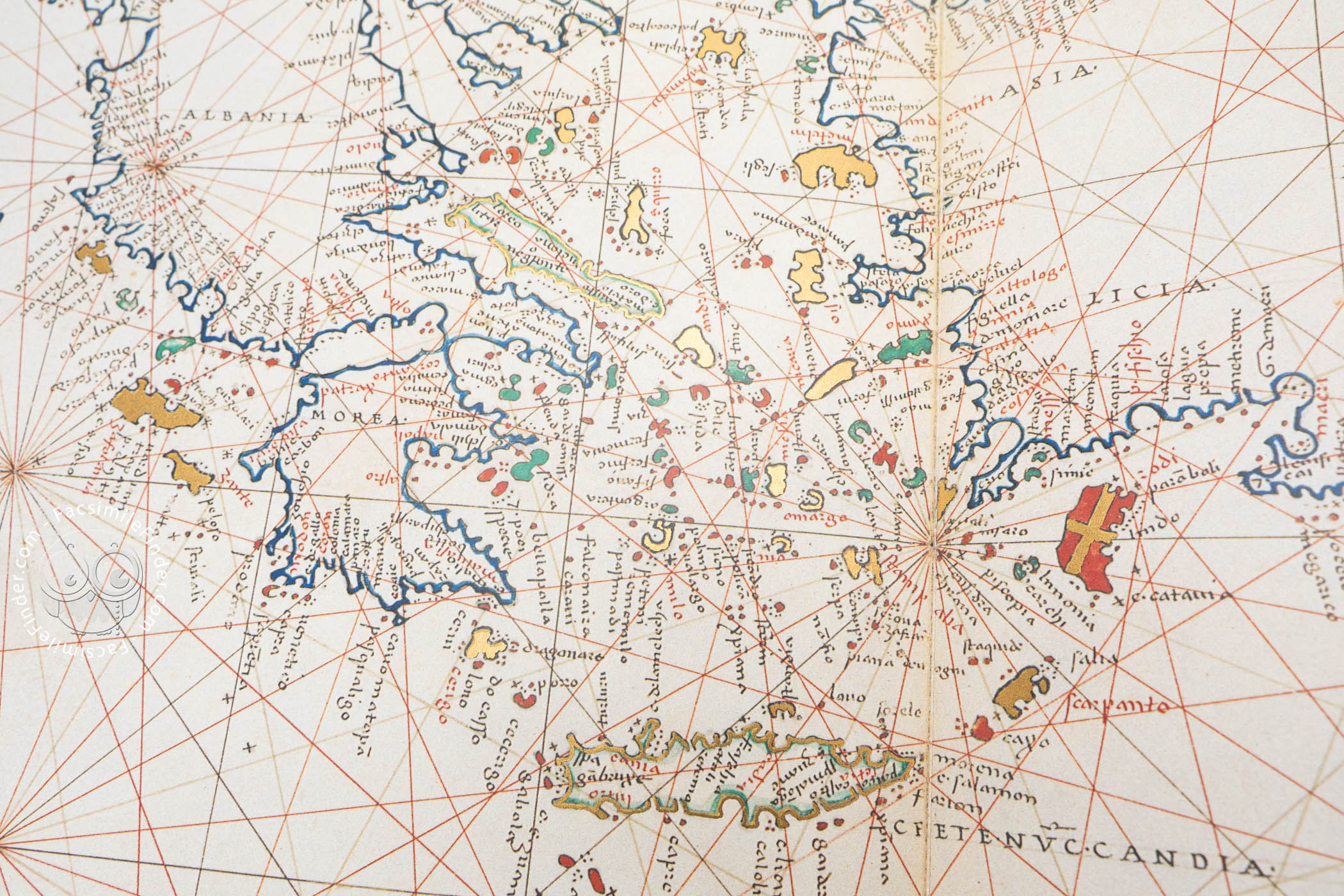
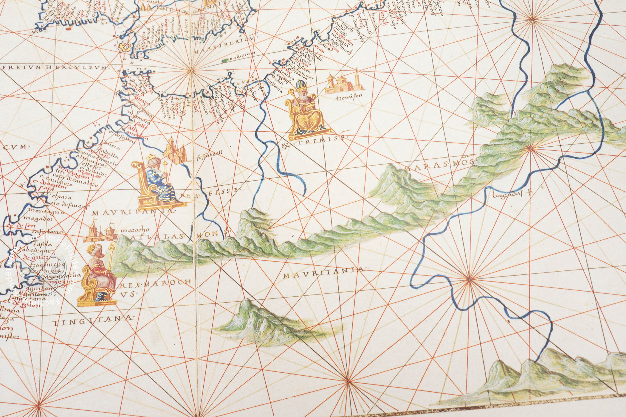
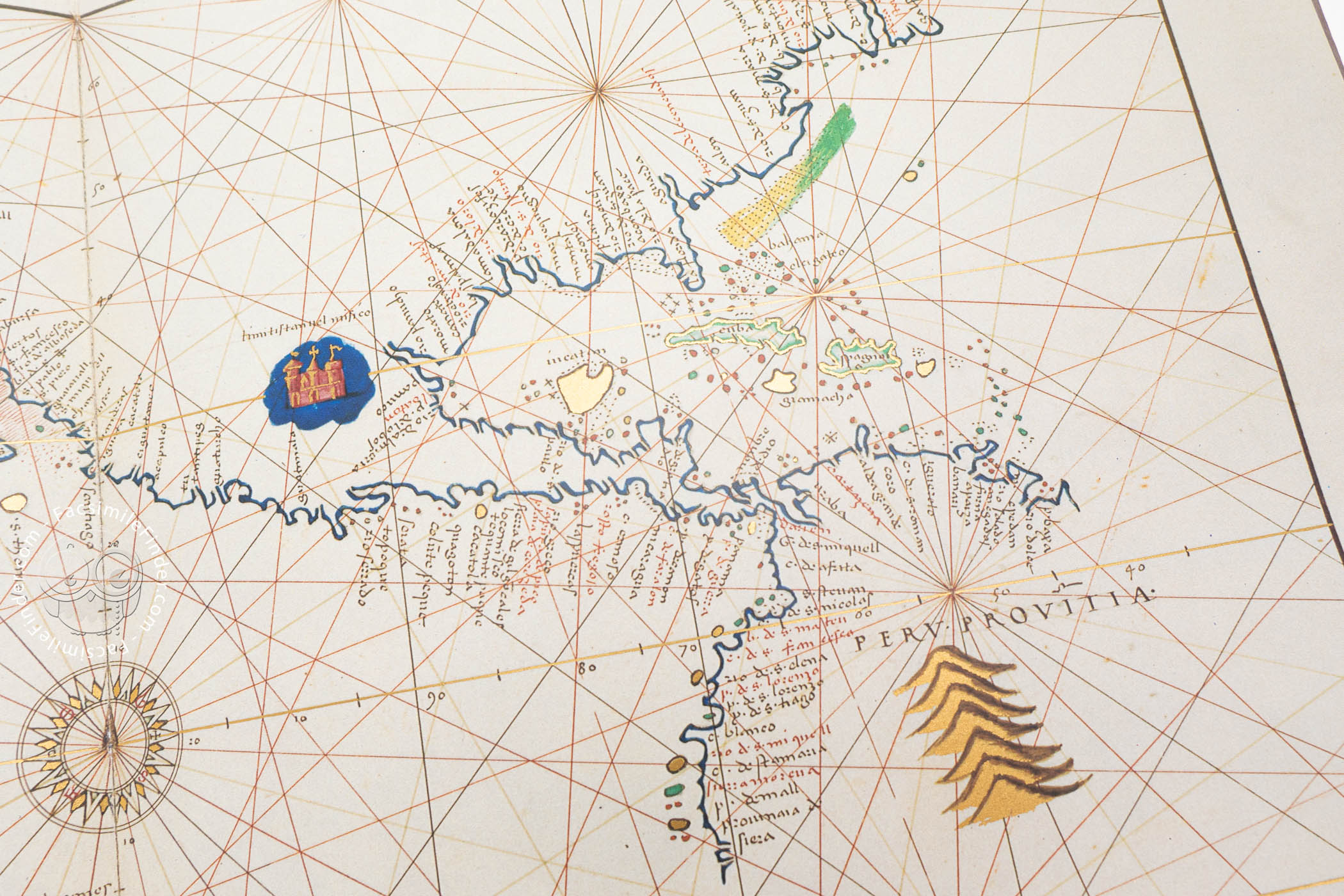
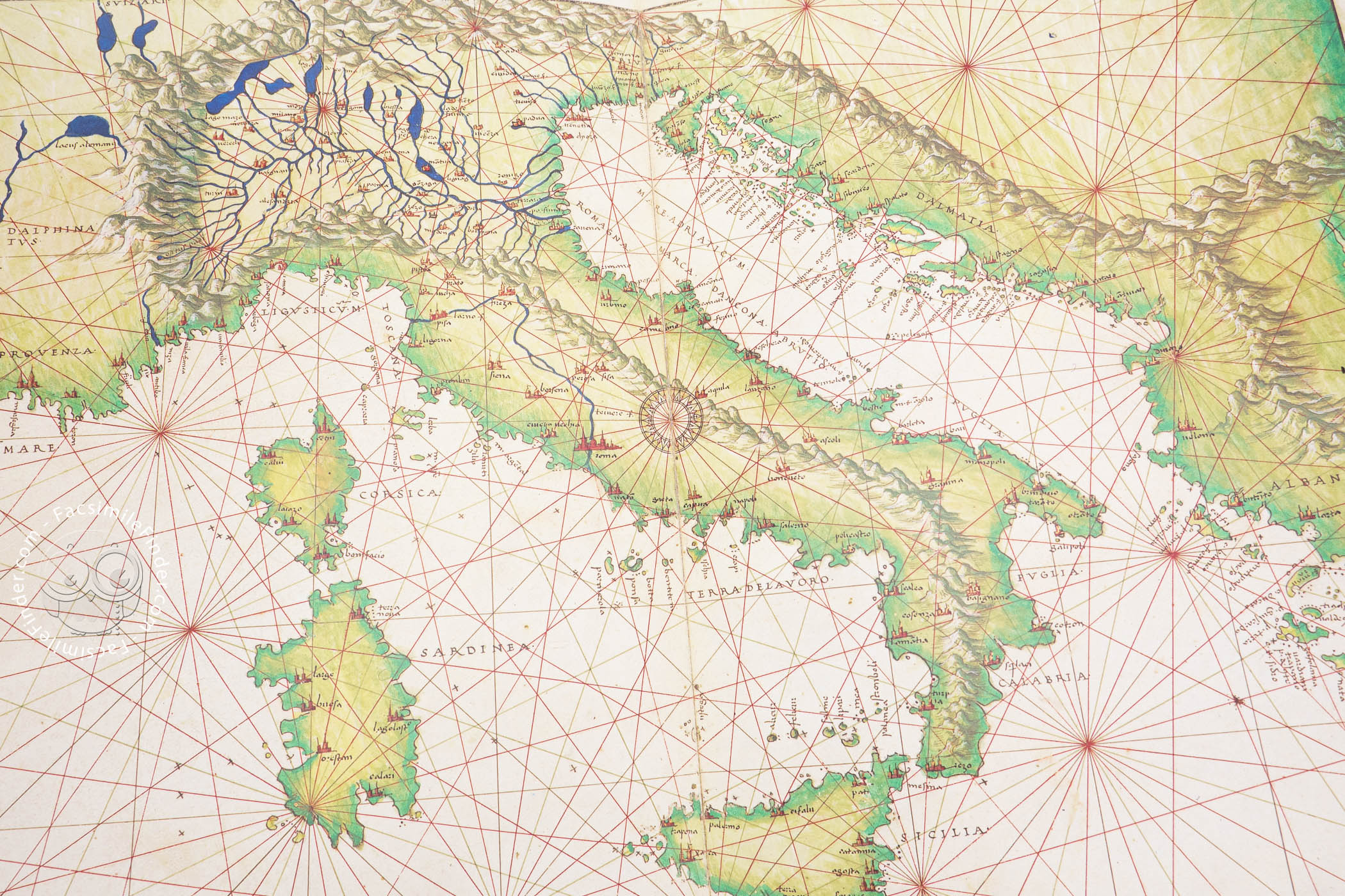
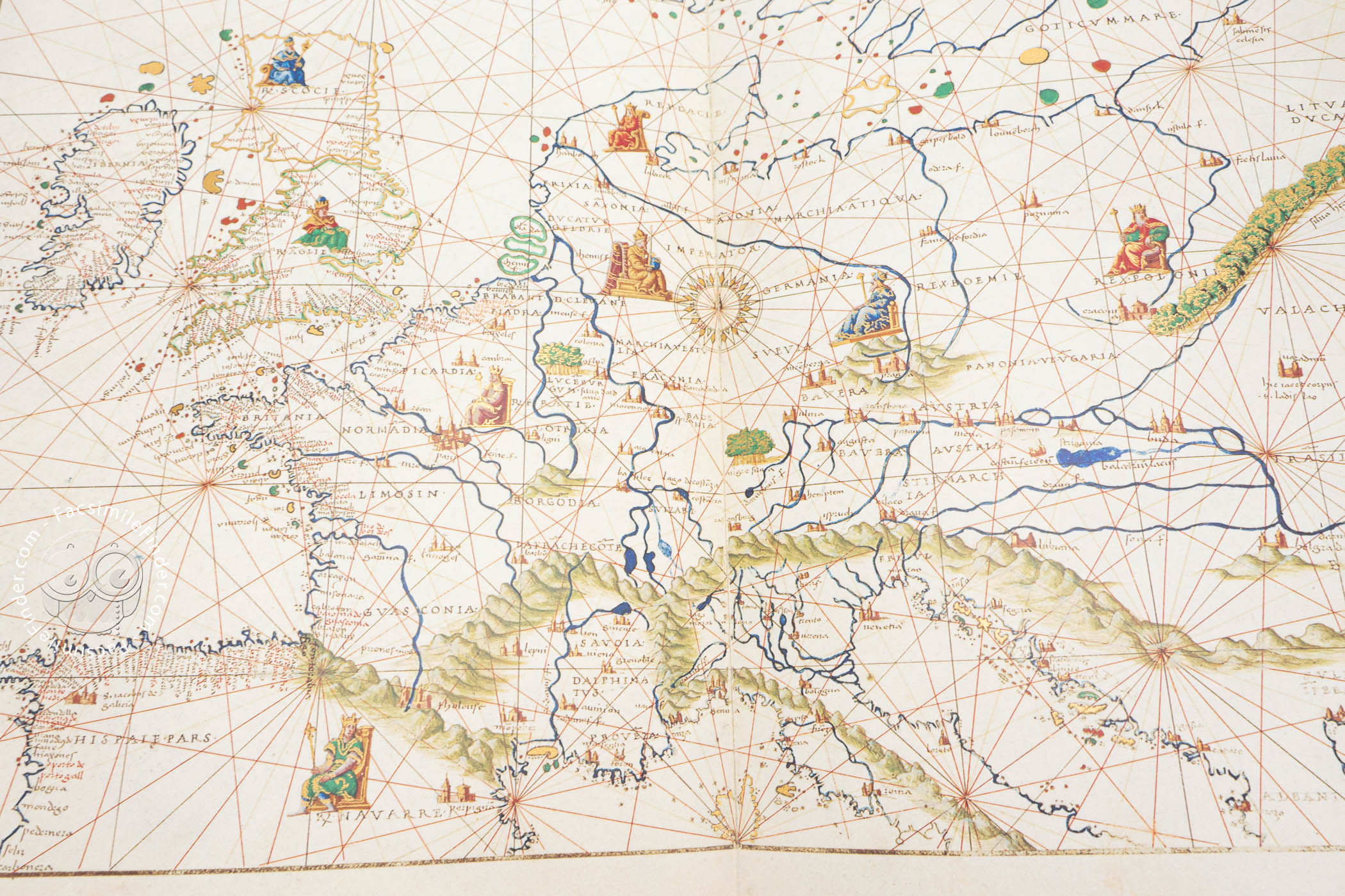
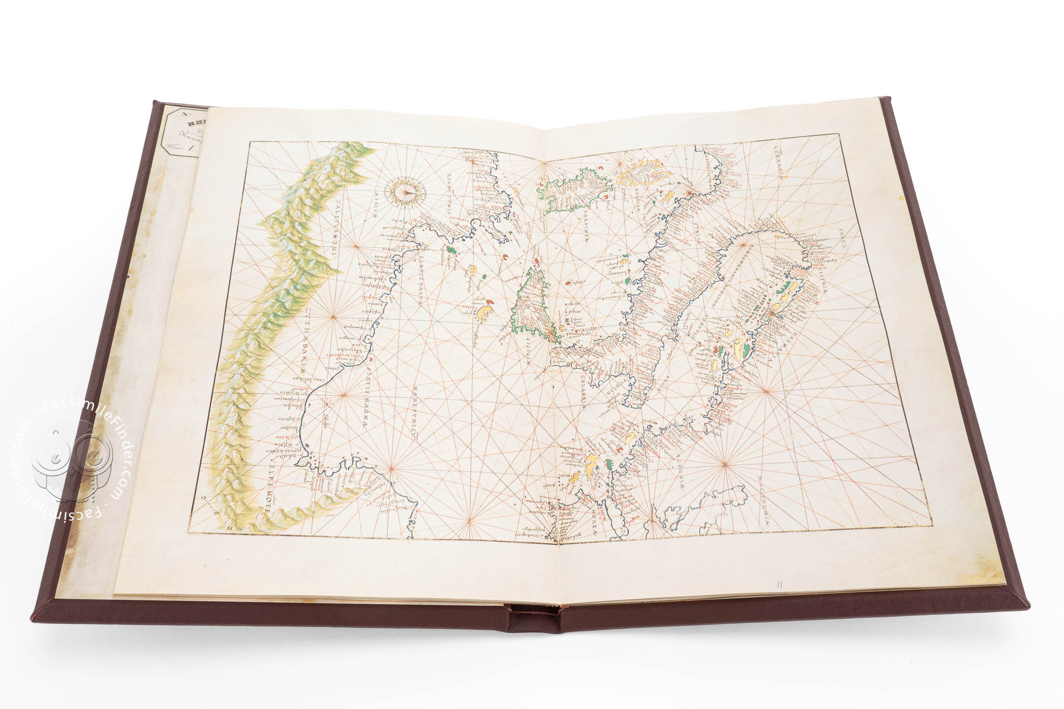
Together with the mythological scenes, the Portolan Atlas, now preserved in Saint Petersburg, is a treasure trove of geographical knowledge: it includes a table of the Sun declinations, an armillary sphere, a rendering of the Ptolemaic-Aristotelian world system, a cosmographic and astronomic text, but also thirteen charts recording the most updated knowledge in geography: the New World and the Pacific Ocean, the Atlantic Ocean with Africa and parts of Europe, the Indian Ocean (with the African coast and Southern Asia), Europe (without Spain), and much more.
The extremely detailed map of Italy, in particular, has been deemed the best chart of its time. However, this deluxe Atlas was not handy for practical use in navigation; rather, it must have been used as a tool for studying geography and astronomy. Scholars have not been able to establish who commissioned the work; however, the patron must have been a highly wealthy merchant or nobleman.
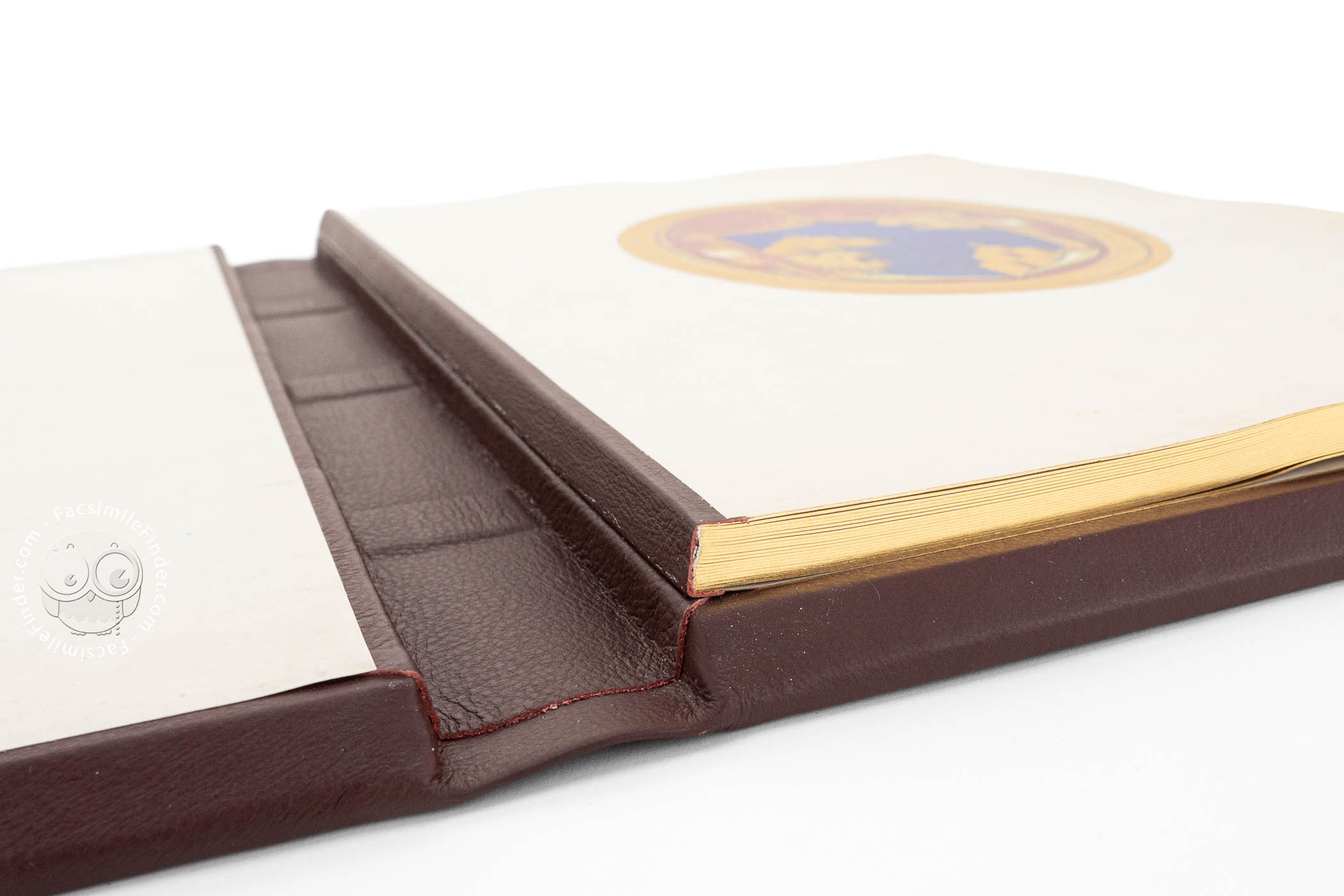
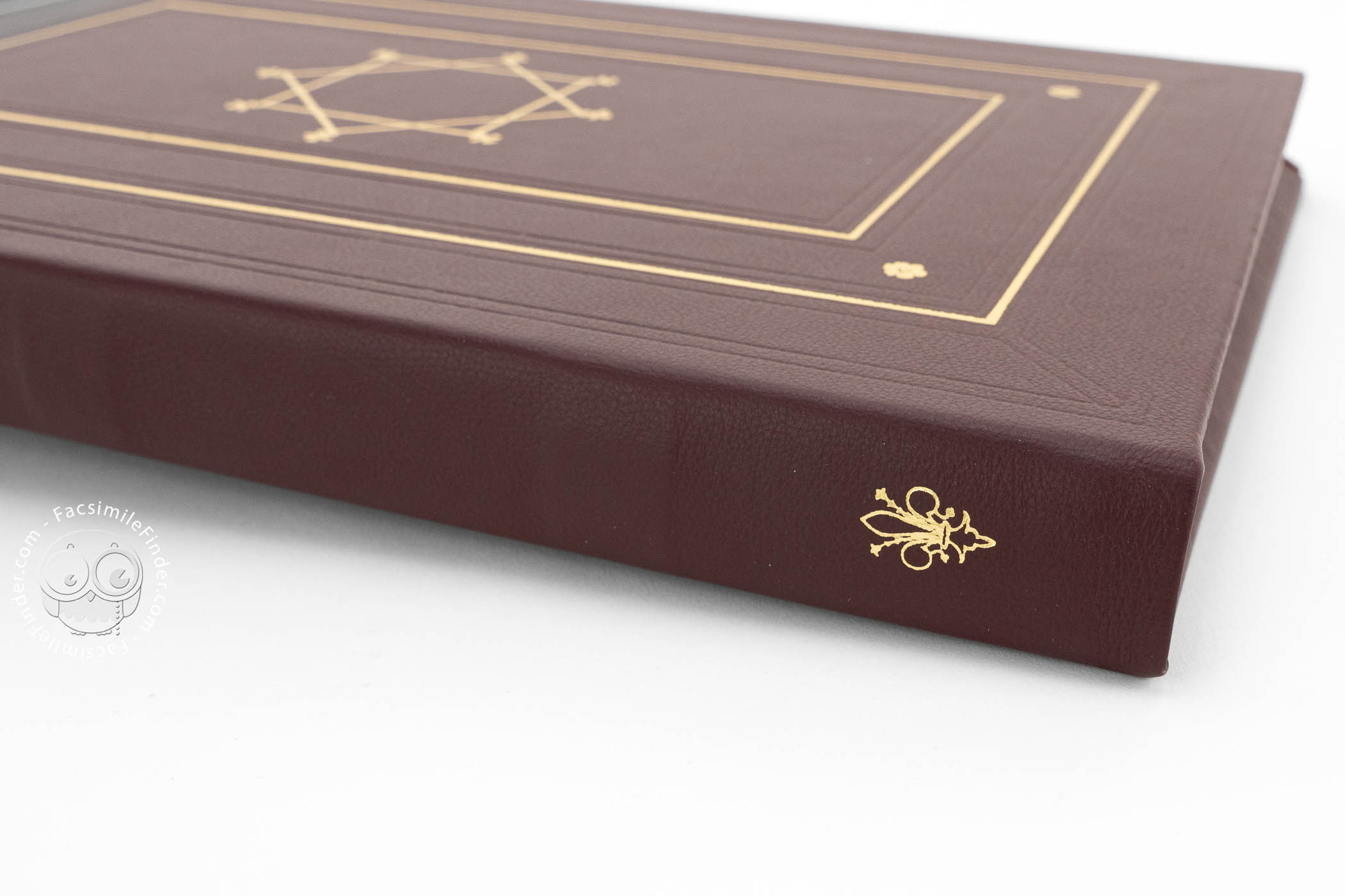
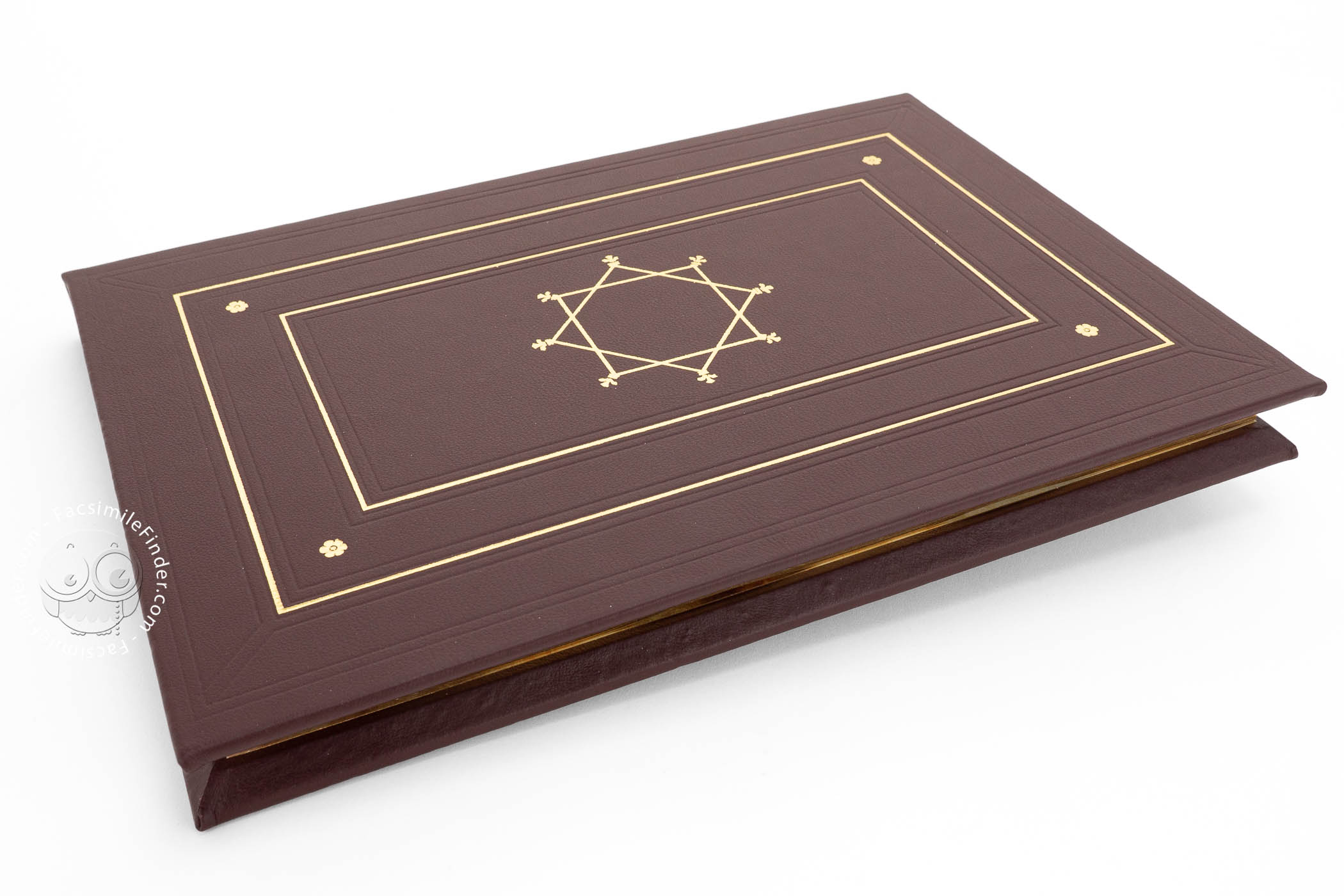
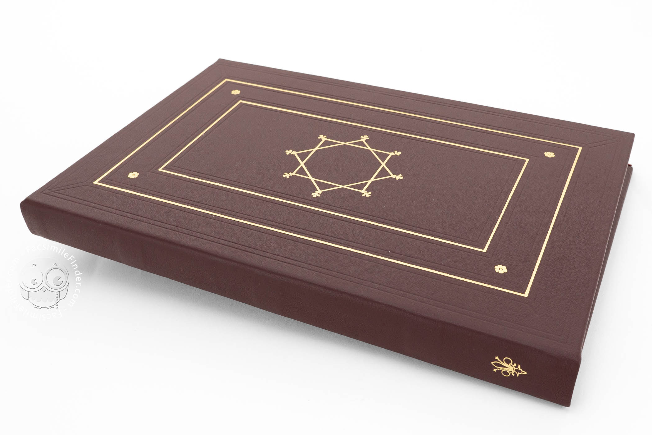
Original binding, made in Venice and composed of two wooden plates covered with red-brown patent leather and decorated with etched ornaments and gold tooling on both the upper and lower plate.
We have 1 facsimile edition of the manuscript "Saint Petersburg Atlas by Battista Agnese": Der Portolan-Atlas des Battista Agnese facsimile edition, published by Akademische Druck- u. Verlagsanstalt (ADEVA), 1993
Request Info / Price