
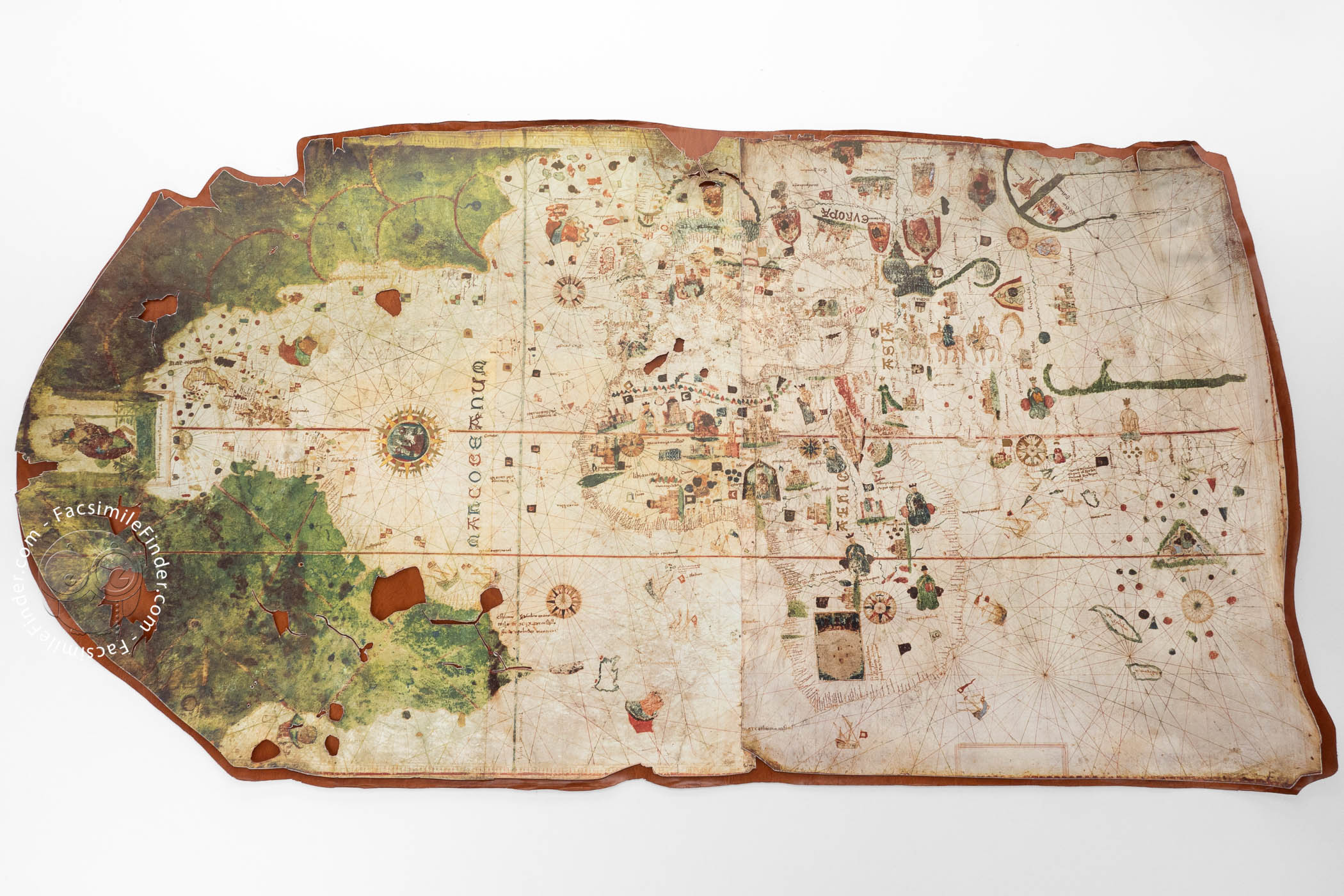


The manuscript Map of Juan de la Cosa is the earliest surviving European map that represents the Americas. Dated 1500 and created at least partly under the supervision of Juan de la Cosa (d. 1510), a member of Christopher Columbus's crew on his second voyage across the Atlantic Ocean (in 1493), the map mainly follows the tradition of nautical portolan charts in showing the world known to Europeans at the end of the fifteenth century.
An inscription near the left edge of the map identifies it as the work of Cosa made at Puerto de Santa María (in southern Spain). The map is the starting point of a new era in the history of European cartography, adding the American continent to the representation of the world.
The American Continent
The map represents the world known to Europeans at the time, with abundant decorative detail, especially in Africa and Asia. The eastern coast of America is shown at the left, painted in green and lacking decoration, except for the many banners representing Spanish dominions. At the center of the left edge, Saint Christopher, patron saint of travelers, is depicted, as is traditional, carrying the Christ Child over water. This is perhaps an allusion to Columbus as Christo Ferens ("Christ-carrier," as he styled himself) in late life.
Rich Decorative Detail
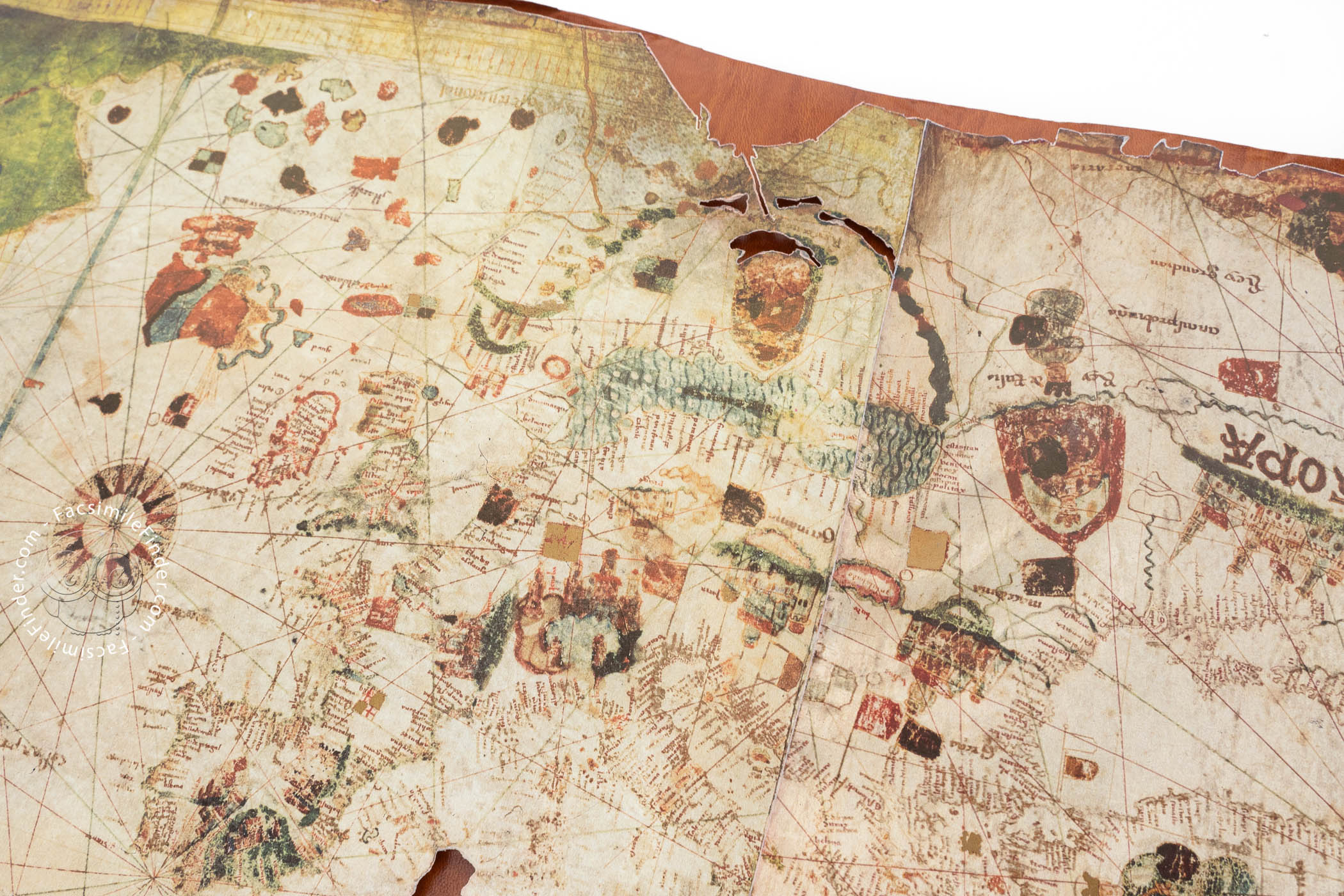
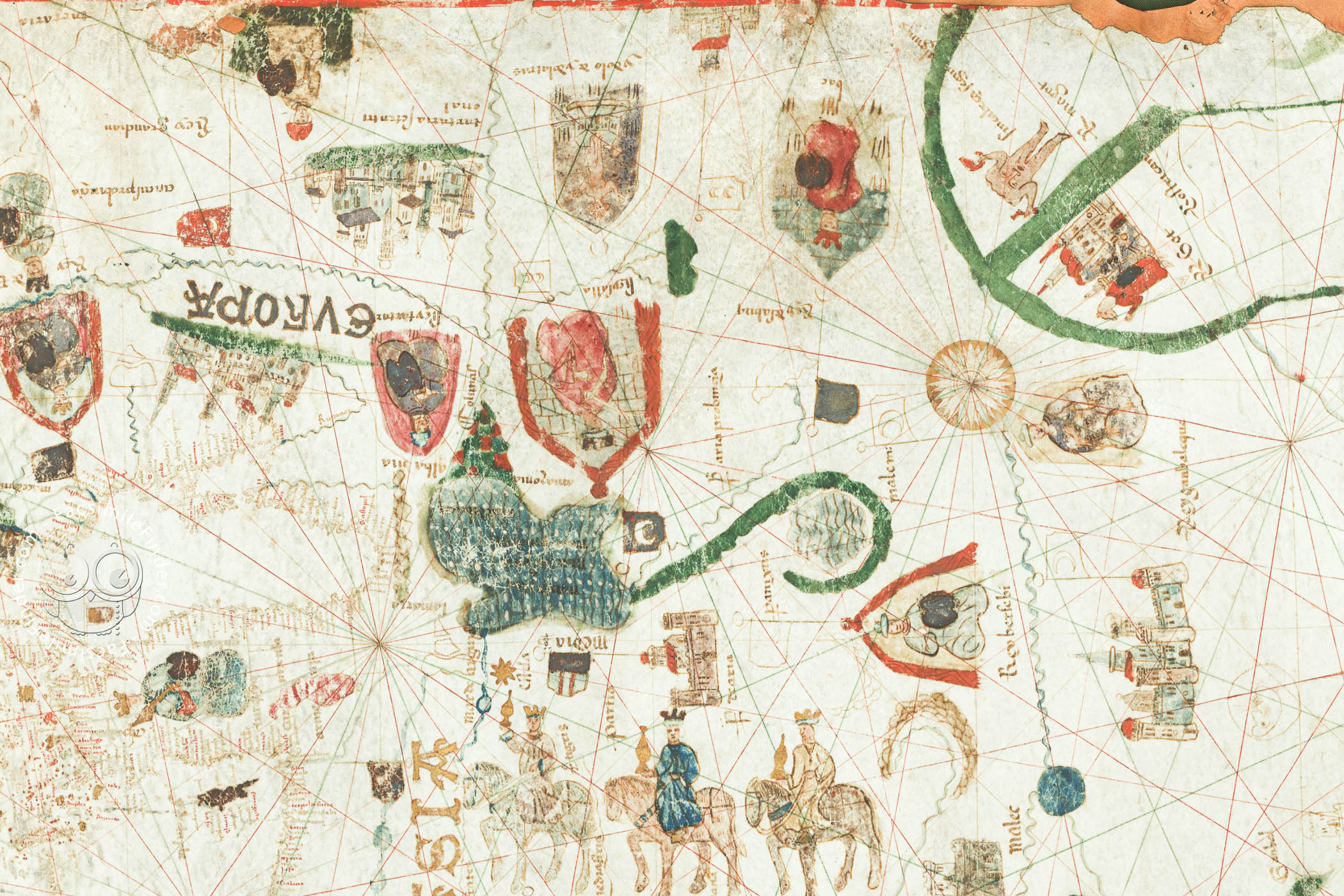
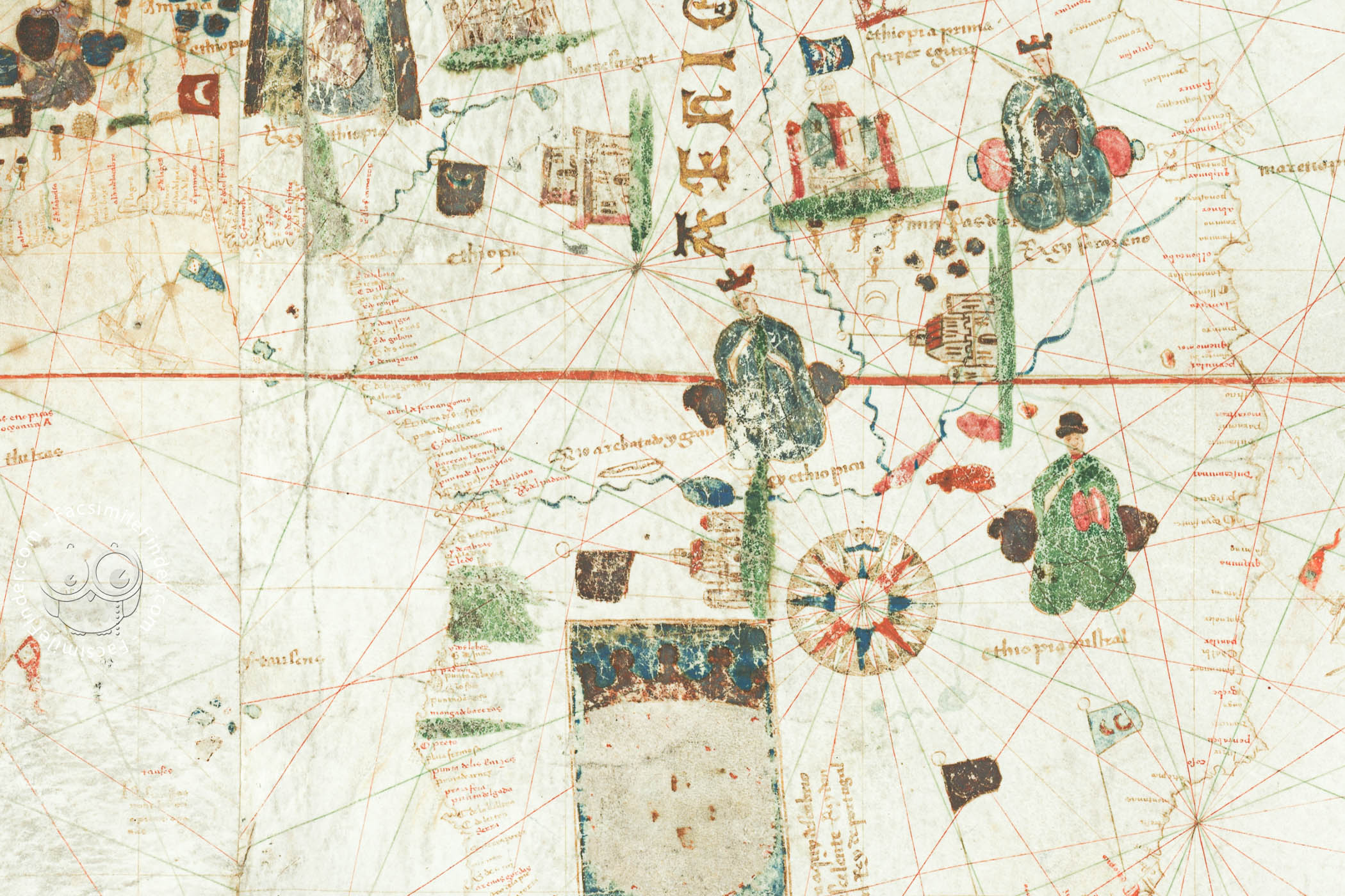
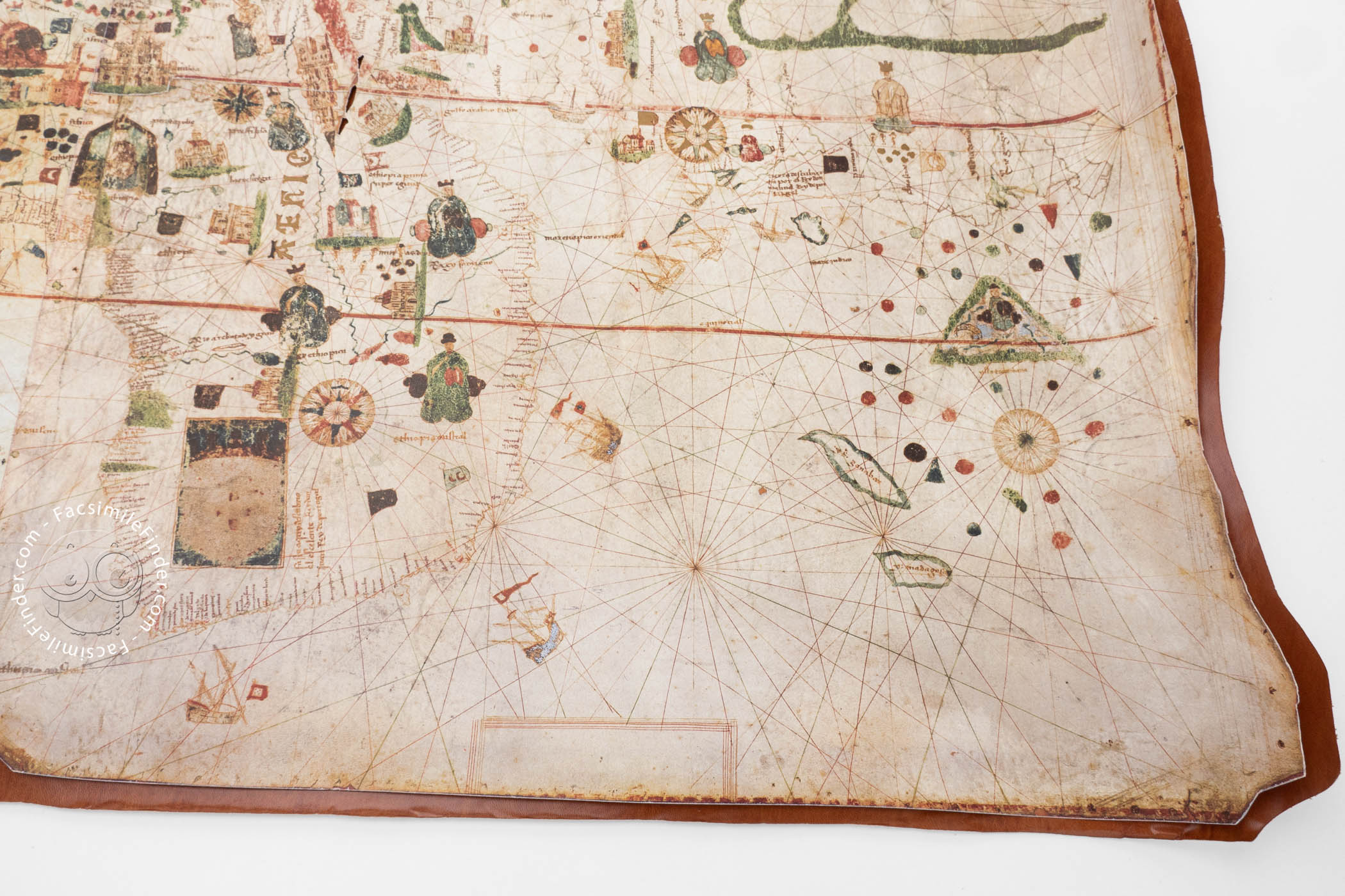
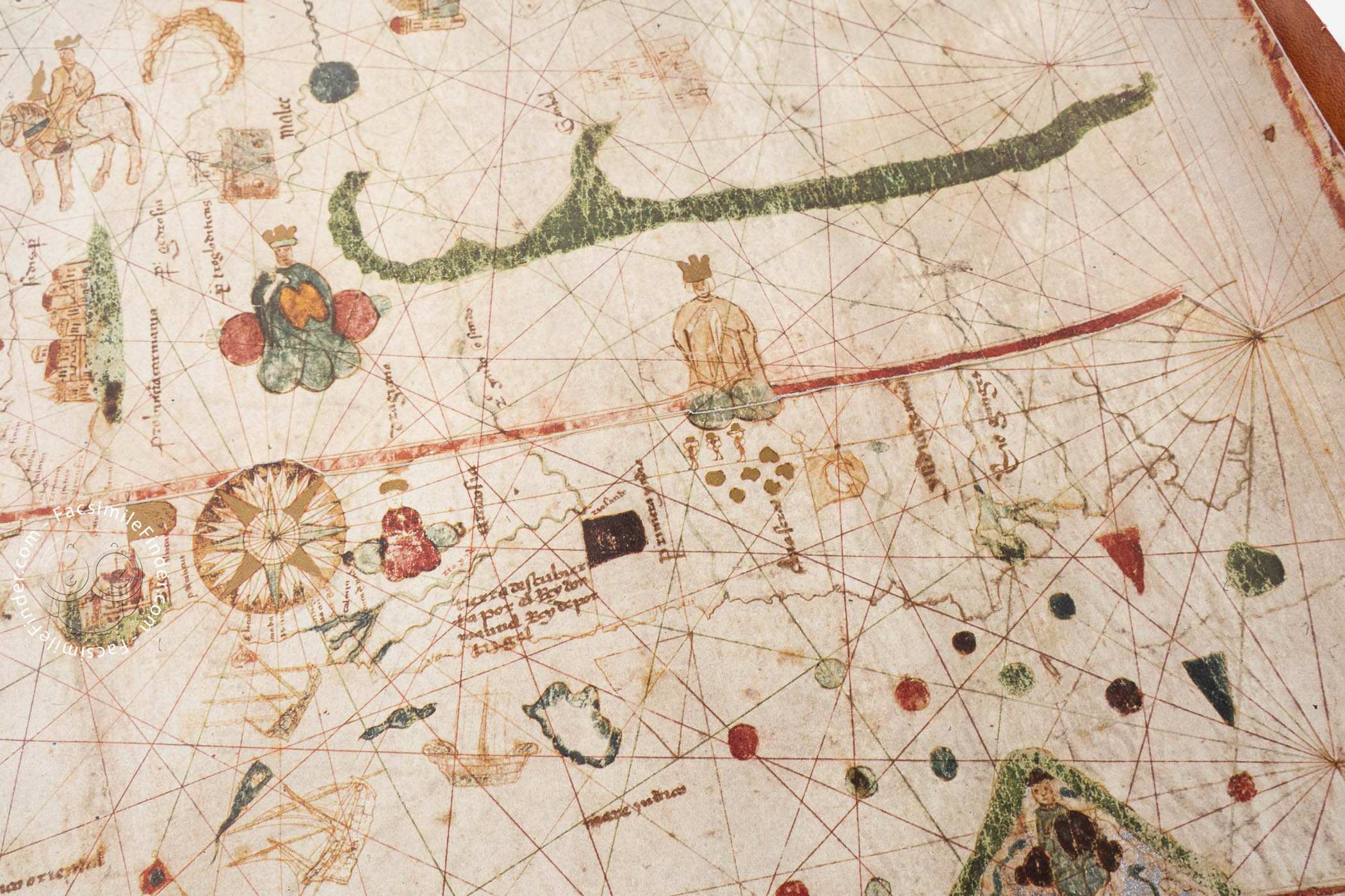
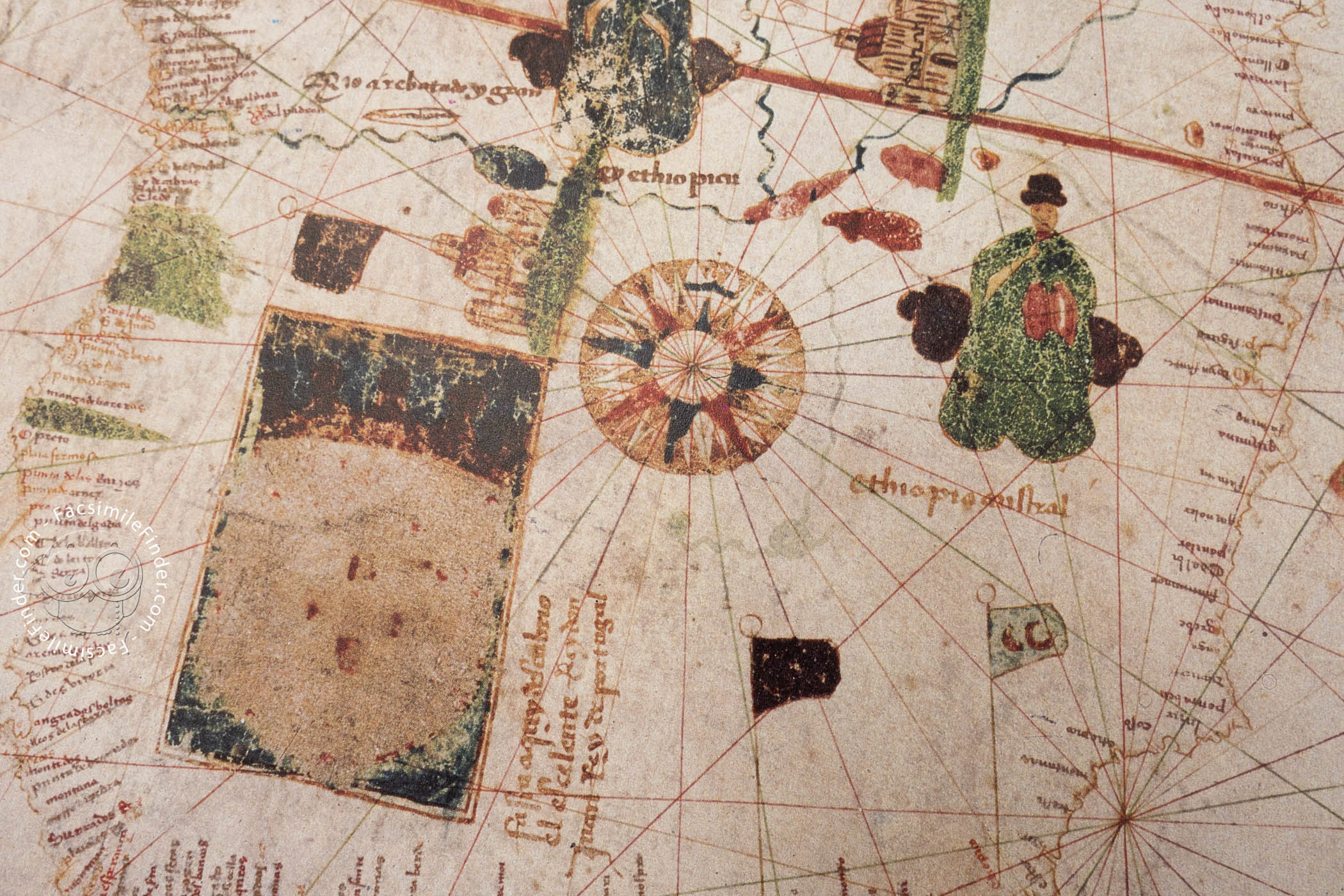
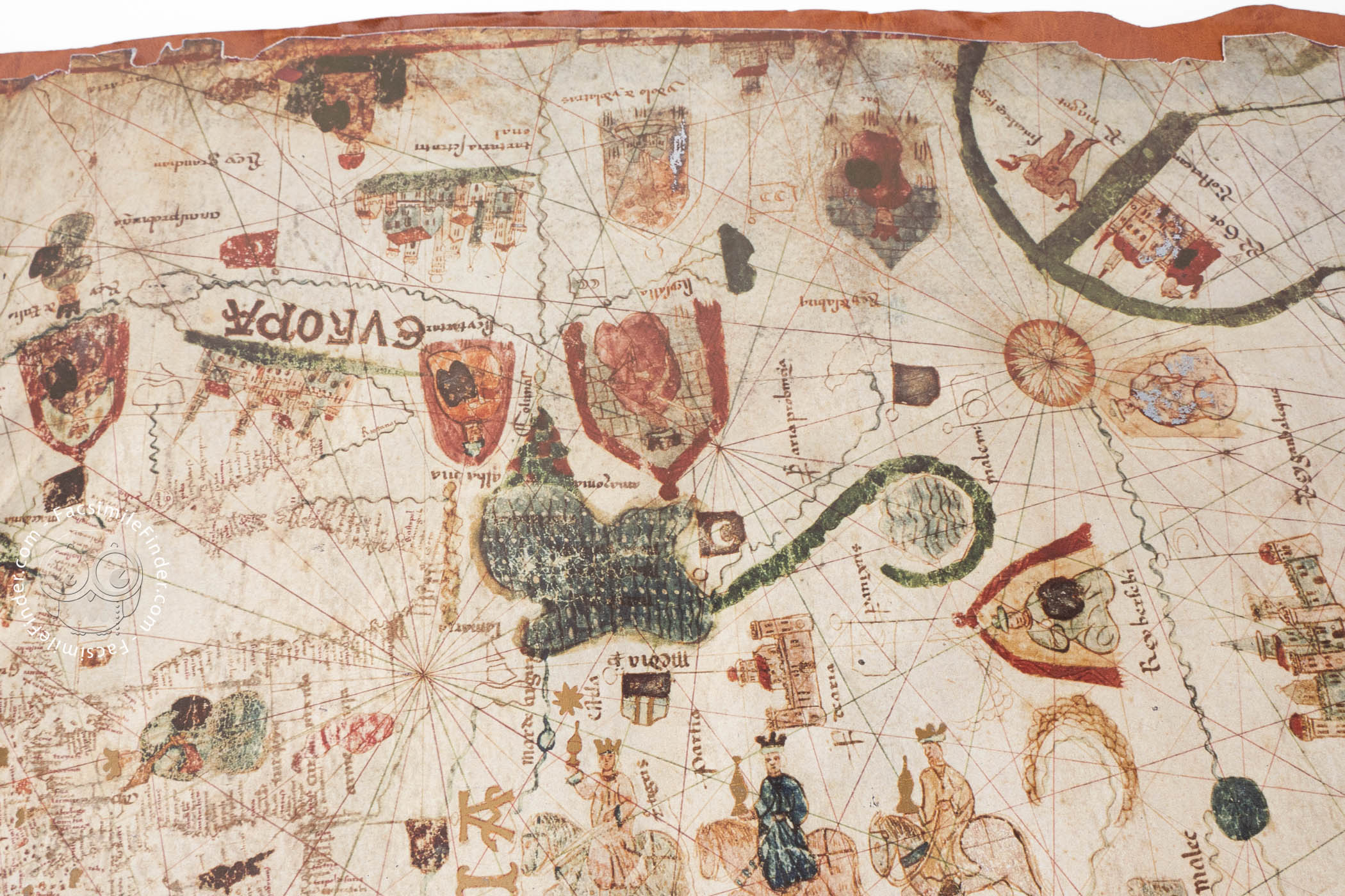
The representation of Europe, Africa, and Asia follows the tradition of portolan nautical charts, with abundant place names along the coastlines and many informative drawings: the city of Genoa is especially prominent in Europe. In Africa, graphic features are abundant: eight kings are pictured. Included among them is Prester John, the legendary Christian king of a land remote from Europe, who is shown wearing a bishop's miter. The mountains of the continent are brightly colored in green and red.
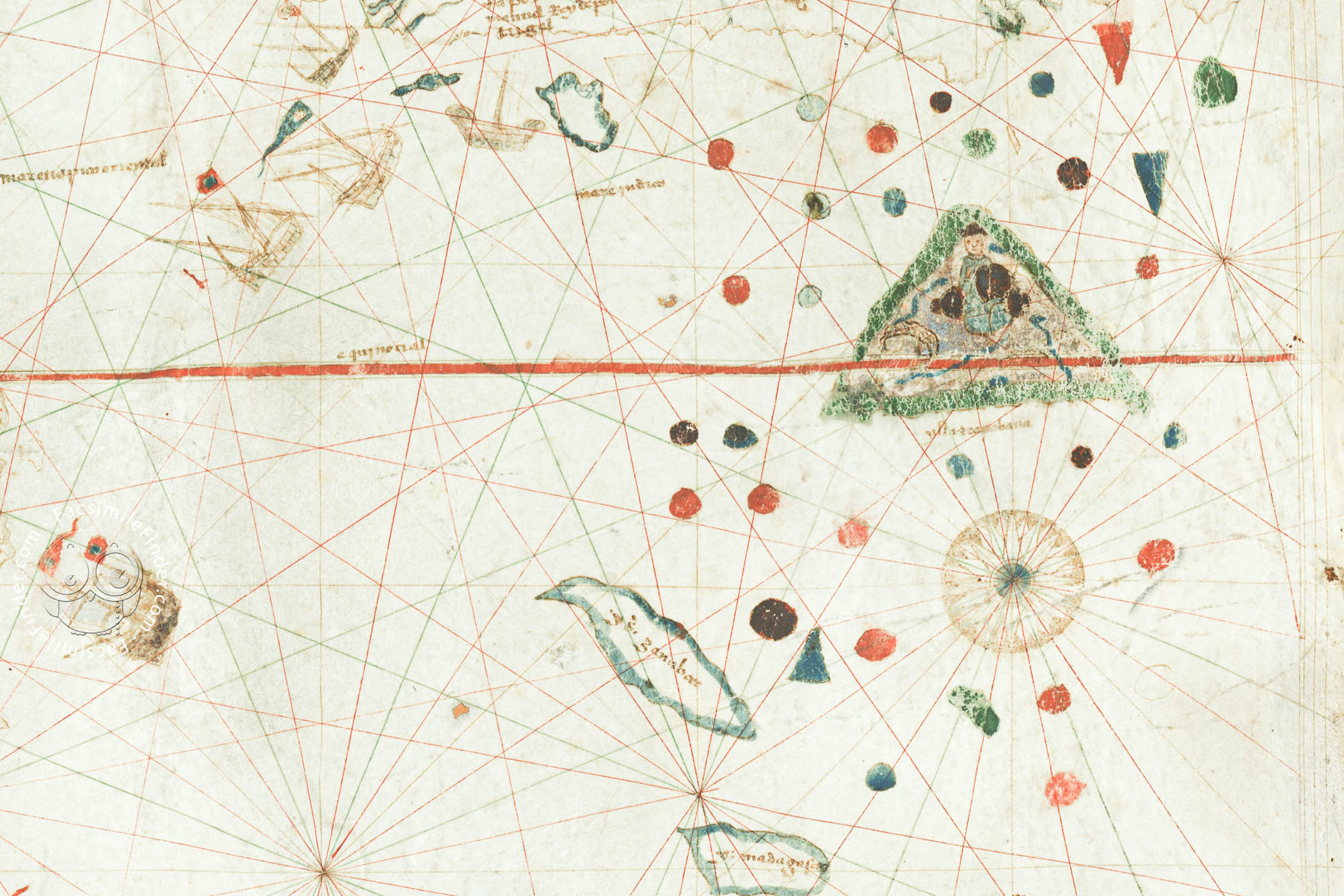
In Asia, various rulers are shown, and a large depiction of the three wise men described in the Gospel of Matthew dominates. A large and elaborate wind rose in the middle of the Atlantic Ocean includes an attached woodcut depiction of the Virgin and Child.
A Variety of Sources
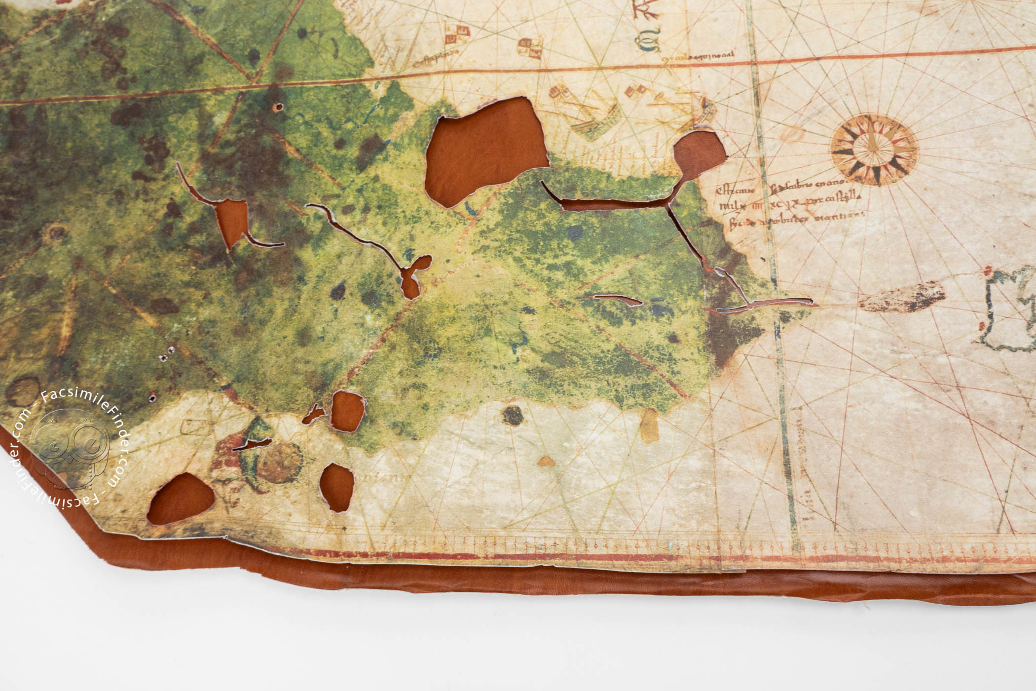
The map was surely created from a variety of sources, and the imprecise delineation of the eastern coast of Africa indicates a lack of available information about that area, which was being slowly explored by the Portuguese at the time. The islands of the Caribbean are large and slightly misplaced, following Columbus's faulty calculations. Indeed, the whole of the coast of America, the only land painted green on the map, is out of scale with most of the map, suggesting a different source for that part of the map.
The early history of the map can only be conjectured. Charles Athanase Walckenaer (1771-1852) purchased the map in Paris in 1832, and it was acquired by the Spanish government in 1853 for the Museo Naval de Madrid.
We have 2 facsimiles of the manuscript "Map of Juan de la Cosa":
- Carta Mapamundi de Juan de la Cosa facsimile edition published by Egeria, S.L., 1992
- Mapa de Juan de la Cosa facsimile edition published by Testimonio Compañía Editorial, 1992