
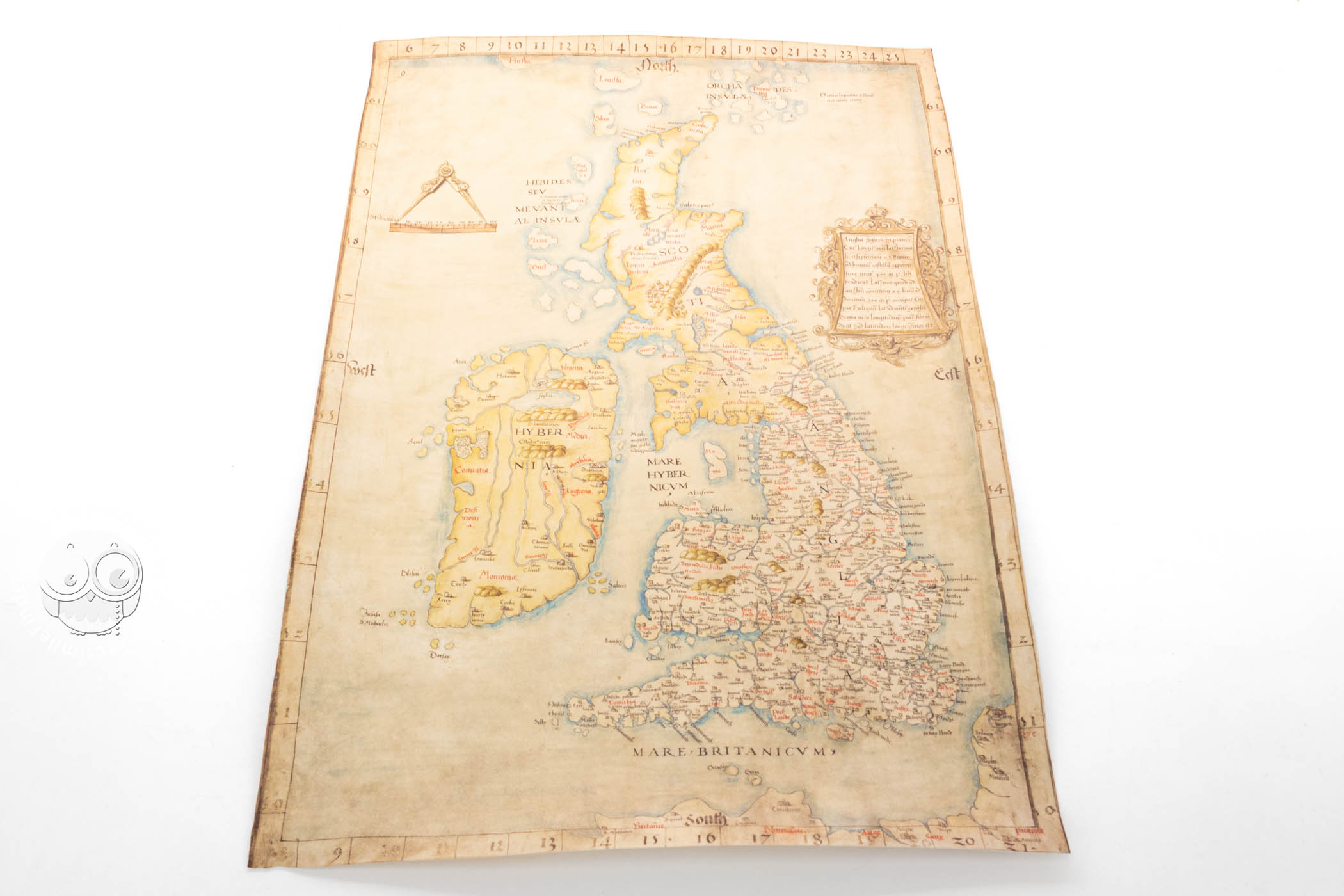

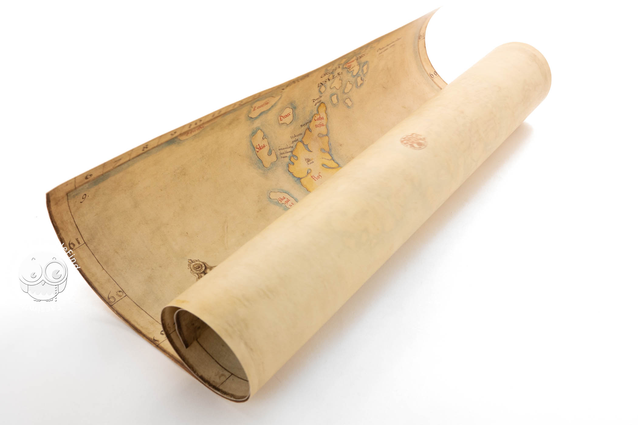


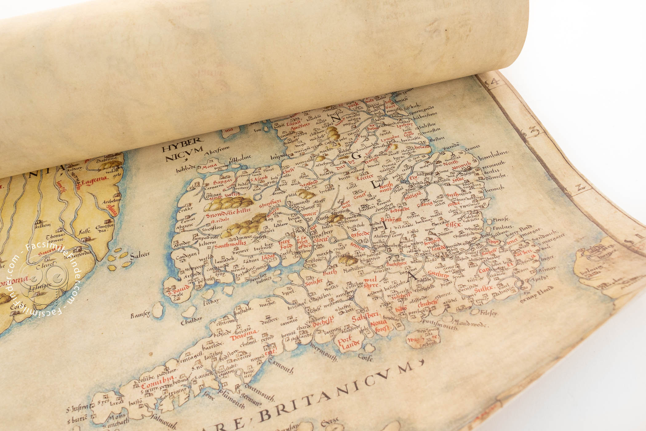


This historic map of Britain, Angliae Figura, hung on the walls of Hampton Court Palace, where its owner, King Henry VIII, would have consulted it frequently. Now a treasure of the British Library, it is the most important manuscript map of Britain created during Henry's reign.
The Iconic Image of the Realm of Henry VIII
At the end of the 1530s the Lord High Admiral noted that Henry VIII had become "marvellously inflamed" by a new map. The Angliae Figura had recently been presented to the King as a New Year's gift in 1537 by the Archdeacon of Rochester. Now housed in the British Library, this beautiful artefact has become one of the most famous representations of Henry's realm.
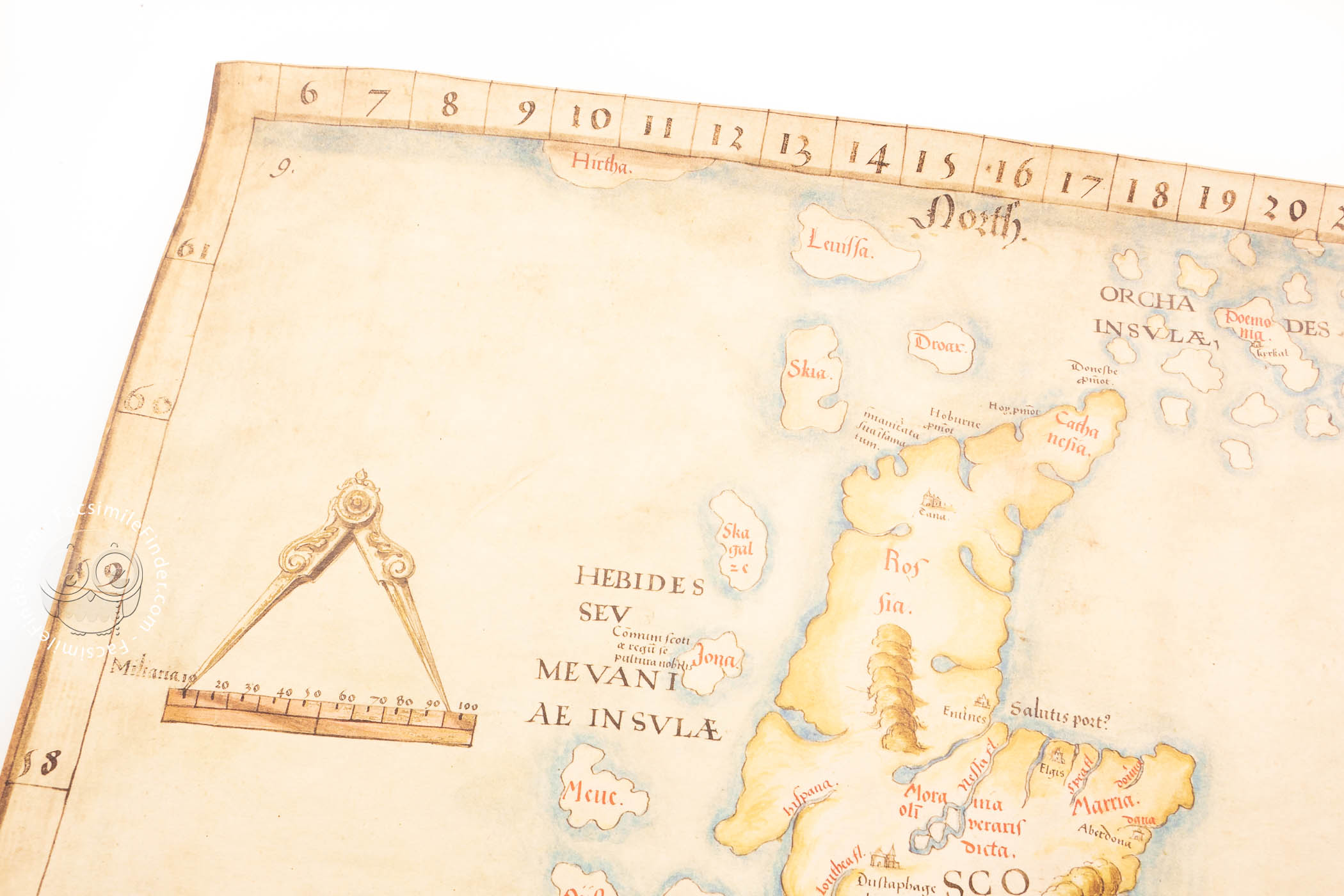
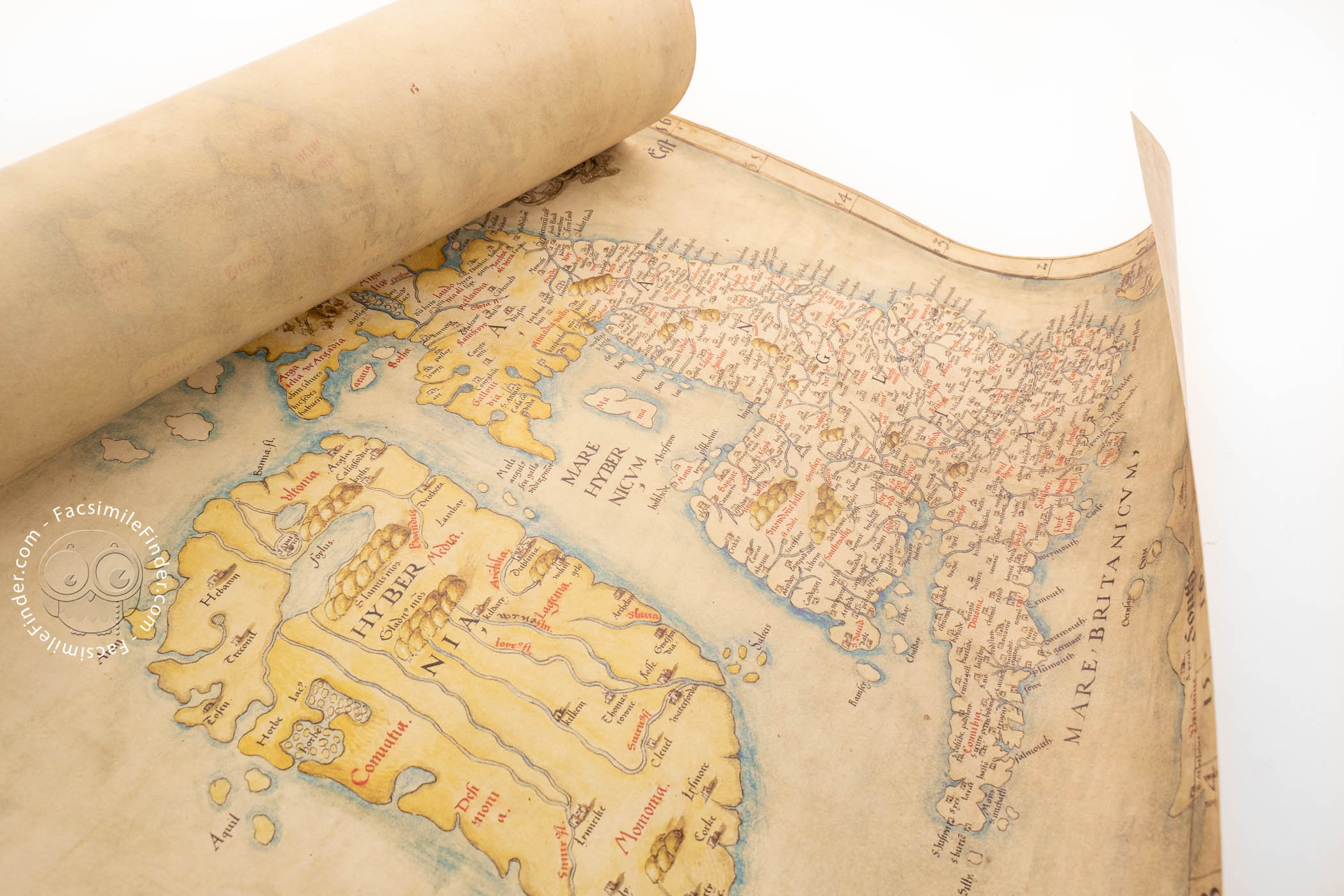
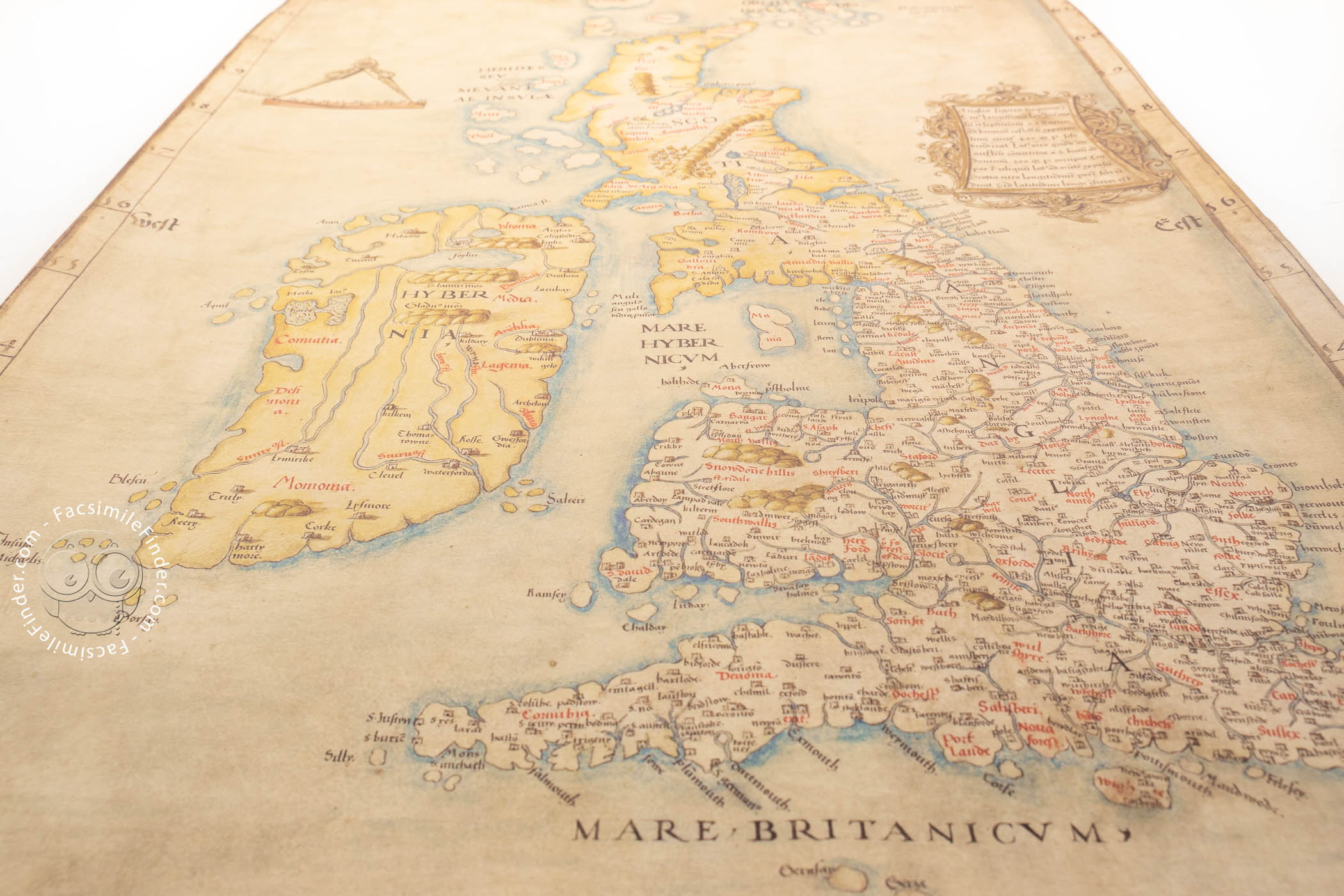
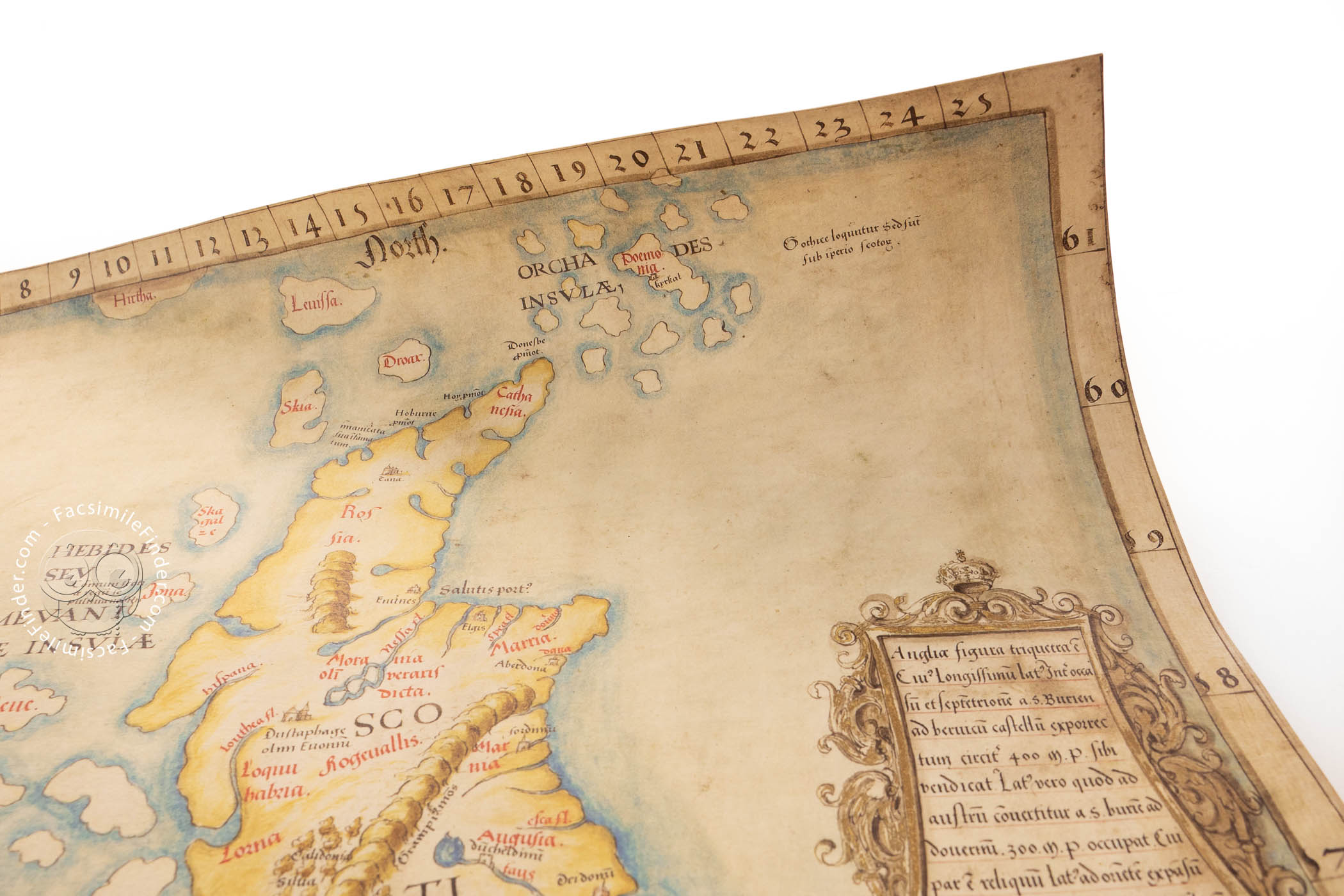
Henry was the first English monarch fully to realise the potential of maps as practical instruments of government. The Angliae Figura was both lavish and useful. Made from a single piece of vellum, it contains eight pinholes around its edges, suggesting that it was attached to a board. It was probably protected by curtains, which accounts for its pristine state. Containing the latest cartographical advances, it would have looked strikingly modern to its sixteenth-century viewers. The accuracy and detail of this map would have made it invaluable to Henry in implementing his policies, both foreign and domestic.
An Historic Portrait of the British Isles
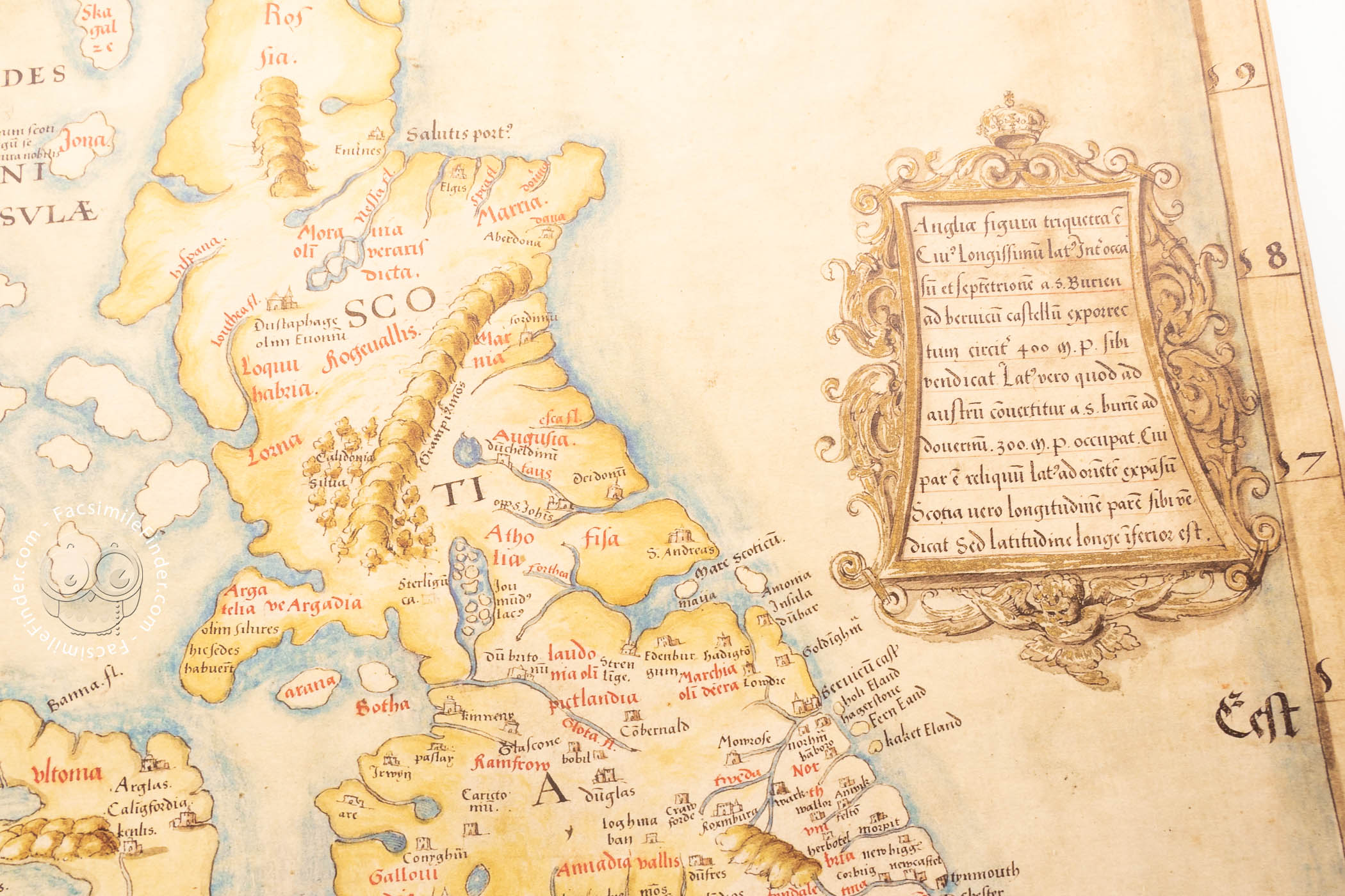
Angliae Figura was the most realistic depiction of Britain to date. The positioning of towns along the east coast of England, from Rye to Berwick-upon-Tweed, is correct, and there are 633 place names, more than any map hitherto. No border is shown between Wales and England, reflecting the recent Acts of Union.
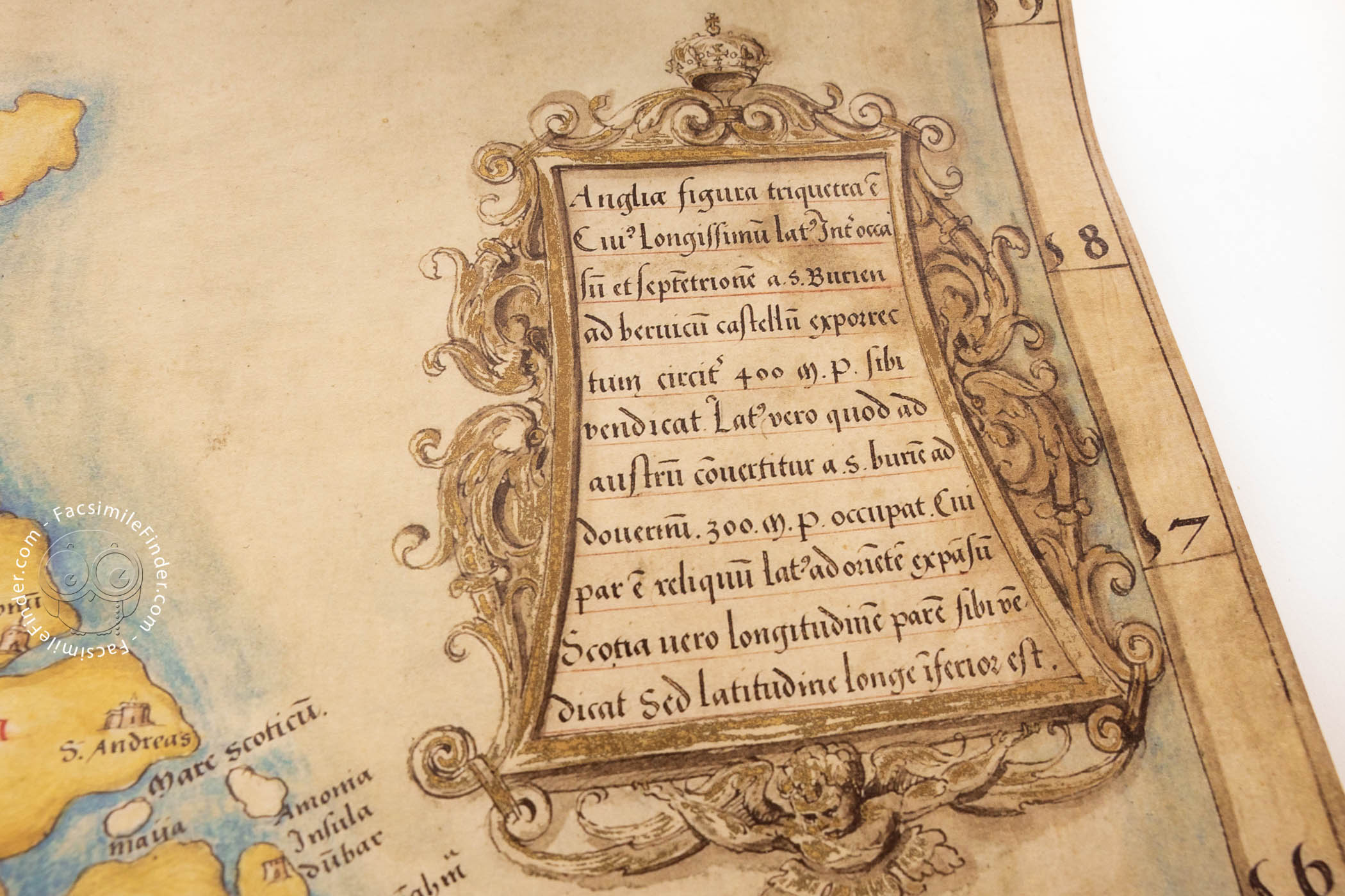
A Revealing Snapshot of the King's Political Ambitions
The title panel is shaped like a royal coat of arms, denoting the map's purpose as a portrait of Henry's realm. Given that the map includes Scotland and northern France, this was a bold statement of political ambition in the late 1530s, as Henry sought to deal with his troublesome neighbours.
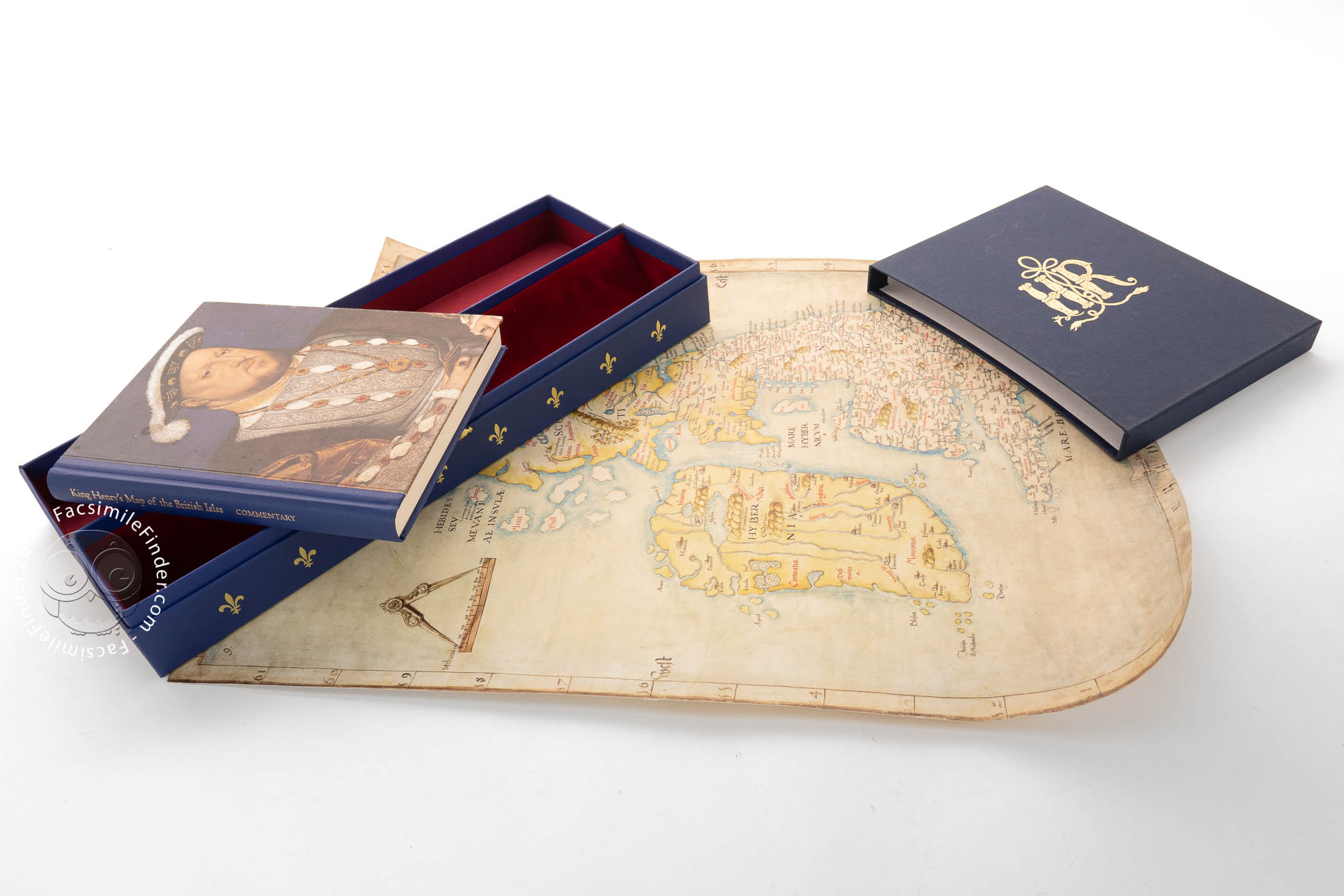
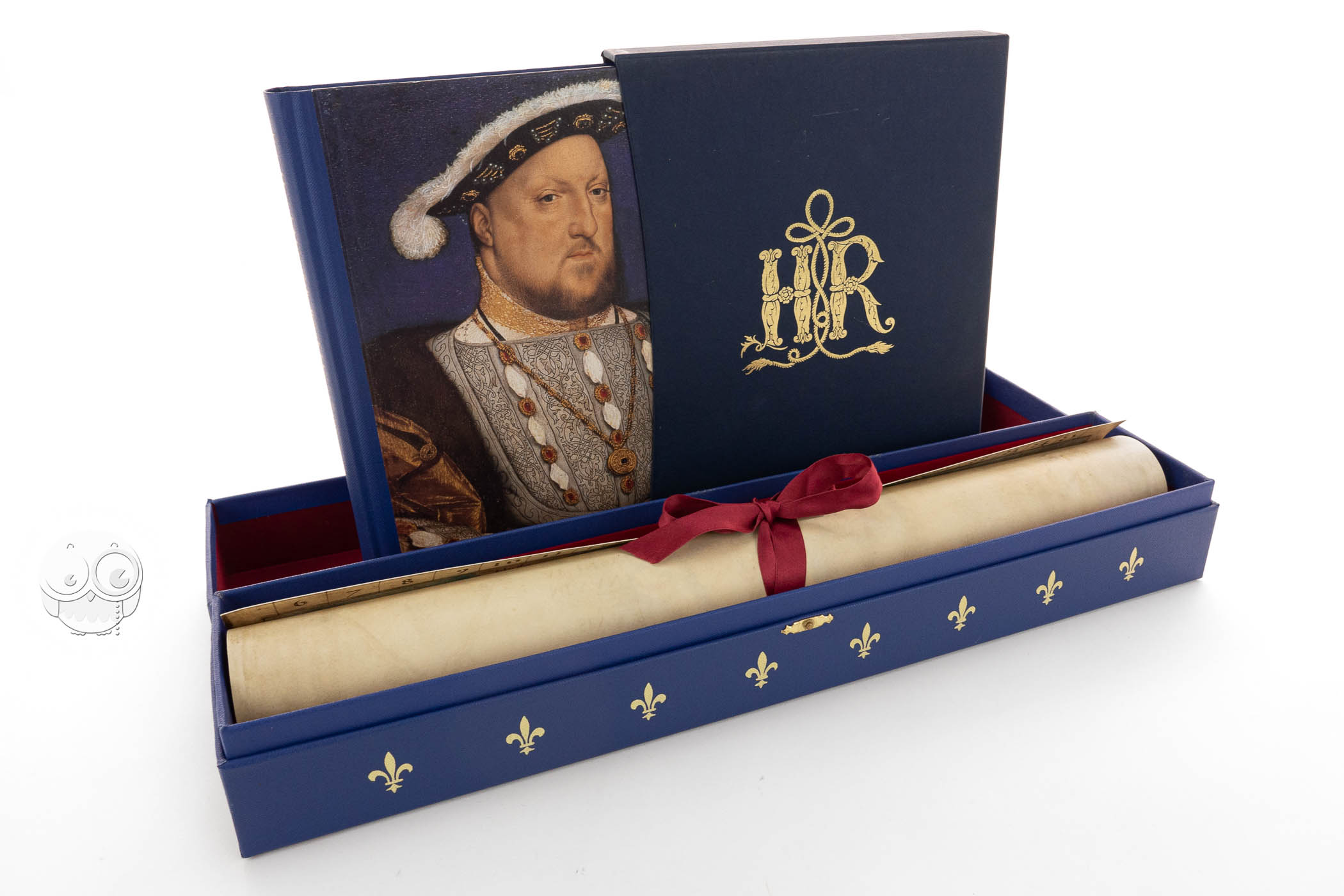
We have 1 facsimile edition of the manuscript "King Henry's Map of the British Isles": King Henry's Map of the British Isles facsimile edition, published by The Folio Society, 2009
Request Info / Price