


This spectacular manuscript atlas is an outstanding cartographic work of the sixteenth century. Dated 1558 and signed by the Portuguese cartographer Diogo Homem (d. after 1576) and commissioned by Queen Mary of England probably as a gift for her husband, Philip II of Spain, the atlas comprises nine maps and diagrams.
Diogo Homem was a member of a well-known and admired family of cartographers. Born in Portugal, he left the country in 1545 accused of murder and lived for a time in England, before settling in Venice. This atlas is an outstanding example of his cartographic and artistic skills.
A Luxury Piece of Cartographic Art
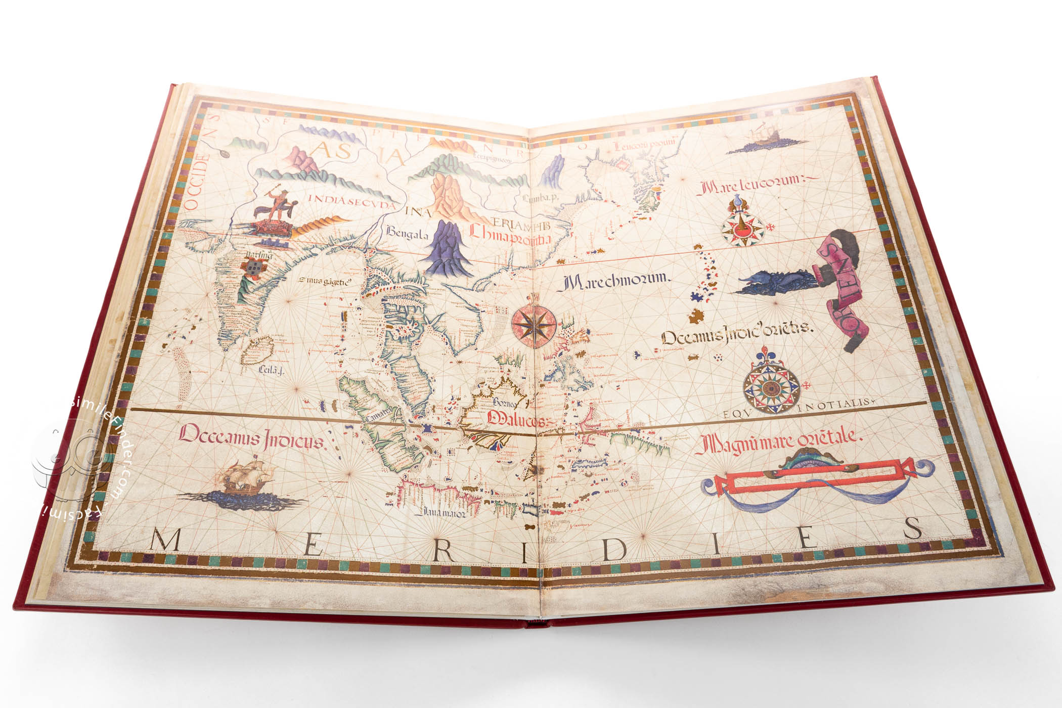
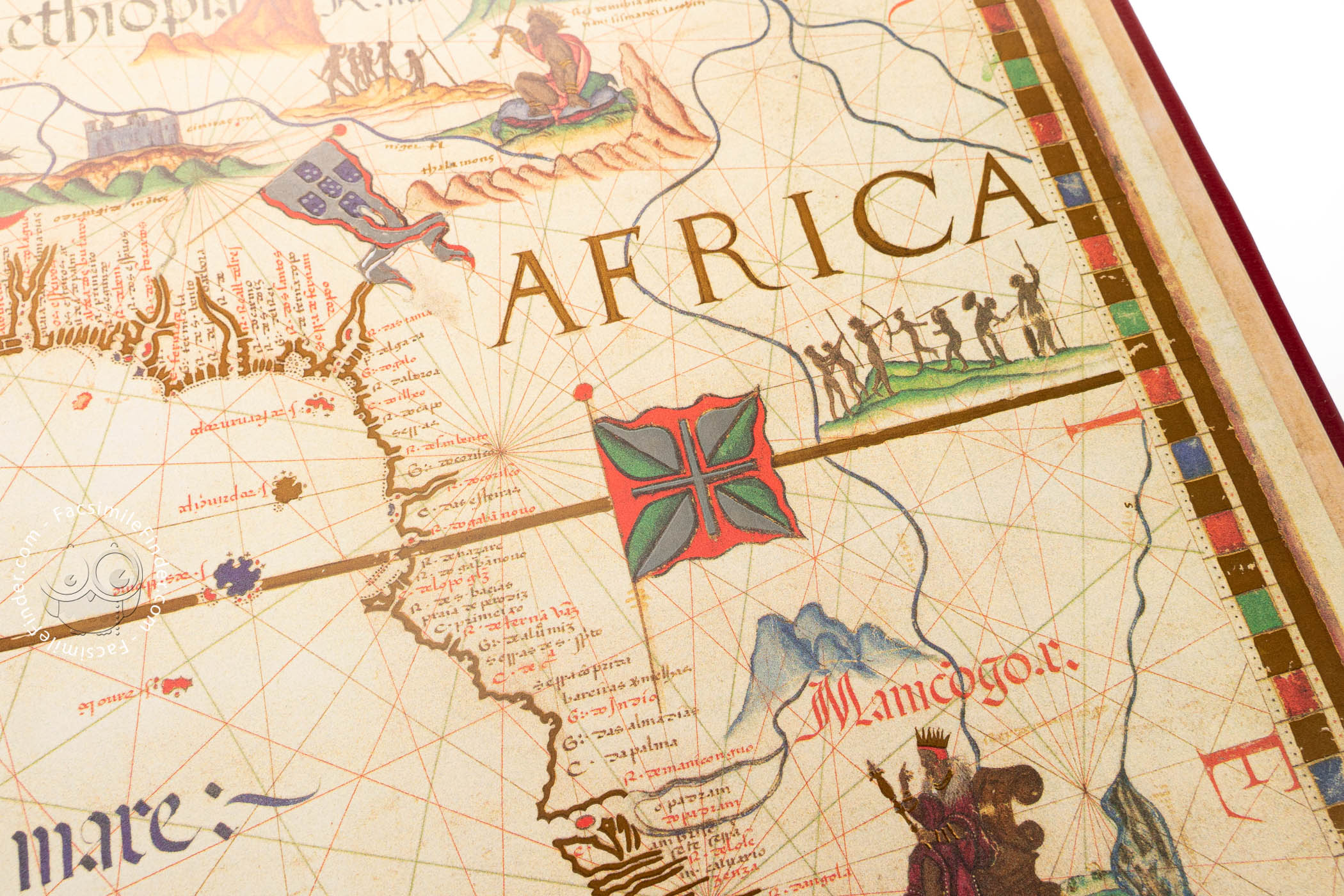
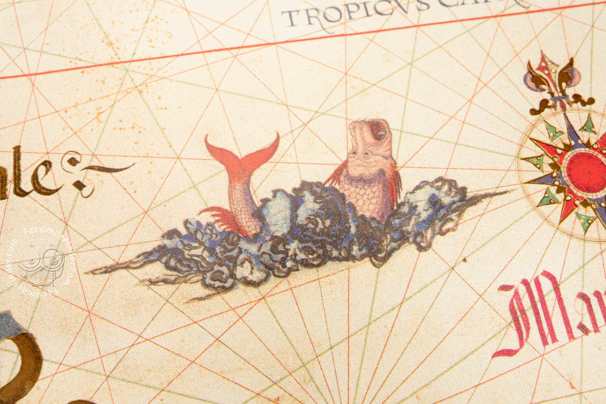
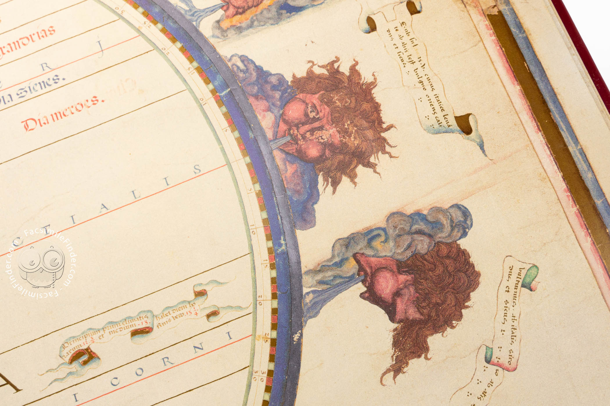
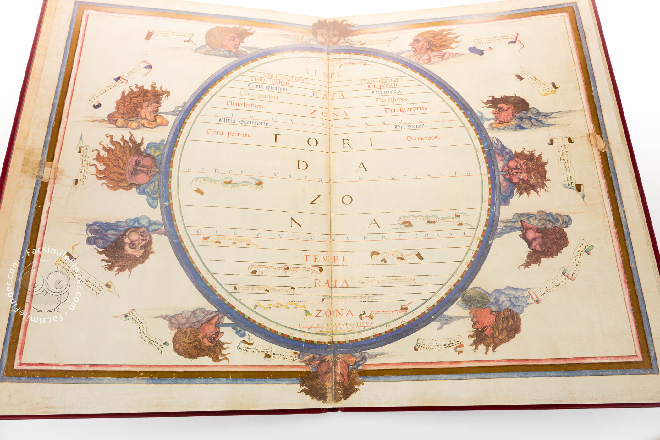
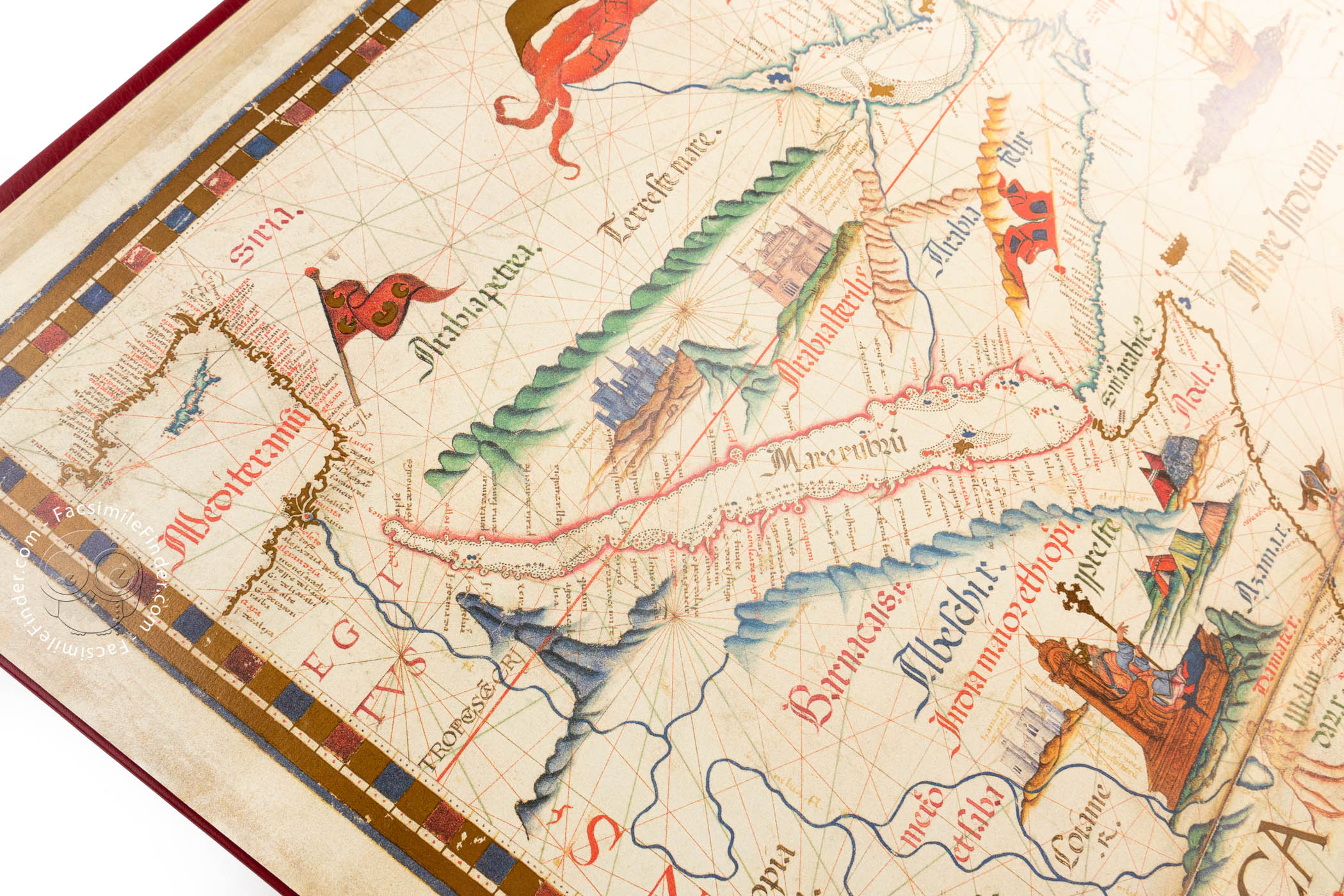
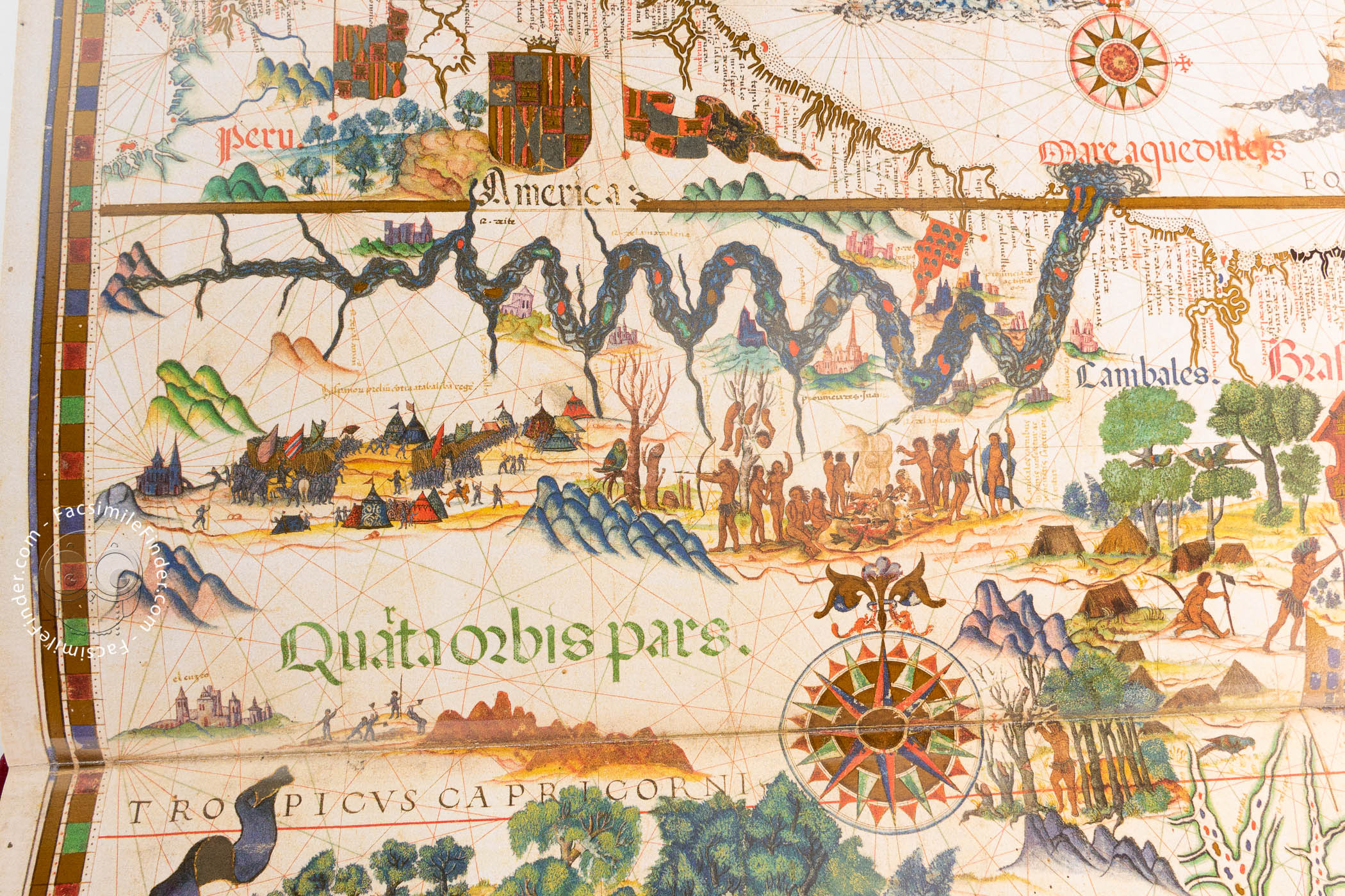
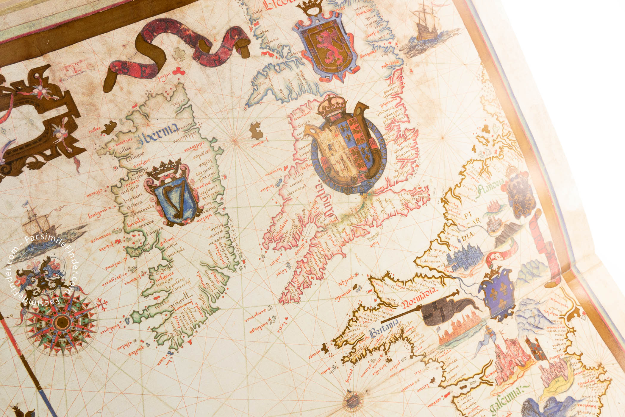
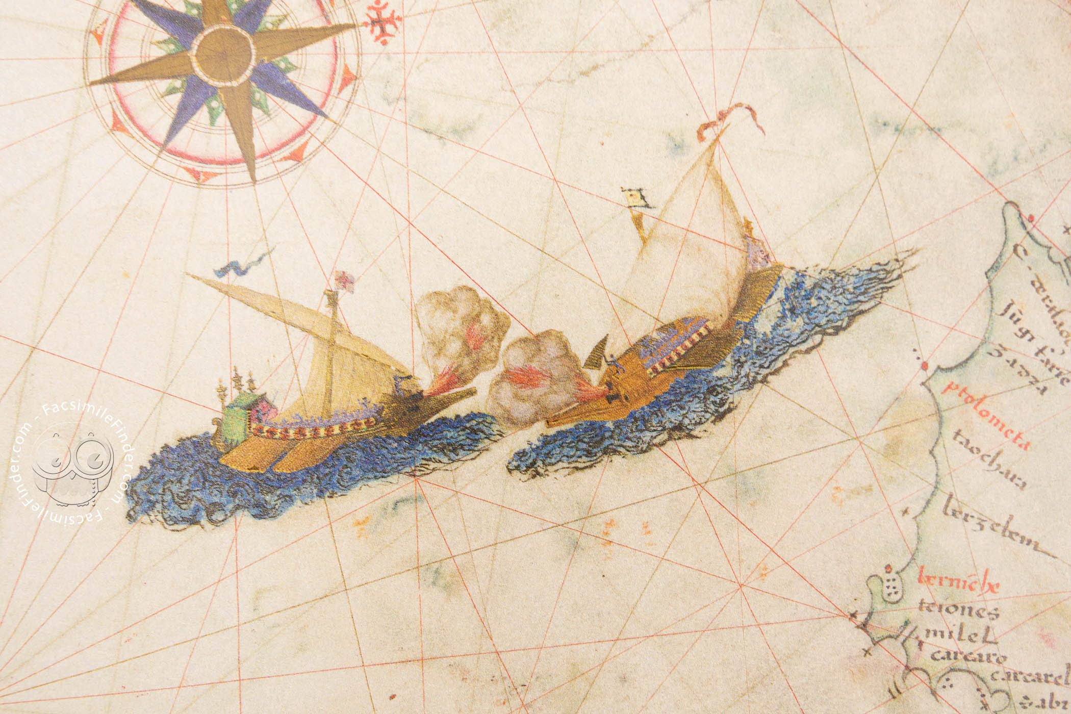
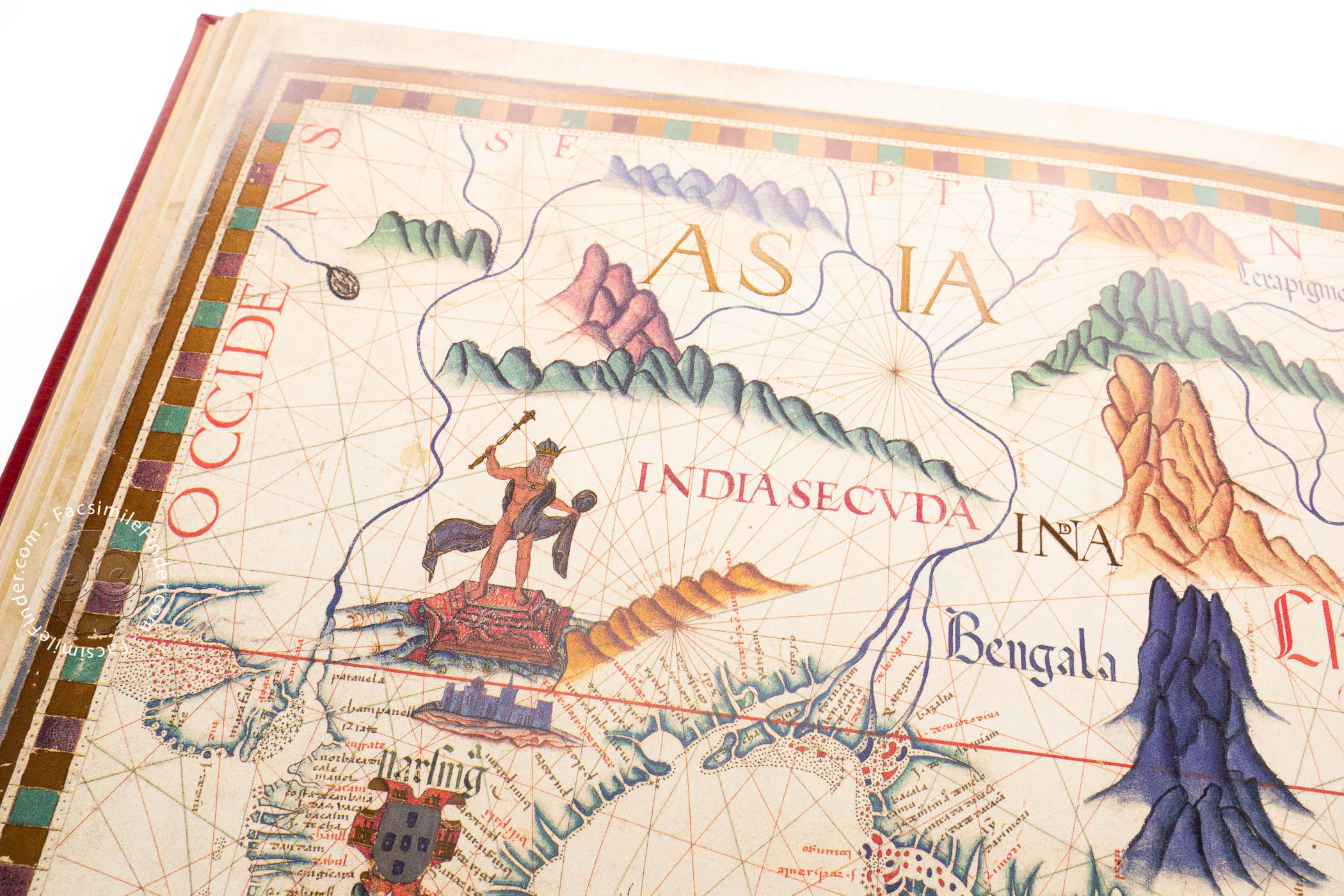
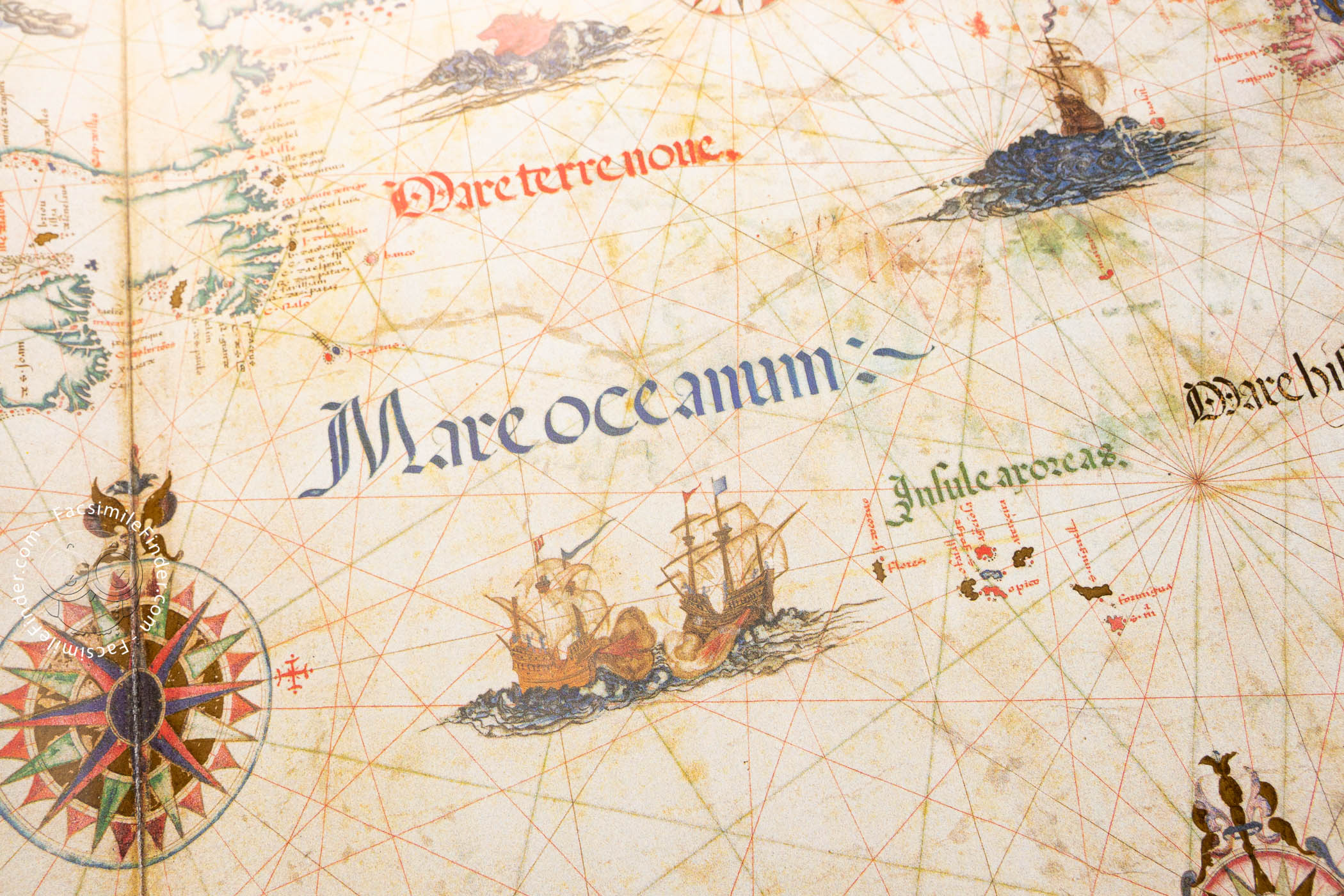
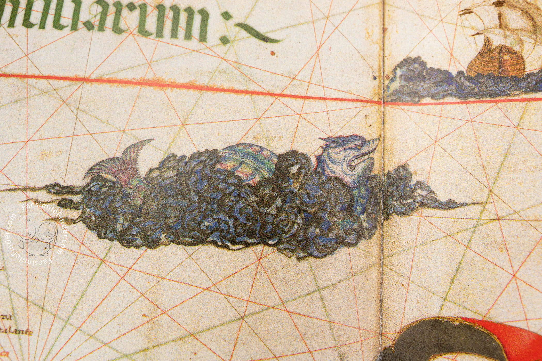
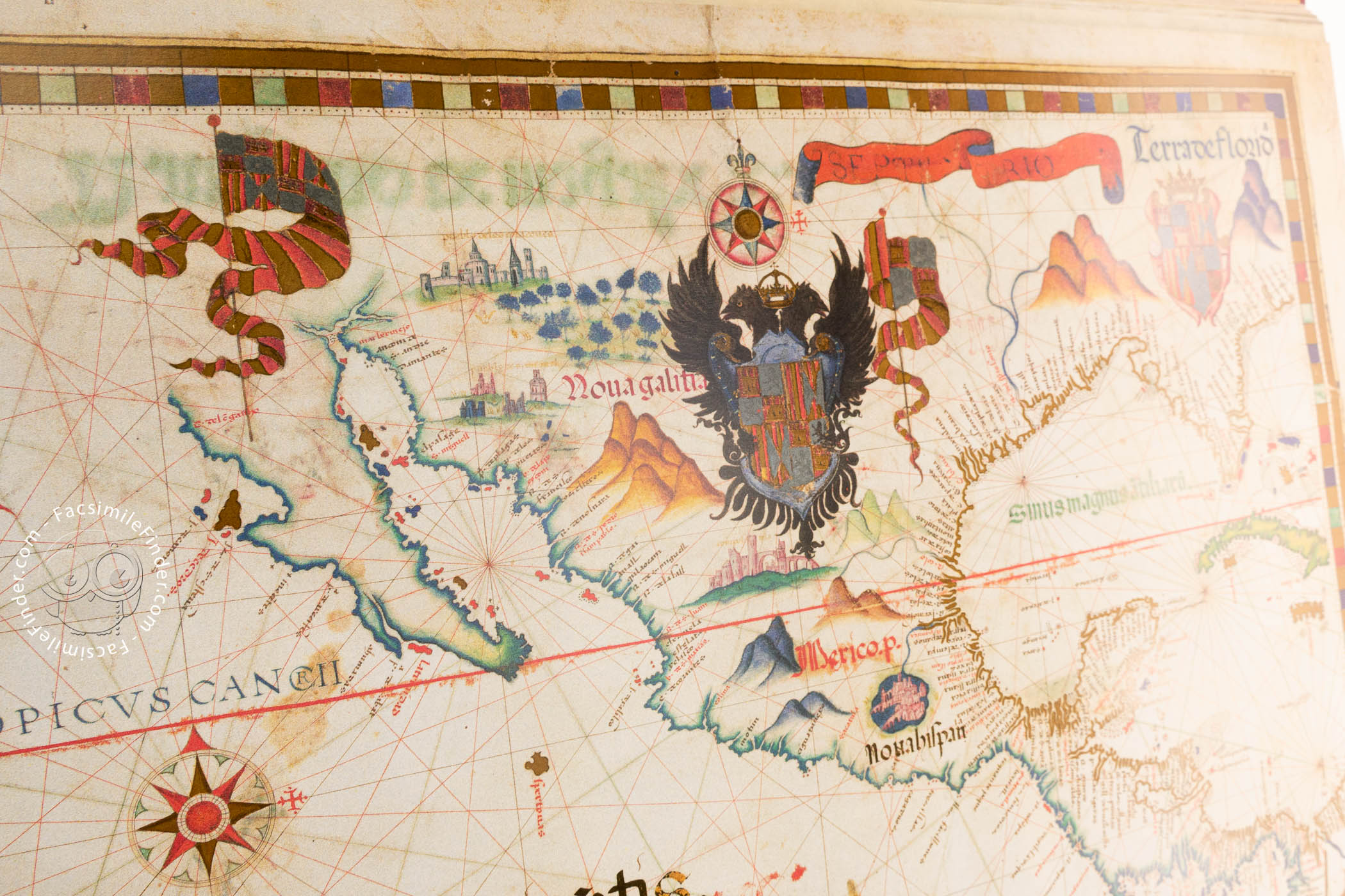
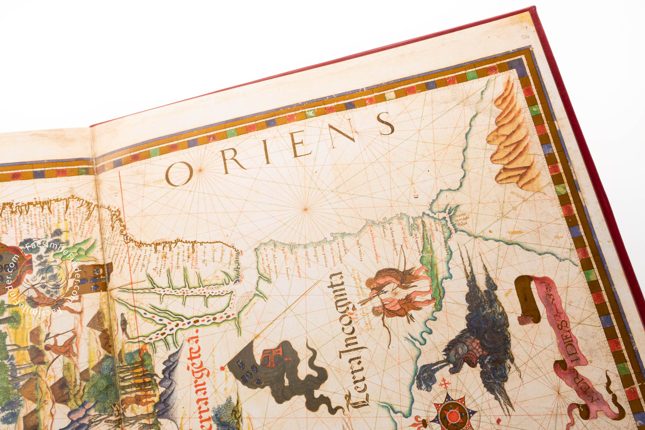
One of the most remarkable features of the atlas is its lavish decoration, with abundant flags, banners, coats of arms, and compass roses. Peoples, rulers, animals, and cities are illustrated, as are ships sailing the oceans and various sea creatures, following the fashions of the cartography of the time. It is probable that much of the embellishment was executed by Italian artists, either in England or in Italy, after Mary's death.
Following the tradition of nautical charts, most of the coastlines are accurately depicted, with abundant place names all along the coast, and networks of rhumb lines crossing the maps.
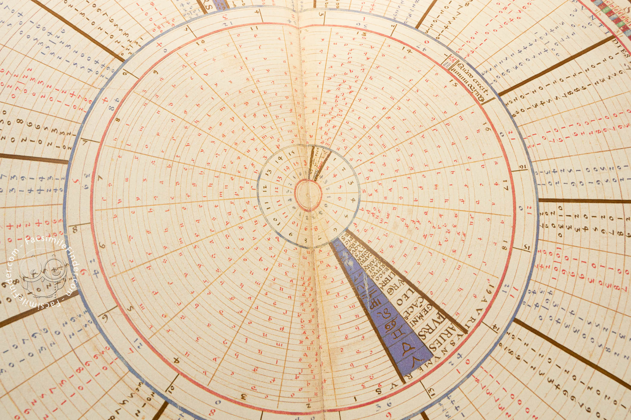
A Nearly Comprehensive Atlas
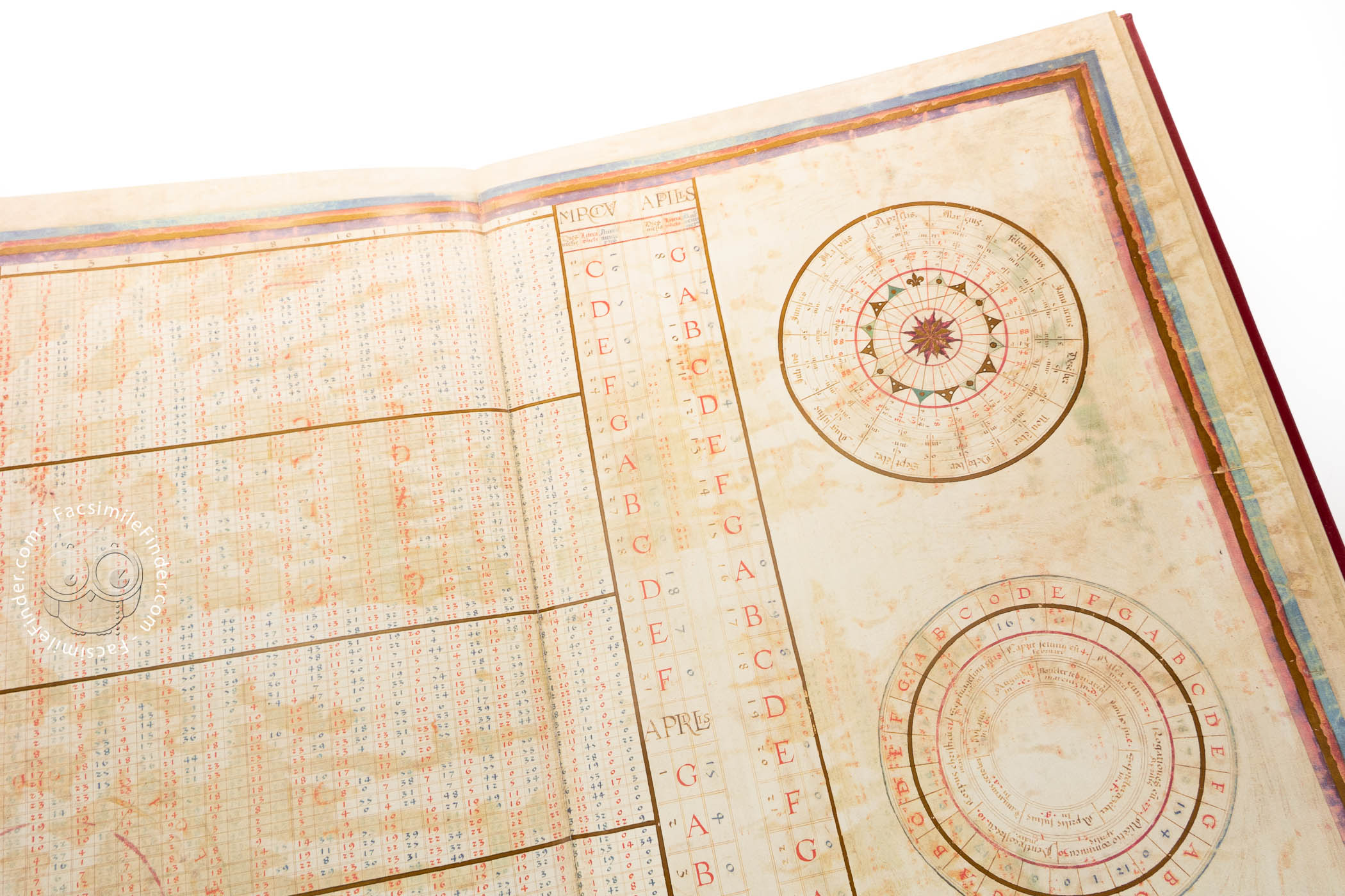
The parchment sheets of the atlas measure 58 × 80 cm. The maps included in the atlas as it survives today are a circular zonal map, a world map, a map of northwestern Europe and the Mediterranean, two maps of western and eastern Africa, one of the East Indies, and three maps of the Americas, as well as lunar and solar tables. It is believed that the atlas is incomplete and that it originally comprised fourteen maps, of which some were lost as the result of a fire in 1731.
All about Spain
The atlas is as much a political statement as a document of geography. The political and geographic importance of Spain is emphasized. Flags and coats of arms of Spain are prominently displayed, and the territories ruled by the Spanish crown are often more accurately depicted than other places. Minimized is the Portuguese presence in Africa, the Far East, and South America, where Brazil is depicted as a simple coastal strip.
A Lavish Gift for a King
The atlas was commissioned in 1555 by Queen Mary I of England (1516–1558), probably as a gift for her husband Philip II of Spain (1527–1598). But the Queen died in 1558 before the atlas could be completed. Thus, the work never reached King Philip. It may have been presented upon its completion in 1559 to Queen Elizabeth I of England (1533-1603). The atlas probably came into the collection of the British Museum as part of the Royal Library. The manuscript holdings of the British Museum library were transferred to the British Library upon its establishment in 1973.
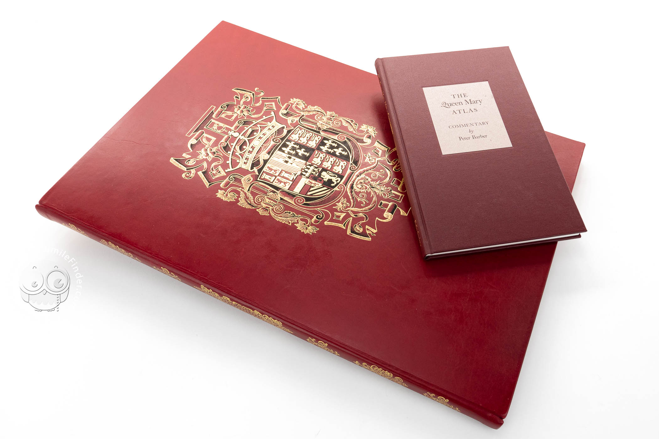
We have 1 facsimile edition of the manuscript "Queen Mary Atlas": Queen Mary Atlas facsimile edition, published by The Folio Society, 2005
Request Info / Price