
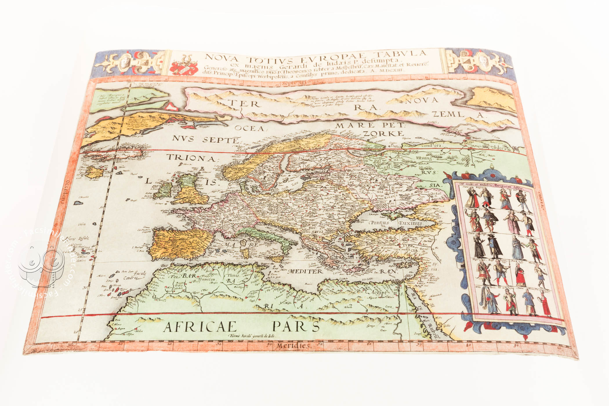
This atlas is a very remarkable and rare example of sixteenth-century Dutch cartography, included by Cornelis de Jode (1568-1600) in his atlas Speculum Orbis Terrae of 1593. It is a new edition of the work of his father, Gerard de Jode (1509-1591), who published an atlas in 1578 with the title Speculum Orbis Terrarum, but he died before he could update it in a new edition. It is one of the most interesting maps of Europe made in the second half of the sixteenth century, given its abundant geographic details and lavish presentation.
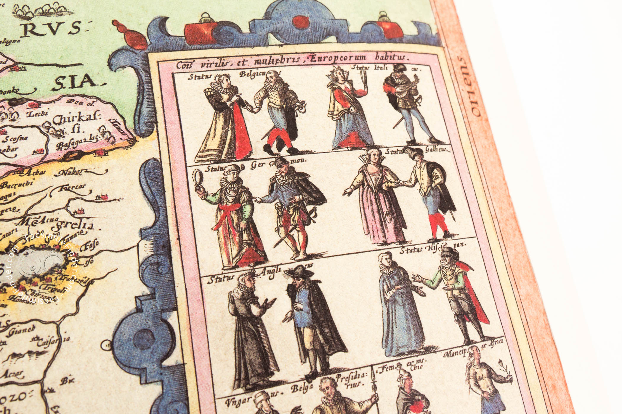
This map, which depicts not only Europe, but also northern Africa, part of Asia and the unknown northern regions, is characterized by its high quality and accuracy, and especially for the very interesting inset that shows the different peoples of Europe and their clothing.
An Outstanding Cartographic Document
De Jode’s map of Europe is a superb example of the lavish decoration of the Dutch atlases of the second half of the sixteenth century. Measuring 33 x 44 cm and written in Latin, it is dedicated to Julius Echter von Mespelbrunn, Prince-Bishop of Würzburg, as we can read in the inscription under the title of the map.
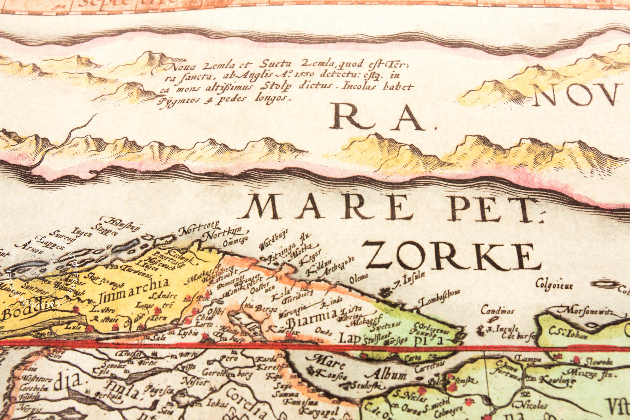
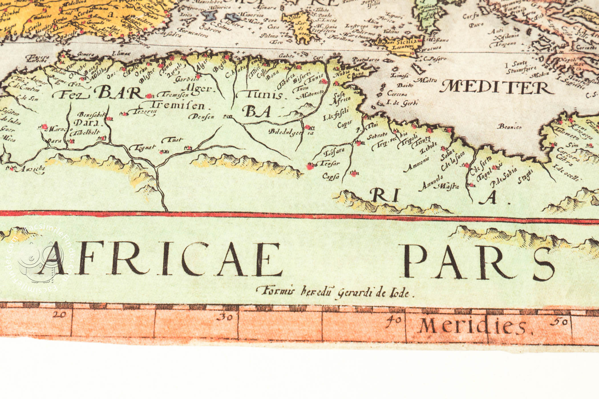
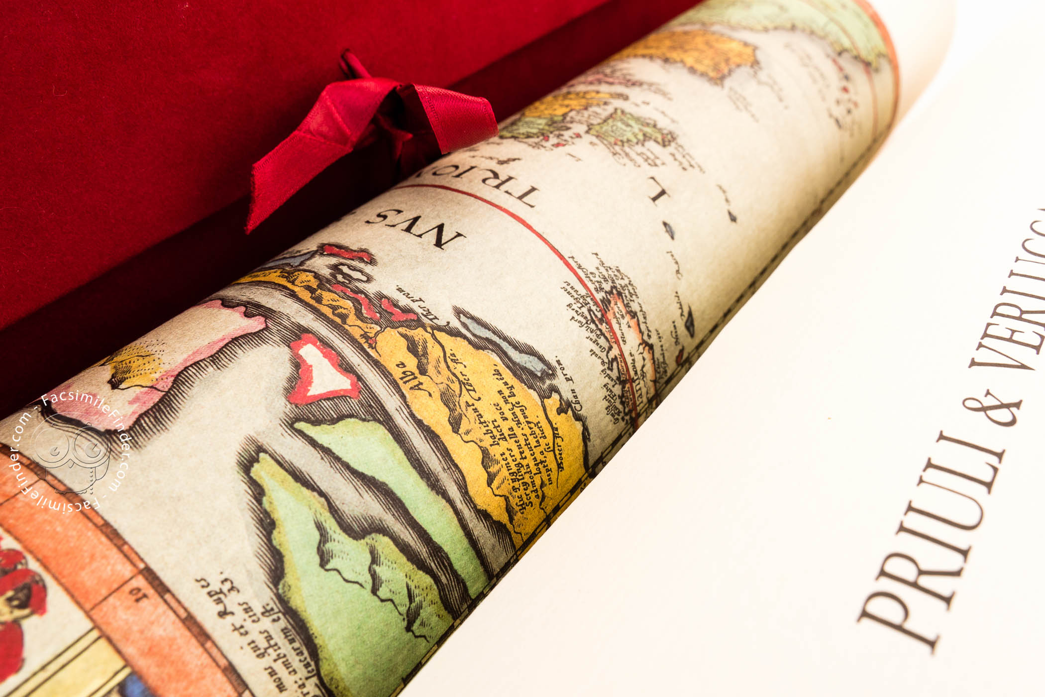
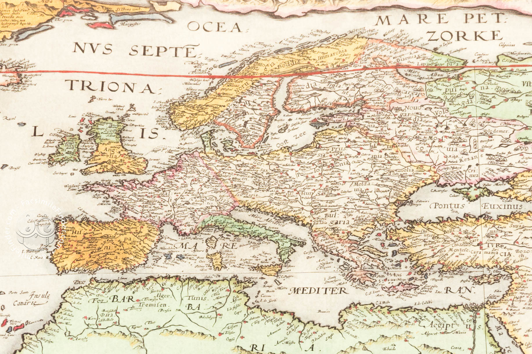
The map shows Europe, northern Africa, the Near East, the extreme northern regions, and the North Atlantic. The representation of the coastlines is very accurate, though he does include several imaginary lands, such as the islands of St. Brendan and Brasil, both in the Atlantic. Thus, this map is a reflection of the coexistence of new geographical references and traditional imaginary regions in early modern cartography.
In Europe, the place names are abundant, and we can see a large number of cities, mountains, and rivers. The regions that are still partly unknown, especially in the north, are filled with descriptive texts, in an attempt to avoid leaving blank spaces on the map.
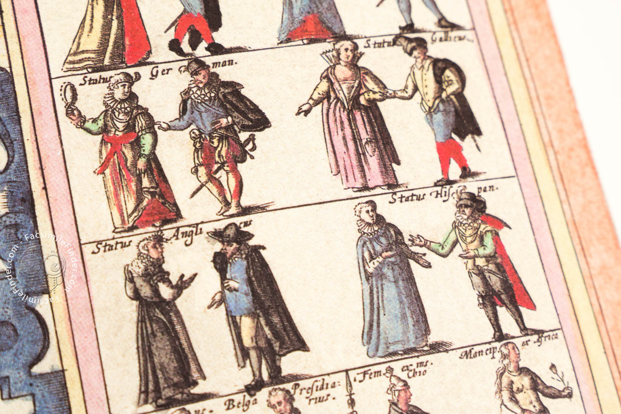
Perhaps the most attractive element in the map is the representation of the different peoples of Europe, framed in a cartouche with Renaissance features, in the lower right-hand corner of the map. Ten couples, each of them from a different European region, are dressed in the clothes typical of their country, adding to the map not only geographical, but also ethnographical information.
The elegant Italic script, lavish decoration, and representative accuracy make this map an outstanding example of Dutch cartography, one of the most important centers of creations of maps and atlases of sixteenth-century Europe.
Gerard and Cornelius de Jode. Milestones of Sixteenth-Century Mapmaking
In 1570, the Brabantian map dealer and cartographer Abraham Ortelius (1527-1598) published his Theatrum Orbis Terrarum, the most successful atlas of the time. The richest and most powerful men of Europe wanted to possess a copy of it, and several cartographers began to create their own updated luxury atlases for the wealthy customers who were demanding new maps.
One of those cartographers was the Netherlandish Gerard de Jode, who published his Speculum Orbis Terrae in 1578, though he began to create individual maps long before that date.
Although De Jode’s atlas was widely admired by other cartographers, its commercial success was limited, and he was not able to compete with Ortelius’ Theatrum Orbis Terrarum. De Jode was working on a new edition of his atlas when he died in 1591. His wife and his son Cornelis continued to operate De Jode’s publishing house, and in 1593 Cornelis published a new edition of his father’s atlas, with the title Speculum Orbis Terrae, in which this map of Europe was included.
This work was not a great commercial success either, and as a result few copies survive. Nevertheless, given its high quality and elegant style, Speculum Orbis Terrrae is considered one of the masterpieces of sixteenth-century European cartography.
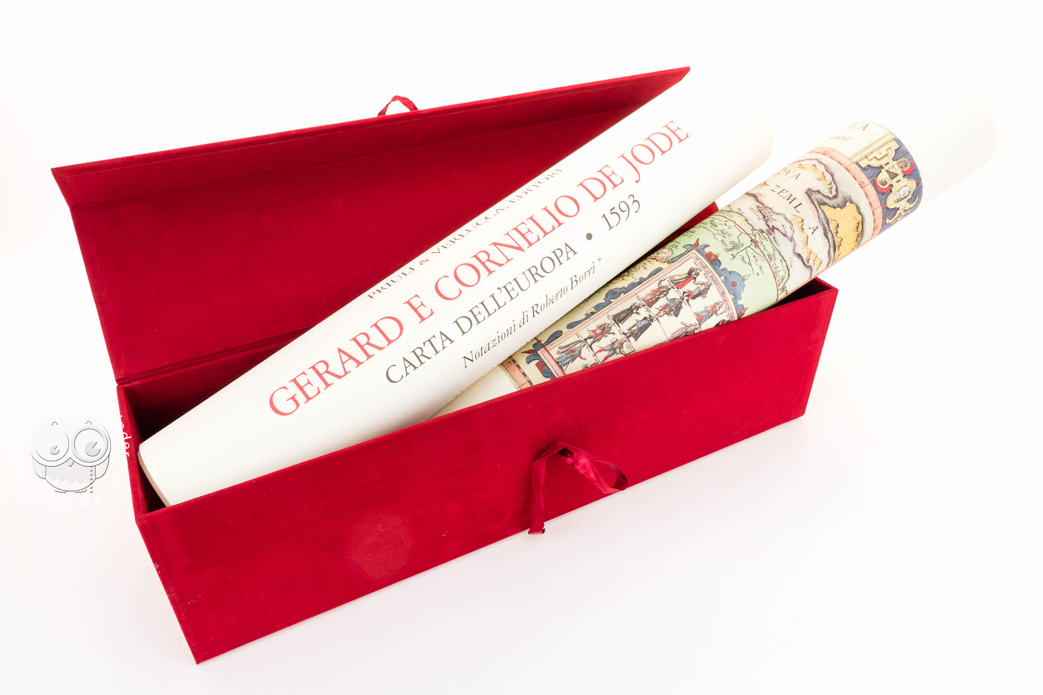
We have 1 facsimile edition of the manuscript "Nova Totius Europae Tabula": Carta dell'Europa di Gerard e Cornelio de Jode facsimile edition, published by Priuli & Verlucca, editori, 2004
Request Info / Price