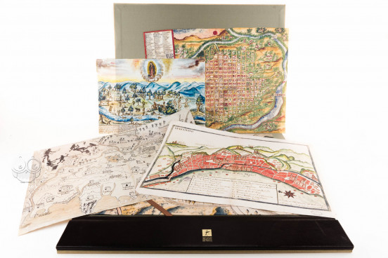
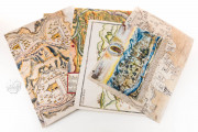
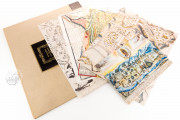
This is a collection of five manuscript maps of Mexico, ranging from the fifteenth to the eighteenth century, which are part of the cartographical collection of the General Archive of the Indies (Archivo General de Indias) in Seville, created by the Spanish monarch Charles III in 1785 to hold the documents concerning the history of the Spanish Empire in the New World. This selection of maps is a valuable example of the visual testimonies that were sent to Seville from the New World since the first years after the discovery to inform about the characteristics of the newly known territories, as well as to request permissions for the establishment of new settlements.
These five hand-painted maps represent different Mexican places: Tetela de Ocampo (1581), Antequera (1771), Jalisco (1550), Guanajato (eighteenth century) and Salto de Agua (1795). The collection is a very interesting source for studying the history of Mexico and the relationship of Spain with its colonies from the fifteenth to the eighteenth century. They are particularly interesting as they are local maps, showing details of topography and settlement.
Visual Testimonies of Mexican History
These maps are made on paper and have different sizes. They present a high quality of execution and an interesting geographical variety; the selection is formed by the following maps:
Map of Tetela de Ocampo
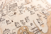
This map, with the shelfmark M.P. Mexico, 31, is dated 1581, and measures 44.3 x 70.3 cm. It was ordered by the magistrate Cristóbal Godínez de Maldonado, and depicts the town of Tetela de Ocampo in Puebla.
Each town of the surrounding area is marked by a large building with a cross that represents the church of the town. We can also see some rivers and roads, which are filled with people walking and mules carrying the merchandise.
Plan of Antequera (Oaxaca de Juárez)
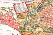
This map was made in 1771 and measures 41 x 30.2 cm. It represents the town of Antequera, in the Valley of Oaxaca. The town, with a typical Renaissance design, is surrounded by the river.
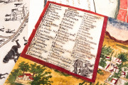
The ecclesiastical buildings are prominent, and are indicated with uppercase letters, from A to U. The main elements of the town, such as schools, bridges, customs, and the tobacco factory, are also depicted. The map has the shelfmark Mexico, 543.
Map of New Galicia
Finished on 8 January 1550, this is one of the oldest maps of the city of Guadalajara and the surrounding areas. It measures 43.7 x 31.5 cm., and is held under the shelfmark M.P. Mexico, 560. The map includes the main buildings in the town, as well as the important mines in the area.
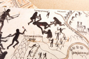
In the upper part of the map, the indigenous peoples are represented as having black skin, naked, and armed with bows and arrows. In the upper left corner, the natives are depicted in a larger scale, making human sacrifices.
Plan of Guanajuato
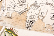
This eighteenth-century schematic plan of Guanajuato is held under the shelfmark M.P. Mexico 601, and measures 39.7 x 31 cm. A compass rose at the lower right of the map indicates north, and the mountains are prominently depicted. In the town, the ecclesiastic buildings are prominent, and a large cartouche identifies various locations on the map.
Panoramic View of the Town of Salto de Agua
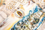
This document has the shelfmark M.P. Guatemala 271 bis, and measures 31.2 x 21.5 cm. It represents the foundation of San Fernando de Guadalupe (known today as Salto de Agua) by Agustín de las Cuentas Zayas in 1794-95.
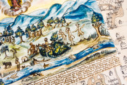
At the bottom of the scene, an arrow indicates the direction of the current of the river, and several ships are depicted, as well as a small dock. At the right of the scene, the mayor and two collaborators run the works, while some natives are cutting down trees, transporting wood, and fishing in the river. At the top of the scene, the Virgin of Guadalupe is prominently drawn.
The General Archive of the Indies. A Fundamental Institution for the History of America
In 1785, the monarch Charles III created a new institution that would hold the documentation related to the New World: the General Archive of the Indies in Seville. It was the first modern archive created not with an administrative aim, but for holding information for historians and researchers, and still holds the most important collection of documents for the History of the Americas.
Among the thousands of bundles that were sent to the archive throughout the centuries were a huge number of maps, plans, and drawings, which were added to the Section of Maps and Plans, created in the late nineteenth century.
Given their valuable information and high quality, these five maps from that Section are an interesting example of the importance of the cartographic heritage held in the Archive of the Indies, as well as a fundamental visual testimony of Mexico in the early modern period.
We have 1 facsimile edition of the manuscript "Mapas de México en el Archivo de Indias (Collection)": Mapas de México en el Archivo de Indias facsimile edition, published by Testimonio Compañía Editorial, 2002
Request Info / Price
