
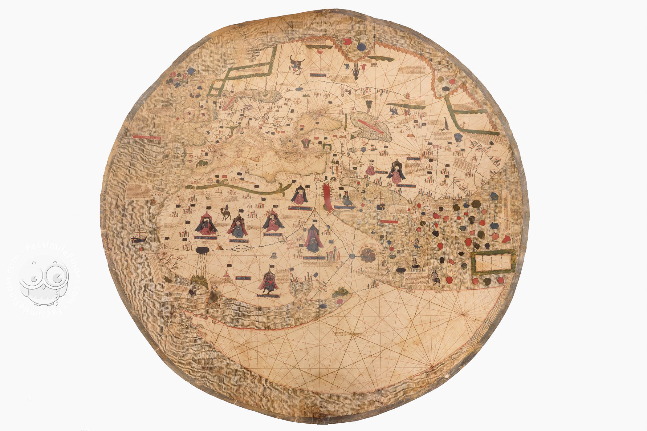
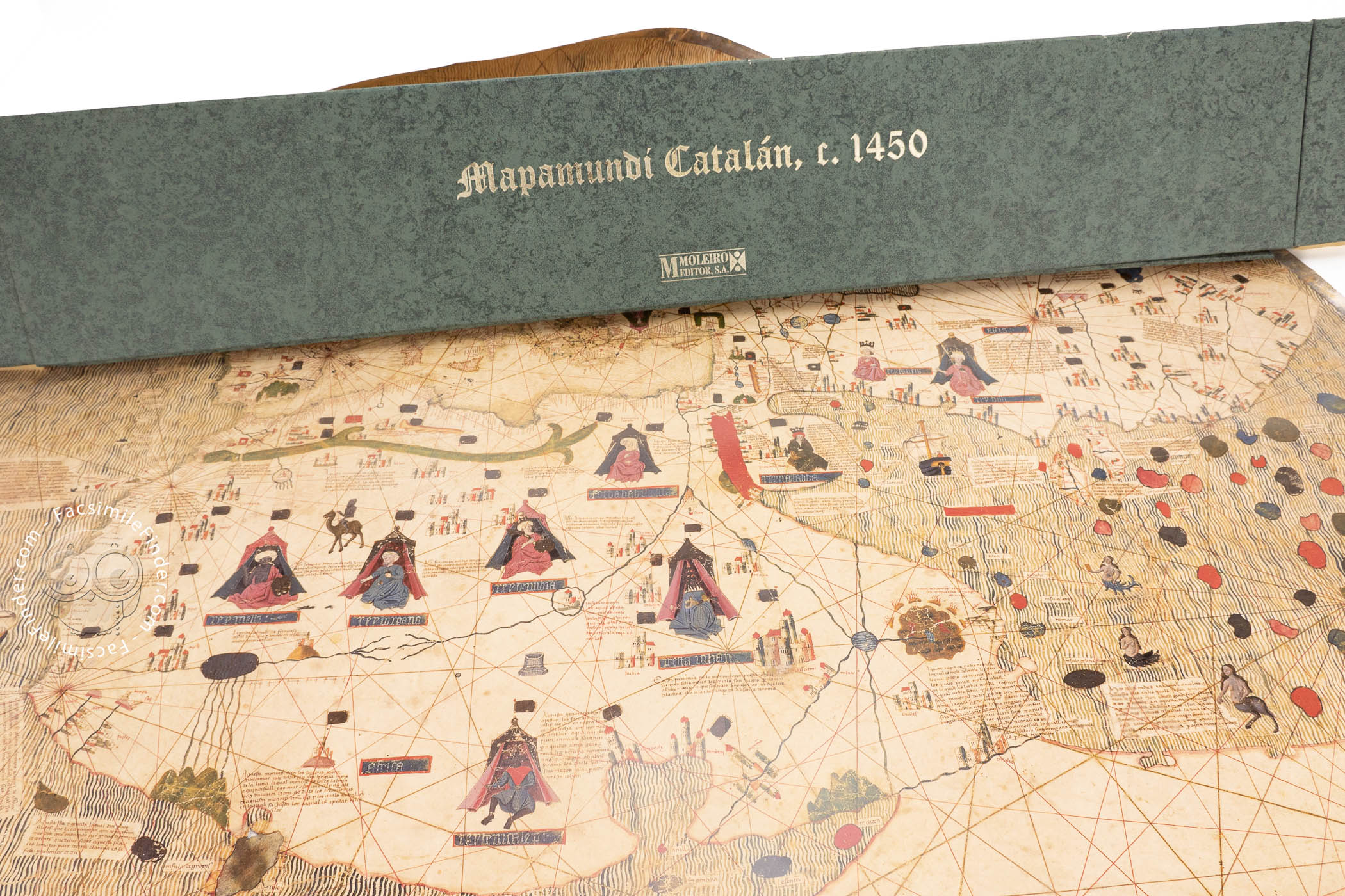
This anonymous manuscript map, created in the mid-fifteenth century, is a very interesting document for understanding the transition between medieval and early modern cartography. It links the tradition of medieval mappaemundi (world maps) with the typically early modern portolan charts, with their accurate coastlines, rhumb lines, and representative details. Its circular outline contains abundant graphic information, showing how the world was known a few decades before Columbus’s voyages to the New World.
Given that its features are coincident with the tradition of the Catalan school of cartography, this map has been also known as the Catalan-Estense world map. The geographical information shares space with mythical and religious references, showing a coexistence between myth and reality, which is an important characteristic of medieval and early modern geography.
Between Tradition and Innovation
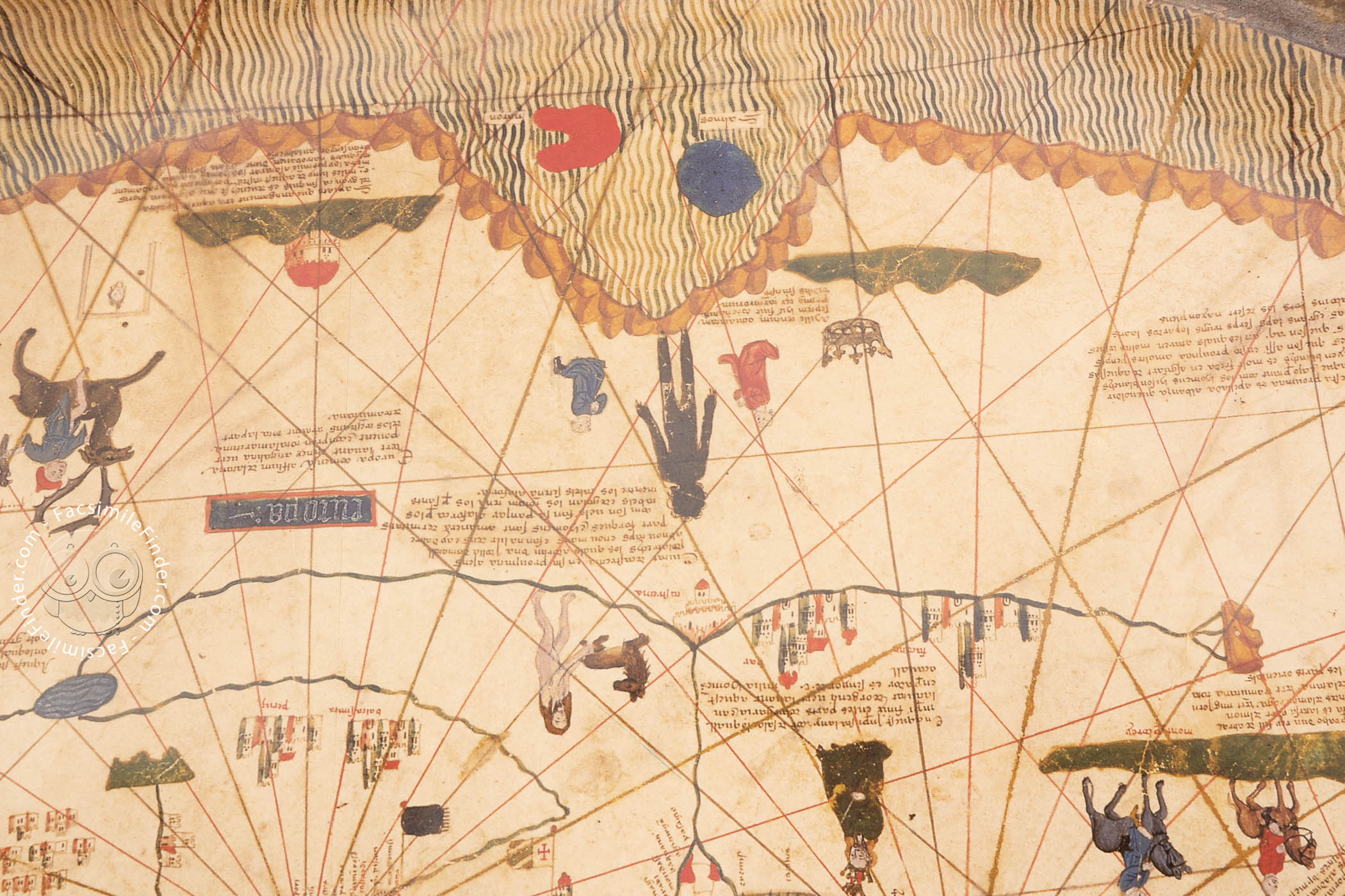
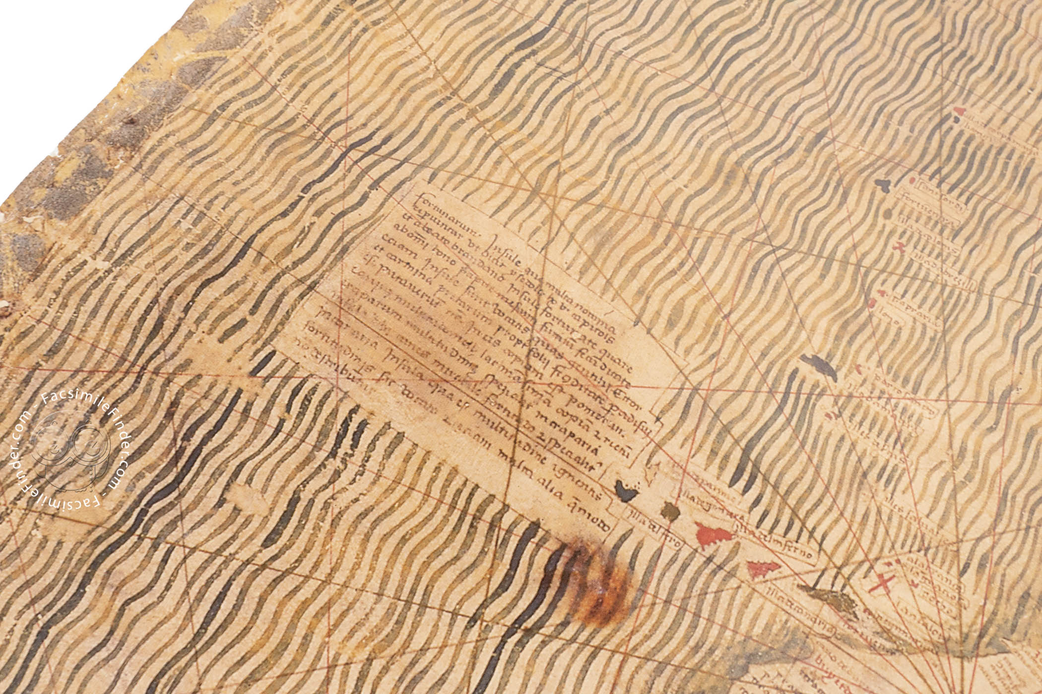
This circular map is made on parchment and measures 113 cm in diameter. Oriented to the north, it depicts a world surrounded by a great ocean, decorated with green wavy lines. Both textual and graphic information are abundant on the map.
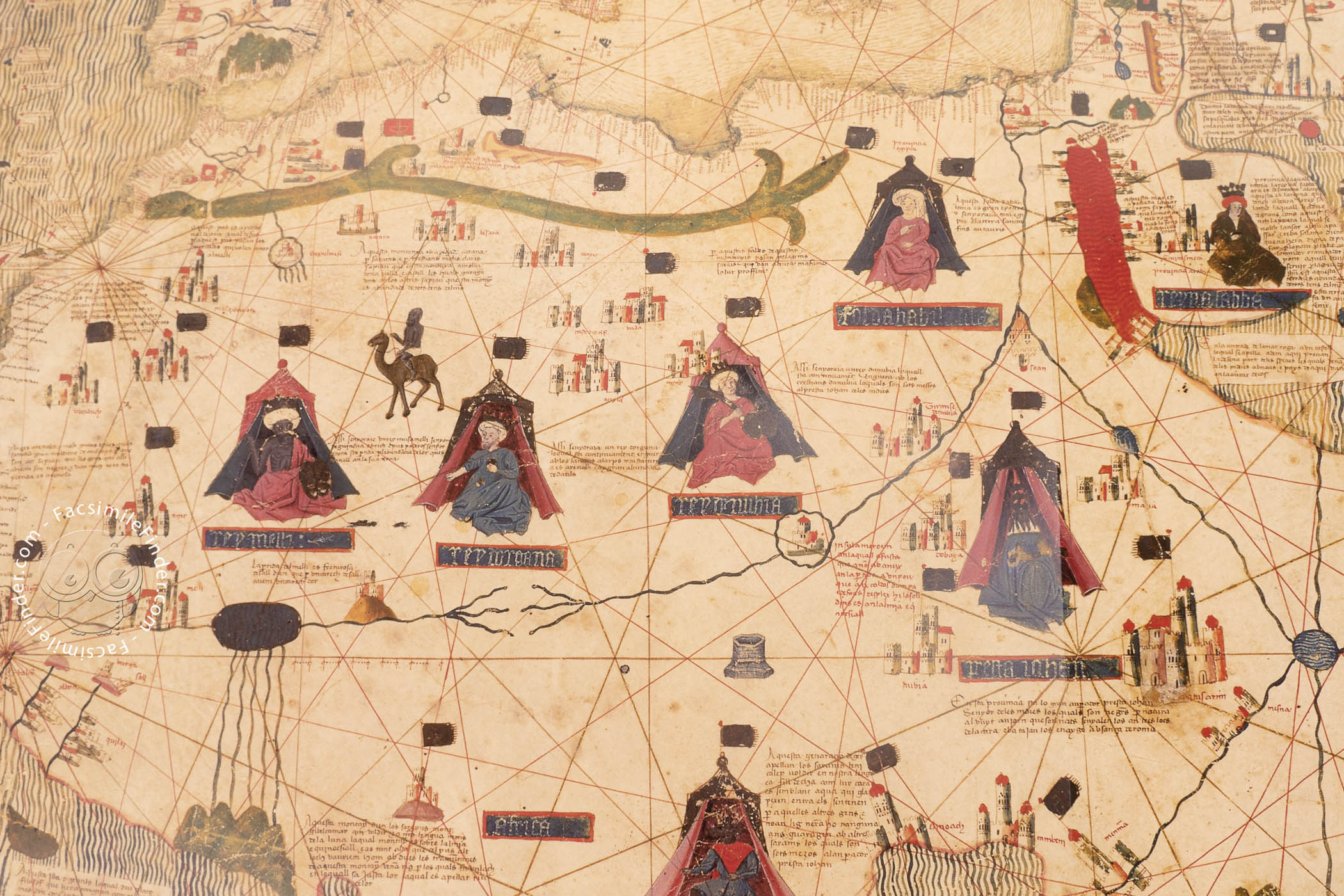
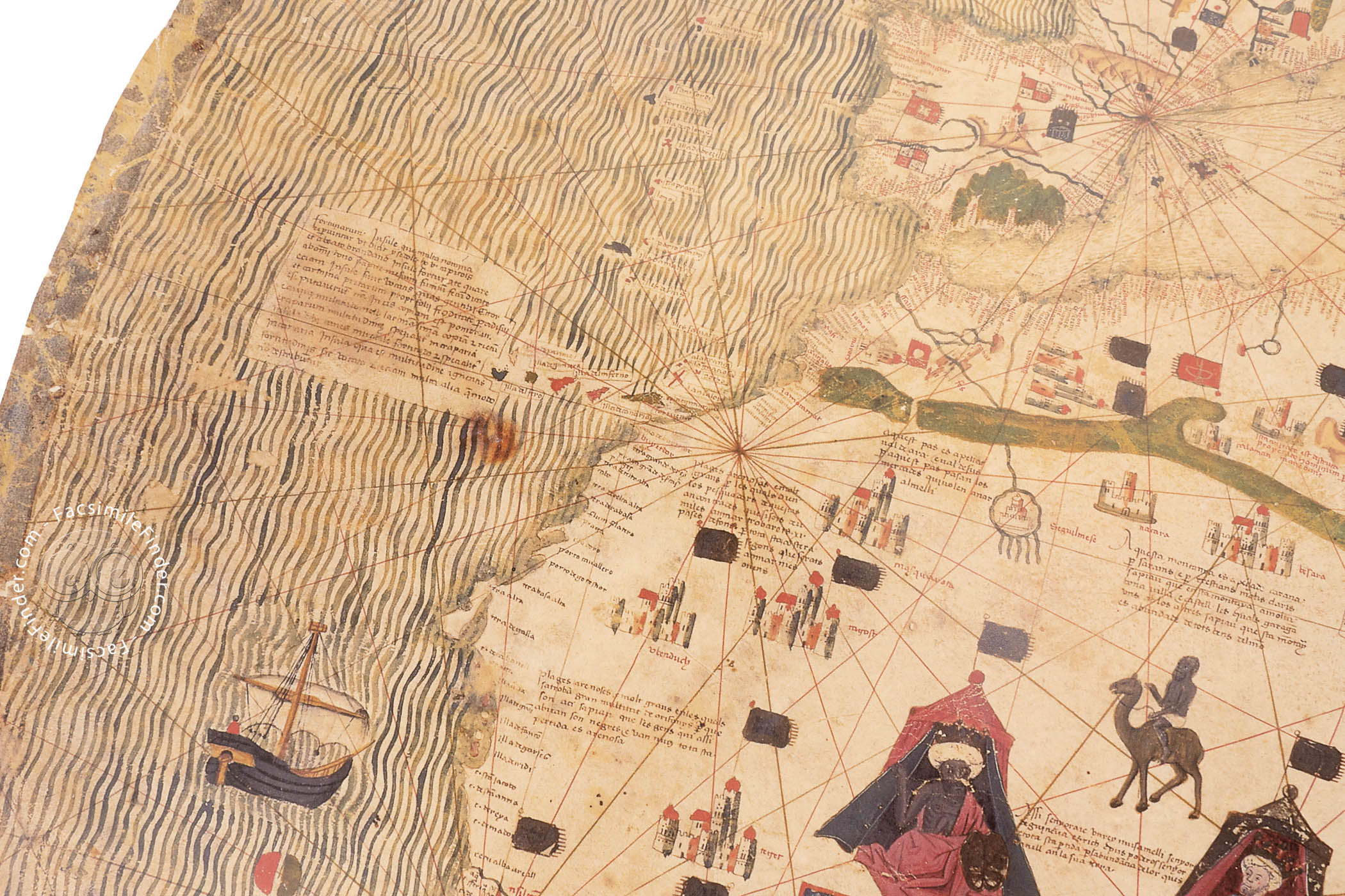
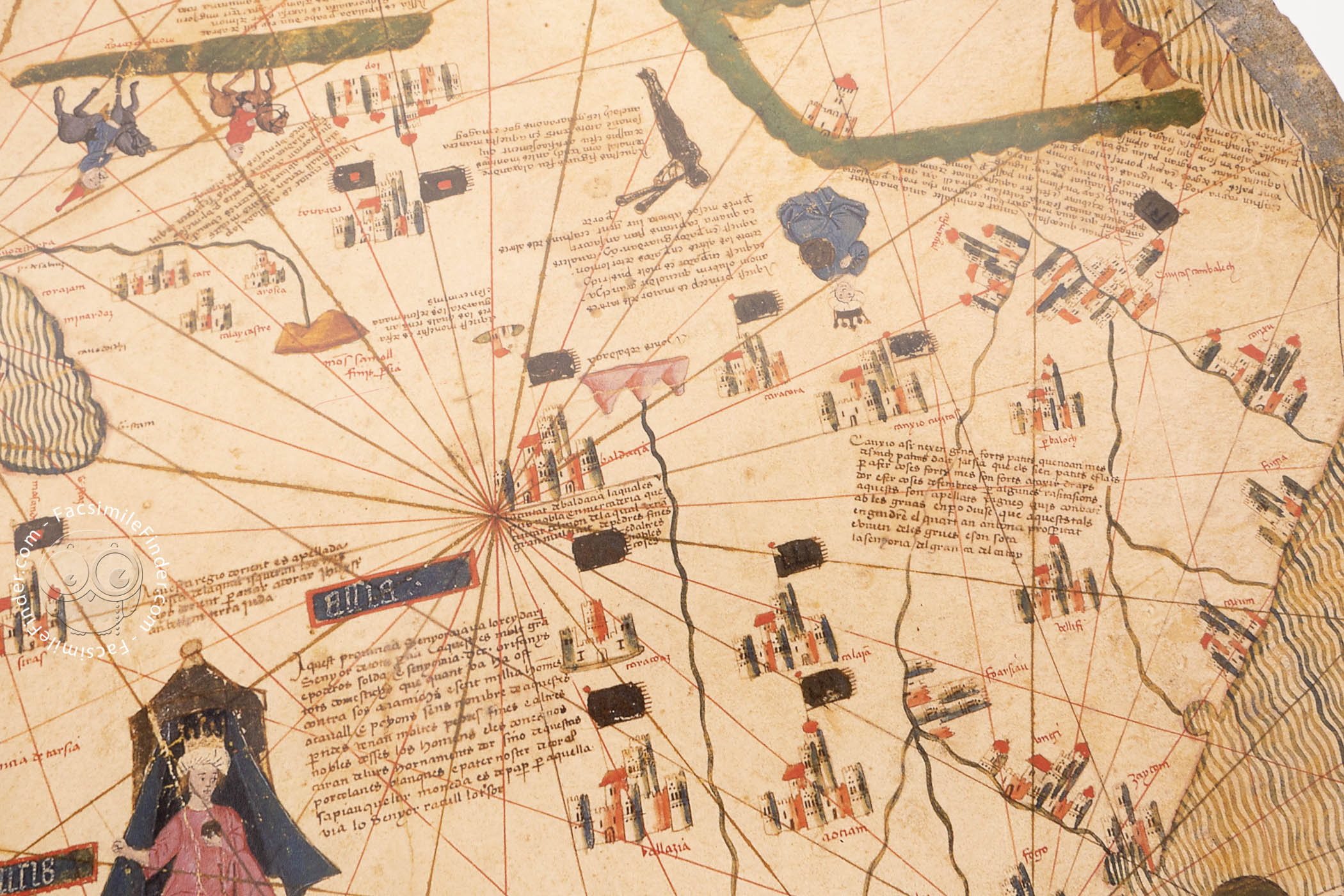
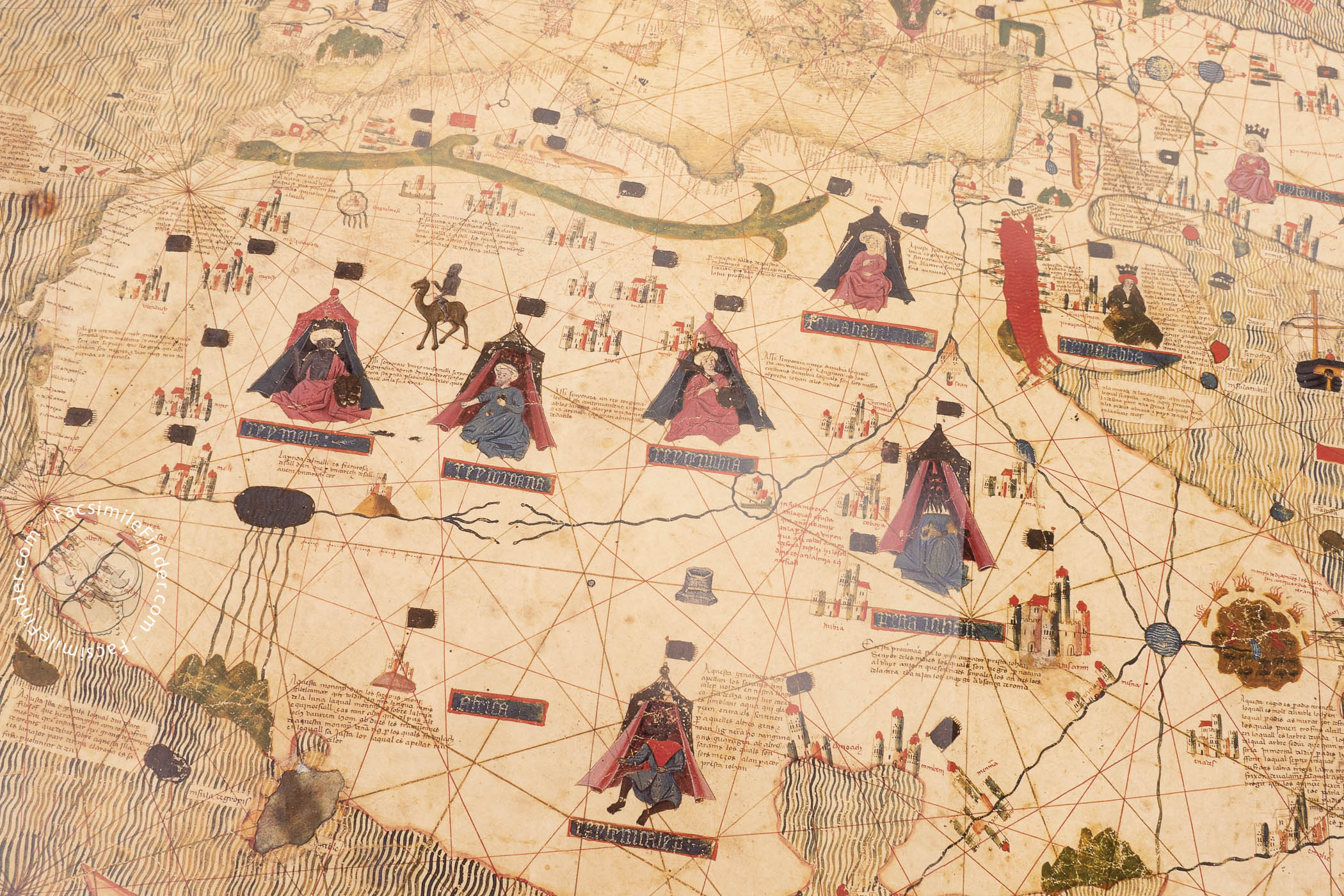
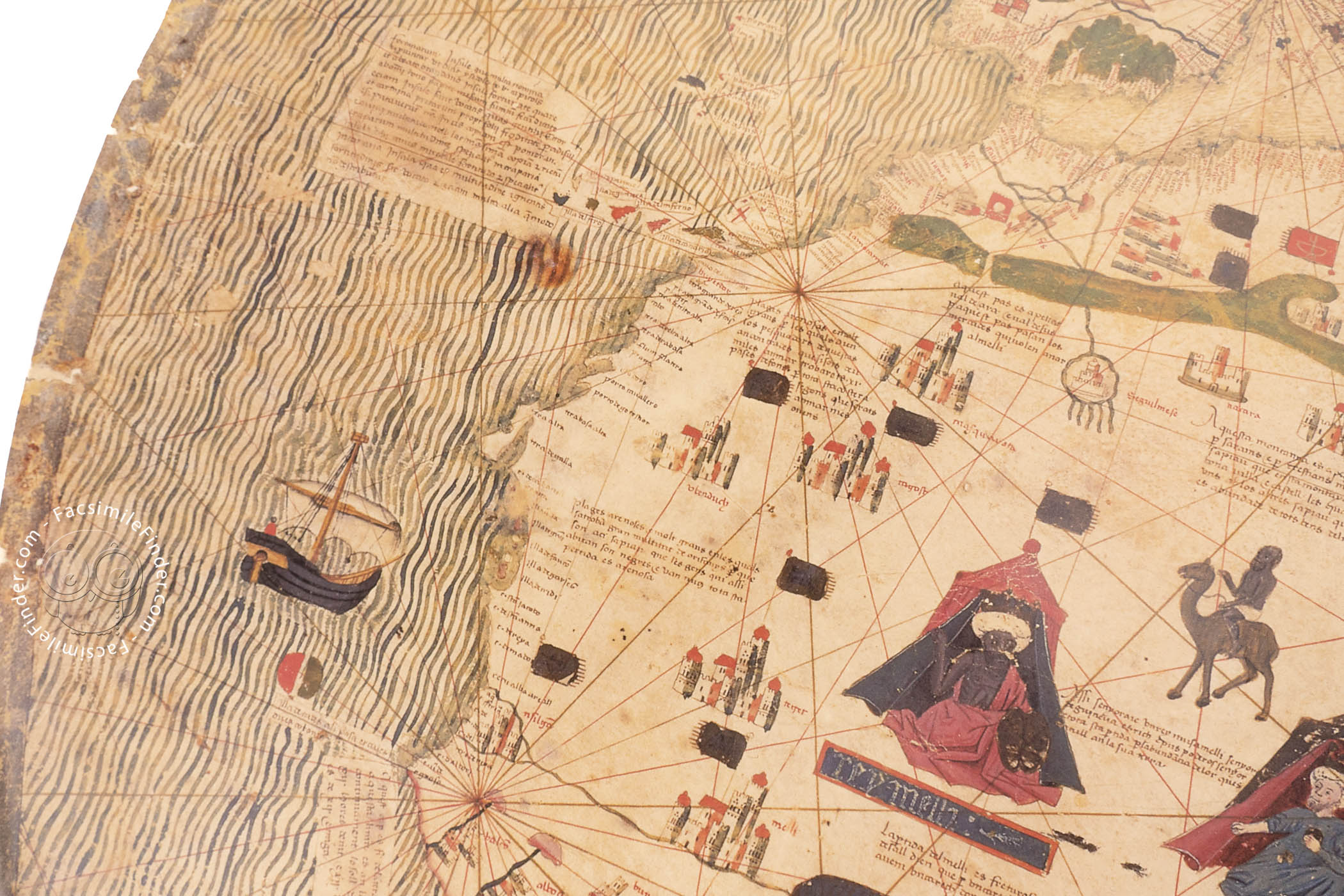
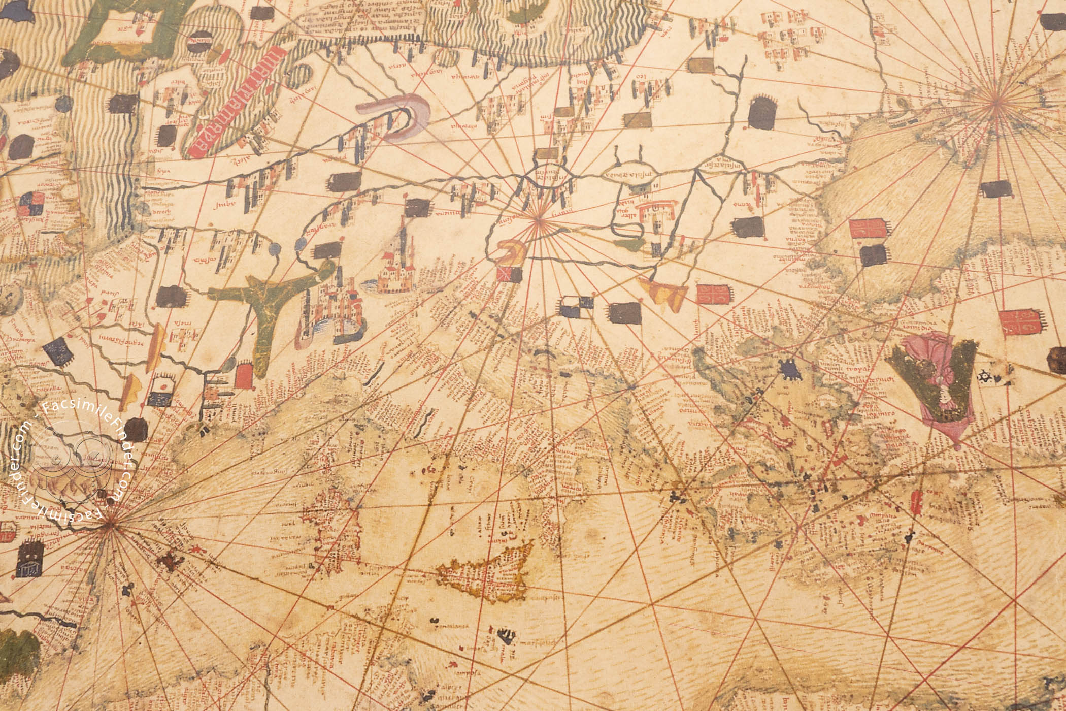
A great number of cities, flags, banners, and coats of arms are present all over the map, indicating the sovereignty of particular places. Following the tradition of early modern nautical charts, the coastlines are accurately depicted, with abundant place names and rhumb lines.
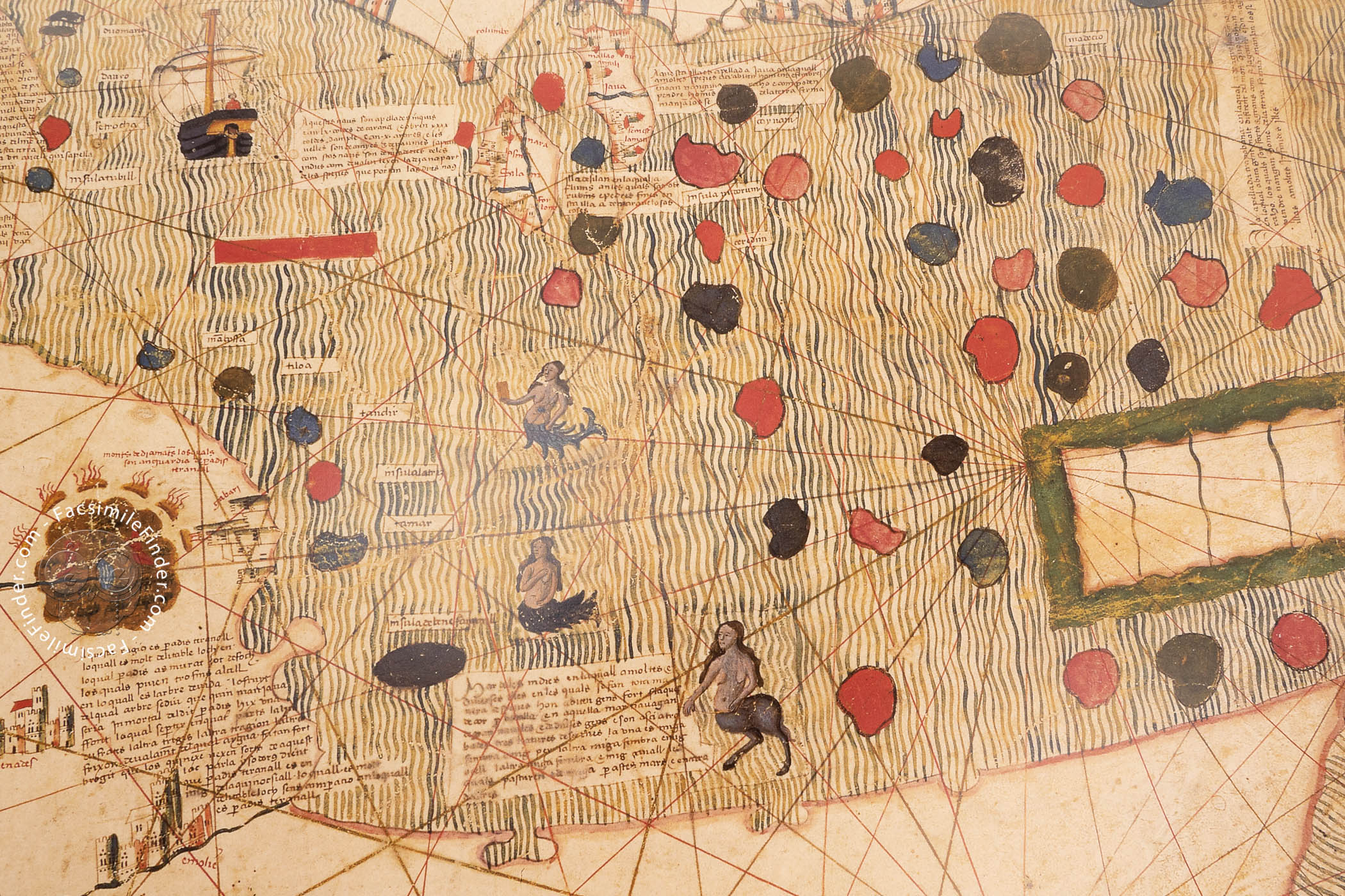
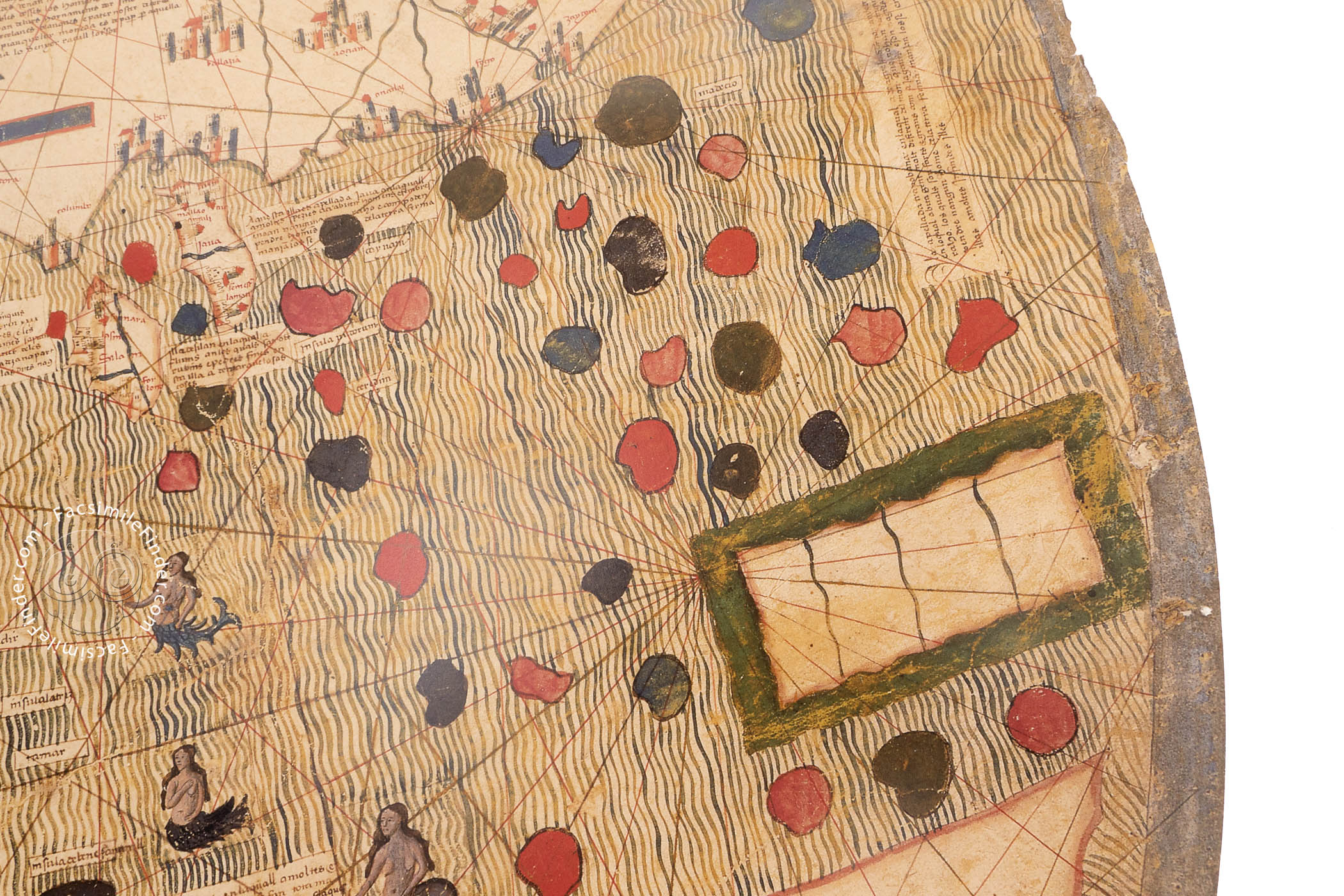
Interestingly, the place names are abundant in Europe and northern Africa, but there are many fewer in southern Africa and Asia. Thus, many of the coastal place names are restricted to the area covered by traditional nautical charts.
Nevertheless, this typically fifteenth-century cartographic representation is depicted in a highly traditional way, i.e. medieval mappaemundi. While the nautical charts of the time are usually focused on the Mediterranean and present a rectangular form, this map depicts the whole known world and is circular in shape, thus partaking of the medieval tradition of mappaemundi.
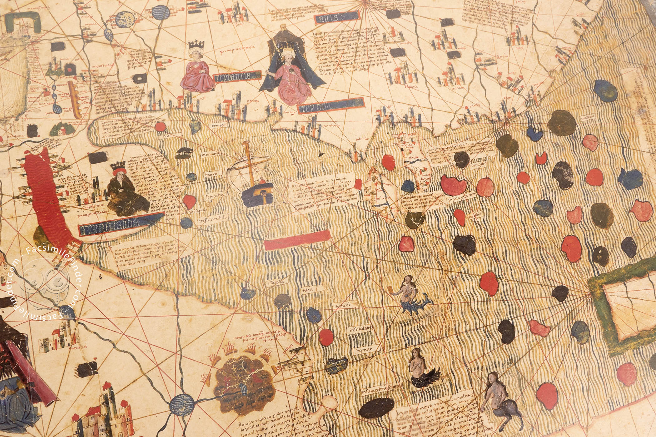
In this map, the portrayal of Africa is especially remarkable. The continent is filled with cities, flags, topographical features, and numerous rulers. A large gulf penetrates into the continent from the west and almost reaches the Indian Ocean.
Moreover, an enormous landmass is depicted in the south, joined to the rest of the continent by this isthmus. The cartographer does not indicate the source of this landmass, thus it is difficult to determine if it represents southern Africa or an austral continent.
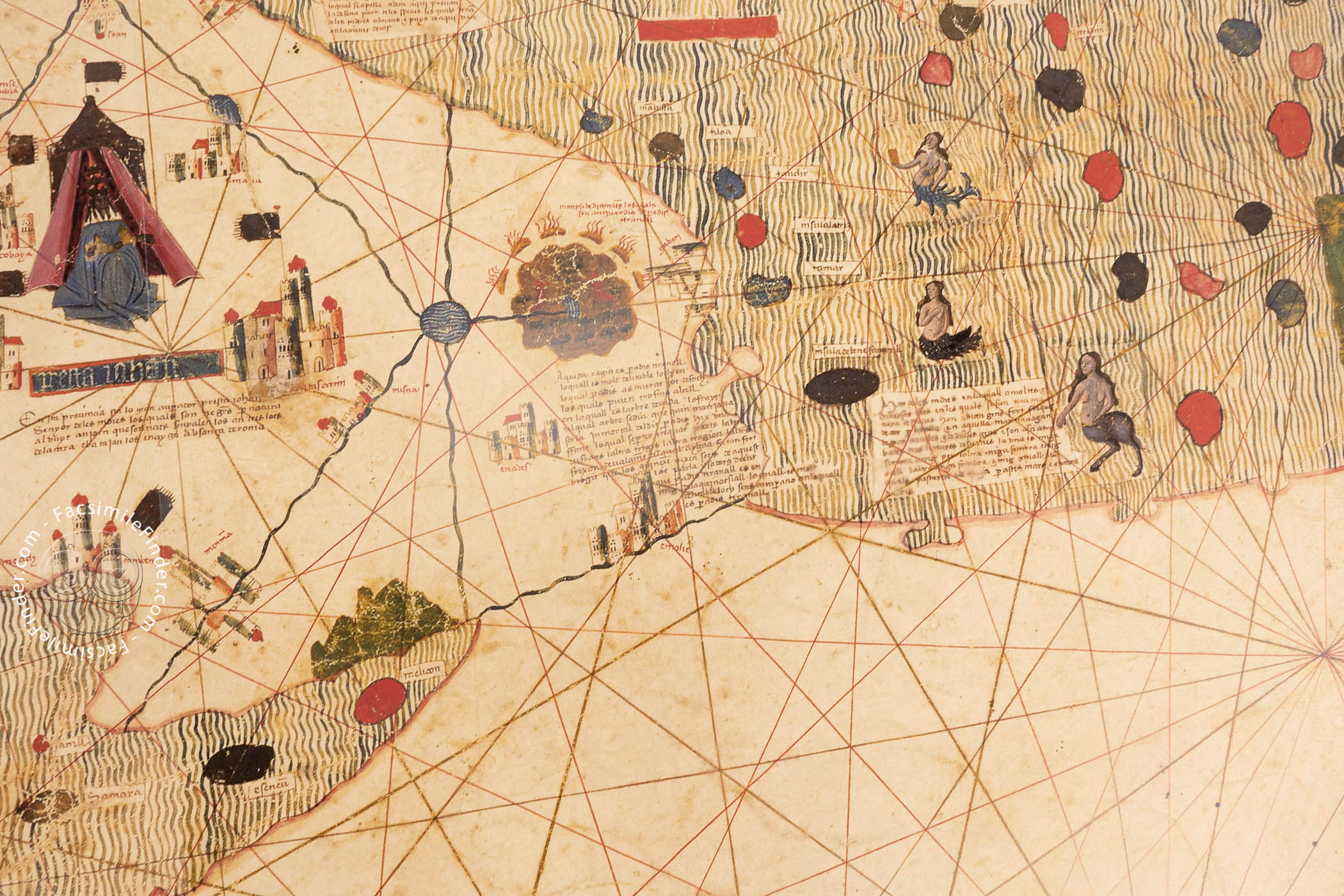
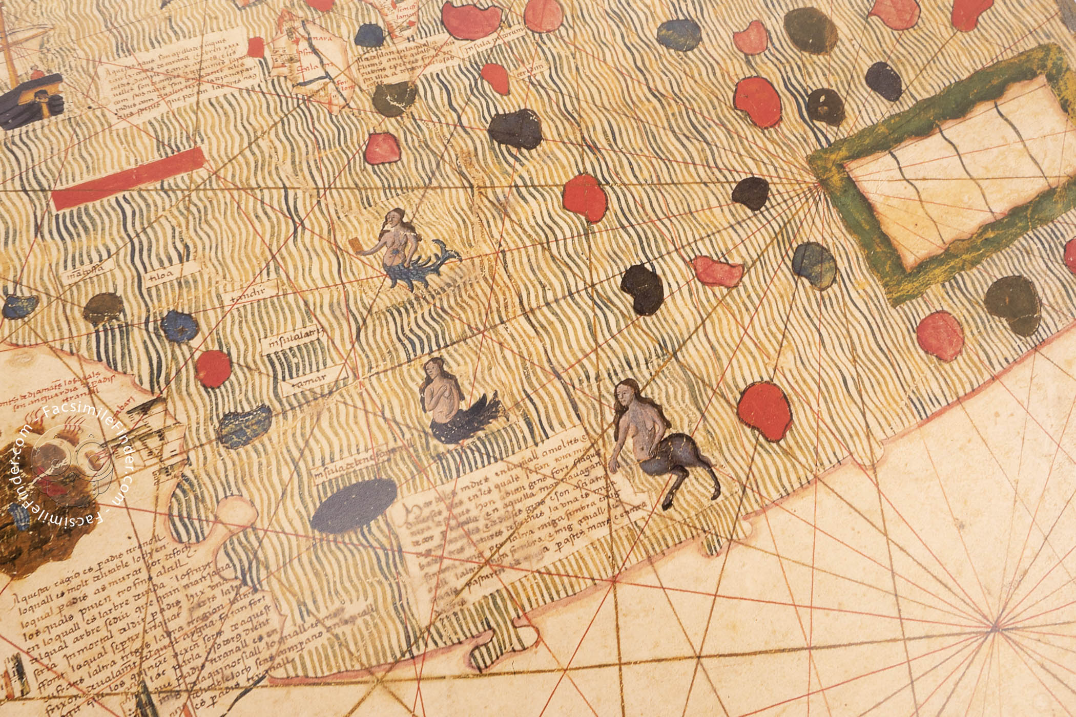
Several examples of the persistence of mythical tradition are visible in Africa. Thus, one of the rulers drawn in the continent is the well-known Prester John, a legendary Christian king who ruled a utopic land near Ethiopia.
On the other hand, a ruler with a dog's head is portrayed in the south, alluding to the mythical cynocephali, dog-headed peoples described by late classical and medieval writers.
Interestingly, at the eastern edge of Africa, there is a circular garden surrounded by fire, accompanied by a text indicating that this is the Terrestrial Paradise.
It is not usual that Paradise is depicted in eastern Africa; this detail is very curious and interesting and shows again the coexistence between mythical Christian references and real geographical contexts.
The complexity of the Estense world map, as well as the link between medieval tradition and early modern innovations and the artistic richness of its illustrations, make it one of the most interesting maps of fifteenth-century southern Europe.
This map is housed in the Biblioteca Estense Universitaria in Modena under the shelfmark C.G.A.1.
An Unknown History
Very little is known about the provenance and history of the Estense World Map. The lack of signatures and dedications do not allow us to know its author or a specific date of creation. Nevertheless, it is commonly accepted that it was made in the mid-fifteenth century since it represents the Portuguese discoveries up to 1445.
The decorative apparatus of the map, as well as the accuracy in the representation and the resource of certain features, link the Estense map to the so-known Catalan-Majorcan school of cartography, one of the most renowned and outstanding traditions of early modern mapmaking.
Some of the masterpieces of fourteenth and fifteenth-century cartography, such as the famous Catalan Atlas by Abraham Cresques (1375) were created in this context, and are considered superlative works of art.
We have 1 facsimile edition of the manuscript "Estense World Map": Mapamundi Catalán facsimile edition, published by M. Moleiro Editor, 1996
Request Info / Price