


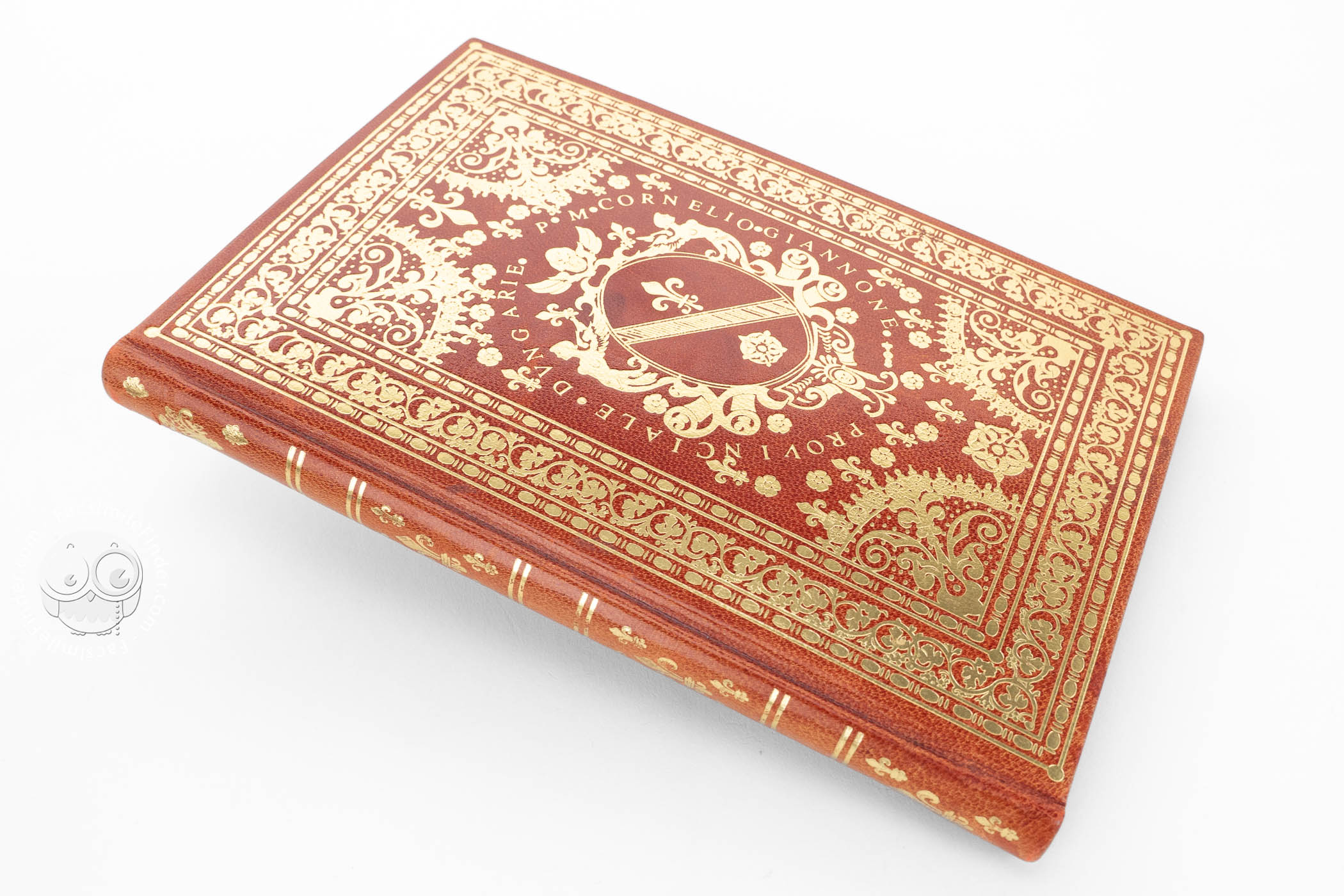


These two manuscript atlases are among the most superb works in sixteenth-century cartography. Made by the Genoese cartographer Battista Agnese (1514-1564), one of the best mapmakers of the sixteenth century, they are lavishly illuminated, and show the most recent geographical discoveries of the time. Linking the tradition of nautical charts, the cartographic innovations of the time, and opulent Renaissance decoration, the Atlas of Charles V and the Madrid Atlas by Battista Agnese are some of the best examples of early modern cartography and illumination.
The so-called Atlas of Charles V, held in the John Carter Brown Library in Providence, was commissioned by Charles V for the geographic instruction of his son, Prince Philip, who would later become the King Philip II of Spain. The other atlas, dated July 1, 1544, is held in the National Library in Madrid, and is one of the most important works in its collection.
Two Masterpieces of Cartography and Illumination
These atlases are considered as two milestones in the art of cartography. Given the importance of both works, it is worth it to talk about them separately.
Atlas of Charles V
Although it has been commonly accepted that this atlas was commissioned by Charles V to give it to his son Philip, the future King Philip II of Spain, modern researches developed by Margot McIlwain Nishimura have proposed that the patron was Martin of Aragon, Duke of Villahermosa.
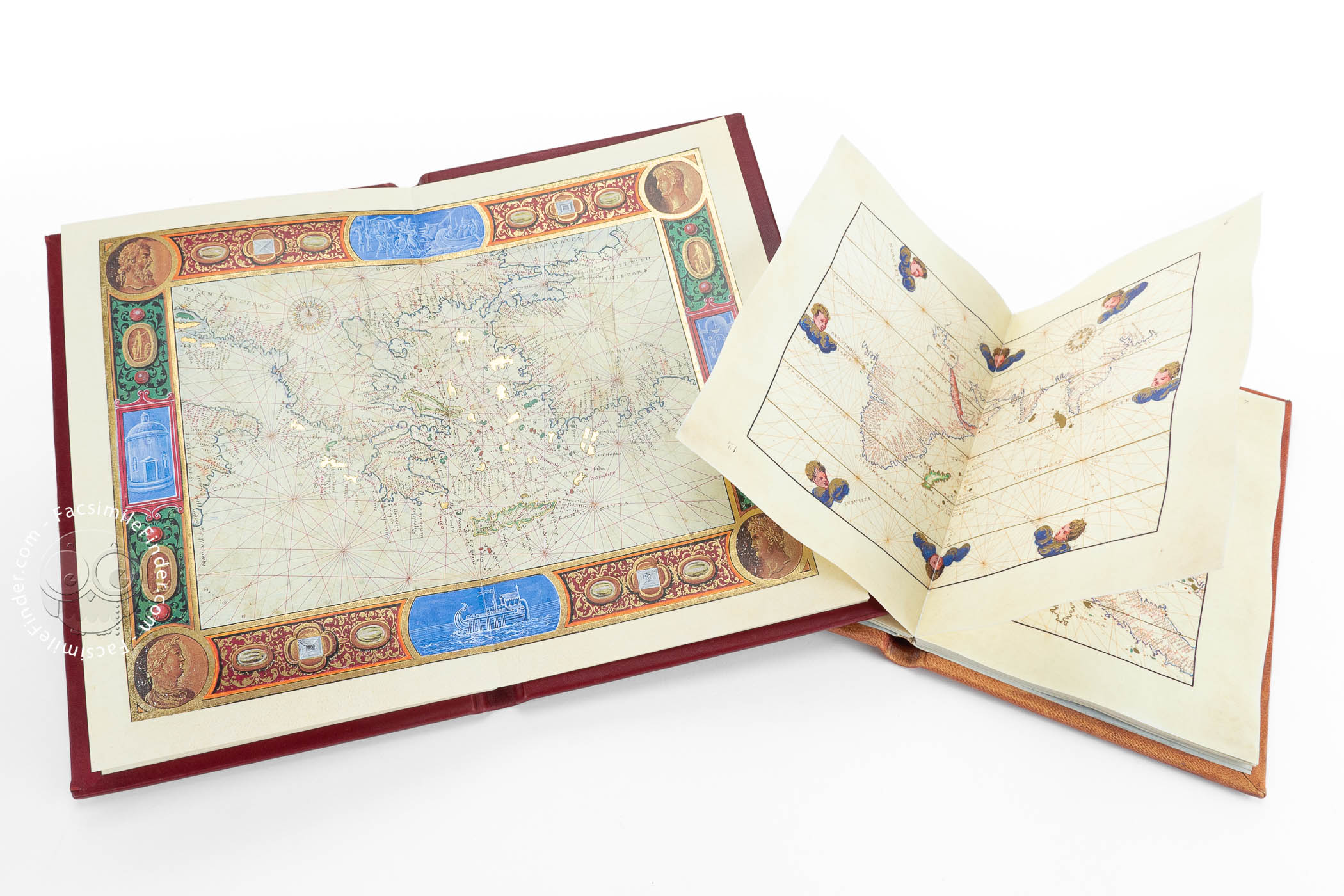
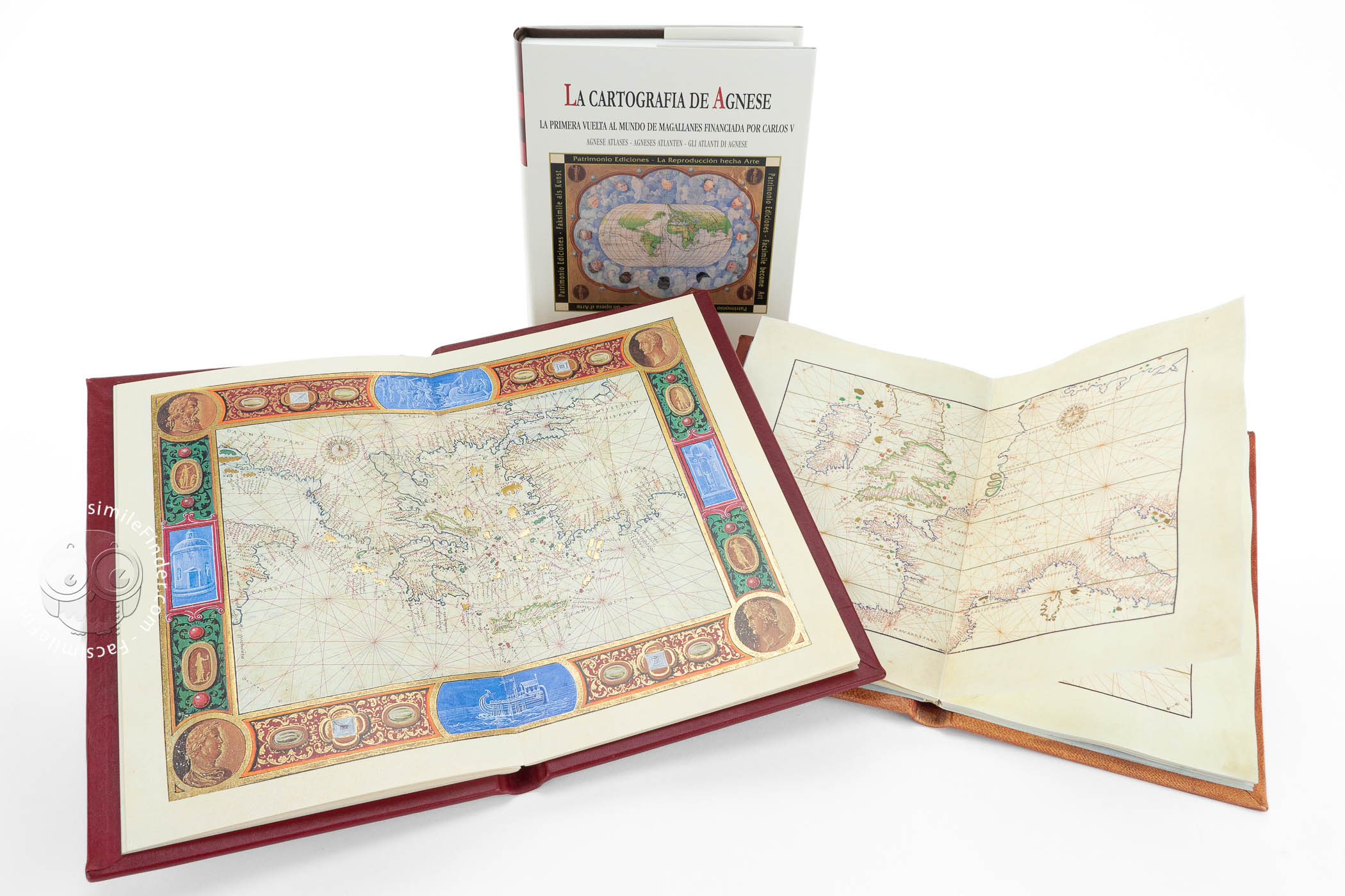
This atlas was made in Venice between 1543 and 1545. Made on vellum, it measures 27 × 34 cm, and is formed by eleven maps showing the whole world known at the time.
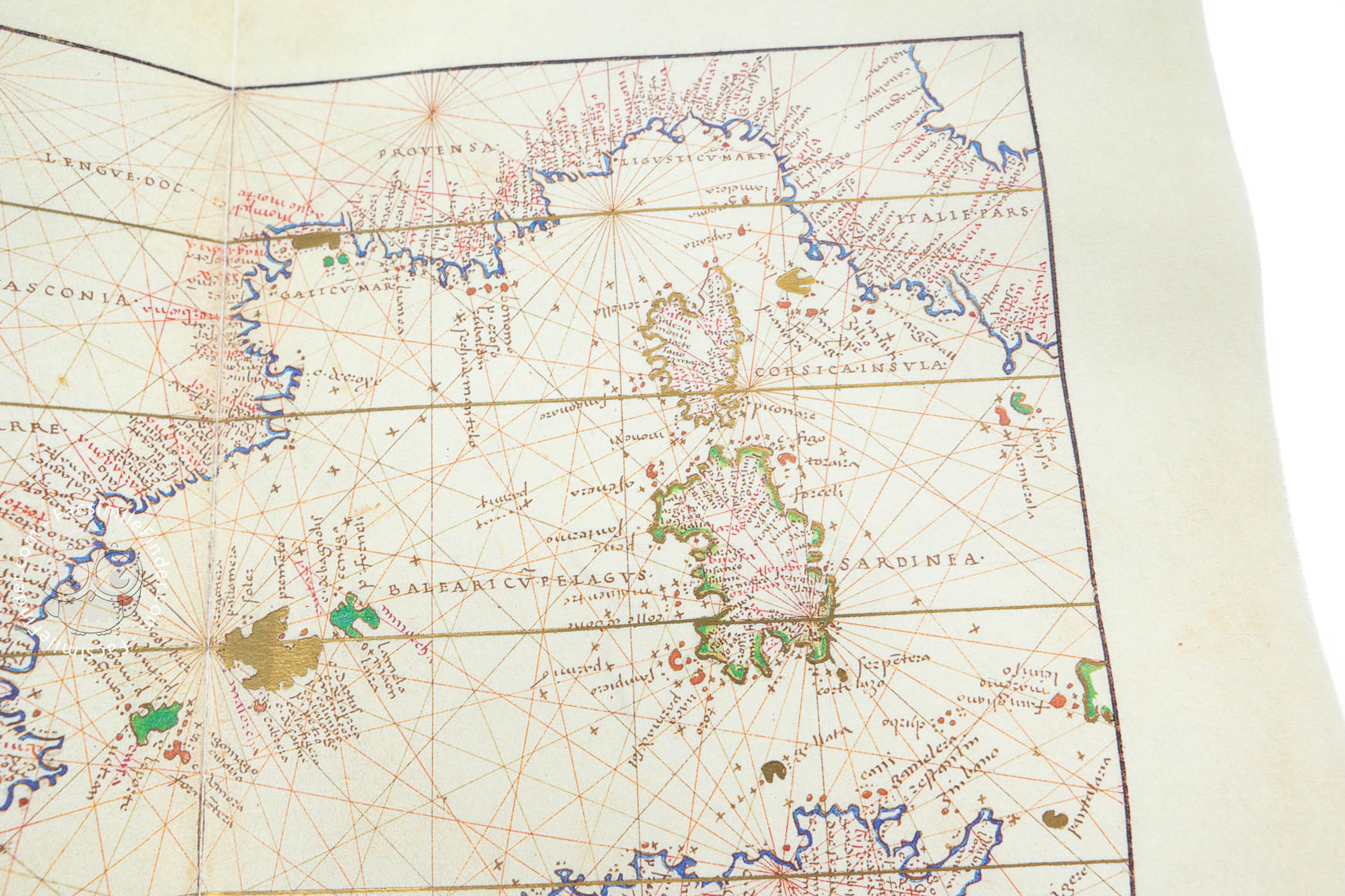
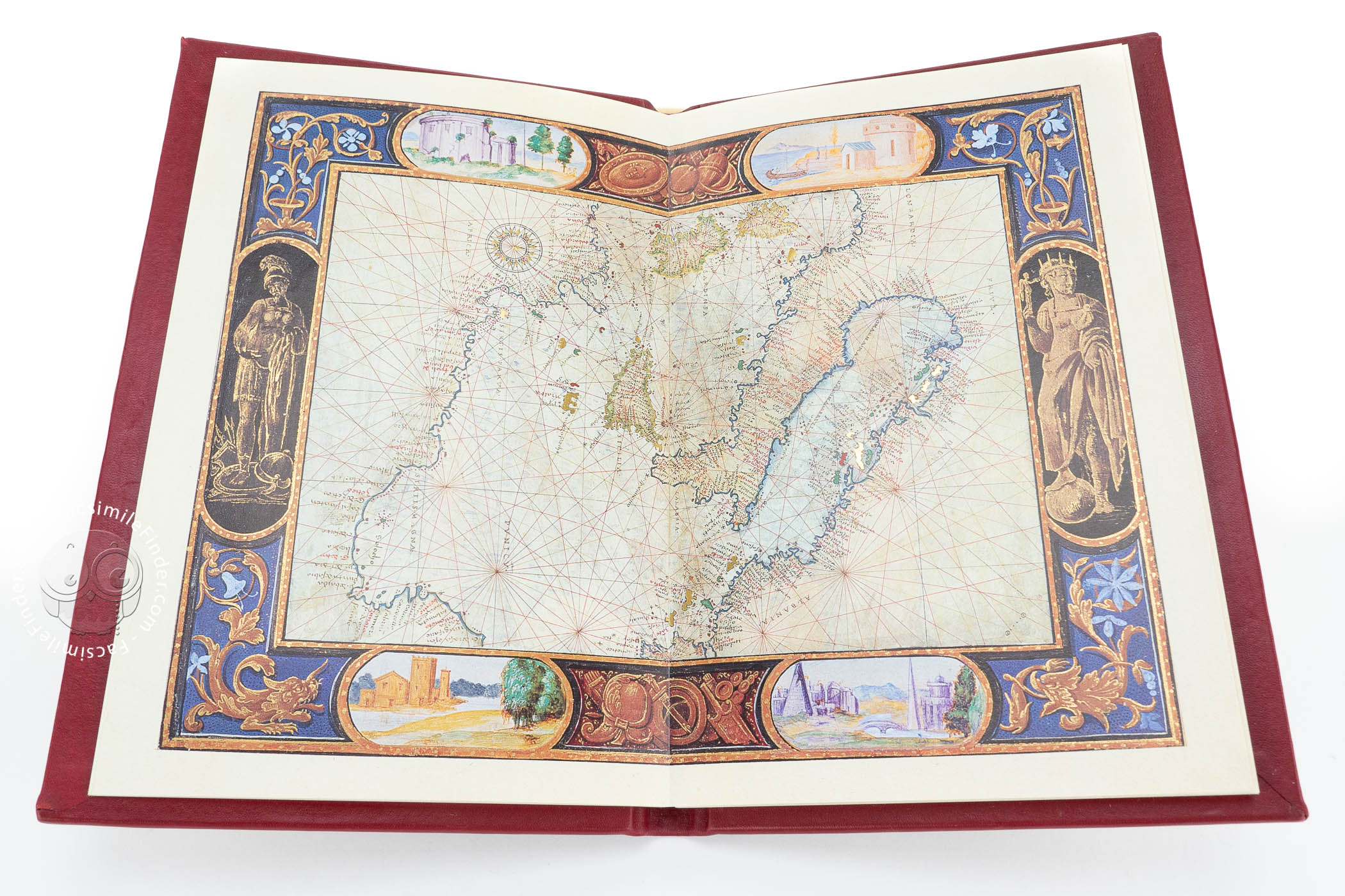
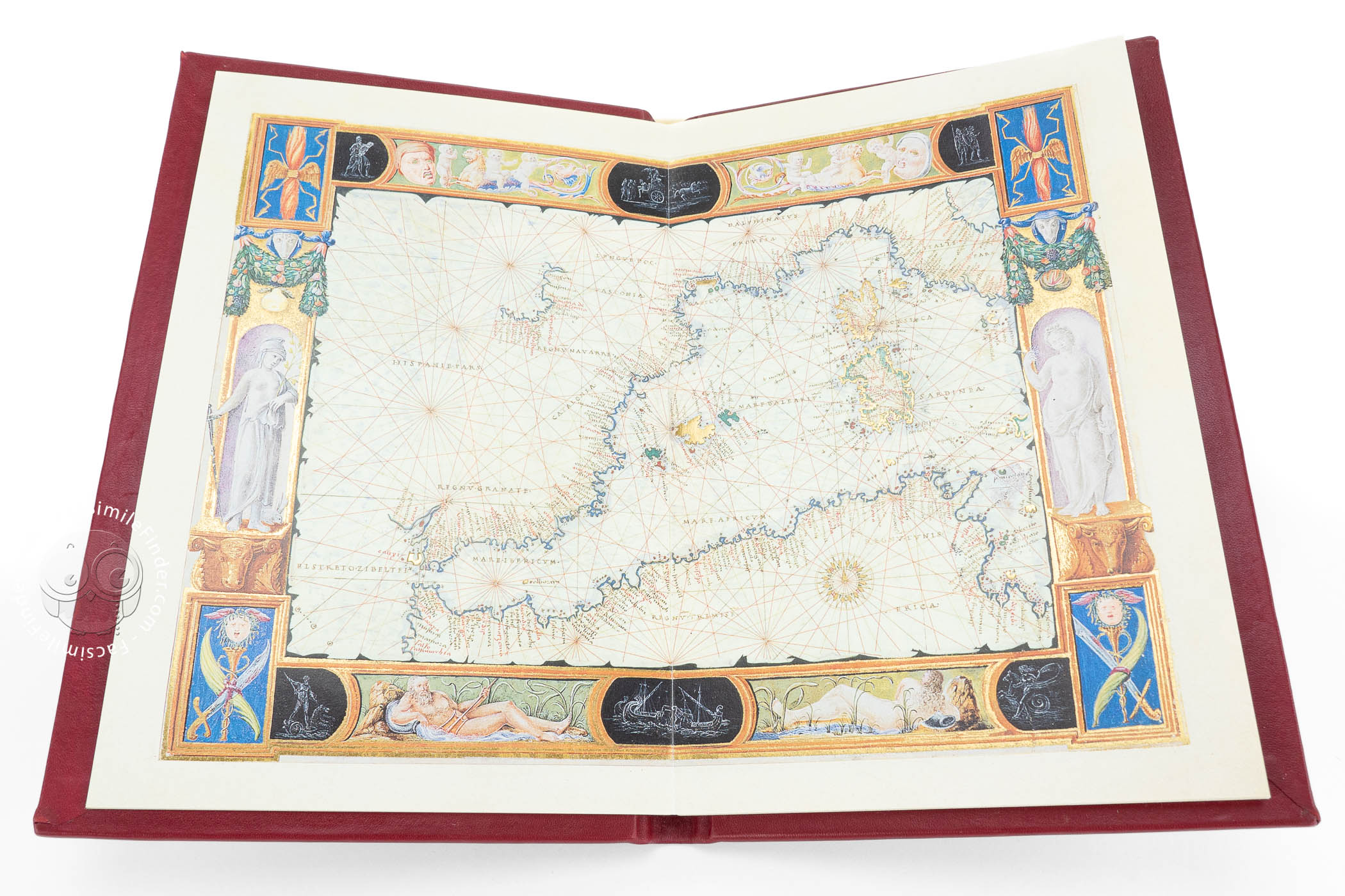
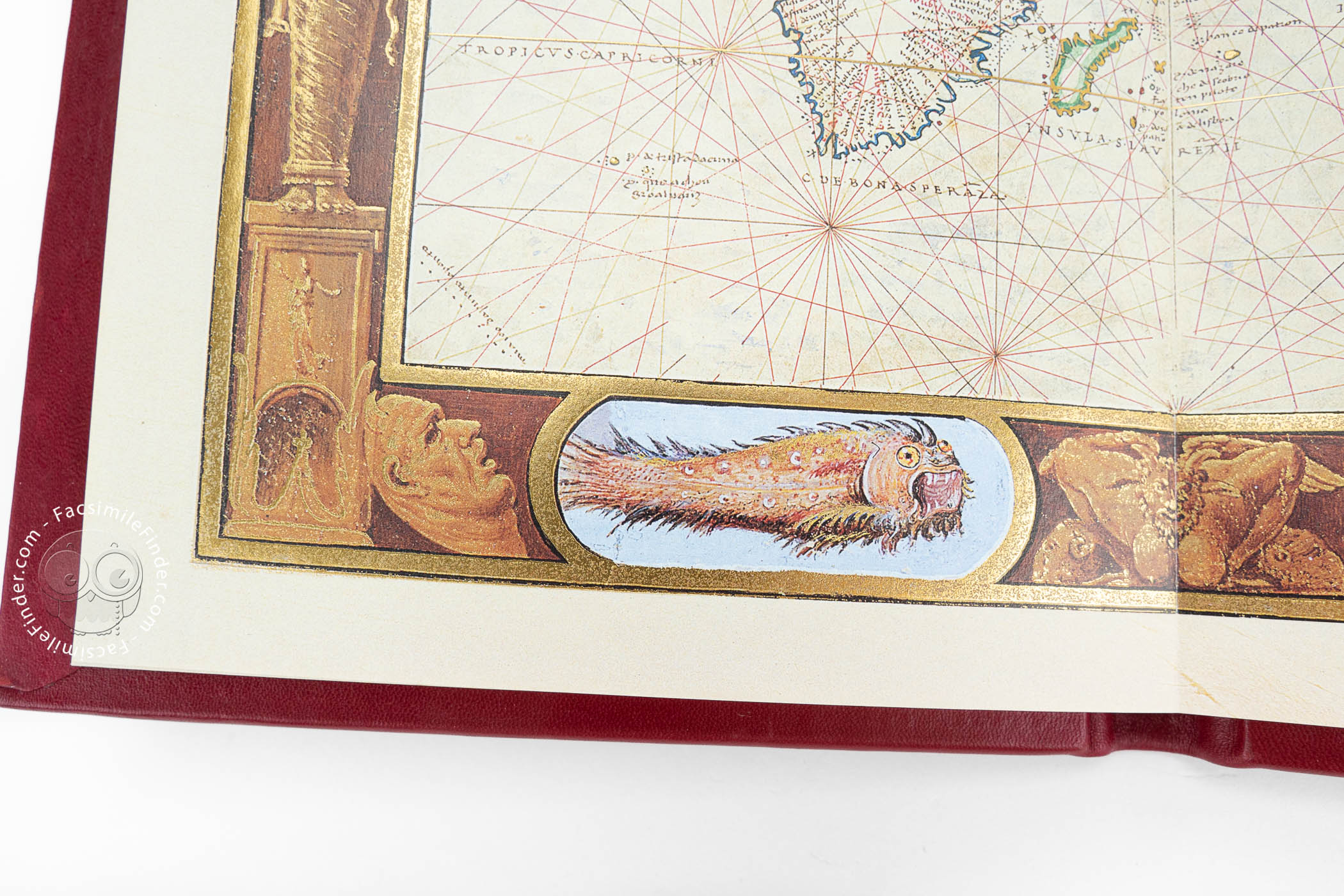
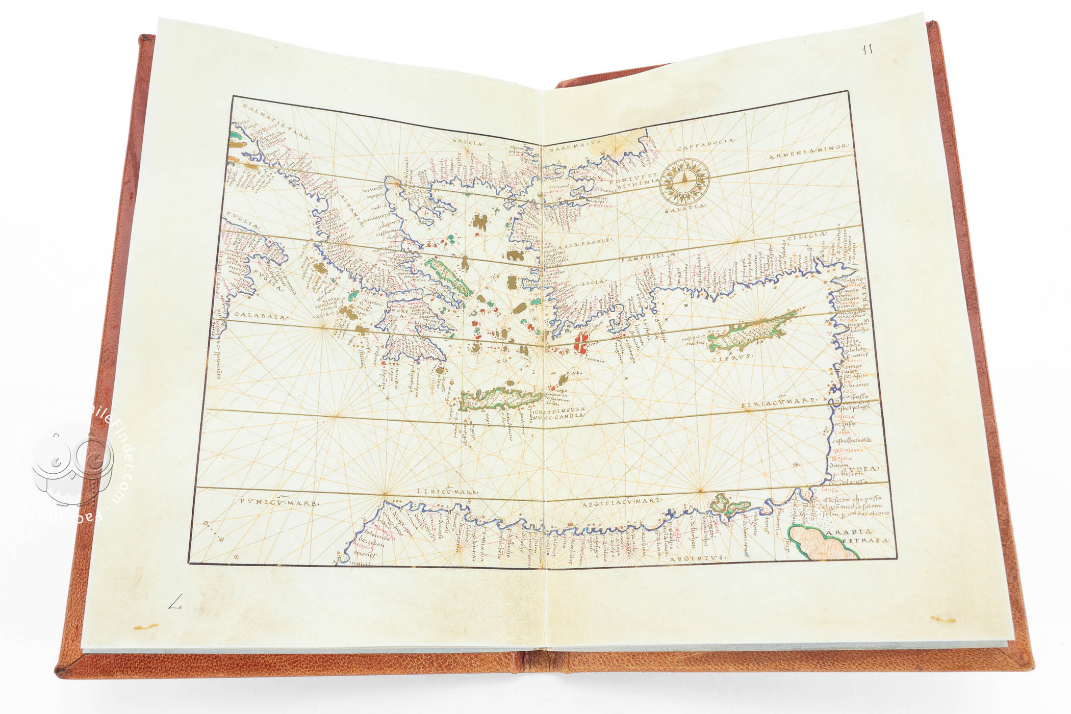
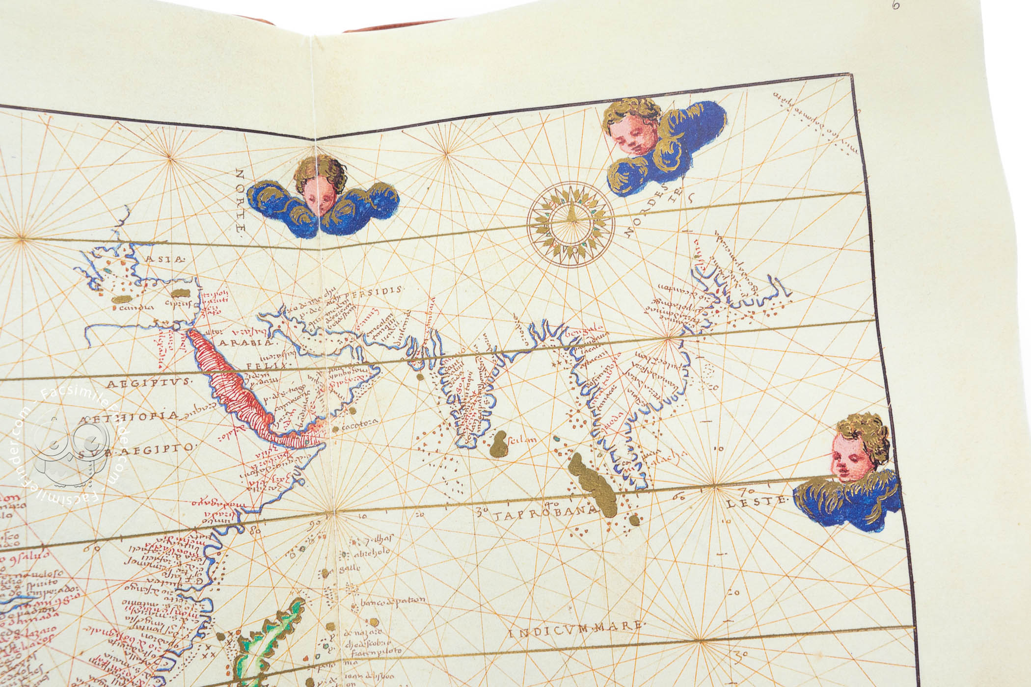
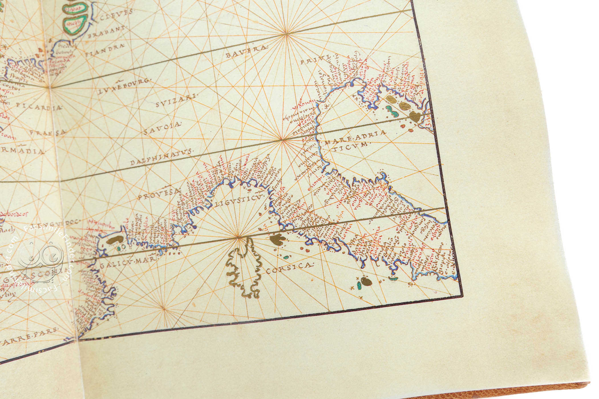
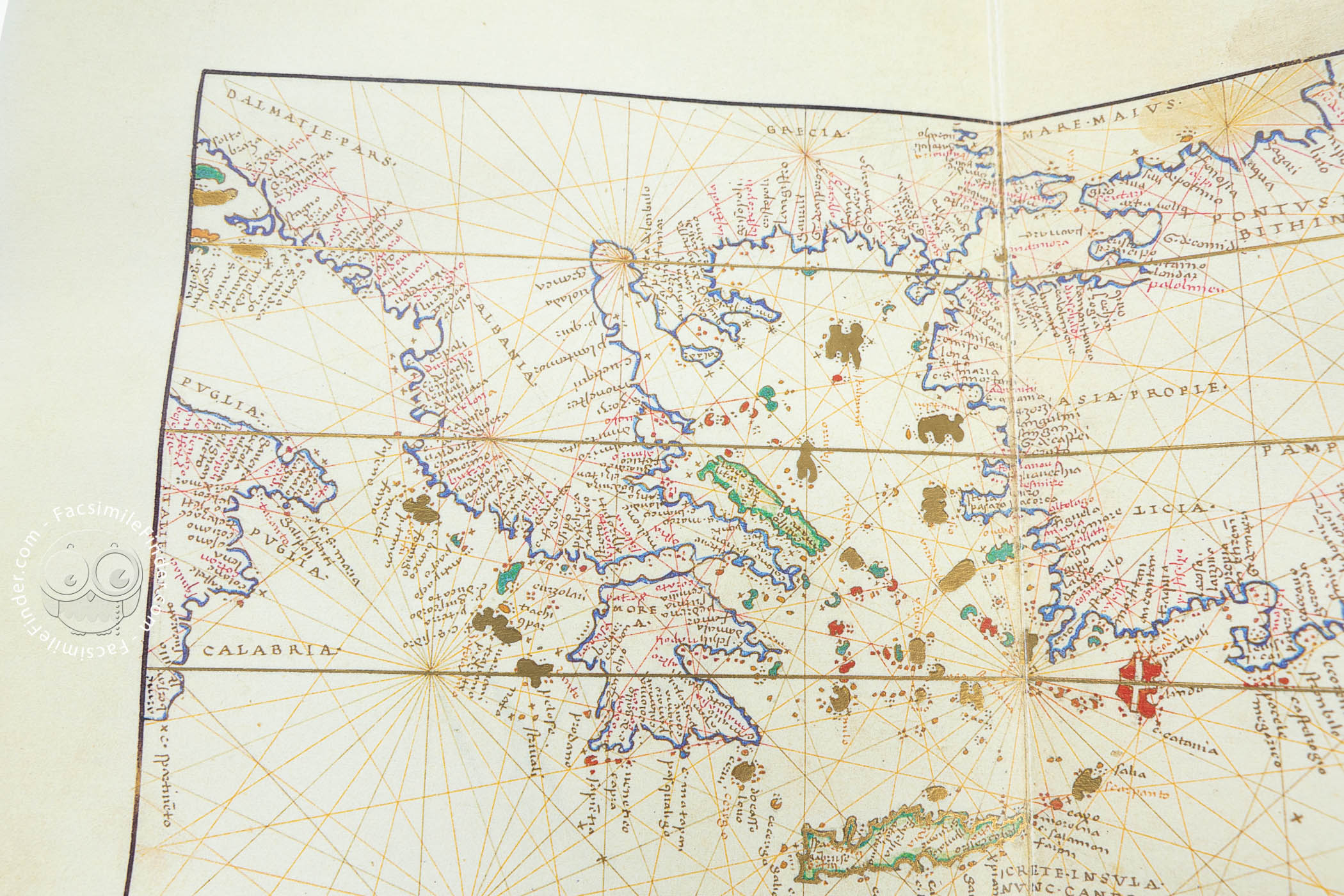
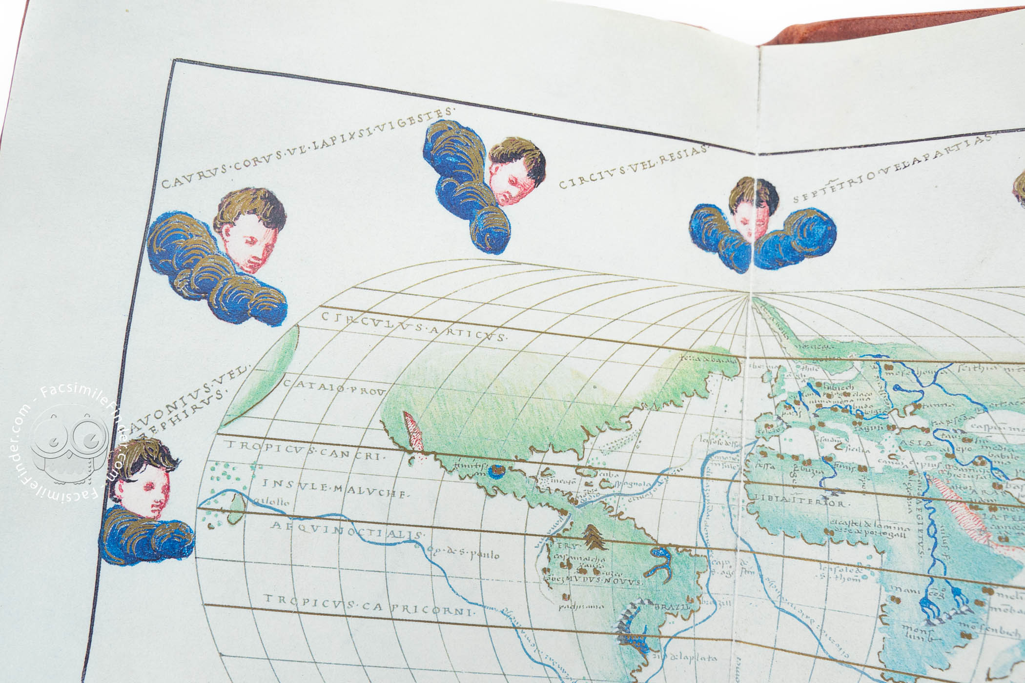
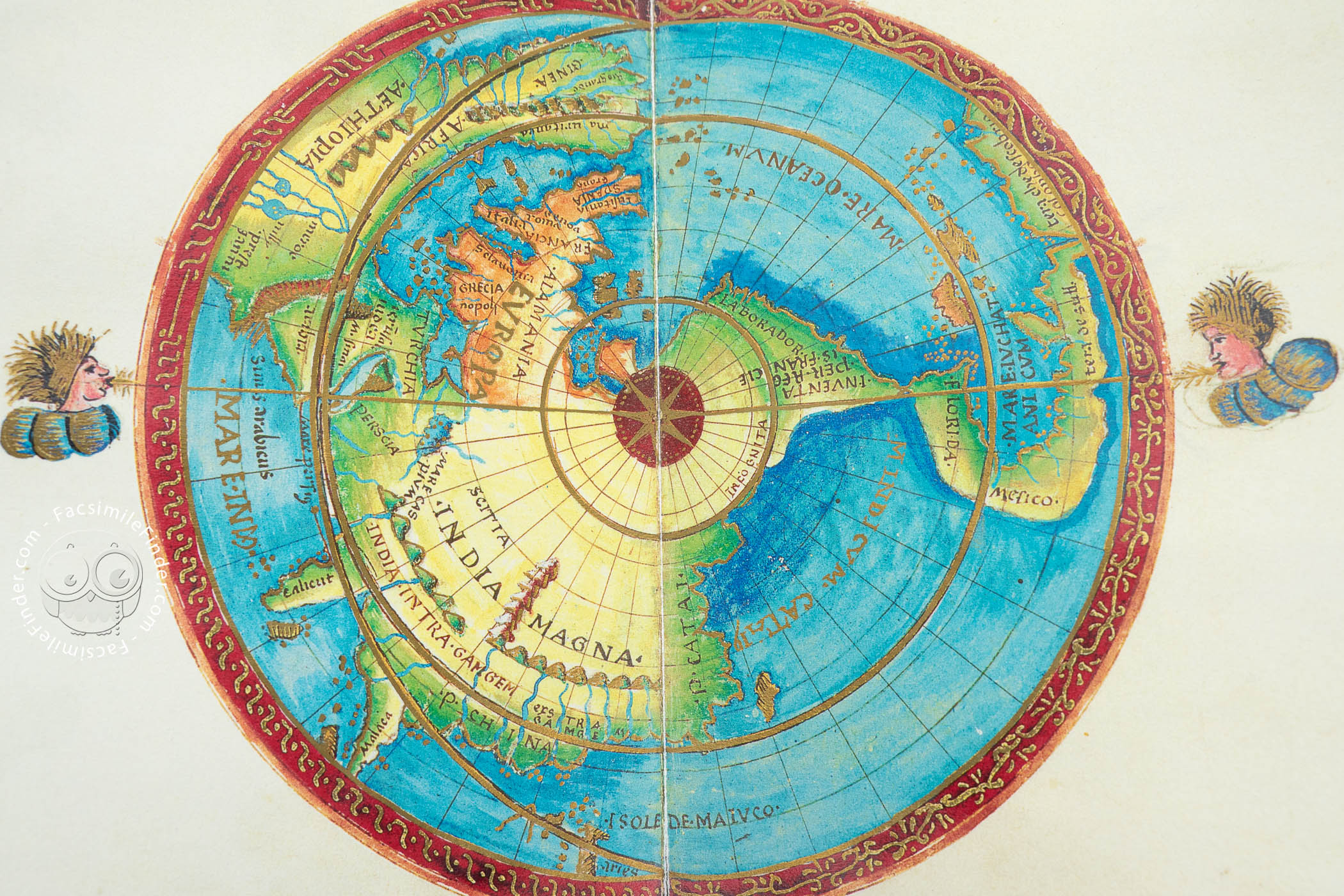
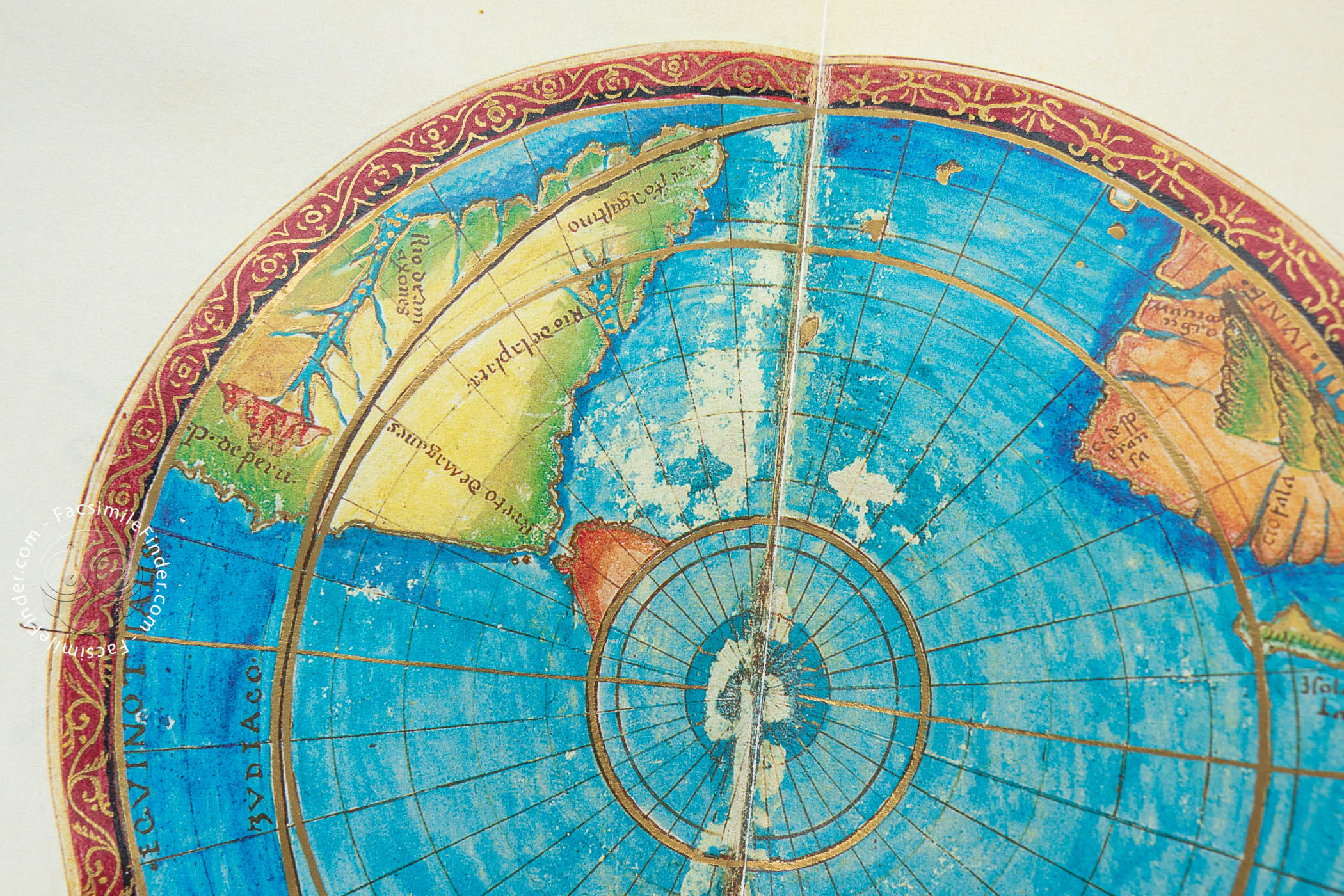
The maps are very accurately represented, showing the latest known geographical discoveries. Framed by fancy figures and decoration, in a very lavish Renaissance style, the atlas contains the maps of northern America, northwestern Africa and Spain, northern Europe, the Mediterranean, the Black Sea, Greece and the Aegean Sea, Asia and southern Asia, the Atlantic Ocean and the Caribbean, as well as a beautiful world map surrounded by heads of cherubs representing the winds.
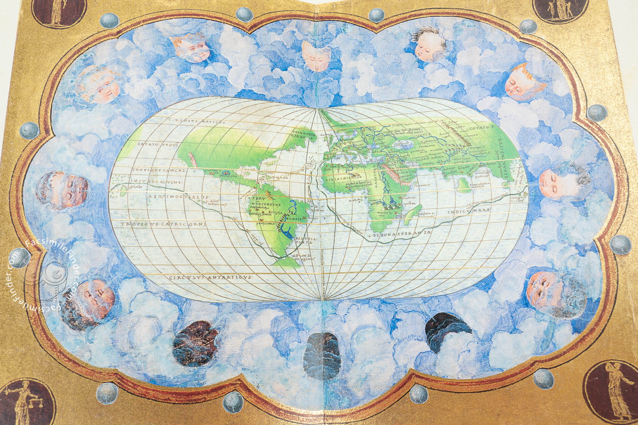
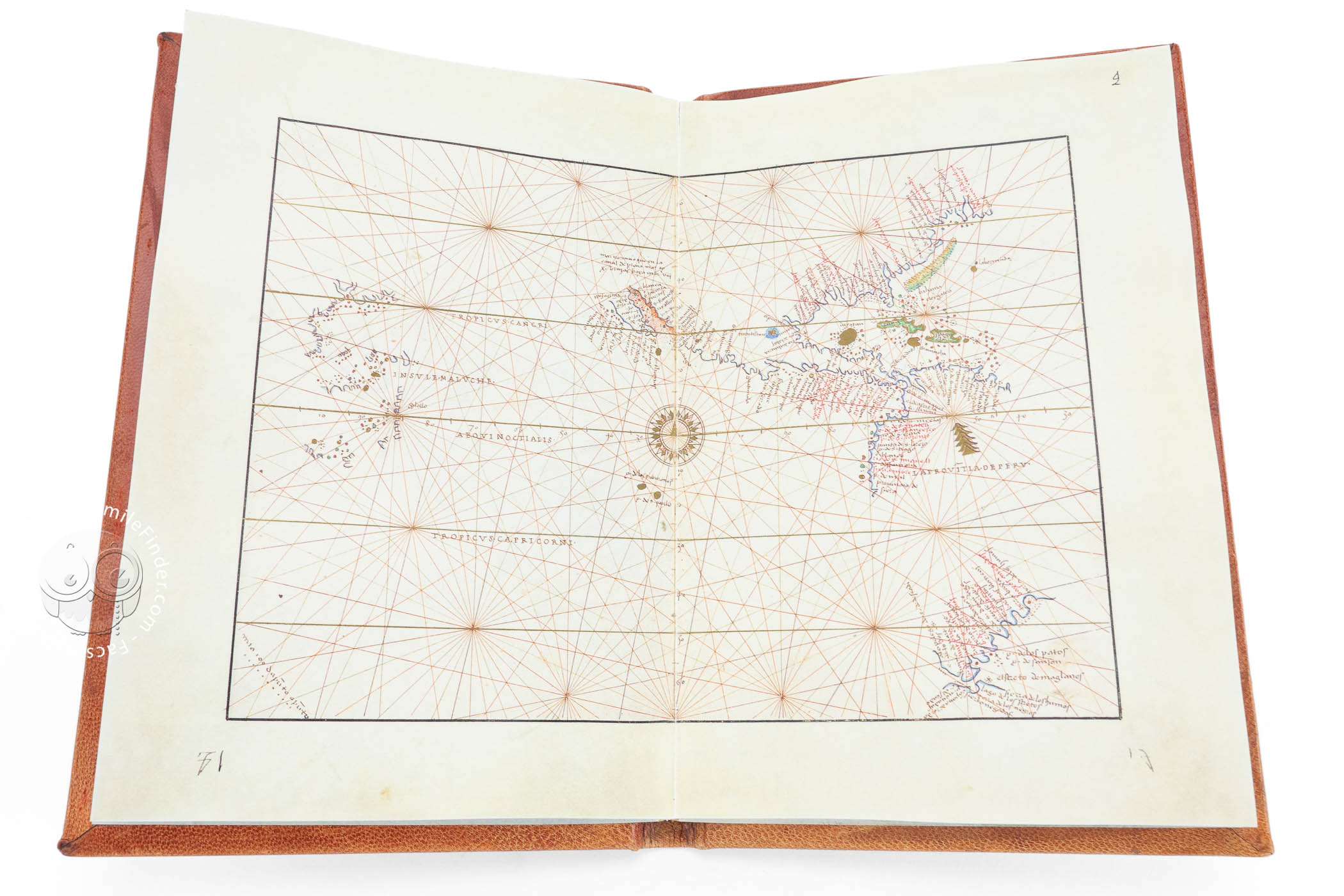
The world map, presented in an oval form, shows the routes of the Magellan-Elcano circumnavigation of the world, which occurred from 1519 to 1522.
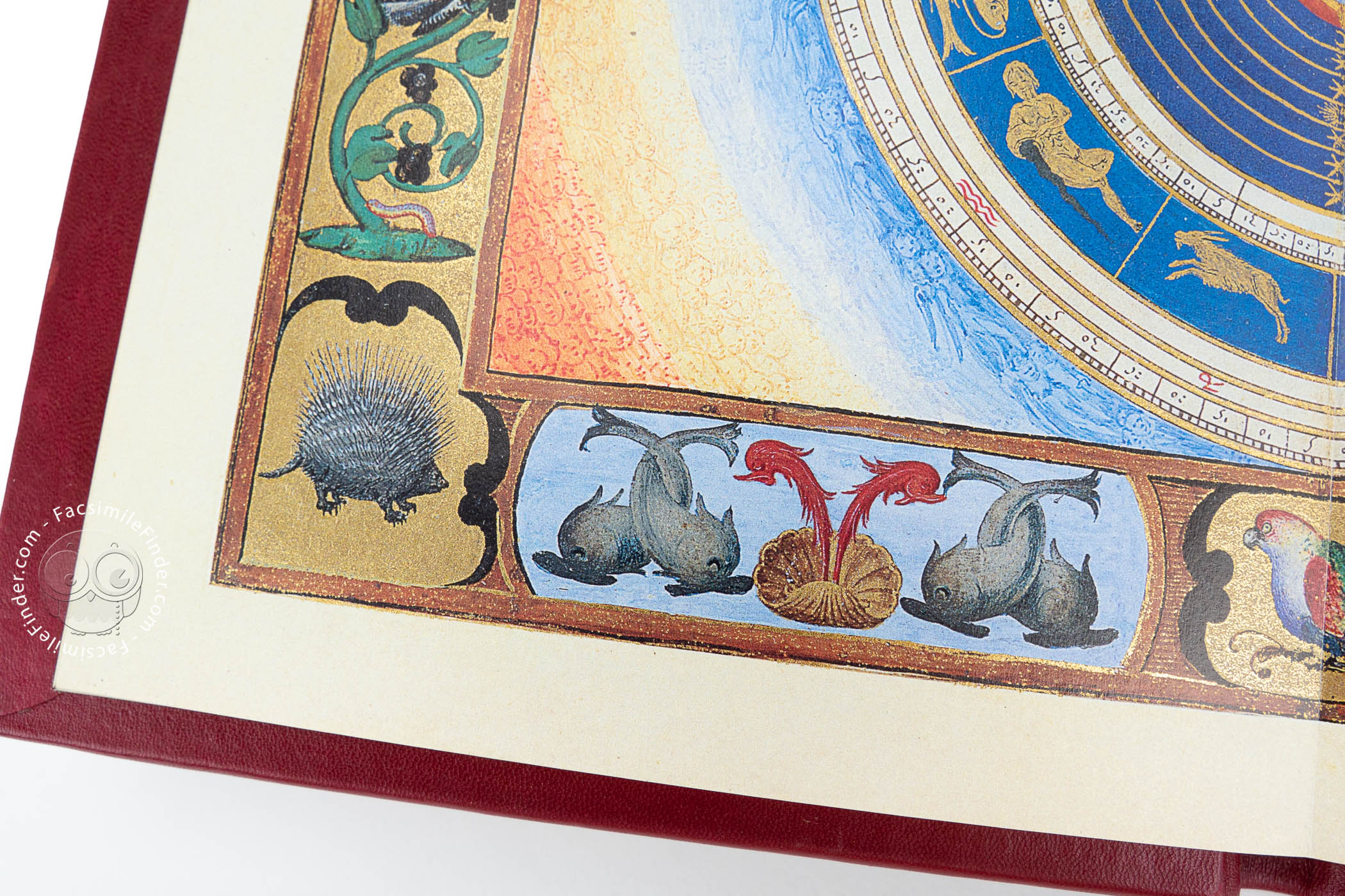
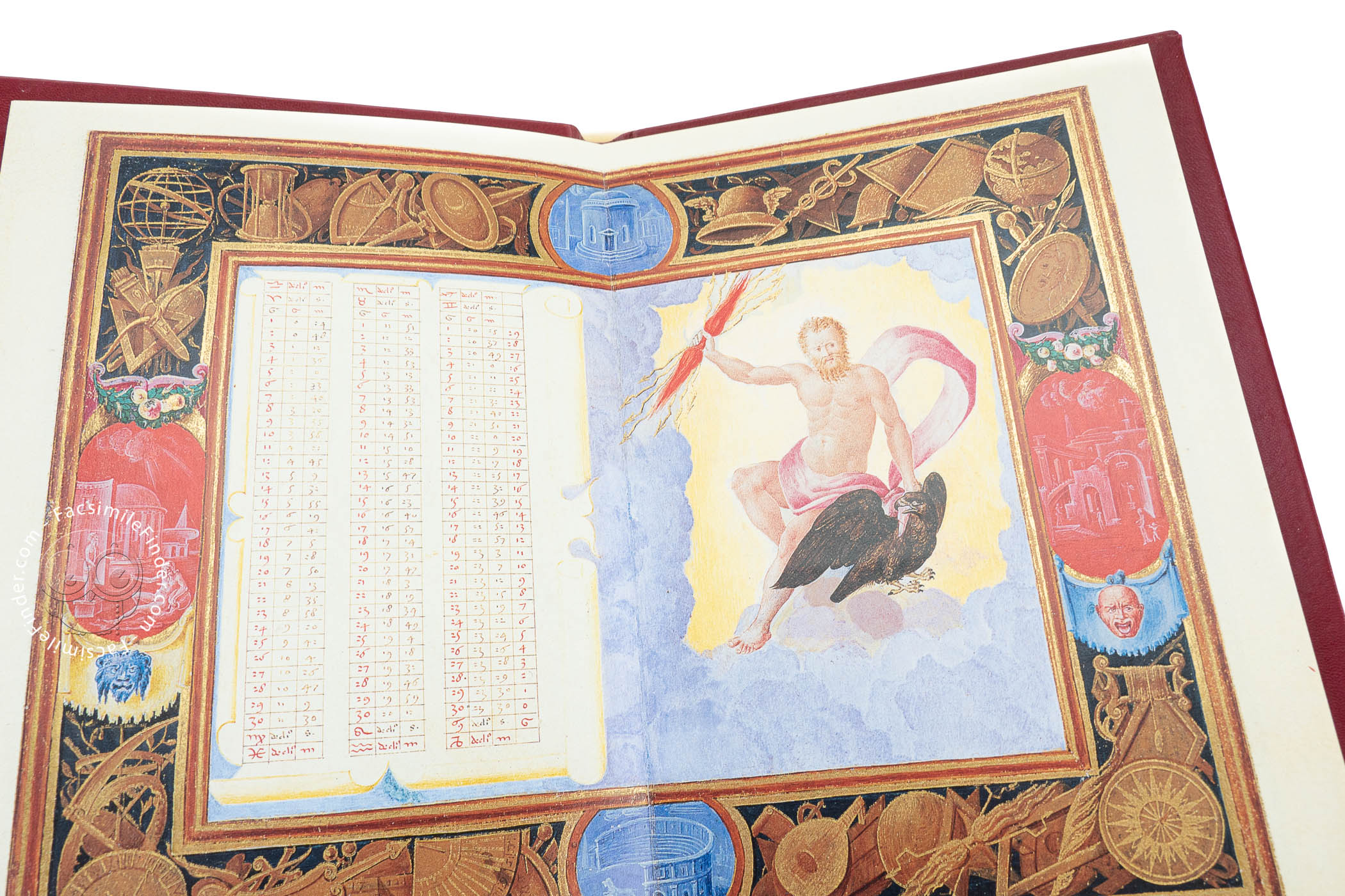
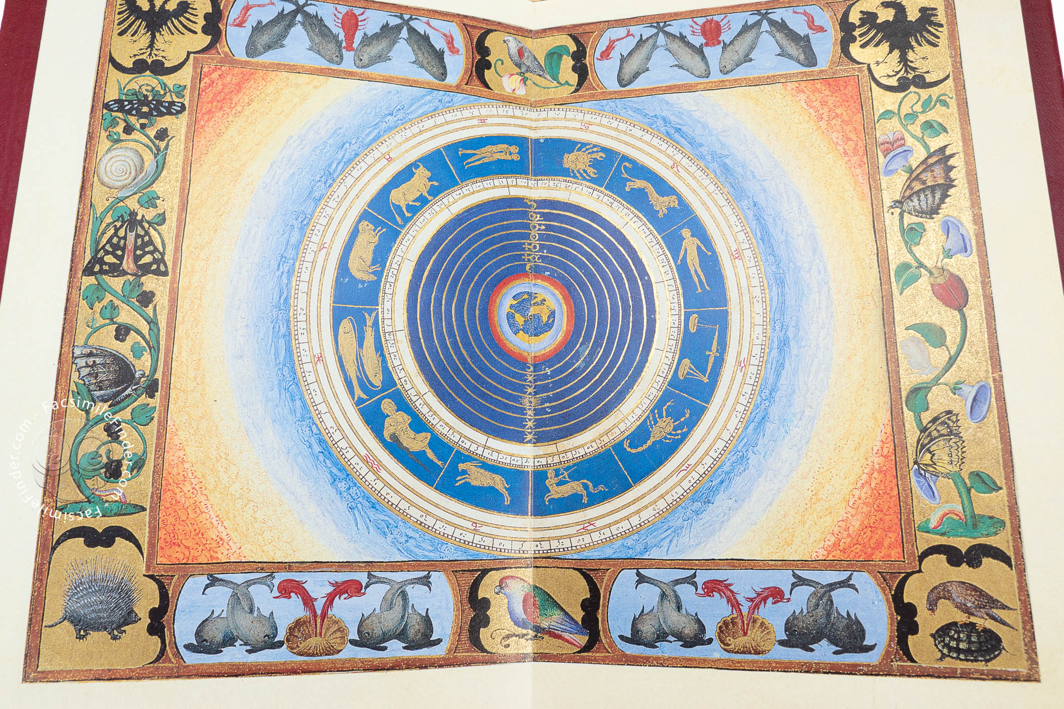
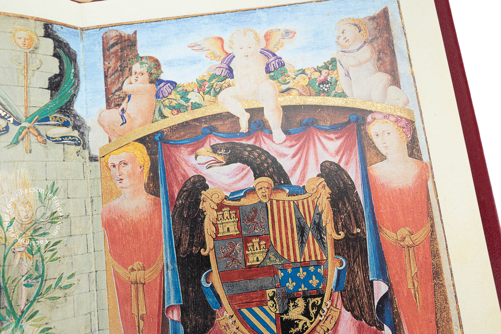
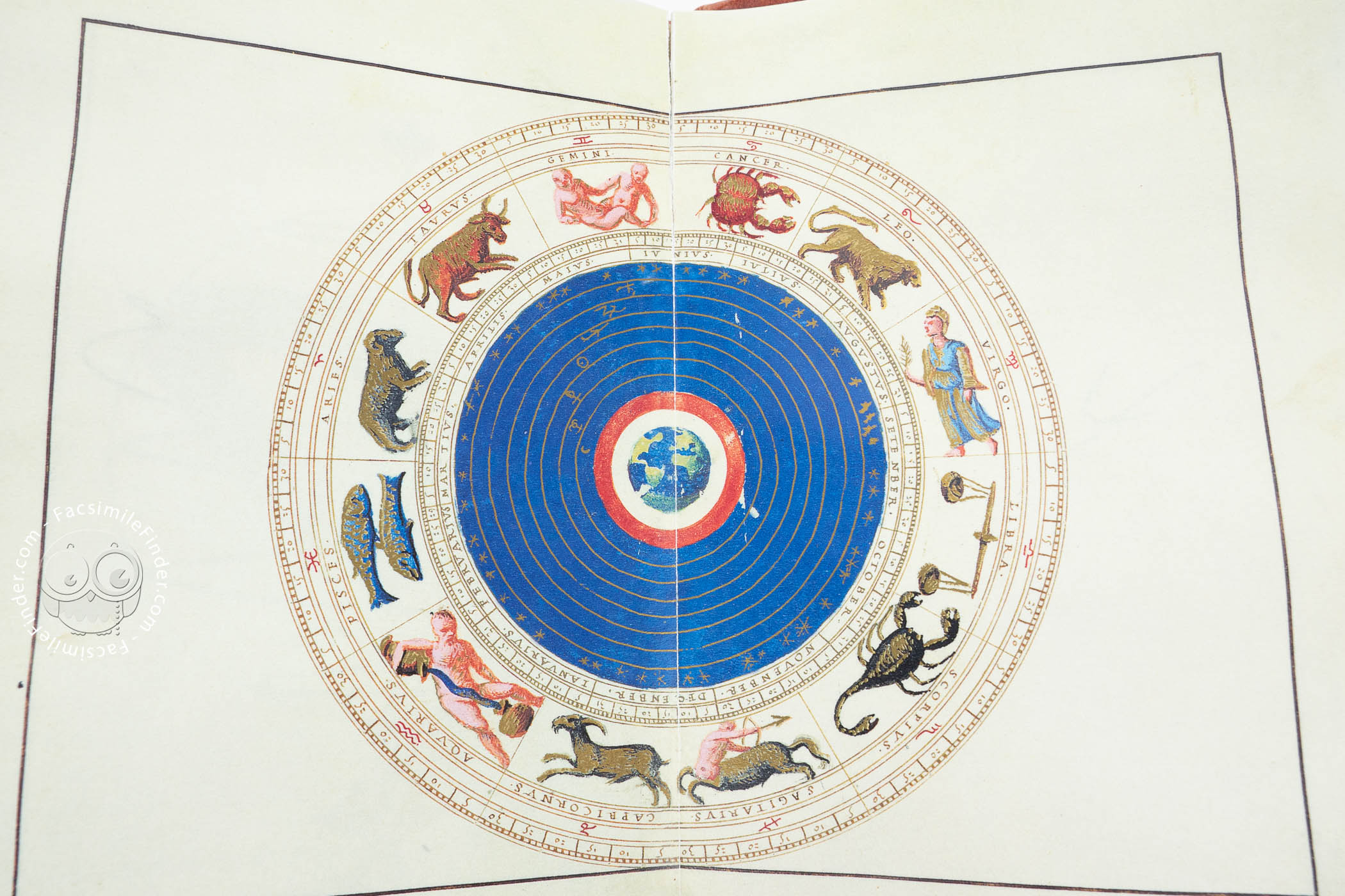
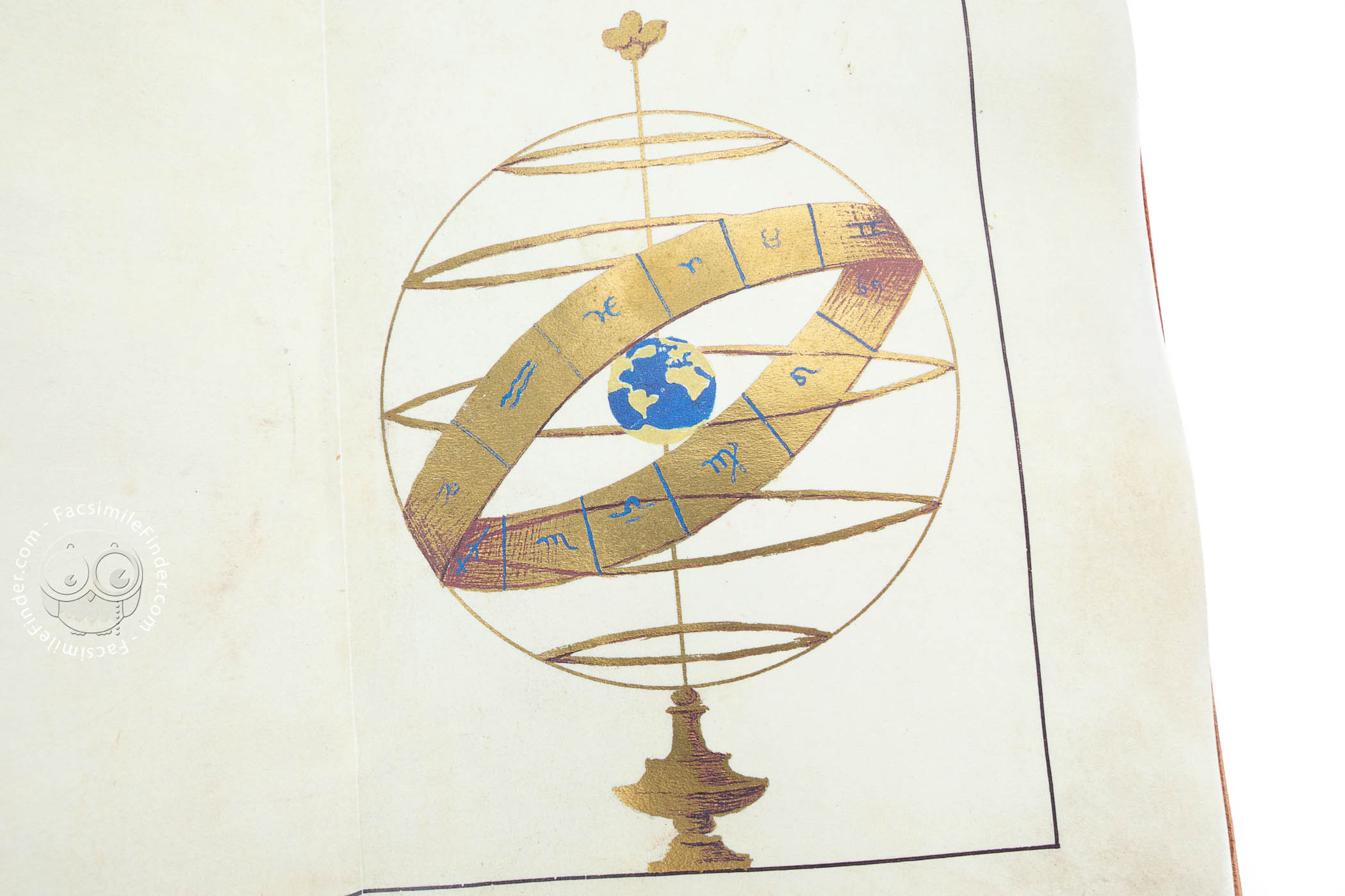
The atlas also contains a dedicatory page with the portrait of Charles V in a medallion, the coat of arms of Castile and Aragon, and a page of declination tables accompanied by a figure of Jupiter. We can also see a double-paged zodiac with a globe showing the Atlantic hemisphere in the center.
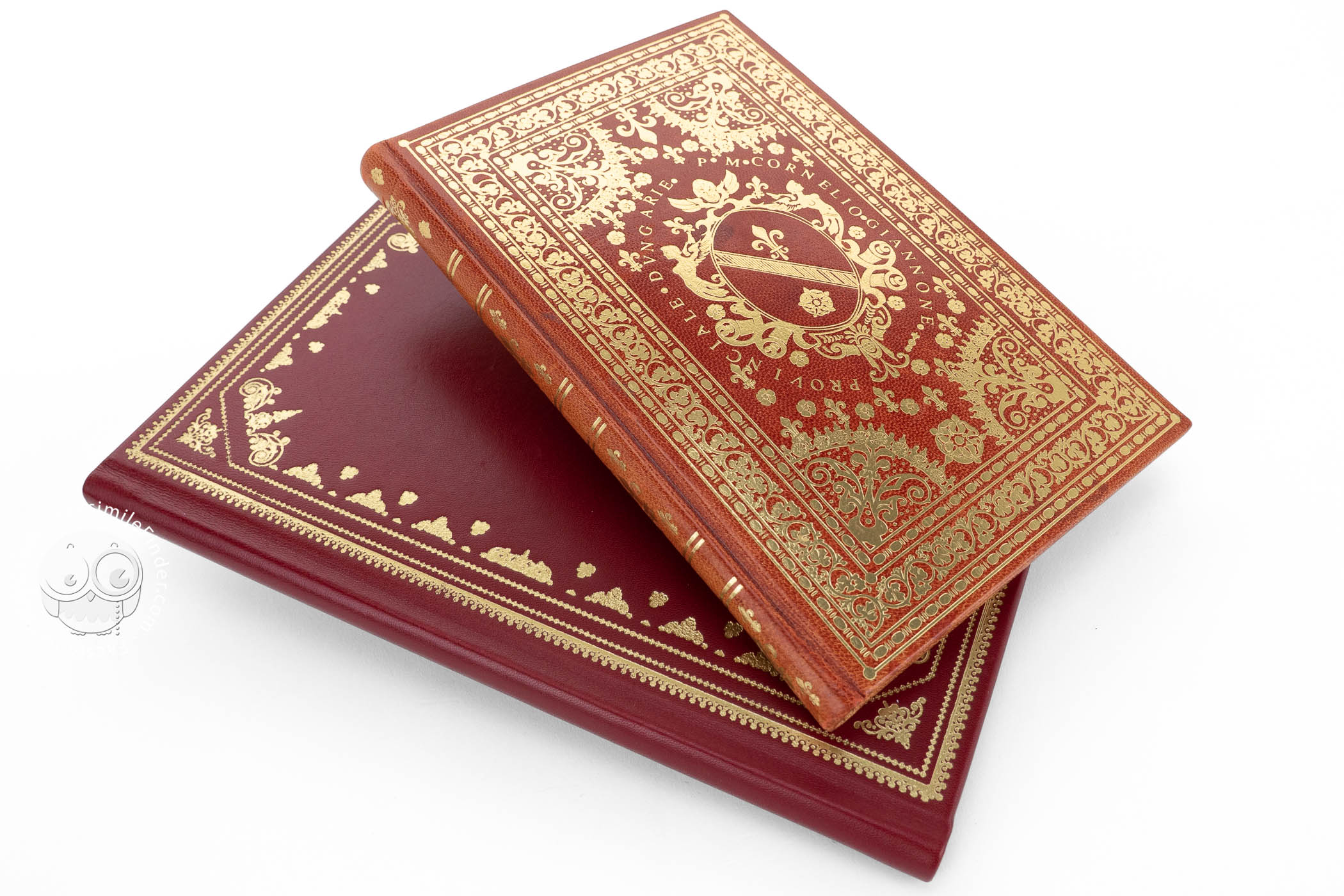
The work is held in the John Carter Brown Library in Providence under the shelfmark Codex Z 3 / 2 – SIZE.
Madrid Atlas
This manuscript atlas is also a masterpiece of early modern cartography. Made on parchment and measuring 20 × 14 cm, it is signed by Battista Agnese and dated 1 July 1544.
The atlas contains eleven maps, drawn following the tradition of nautical charts. The coastlines are accurately portrayed, and the decoration is remarkable, using lavish colors like gold and blue.
The maps contained in the atlas represent the Pacific Ocean, the Atlantic Ocean, the Indian Ocean with eight heads of cherubs representing the winds, northwestern Europe, Spain and northwestern Africa, the western Mediterranean, the central Mediterranean, the Black Sea, the Greek islands, and a world map also surrounded by cherubs.
The world map included in this atlas also shows the routes of the Magellan-Elcano circumnavigation of the world. Thus, Battista Agnese’s atlases are not only superb works of cartography and art, but also reflections of the historical events that occurred at the time.
This atlas is held in the National Library of Spain in Madrid under the shelfmark MS Res. 176.
Battista Agnese. One of the Most Prolific Cartographers of the Sixteenth Century
Battista Agnese (1514-1564) is one of the key figures of early modern cartography. Of Genoese origin, he worked in Venice and became of the most prolific mapmakers of his time and creating at least eighty-three maps and atlases.
Although little is known about his life, it is clear that the high quality of his works and the great number of his atlases make him one of the most important mapmakers of the sixteenth century. He created beautifully executed luxury works for the wealthiest courts and families all over Europe, reflecting the most recent geographic discoveries in a very lavish way.
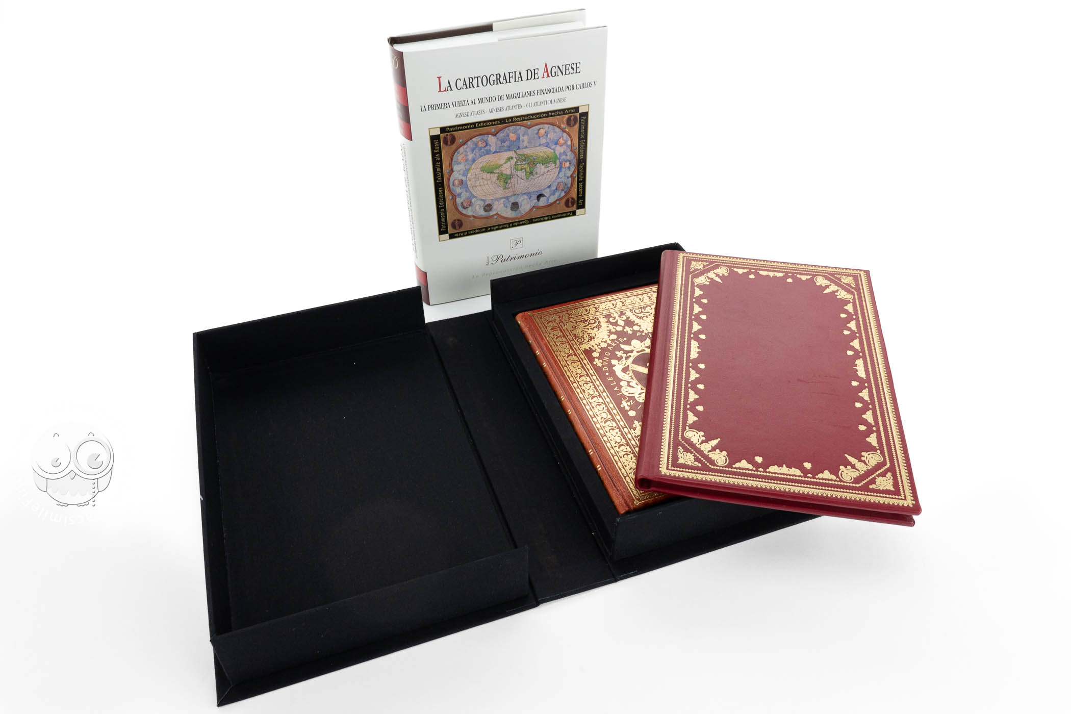
We have 1 facsimile edition of the manuscript "Atlas of Charles V and Madrid Atlas by Battista Agnese (Collection)": Colección: Atlas De Carlos V - Atlas De Magallanes facsimile edition, published by Patrimonio Ediciones, 2005-2007
Request Info / Price